List of conservation parks of Western Australia

Last updated

Western Australia, as of 2022, has 72 conservation parks, of which 40 are named and 32 unnamed. At the time of the last two-yearly Collaborative Australian Protected Areas Database report in 2022, 12,621,397 hectares (31,188,150 acres) of land in Western Australia was covered by conservation parks, which is 1.66 percent of all protected areas in the state and 0.5 percent of the state overall. Overall, just over 30 percent of Western Australia is covered by protected areas. [1] [2]

Contents

Conservation parks list

Map all coordinates using: OpenStreetMap
Name IUCN Gazetted areaDeclaredCoordinates IBRA
Barnabinmah Conservation Park II59,90811 May 2021 28°43′07″S117°17′07″E / 28.7185736565°S 117.2852175021°E / -28.7185736565; 117.2852175021 (Barnabinmah) MUR, YAL
Blackbutt Conservation Park II378 December 2004 34°07′27″S115°57′06″E / 34.1241219295°S 115.951700002°E / -34.1241219295; 115.951700002 (Blackbutt) WAR
Boyagarring Conservation Park II1,20915 November 1991 32°23′12″S116°34′43″E / 32.3865554234°S 116.578649951°E / -32.3865554234; 116.578649951 (Boyagarring) JAF
Brooking Gorge Conservation Park II7,96728 June 1994 17°59′52″S125°29′39″E / 17.9977886028°S 125.494058195°E / -17.9977886028; 125.494058195 (Brooking Gorge) DAL
Burra Conservation Park II7952 February 1900 31°23′57″S121°11′16″E / 31.3990816423°S 121.1879078985°E / -31.3990816423; 121.1879078985 (Burra) COO
Camp Creek Conservation Park II1,26710 July 2000 14°52′35″S125°49′46″E / 14.8763208625°S 125.8293419876°E / -14.8763208625; 125.8293419876 (Camp Creek) NOK
Cane River Conservation Park II147,88212 April 2000 22°07′58″S115°41′32″E / 22.1326936626°S 115.692223099°E / -22.1326936626; 115.692223099 (Cane River) CAR, PIL
Cape Range Conservation Park II9,29413 October 2021 22°12′00″S114°00′40″E / 22.2000004331°S 114.011185233°E / -22.2000004331; 114.011185233 (Cape Range) CAR
Coalseam Conservation Park II75425 May 1893 28°57′49″S115°33′09″E / 28.9636921971°S 115.5523866695°E / -28.9636921971; 115.5523866695 (Coalseam) AVW, GES
Dardanup Conservation Park II6438 December 2004 33°26′02″S115°47′39″E / 33.433838547°S 115.7942301023°E / -33.433838547; 115.7942301023 (Dardanup) JAF, SWA
Devonian Reef Conservation Park II41,37128 June 1994 17°44′06″S125°08′05″E / 17.7349879135°S 125.1346757491°E / -17.7349879135; 125.1346757491 (Devonian Reef) CEK, DAL
Geikie Gorge Conservation Park II5,33228 June 1994 18°03′43″S125°41′20″E / 18.0618384195°S 125.6890205344°E / -18.0618384195; 125.6890205344 (Geikie Gorge) DAL
Goldfields Woodlands Conservation Park II33,11214 April 2000 31°16′50″S120°56′05″E / 31.2805592365°S 120.934793576°E / -31.2805592365; 120.934793576 (Goldfields Woodlands) COO
Gooralong Conservation Park II627 January 1994 32°20′02″S116°03′07″E / 32.3338231175°S 116.0519421416°E / -32.3338231175; 116.0519421416 (Gooralong) JAF
Hester Conservation Park II2,3028 December 2004 33°53′40″S116°10′16″E / 33.8943976592°S 116.171212731°E / -33.8943976592; 116.171212731 (Hester) JAF
Jinmarnkur Conservation Park II26828 September 2016 19°02′40″S121°32′00″E / 19.044423221°S 121.5334198°E / -19.044423221; 121.5334198 (Jinmarnkur) DAL
Kerr Conservation Park II3078 December 2004 33°43′59″S116°01′42″E / 33.732947213°S 116.0282414331°E / -33.732947213; 116.0282414331 (Kerr) JAF
Korijekup Conservation Park II1665 January 2004 33°05′32″S115°55′00″E / 33.092339954°S 115.916699081°E / -33.092339954; 115.916699081 (Korijekup) SWA
Kujungurru Warrarn Conservation Park II1,13928 September 2016 19°52′26″S120°19′56″E / 19.873807292°S 120.3322070088°E / -19.873807292; 120.3322070088 (Kujungurru Warrarn) DAL
Lakeside Conservation Park II7,07718 February 2021 27°37′10″S117°45′21″E / 27.6194818155°S 117.7557070743°E / -27.6194818155; 117.7557070743 (Lakeside) MUR
Lane Poole Reserve Conservation Park II9,9596 February 1987 32°47′22″S116°08′41″E / 32.789547186°S 116.1446700563°E / -32.789547186; 116.1446700563 (Lane Poole Reserve) JAF
Laterite Conservation Park II12,19110 July 2000 14°58′24″S125°55′15″E / 14.973210109°S 125.9208243255°E / -14.973210109; 125.9208243255 (Laterite) NOK
Len Howard Conservation Park II6725 July 1995 32°33′57″S115°41′40″E / 32.56589231°S 115.6944565031°E / -32.56589231; 115.6944565031 (Len Howard) SWA
Leschenault Peninsula Conservation Park II5818 January 1993 33°13′06″S115°41′29″E / 33.2183697033°S 115.6913243455°E / -33.2183697033; 115.6913243455 (Leschenault Peninsula) SWA
Leschenaultia Conservation Park II34123 September 1994 31°51′52″S116°14′08″E / 31.864538078°S 116.2356262691°E / -31.864538078; 116.2356262691 (Leschenaultia) JAF
Lupton Conservation Park II9,32915 March 1963 32°28′05″S116°39′19″E / 32.4680467405°S 116.655396115°E / -32.4680467405; 116.655396115 (Lupton) JAF
Montebello Islands Conservation Park II1,4667 July 1992 20°28′24″S115°31′50″E / 20.4732101306°S 115.530524523°E / -20.4732101306; 115.530524523 (Montebello Islands) CAR
Mount Manning Range Conservation Park II147,29214 December 2005 30°17′10″S119°39′23″E / 30.2860194245°S 119.6563123732°E / -30.2860194245; 119.6563123732 (Mount Manning Range) COO, MUR
Muja Conservation Park II6,3238 December 2004 33°32′57″S116°27′43″E / 33.5492241835°S 116.4618152572°E / -33.5492241835; 116.4618152572 (Muja) JAF
Penguin Island Conservation Park III1118 October 1918 32°18′20″S115°41′30″E / 32.3054744595°S 115.6915729274°E / -32.3054744595; 115.6915729274 (Penguin Island) SWA
R 46235 Conservation Park II391,81310 July 2000 16°56′04″S125°05′43″E / 16.9345246221°S 125.095202723°E / -16.9345246221; 125.095202723 (R 46235) CEK, NOK
Rapids Conservation Park II2,38330 November 2004 33°55′12″S115°17′04″E / 33.9200259683°S 115.284576882°E / -33.9200259683; 115.284576882 (Rapids) JAF
Rock Gully Conservation Park Ia67022 June 2017 34°31′58″S117°02′03″E / 34.532711216°S 117.0343037393°E / -34.532711216; 117.0343037393 (Rock Gully) JAF
Rowles Lagoon Conservation Park II40517 September 1897 30°26′02″S120°51′23″E / 30.433880269°S 120.8563431795°E / -30.433880269; 120.8563431795 (Rowles Lagoon) COO
Shell Beach Conservation Park III5188 January 1993 26°12′21″S113°45′01″E / 26.2057589934°S 113.750264°E / -26.2057589934; 113.750264 (Shell Beach) CAR
Totadgin Conservation Park II2578 May 1888 31°34′23″S118°12′55″E / 31.572926625°S 118.2153481737°E / -31.572926625; 118.2153481737 (Totadgin) AVW
Unnamed WA01333 Conservation ParkII382 August 1888 33°57′25″S116°23′55″E / 33.9569952925°S 116.3986962417°E / -33.9569952925; 116.3986962417 (Unnamed WA01333) JAF
Unnamed WA17804 Conservation ParkII20216 September 1921 31°39′50″S121°13′49″E / 31.6637926155°S 121.2303023163°E / -31.6637926155; 121.2303023163 (Unnamed WA17804) COO
Unnamed WA23088 Conservation ParkII72 June 1950 35°00′33″S117°50′11″E / 35.0091518135°S 117.8363884795°E / -35.0091518135; 117.8363884795 (Unnamed WA23088) JAF
Unnamed WA23920 Conservation ParkII1072 April 1954 28°25′14″S115°19′40″E / 28.420470489°S 115.3277556163°E / -28.420470489; 115.3277556163 (Unnamed WA23920) GES
Unnamed WA24657 Conservation ParkII1215 March 1957 31°58′49″S116°02′37″E / 31.980192468°S 116.0435593302°E / -31.980192468; 116.0435593302 (Unnamed WA24657) JAF
Unnamed WA29901 Conservation ParkII28 August 1969 30°13′28″S115°24′06″E / 30.224492553°S 115.4015346914°E / -30.224492553; 115.4015346914 (Unnamed WA29901) GES
Unnamed WA33448 Conservation ParkII3527 June 1975 32°59′28″S115°58′48″E / 32.9910240782°S 115.980001822°E / -32.9910240782; 115.980001822 (Unnamed WA33448) JAF
Unnamed WA34213 Conservation ParkII3243 September 1976 32°52′29″S119°49′12″E / 32.874732669°S 119.8199972131°E / -32.874732669; 119.8199972131 (Unnamed WA34213) MAL
Unnamed WA38749 Conservation ParkII6925 May 1984 32°35′47″S115°46′56″E / 32.5964477195°S 115.7821657086°E / -32.5964477195; 115.7821657086 (Unnamed WA38749) SWA
Unnamed WA39584 Conservation ParkII11326 September 1986 32°10′22″S115°46′46″E / 32.172907047°S 115.7794703901°E / -32.172907047; 115.7794703901 (Unnamed WA39584) SWA
Unnamed WA39752 Conservation ParkII16023 January 1987 32°10′02″S115°47′10″E / 32.1672871359°S 115.7860809295°E / -32.1672871359; 115.7860809295 (Unnamed WA39752) SWA
Unnamed WA41986 Conservation ParkII2,36914 January 1992 30°35′34″S115°26′55″E / 30.5926569922°S 115.448479987°E / -30.5926569922; 115.448479987 (Unnamed WA41986) GES, SWA
Unnamed WA43290 Conservation ParkII2730 May 1995 31°43′49″S115°46′22″E / 31.730292451°S 115.7728419115°E / -31.730292451; 115.7728419115 (Unnamed WA43290) SWA
Unnamed WA46756 Conservation ParkII120 February 2002 31°49′03″S115°49′08″E / 31.8176380706°S 115.8189173735°E / -31.8176380706; 115.8189173735 (Unnamed WA46756) SWA
Unnamed WA47100 Conservation ParkII2,54221 September 2006 33°15′11″S119°40′40″E / 33.252989896°S 119.6778541956°E / -33.252989896; 119.6778541956 (Unnamed WA47100) ESP
Unnamed WA48291 Conservation ParkII494 October 2005 32°10′12″S115°49′30″E / 32.1698874265°S 115.8251019683°E / -32.1698874265; 115.8251019683 (Unnamed WA48291) SWA
Unnamed WA48436 Conservation ParkII1,30228 November 2005 33°20′26″S118°49′28″E / 33.3406563515°S 118.8244030681°E / -33.3406563515; 118.8244030681 (Unnamed WA48436) MAL
Unnamed WA48717 Conservation ParkII4545 December 2006 30°16′50″S115°06′53″E / 30.2804842223°S 115.114813707°E / -30.2804842223; 115.114813707 (Unnamed WA48717) SWA
Unnamed WA49144 Conservation ParkII525 May 2007 25°47′39″S113°43′11″E / 25.794062146°S 113.7198581392°E / -25.794062146; 113.7198581392 (Unnamed WA49144) CAR
Unnamed WA49220 Conservation ParkII1317 August 2007 32°07′32″S115°45′47″E / 32.125653718°S 115.7629324537°E / -32.125653718; 115.7629324537 (Unnamed WA49220) SWA
Unnamed WA49363 Conservation ParkII7424 September 2008 32°01′39″S115°56′11″E / 32.0275138924°S 115.9365153875°E / -32.0275138924; 115.9365153875 (Unnamed WA49363) SWA
Unnamed WA49561 Conservation ParkII118 April 2008 32°08′42″S115°50′30″E / 32.1450257378°S 115.8416170035°E / -32.1450257378; 115.8416170035 (Unnamed WA49561) SWA
Unnamed WA49742 Conservation ParkII6703 July 2008 33°41′18″S120°19′37″E / 33.6883900645°S 120.3268132573°E / -33.6883900645; 120.3268132573 (Unnamed WA49742) ESP
Unnamed WA49994 Conservation ParkII2,77327 November 2008 31°25′13″S115°34′09″E / 31.4201606925°S 115.5692410658°E / -31.4201606925; 115.5692410658 (Unnamed WA49994) SWA
Unnamed WA51272 Conservation ParkVI4119 September 2012 30°10′06″S115°12′57″E / 30.168195275°S 115.2157829095°E / -30.168195275; 115.2157829095 (Unnamed WA51272) GES
Unnamed WA51376 Conservation ParkIII7473 April 2014 28°36′47″S114°40′12″E / 28.613133245°S 114.66999105°E / -28.613133245; 114.66999105 (Unnamed WA51376) GES
Unnamed WA51963 Conservation ParkII0.1617 June 2015 32°13′18″S116°01′19″E / 32.2217715885°S 116.0220688787°E / -32.2217715885; 116.0220688787 (Unnamed WA51963) JAF
Unnamed WA52103 Conservation ParkIa69522 January 2016 30°51′52″S116°43′39″E / 30.864422251°S 116.7275299132°E / -30.864422251; 116.7275299132 (Unnamed WA52103) AVW
Unnamed WA53269 Conservation ParkVI26228 June 2018 33°36′17″S117°58′12″E / 33.6046860803°S 117.9701376165°E / -33.6046860803; 117.9701376165 (Unnamed WA53269) AVW
Unnamed WA53313 Conservation ParkII61015 May 2020 32°04′47″S115°49′43″E / 32.0797048035°S 115.8286057388°E / -32.0797048035; 115.8286057388 (Unnamed WA53313) SWA
Unnamed WA53632 Conservation ParkII2515 May 2020 32°08′59″S115°47′10″E / 32.1496560551°S 115.786218925°E / -32.1496560551; 115.786218925 (Unnamed WA53632) SWA
Unnamed WA53971 Conservation ParkII100, 10722 December 2021 28°57′36″S117°15′57″E / 28.959942851°S 117.2657122294°E / -28.959942851; 117.2657122294 (Unnamed WA53971) MUR, YAL
Wallaroo Rock Conservation Park II1,2142 July 1965 30°48′05″S120°29′33″E / 30.8013637565°S 120.4925155921°E / -30.8013637565; 120.4925155921 (Wallaroo Rock) COO
Walyarta Conservation Park II231,82028 September 2016 19°51′28″S121°40′50″E / 19.857875053°S 121.6806899297°E / -19.857875053; 121.6806899297 (Walyarta) DAL, GSD
Westralia Conservation Park II85530 November 2004 33°21′37″S116°07′03″E / 33.360170283°S 116.1175383862°E / -33.360170283; 116.1175383862 (Westralia) JAF
Yarra Yarra Lake Conservation Park II10,7585 October 2005 29°43′15″S115°48′19″E / 29.7207970239°S 115.8051543675°E / -29.7207970239; 115.8051543675 (Yarra Yarra Lake) AVW

Key for IBRA

Interim Biogeographic Regionalisation for Australia:

See also

Related Research Articles

<span class="mw-page-title-main">Nuytsland Nature Reserve</span> Nature reserve in Western Australia

Nuytsland Nature Reserve is a protected area of Western Australia in the south-eastern part of the state, on the south coast.

The Nallian Nature Reserve is located approximately fifteen kilometres north east of Wagin, Western Australia.

<span class="mw-page-title-main">Lake Magenta Nature Reserve</span> Nature reserve in Western Australia

Lake Magenta Nature Reserve is a 1080 km2 nature reserve managed by the Department of Parks and Wildlife, making it one of the largest such reserves in the Western Mallee bioregion of Western Australia. It is named after Lake Magenta, which lies just within its eastern boundary.

The Mogumber Nature Reserve is a nature reserve in Western Australia. It is a refuge for the endangered Western Swamp Tortoise along with the Twin Swamps Nature Reserve and the Ellen Brook Nature Reserve. Twin Swamps and Ellen Brook are IUCN Protected Area Management Category IV Reserves, while the Mogumber Nature Reserve is a Category Ia nature reserve.

Burma Road Nature Reserve is a conservation area in the City of Greater Geraldton local government area of Western Australia. It lies 52 kilometres (32 mi) south of Geraldton and 20 kilometres (12 mi) east of Walkaway. It is a C-class reserve and covers an area of 6,889.5 hectares It is predominantly kwongan scrub-heath, typical of the Tathra Vegetation system of Beard and Burns. Almost all the native vegetation within a 20 km (12 mi) radius of the reserve has been cleared. There is only 11% of native vegetation remaining in the area, of which most is within the reserve.

Mount Manning Range Nature Reserve is a nature reserve in the Goldfields region of Western Australia north of Southern Cross in the area known as the Northern Yilgarn, in the Coolgardie bioregion. It originally covered an area of 170,000 hectares, but, as of 2022, its size stands at 36,607 hectares.

<span class="mw-page-title-main">Dragon Rocks Nature Reserve</span> Nature reserve in Western Australia

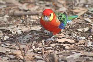
Dragon Rocks is a 322 km2 nature reserve in the south-east of the wheatbelt region of Western Australia, some 310 km east-south-east of Perth. It is surrounded by farmland. It is listed on Australia's Register of the National Estate as an area significant for rare species of plants and animals.

<span class="mw-page-title-main">Karroun Hill Nature Reserve</span> Nature reserve in Western Australia

The Karroun Hill Nature Reserve is a 3097 km2 nature reserve in the Mid West region of Western Australia, about 310 km north-east of Perth.

Moondyne Nature Reserve is a reserve located within the Avon Valley National Park, in the Avon Valley, Western Australia.

Queen Victoria Spring Nature Reserve is a protected area managed by the Department of Parks and Wildlife and is located approximately 200 km (124 mi) east of Kalgoorlie in the Great Victoria Desert in the Goldfields-Esperance region of Western Australia.

Down Road Nature Reserve is a protected area of Western Australia in the south-western part of the state. It is located approximately 14 km (8.7 mi) northwest of Albany. It has existed since 1932 and covers an area of approximately 7.78 square kilometers.

Forest Grove National Park is a national park in the South West region of Western Australia, 292 km (181 mi) south of Perth. It is located in the Shire of Augusta-Margaret River. To the east of the national park lies an unnamed national park (WA46400), which connects Forest Grove to the Blackwood River National Park. It is located in the Jarrah Forest and Warren bioregions.

Mungada Ridge National Park is a national park in the Mid West region of Western Australia, 90 km (56 mi) north-east of Perenjori and 200 km (120 mi) south-east of Geraldton. It was declared on 17 January 2022, is located in the Shire of Perenjori, and is part of the Yalgoo bioregion.

Pimbee National Park is a national park in the Gascoyne region of Western Australia, 180 km (110 mi) south-east of Carnarvon. It was declared in August 2023, is located in the Shire of Carnarvon, and is part of the Carnarvon xeric shrublands bioregion.

Helena and Aurora Ranges National Park, located in the Helena and Aurora Range, is a proposed national park in the Goldfields–Esperance and Wheatbelt regions of Western Australia, 440 km (270 mi) east of Perth. The proposed national park, with an initial size of 149,157 hectares, subsequently extended to 333,127 hectares, is located in the Shires of Menzies and Yilgarn and is part of the Coolgardie bioregion.

References

  1. "Terrestrial CAPAD 2022 WA summary". www.dcceew.gov.au/. Department of Climate Change, Energy, the Environment and Water . Retrieved 10 September 2023.
  2. "Australian Protected Areas Dashboard". www.dcceew.gov.au/. Department of Climate Change, Energy, the Environment and Water . Retrieved 10 September 2023.