Antigua and Barbuda
Islands
| Flag | Duration | Use | Description |
|---|---|---|---|
 | ?-present | Flag of Barbuda | A 3:1:3 horizontal tricolor of red, blue, and green. A yellow disc plasters the center, and a bird seems to be flying, which plasters the disc. |
This page lists the country subdivision flags in North America. It is a part of the Lists of country subdivision flags, which is split into continents due to its size.
| Flag | Duration | Use | Description |
|---|---|---|---|
| | ?-present | Flag of Barbuda | A 3:1:3 horizontal tricolor of red, blue, and green. A yellow disc plasters the center, and a bird seems to be flying, which plasters the disc. |
| Flag | Date | Use | Description |
|---|---|---|---|
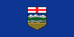 | 1968–present | Flag of Alberta | A blue field with the shield of the coat of arms of Alberta charged in the centre [1] |
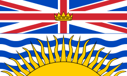 | 1960–present | Flag of British Columbia | A banner of the coat of arms of British Columbia [2] |
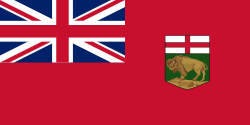 | 1965–present | Flag of Manitoba | A red field with the Royal Union Flag in the canton and the shield of the coat of arms of Manitoba charged in the fly [3] |
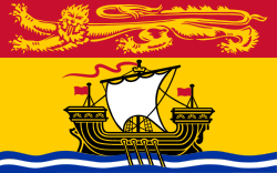 | 1965–present | Flag of New Brunswick | A banner of the coat of arms of New Brunswick [4] |
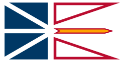 | 1980–present | Flag of Newfoundland and Labrador | A blue and white field party per pale (at nombril point) with a white border, white ordinary cross and white saltire, two triangular divisions in the fly lined in red, a golden arrow between two triangular divisions [5] |
 | 1858 (first use) 1929 (arms adopted) 2013 (flag adopted) –present | Flag of Nova Scotia | A banner of arms of the coat of arms of Nova Scotia [6] |
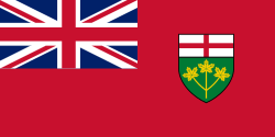 | 1965–present | Flag of Ontario | A red field with the Royal Union Flag in the canton and the shield of the coat of arms of Ontario charged in the fly [7] |
 | 1964–present | Flag of Prince Edward Island | A banner of the coat of arms of Prince Edward Island within a bordure compony of red and white [8] |
 | 1948–present | Flag of Quebec (The Fleurdelisé) | A blue field with an ordinary white cross and a white fleur-de-lis in each quadrant [9] |
 | 1969–present | Flag of Saskatchewan | A field party per fess, green and yellow, with the shield of the coat of arms of Saskatchewan in the canton and western red lily emblem charged in the fly [10] |
| Flag | Date | Use | Description |
|---|---|---|---|
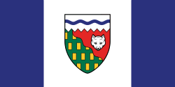 | 1969–present | Flag of the Northwest Territories | A vertical bicolour triband of blue, white, blue with the shield of the coat of arms of the Northwest Territories charged in the Canadian pale [11] |
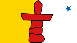 | 1999–present | Flag of Nunavut | A field party per pale, yellow and white, with a red inukshuk charged in the centre and a blue star in the upper fly [12] |
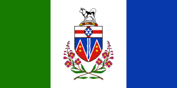 | 1968–present | Flag of Yukon | A vertical tricolour triband of green, white, blue with the shield of the coat of arms of Yukon above a wreath of fireweed charged in the pale, with pale ratio of 1 to 1.5 to 1 [13] |
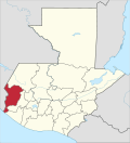
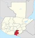
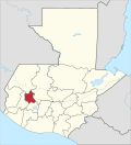
| Flag | Administrative division | Adopted | Description | |
|---|---|---|---|---|
 | 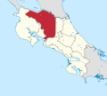 | Alajuela | White flag with the coat of arms of Alajuela Province in the center | |
 | 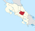 | Cartago | Two horizontal strips blue and red | |
 | 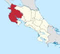 | Guanacaste | Three horizontal strips blue, white and green, with an inverted red triangle to the left | |
 |  | Heredia | Three vertical strips yellow, white and red, with the regional coat of arms in the central strip | |
 |  | Limón | Three horizontal strips green, blue and white | |
 |  | Puntarenas | Two triangles, red (upper left) and green (lower right), crossed by two diagonal joined strips white (lefter) and blue (righter). In the center, an eleven-pointed golden star with the cypher "1848" in black characters. | |
 |  | San José | Blue flag with a five-pointed white star in the center, and bordered with red strips | |
| Flag | Duration | Use | Description |
|---|---|---|---|
 | ?-present | Flag of Monseñor Nouel Province | Horizontal tricolor of blue, white, and green |
 | ?-present | Flag of Puerto Plata Province | Horizontal tricolor of gold, white, and blue |
 | ?-present | Flag of San Pedro de Macorís Province | Horizontal tricolor of gold, crimson, and blue |
| Flag | Subdivision | Adopted | Description | |
|---|---|---|---|---|
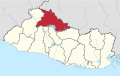
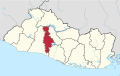
 | 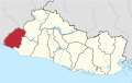 | Ahuachapán | Horizontal tricolor of blue, white, and blue, with the coat of arms of Ahuachapán in the center | |
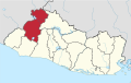
 |  | Cabañas | A vertical bicolor of blue and red separated by a white curved line | |
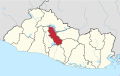
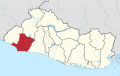
 |  | Chalatenango | May 15, 1969 | Horizontal tricolor of navy, white, and green On the white stripe is the province name, "CHALATENANGO," in golden text, and a white silhouette of a white swing plough |
 |  | Cuscatlán | ||
 |  | La Libertad | ||
 |  | La Paz | ||
 |  | La Unión | ||
 |  | Morazán | ||
 |  | San Miguel | ||
 |  | San Salvador | ||
 |  | San Vicente | ||
 |  | Santa Ana | ||
 |  | Sonsonate | ||
 |  | Usulután | ||
| Flag | Date | Use | Description |
|---|---|---|---|
 | Unofficial Flag of Atlántida Department | ||
| Flag of Choluteca Department | |||
 | Flag of Colón Department | ||
 | Flag of Comayagua Department | ||
 | Flag of Francisco Morazán Department | ||
 | Flag of Ocotepeque Department | ||
 | Flag of Olancho Department | ||
 | Flag of Santa Bárbara Department | ||
| Flag of Valle Department | |||
| Flag | Subdivision | Adopted | Description | |
|---|---|---|---|---|
 |  | Boaco | ||
 |  | Carazo | ||
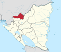
 |  | Chinandega | ||
 |  | Chontales | ||
 |  | Estelí | ||
 |  | Granada | ||
 |  | Jinotega | ||
 |  | León | ||
 |  | Madriz | ||
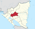
 |  | Managua | ||
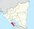
 |  | Masaya | ||
 |  | Matagalpa | ||
 |  | Nueva Segovia | ||
 |  | Rivas | ||
 |  | Rio San Juan | ||
| Flag | Subdivision | Adopted | Description | |
|---|---|---|---|---|
 |  | North Caribbean Coast Autonomous Region | ||
 |  | South Caribbean Coast Autonomous Region | ||
| Flag | Date | Use | Description |
|---|---|---|---|
 | ?-present | Flag of Bocas del Toro Province | Flag divided diagonally in half from top-left corner to bottom-right corner, green on bottom half and yellow on the top half. 3 white five-pointed stars curving slightly in the middle at the top of a capital, stylized 'B', with a drop shadow. |
 | 2004–present | Flag of Coclé Province | Vertical tricolor with, from left to right, red, gray, and white. The red stripe has two gray diamonds, one bottom-left from the top one. The gray stripe has two white diamonds, one at the bottom and one at the top. The white stripe has two red diamonds, one bottom-right from the top one. |
 | 1996–present | Flag of Colón Province | Horizontal tricolor with, from top to bottom, baby blue, white, and gold. The coat of arms of Colón is centered in the middle, with five five-pointed gold stars curved at the top. |
 | ?-present | Flag of Chiriquí Province | Flag divided diagonally in half from the bottom-left corner to the top-right corner, red at the top and green at the bottom. There are 14 white five-pointed stars in the middle arrayed in a circle, similar to the EU flag. |
 | ?-present | Flag of Darién Province | Flag divided diagonally in half from the bottom-left corner to the top-right corner, baby blue at the top and green at the bottom. There are 4 five-pointed yellow stars, arrayed in a hard curve. |
 | 1992–present | Flag of Herrera Province | Flag divided in half horizontally, with gold on the top half and blue on the bottom half. There is a labeled map of the province in the middle, with 7 blue five-pointed stars at the top arrayed in a curve to represent each district in the province. |
 | 1850–present | Flag of Los Santos Province | Horizontal tricolor with, from the top to the bottom, blue, gold, and red. |
 | 2015–present | Flag of Panamá Oeste Province | Horizontal tricolor with, from top to bottom, gold, white, and gold. It also has a green chevron with 5 white five-pointed stars arrayed in a curve. |
 | 2019–present | Flag of Veraguas Province | Blue background with a white filled-in outline of the province. It also has 12 five-pointed white stars arrayed around the map. |
| Flag | Date | Use | Description |
|---|---|---|---|
 | (?-present) | Flag of Emberá-Wounaan Comarca | Horizontal tricolor with a large green stripe at the top, and two other proportionate stripes, from top to bottom, yellow and blue. |
 | (2010–present) [14] | Flag of Guna Yala comarca | Horizontal tricolor with an enlarged middle yellow stripe, and a top red stripe and bottom green stripe. There are two crossed arms in the middle, the right holding an arrow and the left holding a bow. There are 8 five-point stars arrayed in a curve around the top of the middle symbol. |
 | (2009–present) | Flag of Ngäbe-Buglé Comarca | Vertical tricolor, with, from left to right, red, white, and green stripes. In the center, there are three five-point stars, with one stacked on the other two. |
 | (?-present) | Flag of Naso Tjër Di Comarca | The comarca's emblem centered in the middle of a plain white background. |
| Flag | Duration | Use | Description |
|---|---|---|---|
 | ?-present | Flag of Nevis | The flag of Nevis island incorporates the flag of the Federation of Saint Kitts and Nevis in the top left corner. The golden field stands for sunshine. The central triangle represents the conical shape of Nevis, with the blue being the ocean; the green being the verdant slopes of the island; and the white being the clouds that usually wreathe Nevis Peak. |
| Flag | Duration | Use | Description |
|---|---|---|---|
 | ?-present | Flag of Bequia |