Guatemala Department

Last updated
Guatemala Department
Departmento de Guatemala
Department
Collage - Guatemala Department.jpg
Counterclockwise from top: Guatemala City, Santa Catarina Pinula, Mixco, Lago Amatitlan, Parque Nacional Naciones Unidas & Villa Nueva.
Bandera del Departamento Guatemala.svg
Escudo de Armas de la Ciudad de Guatemala.svg
Municipalities of Guatemala Department.svg
CountryFlag of Guatemala.svg  Guatemala
Capital Guatemala City
Municipalities 17
Government
  Type Departmental
Area
  Department2,126 km2 (821 sq mi)
Population
 (2018) [1]
  Department3,015,081
  Density1,400/km2 (3,700/sq mi)
   Urban
2,750,965
  Religions
Roman Catholicism Evangelicalism Maya
Time zone UTC-6

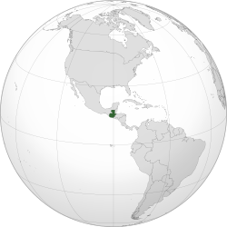
Guatemala Department is one of the 22 departments of Guatemala. The capital is Guatemala City, which also serves as the national capital. The department consists of Guatemala City, its suburbs and other municipalities.

Contents

The department covers a surface area of 2,126 square kilometres (821 sq mi), and had a population of 3,015,081 at the 2018 census. [1]

Municipalities

  1. Amatitlán
  2. Chinautla
  3. Chuarrancho
  4. Fraijanes
  5. Guatemala City
  6. Mixco
  7. Palencia
  8. San José del Golfo
  9. San José Pinula
  10. San Juan Sacatepéquez
  11. San Miguel Petapa
  12. San Pedro Ayampuc
  13. San Pedro Sacatepéquez
  14. San Raymundo
  15. Santa Catarina Pinula
  16. Villa Canales
  17. Villa Nueva

Related Research Articles

<span class="mw-page-title-main">Guatemala City</span> Capital and the largest city of Guatemala

Guatemala City, known nationally also as Guate, is the capital and largest city of Guatemala. It is also a municipality capital of the Guatemala Department and the most populous urban area in Central America. The city is located in the south-central part of the country, nestled in a mountain valley called Valle de la Ermita.

<span class="mw-page-title-main">Chimaltenango</span> Municipality and city in Guatemala

Chimaltenango is a city in Guatemala with a population of 96,985. It serves as both the capital of the department of Chimaltenango and the municipal seat for the surrounding municipality of the same name. Chimaltenango stands some 56 kilometres (35 mi) west of Guatemala City, on the Pan-American Highway. The municipal capital produces textiles and pottery.

<span class="mw-page-title-main">Sacatepéquez Department</span> Department of Guatemala

Sacatepéquez is one of the 22 departments of Guatemala. The name comes from Sacatepéquez, a city from November 21, 1542, until July 29, 1773, when it was destroyed by the 1773 Guatemalan Earthquake. Sacatepéquez means grasshill in the Nahuatl language. The capital of Sacatepéquez is Antigua Guatemala. Other important cities include Ciudad Vieja and San Lucas Sacatepéquez, which also hosts a marketplace and is a culinary attraction. The Chajoma were a group of indigenous people who were Kaqchikel speaking Indians identified Mixco Viejo as their capital, and spread throughout the Sacatepequez Department until their capital was moved to Ciudad Vieja, in Antigua.

San Pedro may refer to:

<span class="mw-page-title-main">Chimaltenango Department</span> Department of Guatemala

Chimaltenango is a department of Guatemala. The capital is Chimaltenango.

<span class="mw-page-title-main">Jalapa Department</span> Department of Guatemala

Jalapa is a department of Guatemala, in the south east-of the republic. The capital is the city of Jalapa.

<span class="mw-page-title-main">San Marcos, Guatemala</span> Municipality in San Marcos, Guatemala

San Marcos (elevation: 7,868 feet is a city and municipality in Guatemala. It is the capital of the department of San Marcos. The municipality has a population of 47,063.

<span class="mw-page-title-main">Chiantla</span> Municipality in Huehuetenango, Guatemala

Chiantla is a town and municipality in the Guatemalan department of Huehuetenango. The municipality is situated at 2,000 metres above sea level and covers an area of 521 km2. The annual festival is on January 28.

<span class="mw-page-title-main">Jacaltenango</span> Municipality in Huehuetenango, Guatemala

Jacaltenango is a town and municipality situated in the Western Highlands of Guatemala. It is located in a valley surrounded by the Sierra Madre Mountains. Jacaltenango serves as the municipal seat for the surrounding municipality of the same name. In 2002, its urban population was about 23,500 but at the 2018 census the town's population has decreased to 22,533.

<span class="mw-page-title-main">San Pedro Soloma</span> Municipality in Huehuetenango, Guatemala

San Pedro Soloma is a town and municipality of Huehuetenango, a department of Guatemala. It is located in the Sierra de los Cuchumatanes at 2,300 m above sea level. The municipality covers a total area of 264 km2 with elevations ranging from 1,900 m to 3,500 m. Its population of 49,030 is spread over the town of Soloma, 19 villages and 50 smaller rural communities (caserios).

San Miguel Petapa also known as Petapa is a city and municipality in the Guatemala department of Guatemala, located south of Guatemala City. The city has a population of 129,124 according to the 2018 census.

<span class="mw-page-title-main">San José Pinula</span> Municipality in Guatemala, Guatemala

San José Pinula is a town, with a population of 67,327, and a municipality in the Department of Guatemala in the Republic of Guatemala in Central America. It is located 21 kilometers (13 mi) from the capital, Guatemala City. The city was established in 1886 as Villorio San José. The city is surrounded by mountains. Until a few years ago, the economy was based on the growing of corn, as well as some vegetables such as guisquil, chayote or pataste. However, the growth of Guatemala City in recent years has transformed farmland into suburban neighborhoods. Golf courses, such as Hacienda Nueva Country Club which used to be a convent in the 16th century and Alta Vista Country Club, both considered world-class, are now in and around San José Pinula.

<span class="mw-page-title-main">Santa Catarina Pinula</span> Municipality in Guatemala, Guatemala

Santa Catarina Pinula is a town, with a population of 70,982 and a municipality in the Guatemala Department of Guatemala.

<span class="mw-page-title-main">San Juan Ostuncalco</span> Municipality and town in Quetzaltenango, Guatemala

San Juan Ostuncalco, is a town, with a population of 20,763, and a municipality in the Quetzaltenango department of Guatemala. Beside Spanish, local people speak the Mam language.

<span class="mw-page-title-main">Ocós</span> Municipality in San Marcos, Guatemala

Ocós is a municipality in the San Marcos Department of Guatemala. It is situated on the Pacific Ocean coast, very close to the border with Mexico at 4 m (13 ft) altitude and two big rivers: the Suchiate and the Naranjo rivers. On 23 January 2014, it lost about 2/3 of its territory when La Blanca was named the thirtieth San Marcos Department municipality.

San Cristóbal Cucho is a town and municipality in the San Marcos department of Guatemala.It was found on 11 October 1825. It was annexed to San Pedro Sacatepéquez, in 1935, but it was named a municipality again on 12 July 1945.

San Pedro Sacatepéquez is a city, with a population of 49,589, and a municipality in the San Marcos department of Guatemala. The municipality covers an area of 114 km2 at an altitude of 2330 metres and has a population of 79,158.

San Juan del Obispo is a small village (pueblo) in Guatemala. It is located in the department of Sacatepéquez, close to the departmental capital, Antigua Guatemala.

<span class="mw-page-title-main">Roman Catholic Archdiocese of Santiago de Guatemala</span> Roman Catholic archdiocese in Guatemala

The Archdiocese of Santiago de Guatemala is a Latin Church ecclesiastical territory or archdiocese of the Catholic Church in Guatemala. It is a primatial metropolitan see with six suffragan dioceses in its ecclesiastical province.

<span class="mw-page-title-main">Guatemala City metropolitan area</span>

The Guatemala City metropolitan area is a conglomeration of densely populated municipalities surrounding Guatemala City. In 2005, the metropolitan area was defined by the governments of Guatemala and Guatemala City as comprising the municipalities of Amatitlán, Chinautla, Guatemala City, Mixco, San Miguel Petapa, Santa Catarina Pinula, Villa Canales and Villa Nueva. Together these eight municipalities cover 478 square kilometres and were projected by Guatemala's National Institute of Statistics to have a combined population of 2,749,161 in 2015.

References

  1. 1 2 "Guatemala: Departments, Major Cities & Towns - Population Statistics, Maps, Charts, Weather and Web Information". www.citypopulation.de. Retrieved 2024-06-14.

Commons-logo.svg Media related to Guatemala Department at Wikimedia Commons

14°38′29″N90°30′47″W / 14.64139°N 90.51306°W / 14.64139; -90.51306