List of county routes in Cayuga County, New York

Last updated

County routes in Cayuga County, New York, are not signed in any form, serving as little more than references for inventory purposes. Route numbers below 114 generally increase progressively based on the alphabetical order of the towns where they are primarily located, beginning with Aurelius and ending with Victory (excluding Montezuma); however, several exceptions exist. Routes 114 through 116 are primarily in the town of Montezuma, while numbers above 121 do not follow any pattern.

Contents

Routes 1–50

RouteLength
(mi) [1]
Length
(km)
FromViaToNotes
CR 15.408.69CR 2A in Cayuga Genesee Street NY 326  / NY 931E in Aurelius
CR 2A1.262.03 Cayuga village line in Aurelius Lake Road and Center and Willard streets NY 90 in Cayuga
CR 3A1.852.98 US 20  / NY 5 Fosterville Road in Aurelius CR 10C
CR 3B3.946.34CR 10C in Aurelius Fosterville RoadCR 142 in Montezuma
CR 4A1.762.83CR 4B in Springport Town Line and Aurelius–Springport roadsCR 168A / CR 168B in Aurelius
CR 4B2.704.35 NY 326 Cross Road in Springport CR 4A
CR 5B3.776.07CR 76A / CR 76BRidge Road in Fleming NY 326
CR 6A1.802.90CR 6B at Fleming town lineBluefield Road in Aurelius NY 326
CR 6B3.255.23 NY 34B Bluefield Road in Fleming CR 6A at Aurelius town line
CR 6C1.262.03CR 6AExperimental Road in Aurelius NY 326
CR 7A2.734.39 Auburn city lineCanoga Road in Aurelius CR 7B at Throop town line
CR 7B0.971.56CR 7A at Aurelius town lineCanoga Road in Throop CR 10B
CR 8A1.812.91CR 1Cayuga Turnpike in Aurelius US 20  / NY 5
CR 91.101.77 US 20  / NY 5  / NY 931E Half Acre Road in Aurelius CR 7A
CR 10A2.754.43CR 10B at Throop town lineTurnpike Road in Sennett NY 5  / CR 87B
CR 10B5.048.11CR 10C at Aurelius town lineTurnpike Road in Throop CR 10A at Sennett town line
CR 10C2.714.36 US 20  / NY 5 Turnpike Road in Aurelius CR 10B at Throop town line
CR 12B2.674.30CR 12C at Sennett town line in Brutus WeedsportSennett Road and South StreetCR 31B in Weedsport
CR 12C1.612.59 NY 5 WeedsportSennett Road in Sennett CR 12B at Brutus town line
CR 13B2.964.76CR 13C at Mentz town line in Brutus Oakland Road and Oakland StreetWest Brutus Street in Weedsport
CR 13C2.223.57CR 56Oakland Road in Mentz CR 13B in Brutus
CR 143.325.34CR 31BCottle and Bonta Bridge roads in Brutus CR 18B at Cato town line
CR 15A1.903.06CR 15B at Sennett town lineJericho Road in Brutus CR 31B
CR 15B0.610.98 NY 5 Jericho Road in Sennett CR 15A at Brutus town line
CR 165.288.50 Onondaga County line in Cato (becomes CR 61)Jordan Road NY 370 in Meridian
CR 17A1.081.74CR 17B at Conquest town lineSlayton Road in Cato NY 370
CR 17B4.026.47 NY 38  / CR 22Slayton Road in Conquest CR 17A at Cato town line
CR 18B6.3610.24CR 14 at Brutus town line in Cato Bonta Bridge Road NY 370 in Meridian
CR 19A2.103.38CR 19B at Conquest town lineEmerson Road in Cato NY 34
CR 19B4.016.45CR 19C at Mentz town lineO'Neil and Emerson roads in Conquest CR 19A at Cato town line
CR 19C1.292.08CR 56O Neil Road in Mentz CR 19B at Conquest town lineDiscontinuous at Seneca River
CR 20B5.398.67 NY 34 in Cato Shortcut Road NY 370 in Meridian
CR 212.954.75CR 4ABenham and Blanchard roads in Aurelius US 20  / NY 5  / CR 142A
CR 221.472.37CR 23Fuller Road in Conquest NY 38  / CR 17B
CR 234.387.05 Wayne County line (becomes CR 275)Spring Lake Road in Conquest NY 38
CR 23A0.370.60 Wayne County lineSpring Lake Road in Conquest CR 131
CR 24A2.894.65CR 23Duck Lake Road in Conquest CR 24B at Victory town line
CR 24B3.515.65CR 24A at Conquest town lineDuck Lake Road in Victory CR 108
CR 252.854.59CR 150Dunning Avenue in Fleming Auburn city line
CR 25A0.370.60 NY 34 Willowbrook Road in Fleming CR 25
CR 26B5.568.95CR 42B in Genoa Wyckoff Road NY 38 in Fleming
CR 26C3.986.41CR 26D at Fleming town lineStewarts Corners Road in Venice CR 43B
CR 26D1.061.71 NY 90  / CR 26E in Genoa Stewarts Corners RoadCR 26C at Venice town line in Fleming
CR 26E1.712.75 NY 34 East Genoa Road in Genoa NY 90  / CR 26D
CR 271.502.41 NY 34 Sand Beach Road in Fleming NY 38  / NY 437
CR 28A4.116.61CR 151Silver Street Road in Fleming NY 34
CR 31B 3.996.42 NY 31 in Weedsport East Brutus Street and East Brutus Street Road Onondaga County line in Brutus (becomes CR 99)Formerly part of NY 31B
CR 324.206.76CR 157Atwater Road in Genoa Tompkins County line (becomes CR 155)
CR 347.4011.91Hill Road in Genoa Indian Field RoadCR 43B in Venice
CR 35A4.527.27CR 35B at Genoa town lineEast Venice and McAllister roads in Venice CR 43B
CR 35B1.121.80 NY 90 McAllister Road in Genoa CR 35A at Venice town line
CR 37A2.373.81CR 37C / CR 38North Road in Ira Oswego County line (becomes CR 21)
CR 37B3.435.52 NY 370 East and Bradt roads in Ira CR 38
CR 37C0.310.50End of county maintenanceFerris Road in Ira CR 37A / CR 38
CR 384.717.58 NY 34  / CR 39AIra Hill and Lysander roads in Ira Onondaga County line (becomes CR 34)
CR 38B5.739.22 NY 31  / NY 90 Loop Road in Montezuma CR 116Includes alternate route along Purser Road
CR 39A2.223.57 NY 34  / CR 38Ira Station Road in Ira CR 39B at Victory town line
CR 39B3.074.94CR 39A at Ira town lineIra Station Road in Victory CR 93
CR 406.09.66 [2] NY 34  / NY 370 Fox Hill Road Oswego County line (became CR 56)Former number; decommissioned in May 1970 for an extension of NY 34. [3]
CR 41A3.365.41CR 41B at Cato town lineSouthard Road in Ira CR 38
CR 41B0.300.48 NY 370 Southard Road in Cato CR 41A at Ira town line
CR 42A3.936.32 NY 90 in Aurora Sherwood RoadCR 42B at Scipio town line in Ledyard
CR 42B6.189.95CR 42A at Ledyard town lineSherwood Road in Scipio NY 38
CR 43A4.066.53 NY 90 in Aurora Paines Creek and Poplar Ridge roadsCR 43B at Venice town line in Ledyard
CR 43B8.3413.42CR 43A at Ledyard town linePoplar Ridge and Long Hill roads in Venice CR 43C at Moravia town line
CR 43C2.874.62CR 43B at Venice town lineLong Hill Road and Aurora Street in Moravia NY 38
CR 44A4.477.19 NY 90 Levanna Road in Ledyard CR 44B at Scipio town line
CR 44B3.665.89CR 44A at Ledyard town lineCenter Road in Scipio NY 34  / CR 44C
CR 44C2.704.35 NY 34  / CR 44BCenter Road in Scipio NY 38
CR 45A2.904.67 NY 90 Ledyard Road in Ledyard NY 34B  / CR 45B
CR 45B3.565.73 NY 34B  / CR 45ALedyard Road in Venice CR 34
CR 464.276.87 NY 90 in Ledyard Kings Corners Road NY 34B in Scipio
CR 481.432.30 Tompkins County line (becomes CR 154)Creek Road in Locke NY 90
CR 501.642.64 Tompkins County line (becomes CR 101)West Groton Road in Locke CR 48

Routes 51–100

RouteLength
(mi) [1]
Length
(km)
FromViaToNotes
CR 512.514.04 Tompkins County lineBird Cemetery Road in Locke NY 90
CR 543.285.28 NY 90 Tollgate Hill Road in Locke CR 54A at Moravia town line
CR 54A0.480.77CR 54 at Locke town lineTollgate Hill Road in Moravia NY 38
CR 54B1.812.91 NY 38 Harris Hill Road in Locke CR 54
CR 551.272.04 NY 38 Booth Road in Locke CR 161
CR 562.323.73 NY 31  / NY 38 in Port Byron Main and North Main streetsNY 38 in Mentz
CR 58A2.263.64CR 58B / CR 139A in Mentz Maiden Lane and Maiden Lane Road NY 38 in Port Byron
CR 58B1.943.12CR 38B in Montezuma Maiden LaneCR 58A / CR 139A in Mentz
CR 591.492.40 NY 38 in Port Byron Pine Street and Nauvoo RoadCR 105 in Mentz
CR 601.262.03CR 60A (segment 1) / CR 144 (segment 2)Halsey Road in Mentz CR 60A (segment 2) at Port Byron village line
CR 60A (1)1.562.51CR 60BHenvy Road in Mentz CR 60 / CR 60A (segment 1)
CR 60A (2)0.480.77CR 60 at Port Byron village lineHalsey Road in Port Byron NY 31  / NY 38
CR 60B1.242.00CR 114BLasher Road in Throop CR 60A
CR 61A5.358.61 NY 38  / NY 38A North Main Street and Rockefeller Road in Moravia CR 61B at Niles town line
CR 61B4.787.69CR 61A at Moravia town lineRockefeller Road in Niles CR 61C at Owasco town line
CR 61C1.362.19CR 61B at Niles town lineRockefeller Road in Owasco NY 38A
CR 62A2.123.41CR 62B at Sempronius town lineDresserville Road in Moravia NY 38A
CR 62B3.585.76CR 62C at Summerhill town lineDresserville and Lake Como roads in Sempronius CR 62A at Moravia town line
CR 62C4.627.44 NY 90 Lake Como Road in Summerhill CR 62B at Sempronius town line
CR 63A1.752.82 NY 38A  / CR 155Sayles Corners Road in Moravia CR 63B at Sempronius town line
CR 63B2.273.65CR 63A at Sempronius town lineSayles Corners Road in Sempronius NY 41A
CR 65A4.877.84CR 61AOak Hill Road in Moravia CR 65B at Niles town line
CR 65B3.385.44CR 65A at Moravia town lineOak Hill and Arnold roads in Niles CR 61B
CR 66A6.2210.01 NY 38A  / CR 71BGlobe, Salt, New Hope, and Glen Haven roads in Niles CR 66B at Sempronius town line
CR 66B1.862.99CR 66A at Niles town lineGlen Haven Road in Sempronius Cortland County line (becomes CR 101)
CR 673.064.92CR 66AOld Salt Road in Niles NY 41A
CR 681.893.04CR 61BSam Adams Lane in Niles CR 61B
CR 696.5510.54CR 62B / CR 80 in Sempronius Sand Hill, Hatheway, and White roadsCR 66A in Niles
CR 69A0.731.17CR 69Phillips Road in Sempronius NY 41A
CR 701.622.61CR 61BDuryea Road in Niles CR 65B
CR 71A6.5110.48CR 71C in Owasco Twelve Corners Road NY 38A  / CR 72 / CR 75 in Niles
CR 71C0.360.58 NY 38A  / CR 66AWiggins Road in Owasco CR 71A
CR 724.927.92 NY 38A Melrose Road in Owasco CR 72B / CR 164
CR 72A0.210.34 NY 38A Emma Street in Owasco CR 72
CR 72B3.375.42 NY 38A  / CR 71A / CR 75North Road in Owasco CR 72 / CR 164
CR 731.252.01 NY 38A Oakridge Road in Owasco CR 72
CR 742.453.94 NY 38A Swartout Road in Owasco CR 72B
CR 750.430.69CR 71AGahwiler and Scho roads in Owasco NY 38A  / CR 71A / CR 72B
CR 76A0.821.32 NY 34B Ridge Road in Scipio CR 5B / CR 76B
CR 76B3.545.70 NY 90 in Union Springs Center Street and Number One RoadCR 5B / CR 76A in Fleming
CR 771.732.78CR 89Truesdale Road in Springport CR 76B
CR 793.435.52CR 44BBlack Street in Scipio NY 34
CR 800.921.48CR 62B / CR 69Crofoot Road in Sempronius NY 41A
CR 81A2.954.75CR 81B at Summerhill town lineAtwood Road in Sempronius NY 41A
CR 81C3.455.55CR 62CCreech, Cutler School, and Atwood roads in Summerhill CR 81A at Sempronius town line
CR 834.176.71 Auburn city lineFranklin Street in Sennett Onondaga County line (becomes CR 133)
CR 842.083.35CR 83 / CR 86Chestnut Ridge Road in Sennett NY 5
CR 852.093.36 NY 34 County House Road in Sennett NY 5
CR 861.001.61 US 20 Pine Ridge Road in Sennett CR 83 / CR 84
CR 87A1.252.01CR 83Cherry Street in Sennett CR 87B
CR 87B4.186.73CR 87ACenter Street and Parcell, Miller, Freeman, and Depot roads in Sennett NY 5
CR 881.702.74CR 76BDavis Road in Springport NY 326  / CR 150A
CR 894.006.44 NY 90 in Springport Great Gully Road NY 34B in Scipio
CR 901.602.57CR 5B in Fleming Fitzpatrick and Lockwood roads NY 326 in Springport
CR 910.180.29 NY 90 Farleys Point Road in Springport Dead end
CR 935.248.43 NY 104 Ira Station North and Martville roads in Sterling NY 3
CR 941.672.69CR 95 / CR 124 in Sterling Fair Haven and Short Cut roads NY 104A in Fair Haven
CR 956.7410.85 Wayne County lineSterling Station Road in Sterling NY 104A
CR 963.195.13 NY 104A  / CR 97Irwin Road in Sterling Oswego County line (becomes CR 20)
CR 971.883.03CR 98McFarland, Gray, and Old State roads in Sterling NY 104A  / CR 96
CR 983.315.33 NY 104A Center and Farden roads in Sterling CR 97
CR 990.951.53 NY 38 Finches Corners Road in Sterling CR 93
CR 1001.522.45CR 102Montgomery Road in Summerhill CR 101

Routes 101 and up

RouteLength
(mi) [1]
Length
(km)
FromViaToNotes
CR 1011.262.03 Tompkins County line (becomes CR 103A)Champlin Road in Summerhill NY 90
CR 1021.191.92 Tompkins County line (becomes CR 102)Salt Road in Summerhill NY 90
CR 1030.500.80CR 62CBranch Road in Summerhill NY 41A
CR 1041.973.17 Auburn city lineNorth Division Street Road in Throop CR 10B
CR 1040.891.43 Wayne County lineOld State Road in Victory NY 104 Former routing of NY 104
CR 1055.038.10 NY 38 in Throop Centerport Road NY 31 in Mentz
CR 108 (1)1.903.06 NY 370 Victory Road in Victory Wayne County line (becomes CR 267)
CR 108 (2)1.031.66CR 108 (segment 1)Kasson Way in Victory Wayne County line (intersects CR 268)
CR 1126.8110.96 NY 370 Pople Road in Victory NY 38
CR 114A1.262.03CR 3BMcDonald Road in Montezuma CR 114B at Throop town line
CR 114B3.555.71CR 114A at Montezuma town lineMcDonald Road in Throop CR 10b
CR 1151.873.01CR 114AMentz Church Road in Montezuma NY 31
CR 1162.223.57 NY 31 Denman Road in Montezuma CR 58B
CR 1211.131.82CR 98Macniel and Sterling Valley roads in Sterling NY 104A
CR 1222.373.81 NY 104A Old State Road in Sterling CR 98
CR 1230.120.19 Wayne County lineWest Bay Road in Sterling Fair Haven village line
CR 1242.624.22CR 94 / CR 95Shortcut Road in Sterling NY 38
CR 1263.936.32 NY 38 in Victory Coleman and Wright roadsCR 95 in Sterling
CR 127 (1)4.326.95 NY 370 Old State Road in Victory NY 38 Former routing of NY 370; includes spur (Town Barn Road) at NY 38
CR 127 (2)3.736.00 NY 370 Upton RoadCR 104Former routing of NY 370; includes one-way connector at NY 370
CR 1283.115.01CR 38White Cemetery Road in Ira Oswego County line
CR 1291.963.15 NY 38 in Conquest Townline Road NY 370 in Victory
CR 1311.071.72CR 23Curran Road in Conquest Wayne County line (becomes CR 262)
CR 1322.293.69CR 19BSpook Woods Road in Conquest CR 17B
CR 133A1.552.49CR 19BLemon School Road in Conquest Cato town line
CR 1352.694.33 NY 34 Jorolemon Road in Cato CR 16
CR 1360.370.60CR 12CShepherd Road in Sennett CR 136A at Brutus town line
CR 136A2.403.86CR 136 at Sennett town lineShepherd Road in Brutus CR 31B
CR 1391.792.88 Erie Canal in Montezuma Howland Island Road NY 38 in Mentz
CR 139A1.201.93CR 58A / CR 58B in Mentz High Bridge RoadCR 139 in Mentz
CR 1401.382.22 NY 31 Trumble and Thompson roads in Mentz CR 58ADiscontinuous at New York State Thruway
CR 141A2.173.49 US 20  / NY 5 Laraway Road in Aurelius CR 141B at Montezuma town line
CR 141B2.504.02CR 141A at Aurelius town lineLaraway Road in Montezuma NY 90
CR 1422.073.33CR 3BCarner and Fuller roads in Montezuma NY 90
CR 142A2.193.52 US 20  / NY 5  / CR 21Blanchard and Fuller roads in Aurelius CR 142B at Montezuma town line
CR 142B1.061.71CR 142A at Aurelius town lineFuller Road in Montezuma CR 142
CR 1432.704.35CR 10B in Throop Beach RoadCR 114A in Montezuma
CR 144 (1)1.652.66CR 167Beechtree Road in Aurelius CR 144A at Mentz town line
CR 144 (2)0.831.34CR 60 / CR 60A (segment 1)Halsey and Hayden roads in Mentz NY 38
CR 144A4.186.73CR 144 (segment 1) at Aurelius town lineBeechtree Road, School Street, and Powers Road in Throop CR 144 (segment 2)
CR 1451.201.93 NY 38 Sine Road in Throop CR 105
CR 1462.363.80CR 87BDepot Road in Sennett Onondaga County line (becomes CR 176)
CR 1471.642.64CR 87BMiller Road in Sennett Onondaga County line
CR 1502.814.52CR 5BSkillet Road in Fleming NY 34
CR 150A1.873.01 NY 326  / CR 88 in Springport Powers RoadCR 5B in Fleming
CR 1512.363.80 NY 34 Fleming–Scipio Town Line Road in Fleming CR 26B
CR 1522.734.39CR 42ASands and Cooneys Corner roads in Ledyard CR 46
CR 1543.916.29CR 45ABlack Rock and Dog Corners roads in Ledyard CR 42A
CR 1562.273.65 NY 38A  / CR 156AMartin Road in Owasco CR 74
CR 156A0.931.50CR 156B at Niles town lineValentine Road in Owasco NY 38A  / CR 156
CR 156B2.203.54CR 65BValentine Road in Niles CR 156A at Owasco town line
CR 1573.074.94 Tompkins County line (becomes CR 185)Lake Road in Genoa NY 90
CR 1592.103.38CR 26EGoose Street in Genoa NY 90
CR 1602.123.41 NY 90 Goodrich Hill Road in Locke West Hill Road
CR 1611.842.96 Tompkins County line (becomes CR 171)Chipmans Corners Road in Locke NY 90
CR 1631.221.96 Tompkins County line (becomes CR 103B)Hinman Road in Summerhill NY 90
CR 1640.701.13CR 72 / CR 72BBaptist Corners Road in Owasco Onondaga County line
CR 1653.205.15CR 65BGrange Hall Road in Niles CR 71B
CR 1661.452.33CR 81AScott Gulf Road in Sempronius Cortland County line (becomes CR 100)
CR 1670.781.26 US 20  / NY 5 Clark Street Road in Aurelius Auburn city line
CR 168A 1.422.29CR 4A / CR 168BOakwood Road in Aurelius CR 1Former routing of NY 326
CR 168B 0.821.32 NY 326 Oakwood Road in Springport CR 4A / CR 168AFormer routing of NY 326

See also

Related Research Articles

<span class="mw-page-title-main">Cayuga County, New York</span> County in New York, United States

Cayuga County is a county in the U.S. state of New York. As of the 2020 census, the population was 76,248. Its county seat and largest city is Auburn. The county was named for the Cayuga people, one of the Native American tribes in the Iroquois Confederation.

<span class="mw-page-title-main">Aurelius, New York</span> Town in New York, United States

Aurelius is a town in Cayuga County, New York, United States. The population was 2,610 at the 2020 census. The town was named after the Roman emperor Marcus Aurelius. It is at the western edge of the county and borders the city of Auburn.

<span class="mw-page-title-main">Mentz, New York</span> Town in New York, United States

Mentz is a town in Cayuga County, New York, United States. The population was 2,114 at the 2020 census. The town is in the central part of the county, 7 miles north of Auburn.The town's name has never been determined, but it is locally believed that it derived from Mainz, in Germany.

<span class="mw-page-title-main">Montezuma, New York</span> Town in New York, United States

Montezuma is a town in Cayuga County, New York, United States. The population was 1,277 at the 2010 census.

<span class="mw-page-title-main">Tyre, New York</span> Town in New York, United States

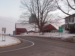
Tyre is a town in Seneca County, New York, United States. The population was 1,002 at the 2020 census. The town is named after the Lebanese city of Tyre.

<span class="mw-page-title-main">Savannah, New York</span> Town in New York, United States

Savannah is a town in the southeast portion of Wayne County, New York, United States. The population was 1,730 at the 2010 census.

<span class="mw-page-title-main">Seneca Falls, New York</span> Town in New York, United States

Seneca Falls is a town in Seneca County, New York, United States. The population was 8,942 at the 2020 census.

<span class="mw-page-title-main">New York State Route 13</span> State highway in New York, US

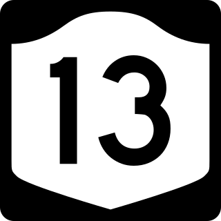
New York State Route 13 (NY 13) is a state highway that runs mainly north–south for 152.30 miles (245.10 km) between NY 14 in Horseheads and NY 3 west of Pulaski in Central New York in the United States. In between, NY 13 intersects with Interstate 81 (I-81) in Cortland and Pulaski and meets the New York State Thruway (I-90) in Canastota. NY 13 is co-signed with several routes along its routing, most notably NY 34 and NY 96 between Newfield and Ithaca; NY 80 between DeRuyter and Cazenovia; and NY 5 between Chittenango and Canastota.

<span class="mw-page-title-main">New York State Route 104</span> Highway in New York

New York State Route 104 (NY 104) is a 182.41-mile-long (293.56 km) east–west state highway in Upstate New York in the United States. It spans six counties and enters the vicinity of four cities—Niagara Falls, Lockport, Rochester, and Oswego—as it follows a routing largely parallel to the southern shoreline of Lake Ontario, along a ridge of the old shoreline of Glacial Lake Iroquois. The western terminus of NY 104 is an intersection with NY 384 in Niagara Falls, Niagara County, while its eastern terminus is a junction with NY 13 in the town of Williamstown, Oswego County. The portion of NY 104 between Rochester and the village of Webster east of the city is a freeway known as the Keeler Street Expressway west of NY 590 and the Irondequoit–Wayne County Expressway east of NY 590; from Williamson to Oswego, NY 104 is a super two highway.

<span class="mw-page-title-main">New York State Route 34</span> State highway in central New York, US

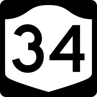
New York State Route 34 (NY 34) is a north–south New York state route located in Central New York. Its southern terminus is at the Pennsylvania state line in the village of Waverly, where it connects to Pennsylvania Route 199 and meets I-86/NY 17. Its northern terminus is at NY 104, outside the village of Hannibal.

<span class="mw-page-title-main">New York State Route 437</span> States shortest signed state highway

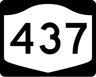
New York State Route 437 (NY 437) is a state highway located south of Auburn in Cayuga County, New York, in the United States. At 0.30 miles (0.48 km) in length, it is the shortest signed state route in New York. It is a brief connector route between NY 38 and NY 38A known locally as White Bridge Road. The highway allows motorists, especially those wanting quick access to the opposite side of nearby Owasco Lake, to avoid having to cross the Owasco Outlet further downstream, in the city. NY 437 was assigned in 1970; however, the designation had appeared on maps of the area as early as two decades before.

<span class="mw-page-title-main">New York State Route 182</span> State highway in Niagara County, New York, US

New York State Route 182 (NY 182) is a 6.18-mile (9.95 km) state highway in Niagara County, New York, in the United States. It serves as a signed connection between the Whirlpool Rapids Bridge over the Niagara River and the Niagara Falls International Airport east of the city of Niagara Falls. From the bridge, NY 182 runs across the city of Niagara Falls, following several local streets as it makes its way to an intersection with U.S. Route 62 (US 62) in Wheatfield. The route was originally designated as New York State Route 18D in the early 1930s. It gained its current designation on January 1, 1962.

<span class="mw-page-title-main">New York State Route 38</span> Highway in New York

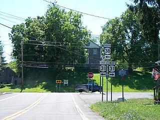
New York State Route 38 (NY 38) is a north–south state highway in the Finger Lakes region of New York in the United States. Its southern terminus is at an intersection with NY 96 in the town of Owego in Tioga County. The northern terminus is at a junction with NY 104A in the town of Sterling in Cayuga County. NY 38 is a two-lane local road for most of its length. The route is the main access road to parts of Auburn, Dryden, Newark Valley and Port Byron. It passes through mountainous terrain in Tioga and Cortland counties, but the terrain levels out as it heads through the Finger Lakes area and Cayuga County.

<span class="mw-page-title-main">New York State Route 90</span> State highway in New York, US

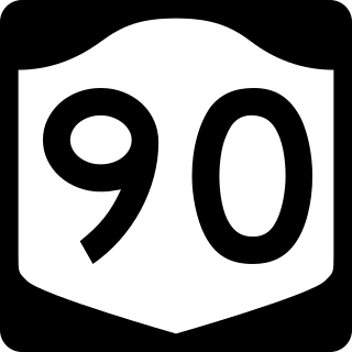
New York State Route 90 (NY 90) is a north–south state highway in the Finger Lakes region of New York in the United States. All but five of the route's 53 miles (85 km) are located in Cayuga County, with the remaining 5 miles (8 km) situated in Cortland County. The southern terminus of the route is at an intersection with U.S. Route 11 (US 11) and NY 41 in the village of Homer. Its northern terminus is at a junction with NY 31 in the town of Montezuma. Although the route is signed as north–south, the portion of NY 90 from King Ferry to Homer follows an east–west alignment.

<span class="mw-page-title-main">New York State Route 38A</span> New York state highway

New York State Route 38A (NY 38A) is a north–south state highway located within Onondaga and Cayuga counties in central New York in the United States. The southern terminus of the route is at an intersection with NY 38 in the village of Moravia. Its northern terminus is at a junction with U.S. Route 20 (US 20) and NY 5 in downtown Auburn. Much of NY 38A runs through rural, undeveloped areas situated between Owasco Lake and Skaneateles Lake.

<span class="mw-page-title-main">New York State Route 34B</span> State highway in central New York, US

New York State Route 34B (NY 34B) is a north–south state highway located within Tompkins and Cayuga counties in Central New York in the United States. Its northern terminus is located at a junction with NY 34 by the hamlet of Fleming within the town of the same name in Cayuga County. The southern terminus is located at a junction with NY 38 in the town of Dryden in Tompkins County.

<span class="mw-page-title-main">New York State Route 89</span> State highway in central New York, US

New York State Route 89 (NY 89) is a north–south state highway in central New York in the United States. It extends for 62.35 miles (100.34 km) from an intersection with NY 13, NY 34, and NY 96 in the Tompkins County city of Ithaca to an interchange with NY 104 in the Wayne County town of Wolcott. The route spans a total of three counties, connecting the heart of the Finger Lakes Region to a point 6 miles (10 km) south of Lake Ontario. Along the way, NY 89 intersects two regionally important highways: the conjoined routes of U.S. Route 20 (US 20) and NY 5 in Seneca Falls and NY 31 in Savannah. NY 89 runs along the western edge of Cayuga Lake from Ithaca to Seneca Falls.

<span class="mw-page-title-main">New York State Route 326</span> State highway in Cayuga County, New York, US

New York State Route 326 (NY 326) is a 8.74-mile-long (14.07 km) state highway in Cayuga County, New York, in the United States. NY 326 runs in a southwest to northeast direction from the village of Union Springs to the city of Auburn. The western terminus of the route is at an intersection with NY 90 near the northern village line of Union Springs. Its eastern terminus is at a junction with U.S. Route 20 (US 20) and NY 5 just west of the Auburn city limits in the town of Aurelius. NY 326 passes through largely rural portions of the Finger Lakes region and does not pass through any built-up areas other than those at each of its termini.

<span class="mw-page-title-main">New York State Route 31B</span> A state highway in central New York in the United States

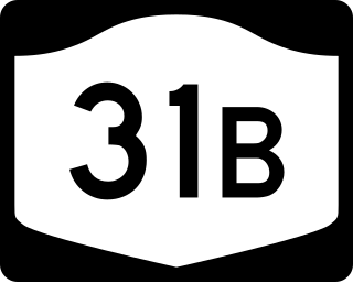
New York State Route 31B (NY 31B) was a state highway in central New York in the United States. It served as a connector between NY 31, its parent route, in the Cayuga County village of Weedsport and NY 5 in the Onondaga County town of Elbridge. NY 31B was assigned c. 1933, replacing New York State Route 293, a route assigned as part of the 1930 renumbering of state highways in New York. The NY 31B designation was removed in 1980 and replaced by County Route 31B (CR 31B) in Cayuga County and CR 99 in Onondaga County.

References

  1. 1 2 3 "County Roads Listing - Cayuga County" (PDF). New York State Department of Transportation. June 22, 2021. Retrieved August 13, 2021.
  2. Google (January 18, 2016). "overview map of NY 34 from Cato to Oswego County line" (Map). Google Maps . Google. Retrieved January 18, 2016.
  3. "Route 34 Extended North 9 1/2 Miles to Route 104". Auburn Citizen Advertiser. May 26, 1970. p. 3. Retrieved January 18, 2016 via Newspaperarchive.com. Open Access logo PLoS transparent.svg