Related Research Articles

Santa Rosa National Park, is a national park, in Guanacaste Province, northwestern Costa Rica, it was created in 1966 by decree 3694.

The Talamancan montane forests ecoregion, in the tropical moist broadleaf forest biome, are in montane Costa Rica and Panama in Central America.
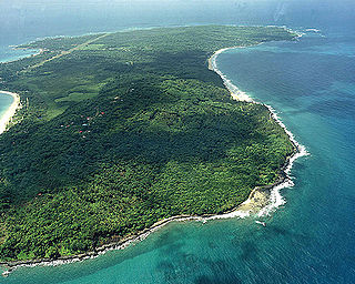
The Mosquitia-Nicaraguan Caribbean Coast mangroves ecoregion, in the Mangrove biome, are along the Caribbean coasts of Nicaragua, Honduras, and Costa Rica as well as off shore islands such as the Corn Islands.
The Central America bioregion is a biogeographic region comprising southern Mexico and Central America.

The following outline is provided as an overview of and topical guide to Costa Rica:

The Isthmian–Atlantic moist forests (NT0129) are a Central American tropical moist broadleaf forest ecoregion located on the lowland slopes on the caribbean sea side of Nicaragua and Costa Rica and the Gulf and Pacific Ocean sides of Panama. The forest species are a mix of North American and South American, as this region only became a land bridge in the past 3 million years.

Tortuguero National Park is a national park in the Limón Province of Costa Rica. It is situated within the Tortuguero Conservation Area of the northeastern part of the country. Despite its remote location, reachable only by airplane or boat, it is the third-most visited park in Costa Rica. The park has a large variety of biological diversity due to the existence within the reserve of eleven different habitats, including rainforest, mangrove forests, swamps, beaches, and lagoons. Located in a tropical climate, it is very humid, and receives up to 250 inches (6,400 mm) of rain a year.

The Amazon–Orinoco–Southern Caribbean mangroves (NT1401) is an ecoregion along the coasts of Colombia, Venezuela, Guyana, Suriname, French Guiana and Brazil.
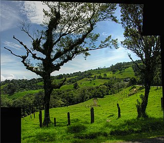
The Costa Rican seasonal moist forests ecoregion covers the Pacific Slope of the volcanic mountain range of northwestern Costa Rica and the extreme south of Nicaragua. The area has a distinct dry season during which the characteristic deciduous trees drop their leaves. The forests themselves have been highly degraded in the past by human conversion to agriculture and settlement. The Costa Rican capital city of San Jose is in the middle of this ecoregion.

The Bocas del Toro-San Bastimentos Island-San Blas mangroves ecoregion covers the mangrove habitats along the Caribbean Sea coast of Costa Rica and across the northern coast of Panama. An offshore reef and barrier islands of the region help protect the mangroves from destructive waves. The ecoregion has a high number of endangered and threatened species, including the loggerhead sea turtle, green sea turtle, and hawk's bill sea turtle.

The Moist Pacific Coast mangroves ecoregion covers a series of disconnected mangrove sites along the Pacific Ocean coast of Costa Rica and Panama. These sites occur mostly on coastal flatlands around lagoons, particularly where rivers from the inland mountains reach the sea, bringing fresh water to the coastal forests. The area is in a transition zone from the drier coastline to the north; rainfall in this ecoregions is over 2,000 mm/year, and reaches over 3,600 mm/year at the southern end.

The Rio Negro-Rio San Sun mangroves ecoregion covers a series of small of discontinuous mangrove forests on the Caribbean Sea coast of Costa Rica, from a small portion inside the border with Nicaragua in the west to the border with Panama in the east. The coast on this stretch is a flat, alluvial plain, and mangroves are only a small part of a diverse patchwork of local habitats including swamps, mixed rainforests, coastal lagoons, sea grass beds, and sandy beaches. Much of the territory is "blackwater river" in character - slow-moving channels in wooded swamps with water stained by decayed matter. These mangroves are periodically damaged by hurricanes, such as in 1988 from Hurricane Joan, but are able to regenerate.
References
- ↑ Bermúdez M., Mariela; Joaquín Sánchez G., eds. (2000). Identificación de vacíos de información botánica en Centroamérica (in Spanish). WWF Centroamérica, Museo Nacional de Costa Rica, Red de Herbarios de Mesoamérica y el Caribe. p. 17.
- ↑ Programa de monitoreo ecológico del área de conservación Osa, Costa Rica. El sitio Osa: definición y caracterización. PROMEC-ACOSA. (in Spanish)
- ↑ "Central American Atlantic moist forests". World Wildlife Fund. Retrieved 2013-09-23.
- ↑ "Cocos Island moist forests". World Wildlife Fund. Retrieved 2013-09-23.
- ↑ "Costa Rican seasonal moist forests". World Wildlife Fund. Retrieved 2013-09-23.
- ↑ "Isthmian-Atlantic moist forests". World Wildlife Fund. Retrieved 2013-09-23.
- ↑ "Isthmian-Pacific moist forests". World Wildlife Fund. Retrieved 2013-09-23.
- ↑ "Talamancan montane forests". World Wildlife Fund. Retrieved 2013-09-23.
- ↑ "Central American dry forests". World Wildlife Fund. Retrieved 2013-09-23.
- ↑ "Bocas del Toro-San Bastimentos Island-San Blas mangroves". World Wildlife Fund. Retrieved 2013-09-23.
- ↑ "Moist Pacific Coast mangroves". World Wildlife Fund. Retrieved 2013-09-23.
- ↑ "Mosquitia-Nicaraguan Caribbean Coast mangroves". World Wildlife Fund. Retrieved 2013-09-23.
- ↑ "Rio Negro-Rio San Sun mangroves". World Wildlife Fund. Retrieved 2013-09-23.
- ↑ "Southern Dry Pacific Coast mangroves". World Wildlife Fund. Retrieved 2013-09-23.
- ↑ "Chiriqui". Freshwater Ecoregions of the World. Accessed 19 June 2021. https://www.feow.org/ecoregions/details/206
- ↑ "Estero Real–Tempisque". Freshwater Ecoregions of the World. Accessed 19 June 2021. https://www.feow.org/ecoregions/details/204
- ↑ "Isthmus Caribbean". Freshwater Ecoregions of the World. Accessed 19 June 2021. https://www.feow.org/ecoregions/details/207
- ↑ "San Juan (Nicaragua/Costa Rica)". Freshwater Ecoregions of the World. Accessed 19 June 2021. https://www.feow.org/ecoregions/details/205
- 1 2 3 4 "Marine Ecoregions (Spalding 2007). [Map by] GEOMAR, University of Seville, Department of Human Geography". Marine ecoregions. marineplan.es. Archived from the original (jpg) on 2017-02-12. Retrieved 2013-09-26.
!["Marine Ecoregions (Spalding 2007). [Map by] GEOMAR, University of Seville, Department of Human Geography"](https://web.archive.org/web/20170212110426/http://www.marineplan.es/ES/fichas_kml/mapasfichas/ecoregions.jpg)