Related Research Articles
The Global 200 is the list of ecoregions identified by WWF, the global conservation organization, as priorities for conservation. According to WWF, an ecoregion is defined as a "relatively large unit of land or water containing a characteristic set of natural communities that share a large majority of their species dynamics, and environmental conditions". So, for example, based on their levels of endemism, Madagascar gets multiple listings, ancient Lake Baikal gets one, and the North American Great Lakes get none.
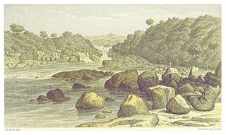
The Courantyne/Corentyne/Corantijn River is a river in northern South America in Suriname and Guyana. It is the longest river in the country and creates the border between Suriname and the East Berbice-Corentyne region of Guyana.

The Central Suriname Nature Reserve is a conservation unit in Suriname. It preserves an area of tropical rainforest. The reserve is a pristine condition.

Kaieteur National Park is a national park located in the Potaro-Siparuni Region of Guyana. The Park's boundaries and purpose are defined in the Kaieteur National Park Act, and was created to preserve the natural scenery, and its fauna and flora. The Act is administered by the Kaieteur National Park Commission.

The Guianan gnatcatcher is a species of bird in the family Polioptilidae. It is found in Brazil, French Guiana, Guyana, Suriname, and Venezuela.

Campinarana, also called Rio Negro Campinarana, is a neotropical ecoregion in the Amazon biome of the north west of Brazil and the east of Colombia that contains vegetation adapted to extremely poor soil. It includes savanna, scrub and forest, and contains many endemic species of fauna and flora.

The Guianan savanna (NT0707) is an ecoregion in the south of Venezuela, Guyana and Suriname and the north of Brazil. It is in the Amazon biome. The savanna covers an area of rolling upland plains on the Guiana Shield between the Amazon and Orinoco basins. It includes forested areas, but these are shrinking steadily due to the effect of frequent fires, either accidental or deliberate. The ecoregion includes the Gran Sabana region of Venezuela.

The Negro–Branco moist forests (NT0143) is an ecoregion of tropical moist broadleaf forest to the east of the Andes in southern Venezuela, eastern Colombia and northern Brazil, in the Amazon biome. It lies on the watershed between the Orinoco and Rio Negro basins. It includes both blackwater and whitewater rivers, creating different types of seasonally flooded forest. The vegetation is more typical of the Guiana region than the Amazon.

The Uatuma–Trombetas moist forests (NT0173) is an ecoregion in northwest Brazil in the Amazon biome. It covers the Amazon basin north of the Amazon River from close to the Atlantic Ocean to the Rio Negro west of Manaus. The ecoregion is relatively intact, although it has been damaged along the main rivers and around population centers.
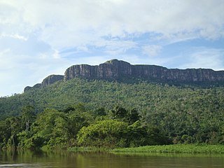
The Guayanan Highlands moist forests (NT0124) is an ecoregion in the south of Venezuela and the north of Brazil and in Guyana, Suriname, French Guiana. It is in the Amazon biome. It encompasses an upland region with diverse fauna and flora, which contains dramatic tepuis, or sandstone table mountains. The region has been inaccessible in the past and is generally fairly intact, apart from the north and northeast where large scale agriculture, ranching and mining operations are steadily encroaching on the ecosystem. New roads are opening the interior to logging, and planned dams will have a drastic impact on the riparian zones.

The Guianan piedmont and lowland moist forests (NT0182) is an ecoregion in the south of Venezuela and the north of Brazil. It is in the Amazon biome. The ecoregion is relatively intact, largely protected by conservation units or indigenous territories, and less threatened by global warming than flatter and more deforested regions.

The Guianan moist forests (NT0125) is an ecoregion in the east of Venezuela, north of Brazil and the Guyanas. It is in the Amazon biome. The climate is hot and humid, with two rainy seasons each year. As of 1996 the tropical rainforest habitat was relatively intact, although there were mounting threats from illegal logging and gold mining.

The Amazon–Orinoco–Southern Caribbean mangroves (NT1401) is an ecoregion along the coasts of Colombia, Venezuela, Guyana, Suriname, French Guiana and Brazil.

The Guianan mangroves (NT1411) is a coastal ecoregion of southeastern Venezuela, Guyana, Suriname and French Guiana. The mangroves provide an important habitat for migrating birds that winter in the area. Large areas are intact, although they are threatened by destruction of the trees for timber and to make way for agriculture, and from upstream agricultural and industrial pollution.

The Orinoco Delta swamp forests (NT0147) is an ecoregion of eastern Venezuela and northern Guyana covering the large and shifting Orinoco Delta. The vegetation is mostly permanently flooded rainforest. The ecoregion is relatively intact apart from a large area that was damaged by a failed flood control program in the 1960s. It is inaccessible, so logging is difficult, and the soil is unsuitable for farming. The main threat comes from oil exploration, which would bring an influx of settlers into the delta.

The Paramaribo swamp forests (NT0149) is an ecoregion in the coastal plain of Suriname covering a strip of land that is almost always flooded by fresh waters. It transitions into saline mangrove swamps towards the coast, and into submontane forests towards the interior.
References
- Dinerstein, Eric; David Olson; Douglas J. Graham; et al. (1995). A Conservation Assessment of the Terrestrial Ecoregions of Latin America and the Caribbean. World Bank, Washington, D.C..