This is a list of fossiliferous stratigraphic units in Cape Verde .
Contents
| Group | Formation | Period | Notes |
|---|---|---|---|
| Assomada Formation | Calabrian | [1] | |
This is a list of fossiliferous stratigraphic units in Cape Verde .
| Group | Formation | Period | Notes |
|---|---|---|---|
| Assomada Formation | Calabrian | [1] | |

Ponta do Sol is the northernmost city on the island of Santo Antão and Cape Verde. It is situated on the coast, 4 km northwest of Ribeira Grande and 20 km north of the island capital Porto Novo. It is the seat of Ribeira Grande municipality.

Serra Negra is a hill in the southeastern part of the island of Sal in Cape Verde. Its maximum elevation is 104 m, the highest point in southern Sal. It stretches for about 2.5 km along the east coast of the island, between the headland Ponta da Fragata in the south and the Ponta do Morrinho Vermelho in the north. The nearest settlement is Murdeira, to the west. The mountain forms part of a protected area as a nature reserve, important as nesting area for seabirds and turtles. The nature reserve covers 3.31 km2 (1.28 sq mi) of land and 22.96 km2 (8.86 sq mi) of ocean.

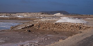
Buracona is a small bay in the northwest of the island of Sal, Cape Verde. The bay is approximately 5 km north of the village Palmeira. The bay is part of the 5.45 km2 (2.10 sq mi) protected landscape of Buracona-Ragona, which covers the coast between Palmeira and Ponta Preta, and the mountain Monte Leste.

Ilhéu de Sal Rei is an uninhabited islet near the coast of Boa Vista Island, Cape Verde. It is located 1 km southwest of the island capital Sal Rei. Its area is 89 ha (0.34 sq mi) and its highest point is 27 m (88.6 ft).

The Mancos Shale or Mancos Group is a Late Cretaceous geologic formation of the Western United States.

The Whitewater Formation is a geologic formation in Ohio and Indiana. It preserves fossils dating back to the Ordovician period.

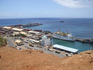
Praia Harbor is the port of the city of Praia in the southern part of the island of Santiago, Cape Verde. It is situated in a natural bay of the Atlantic Ocean. Since the latest modernization in 2014, it has 2 long quays, 3 shorter quays, a quay for fishing boats with fish processing installations, 2 container parks, 2 roll-on/roll-off ramps and a passenger terminal. The total length of the quays is 863 m, and the maximum depth is 13.5 m. The port of Praia played an important role in the colonization of Africa and South America by the Portuguese. With 817,845 metric tonnes of cargo and 85,518 passengers handled (2017), it is the second busiest port of Cape Verde, after Porto Grande (Mindelo).

Ponta das Bicudas is a headland in the southeastern part of the island of Santiago, Cape Verde. It is 3 km east of the city centre of Praia, near the neighbourhood Achada Grande Tras. The Praia Harbour lies west of the headland.
Ponta Bicuda is a headland in the northern part of the island of Santiago, Cape Verde. It is 3 km (1.9 mi) east of Ponta Moreia, the northernmost point of Santiago, and 8 kilometres (5.0 mi) northeast of Tarrafal. In the 1747 map by Jacques-Nicolas Bellin, the point was mentioned as "Pt. Bikkude".

The Ganigobis Formation is a Late Carboniferous (Gzhelian) to Early Permian (Artinskian) geologic formation of the Dwyka Group in the ǁKaras Region of southeastern Namibia and the Northern Cape of South Africa. The widespread formation was deposited in the Aranos and Karoo Basins of southern Africa.