List of lakes in Missoula County, Montana

Last updated

Map all coordinates using: OpenStreetMap  
Download coordinates as: KML  ·  GPX

There are at least 132 named lakes and reservoirs in Missoula County, Montana .

Lake A body of relatively still water, in a basin surrounded by land

A lake is an area filled with water, localized in a basin, surrounded by land, apart from any river or other outlet that serves to feed or drain the lake. Lakes lie on land and are not part of the ocean, and therefore are distinct from lagoons, and are also larger and deeper than ponds, though there are no official or scientific definitions. Lakes can be contrasted with rivers or streams, which are usually flowing. Most lakes are fed and drained by rivers and streams.

Reservoir A storage space for fluids

A reservoir is, most commonly, an enlarged natural or artificial lake, pond or impoundment created using a dam or lock to store water.
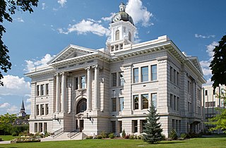
Missoula County, Montana County in the United States

Missoula County is a county in the State of Montana. As of the 2010 United States Census, the population was 109,426, making it Montana's second-most populous county. Its county seat and largest city is Missoula. The county was founded in 1860.

Contents

Lakes

Boulder Lake is located in the Olympic National Park in Washington. It is accessible by the Olympic Hot Springs Trail and the Appleton Pass trail. The hike is about 12 miles (19 km) round trip and has about a 2,500-foot (760 m) elevation gain. At the lake there are a few camp sites and a bear wire to hang food. The lake lies at the base of Boulder Peak.

Hemlock Lake lake in Livingston County, New York, USA

Hemlock Lake is one of the minor Finger Lakes. It is mostly located in Livingston County, New York, south of Rochester, with a portion overlapping into Ontario County. Hemlock is a translation of the Seneca name for the lake, O-neh-da Te-car-ne-o-di.

Rainy Lake lake in Ontario, Canada and Minnesota, United States

Rainy Lake is a relatively large freshwater lake straddling the border between the United States and Canada. The Rainy River issues from the west side of the lake and is harnessed to make hydroelectricity for US and Canadian locations. The sister cities of International Falls, Minnesota, and Fort Frances, Ontario, are situated on either side of the outflow of the river from the lake. Rainy Lake and Rainy River establish part of the boundary between the US state of Minnesota and the Canadian province of Ontario.

Reservoirs

See also

Notes

  1. "Beanhole Lake". Geographic Names Information System . United States Geological Survey.
  2. "Beaver Lake". Geographic Names Information System . United States Geological Survey.
  3. "Big Lake". Geographic Names Information System . United States Geological Survey.
  4. "Big Sky Lake". Geographic Names Information System . United States Geological Survey.
  5. "Blanchard Lake". Geographic Names Information System . United States Geological Survey.
  6. "Boulder Lake". Geographic Names Information System . United States Geological Survey.
  7. "Buck Lake". Geographic Names Information System . United States Geological Survey.
  8. "Bull Lake". Geographic Names Information System . United States Geological Survey.
  9. "Bunyan Lake". Geographic Names Information System . United States Geological Survey.
  10. "Carlton Lake". Geographic Names Information System . United States Geological Survey.
  11. "Cheff Lake". Geographic Names Information System . United States Geological Survey.
  12. "Clearwater Lake". Geographic Names Information System . United States Geological Survey.
  13. "Colt Lake". Geographic Names Information System . United States Geological Survey.
  14. "Conko Lake". Geographic Names Information System . United States Geological Survey.
  15. "Cott Lake". Geographic Names Information System . United States Geological Survey.
  16. "Cottonwood Lakes". Geographic Names Information System . United States Geological Survey.
  17. "Crazy Fish Lake". Geographic Names Information System . United States Geological Survey.
  18. "Crescent Lake". Geographic Names Information System . United States Geological Survey.
  19. "Crystal Lake". Geographic Names Information System . United States Geological Survey.
  20. "Cygnet Lake". Geographic Names Information System . United States Geological Survey.
  21. "Doctor Lake". Geographic Names Information System . United States Geological Survey.
  22. "Eagle Lake". Geographic Names Information System . United States Geological Survey.
  23. "Elbow Lake". Geographic Names Information System . United States Geological Survey.
  24. "Elk Lake". Geographic Names Information System . United States Geological Survey.
  25. "Farmers Lakes". Geographic Names Information System . United States Geological Survey.
  26. "Finley Lakes". Geographic Names Information System . United States Geological Survey.
  27. "Florence Lake". Geographic Names Information System . United States Geological Survey.
  28. "Fly Lake". Geographic Names Information System . United States Geological Survey.
  29. "George Lake". Geographic Names Information System . United States Geological Survey.
  30. "Glacier Lake". Geographic Names Information System . United States Geological Survey.
  31. "Glacier Lake". Geographic Names Information System . United States Geological Survey.
  32. "Gray Wolf Lake". Geographic Names Information System . United States Geological Survey.
  33. "Grizzly Lake". Geographic Names Information System . United States Geological Survey.
  34. "Harpers Lake". Geographic Names Information System . United States Geological Survey.
  35. "Harpers Lake". Geographic Names Information System . United States Geological Survey.
  36. "Heart Lake". Geographic Names Information System . United States Geological Survey.
  37. "Hemlock Lake". Geographic Names Information System . United States Geological Survey.
  38. "Hidden Lake". Geographic Names Information System . United States Geological Survey.
  39. "Hidden Lake". Geographic Names Information System . United States Geological Survey.
  40. "High Park Lake". Geographic Names Information System . United States Geological Survey.
  41. "Holland Lake". Geographic Names Information System . United States Geological Survey.
  42. "Island Lake". Geographic Names Information System . United States Geological Survey.
  43. "Jewell Lake". Geographic Names Information System . United States Geological Survey.
  44. "Jim Lake". Geographic Names Information System . United States Geological Survey.
  45. "Koessler Lake". Geographic Names Information System . United States Geological Survey.
  46. "Kreis Pond". Geographic Names Information System . United States Geological Survey.
  47. "Lace Lake". Geographic Names Information System . United States Geological Survey.
  48. "Lagoon Lake". Geographic Names Information System . United States Geological Survey.
  49. "Lake Alva". Geographic Names Information System . United States Geological Survey.
  50. "Lake Dinah". Geographic Names Information System . United States Geological Survey.
  51. "Lake Elsina". Geographic Names Information System . United States Geological Survey.
  52. "Lake Inez". Geographic Names Information System . United States Geological Survey.
  53. "Lake Marshall". Geographic Names Information System . United States Geological Survey.
  54. "Lake Sa-ol-Sooth". Geographic Names Information System . United States Geological Survey.
  55. "Lena Lake". Geographic Names Information System . United States Geological Survey.
  56. "Lick Lake". Geographic Names Information System . United States Geological Survey.
  57. "Lindbergh Lake". Geographic Names Information System . United States Geological Survey.
  58. "Little Carlton Lake". Geographic Names Information System . United States Geological Survey.
  59. "Little Lake". Geographic Names Information System . United States Geological Survey.
  60. "Lockwood Lake". Geographic Names Information System . United States Geological Survey.
  61. "Loco Lake". Geographic Names Information System . United States Geological Survey.
  62. "Loon Lake". Geographic Names Information System . United States Geological Survey.
  63. "Lost Lake". Geographic Names Information System . United States Geological Survey.
  64. "Lost Lake". Geographic Names Information System . United States Geological Survey.
  65. "Lost Sheep Lake". Geographic Names Information System . United States Geological Survey.
  66. "Lower Cold Lake". Geographic Names Information System . United States Geological Survey.
  67. "Lower Jocko Lake". Geographic Names Information System . United States Geological Survey.
  68. "Marys Pond". Geographic Names Information System . United States Geological Survey.
  69. "McClain Lake". Geographic Names Information System . United States Geological Survey.
  70. "Meadow Lake". Geographic Names Information System . United States Geological Survey.
  71. "Meadow Lake". Geographic Names Information System . United States Geological Survey.
  72. "Mollman Lakes". Geographic Names Information System . United States Geological Survey.
  73. "Mountaineer Lake". Geographic Names Information System . United States Geological Survey.
  74. "Necklace Lakes". Geographic Names Information System . United States Geological Survey.
  75. "North Hemlock Lake". Geographic Names Information System . United States Geological Survey.
  76. "North One Horse Lake". Geographic Names Information System . United States Geological Survey.
  77. "Notlimah Lake". Geographic Names Information System . United States Geological Survey.
  78. "Onemile Pond". Geographic Names Information System . United States Geological Survey.
  79. "Pasture Lake". Geographic Names Information System . United States Geological Survey.
  80. "Pendent Lake". Geographic Names Information System . United States Geological Survey.
  81. "Pierce Lake". Geographic Names Information System . United States Geological Survey.
  82. "Placid Lake". Geographic Names Information System . United States Geological Survey.
  83. "Rainy Lake". Geographic Names Information System . United States Geological Survey.
  84. "Reed Lake". Geographic Names Information System . United States Geological Survey.
  85. "Roosevelt Lake". Geographic Names Information System . United States Geological Survey.
  86. "Rubble Lake". Geographic Names Information System . United States Geological Survey.
  87. "Rumble Creek Lake". Geographic Names Information System . United States Geological Survey.
  88. "Salmon Lake". Geographic Names Information System . United States Geological Survey.
  89. "Sapphire Lake". Geographic Names Information System . United States Geological Survey.
  90. "Sappho Lake". Geographic Names Information System . United States Geological Survey.
  91. "Seeley Lake". Geographic Names Information System . United States Geological Survey.
  92. "Seepela Lake". Geographic Names Information System . United States Geological Survey.
  93. "Skylark Lake". Geographic Names Information System . United States Geological Survey.
  94. "Sleeping Elk Lake". Geographic Names Information System . United States Geological Survey.
  95. "South One Horse Lake". Geographic Names Information System . United States Geological Survey.
  96. "Spider Lake". Geographic Names Information System . United States Geological Survey.
  97. "Spook Lake". Geographic Names Information System . United States Geological Survey.
  98. "Spook Lake". Geographic Names Information System . United States Geological Survey.
  99. "Stoner Lake". Geographic Names Information System . United States Geological Survey.
  100. "Sudden Lake". Geographic Names Information System . United States Geological Survey.
  101. "Summit Lake". Geographic Names Information System . United States Geological Survey.
  102. "Summit Lake". Geographic Names Information System . United States Geological Survey.
  103. "Sunset Lake". Geographic Names Information System . United States Geological Survey.
  104. "Terrace Lakes". Geographic Names Information System . United States Geological Survey.
  105. "The Angels Bathing Pool". Geographic Names Information System . United States Geological Survey.
  106. "Tote Road Lake". Geographic Names Information System . United States Geological Survey.
  107. "Tunnel Lake". Geographic Names Information System . United States Geological Survey.
  108. "Tuppers Lake". Geographic Names Information System . United States Geological Survey.
  109. "Turquoise Lake". Geographic Names Information System . United States Geological Survey.
  110. "Twin Lakes". Geographic Names Information System . United States Geological Survey.
  111. "Upper Cold Lake". Geographic Names Information System . United States Geological Survey.
  112. "Upper Holland Lake". Geographic Names Information System . United States Geological Survey.
  113. "Upper Jocko Lake". Geographic Names Information System . United States Geological Survey.
  114. "Wapiti Lake". Geographic Names Information System . United States Geological Survey.
  115. "Whelp Lake". Geographic Names Information System . United States Geological Survey.
  116. "White Horse Lake". Geographic Names Information System . United States Geological Survey.
  117. "Woodward Lake". Geographic Names Information System . United States Geological Survey.
  118. "Worden Lake". Geographic Names Information System . United States Geological Survey.
  119. "Yellow Lake". Geographic Names Information System . United States Geological Survey.
  120. "Black Lake". Geographic Names Information System . United States Geological Survey.
  121. "Carter Lake". Geographic Names Information System . United States Geological Survey.
  122. "Glacier Lake". Geographic Names Information System . United States Geological Survey.
  123. "Jocko Lake". Geographic Names Information System . United States Geological Survey.
  124. "Lower Lake of Twin Lakes". Geographic Names Information System . United States Geological Survey.
  125. "McKinley Lake". Geographic Names Information System . United States Geological Survey.
  126. "Milltown Reservoir". Geographic Names Information System . United States Geological Survey.
  127. "Sanders Lake". Geographic Names Information System . United States Geological Survey.
  128. "Sanders Lake". Geographic Names Information System . United States Geological Survey.
  129. "Sheridan Lake". Geographic Names Information System . United States Geological Survey.
  130. "Spring Creek Reservoir". Geographic Names Information System . United States Geological Survey.
  131. "Upper Lake". Geographic Names Information System . United States Geological Survey.

Related Research Articles

Waterfalls of Montana Wikimedia list article

There are at least 120 named waterfalls in Montana. A waterfall is a place where flowing water rapidly drops in elevation as it flows over a steep region or a cliff. Waterfalls are most commonly formed when a river is young.