List of lakes in Sanders County, Montana

Last updated
Map all coordinates using: OpenStreetMap  ·  Google Maps
Download coordinates as: KML  ·  GPX

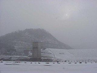
There are at least 66 named lakes and reservoirs in Sanders County, Montana .

Lake A body of relatively still water, in a basin surrounded by land

A lake is an area filled with water, localized in a basin, that is surrounded by land, apart from any river or other outlet that serves to feed or drain the lake. Lakes lie on land and are not part of the ocean, and therefore are distinct from lagoons, and are also larger and deeper than ponds, though there are no official or scientific definitions. Lakes can be contrasted with rivers or streams, which are usually flowing. Most lakes are fed and drained by rivers and streams.

Reservoir A storage space for fluids

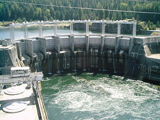
A reservoir is, most commonly, an enlarged natural or artificial lake, pond or impoundment created using a dam or lock to store water.

Sanders County, Montana County in the United States

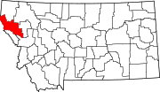
Sanders County is a county in the U.S. state of Montana. As of the 2010 United States Census, the population was 11,413. Its county seat is Thompson Falls. The county was founded in 1905.

Contents

Lakes

Banana Lake or is a 268-acre (1,080,000 m2) natural freshwater lake in southeast Lakeland, Florida. Before 1860 this lake was called Mud Lake. A family homesteaded at the lake and planted bananas, amongst other types of fruit. By 1890 the lake was known by its current name. Banana Lake is in a suburban area. Residential areas and agricultural areas surround it. To the southwest 200 feet (61 m) is Little Banana Lake. Lake Stahl is 400 feet (120 m) to the northwest. Just to the north of Lake Stahl is the Sanlan Golf Course, which also borders Banana Lake.

Fishtrap Lake

Fishtrap Lake is a 1,130-acre (5 km2) reservoir in Pike County, Kentucky. Dedicated by President Lyndon B. Johnson in 1968, the lake was formed by the impounding of the Levisa Fork of the Big Sandy River at the 195-foot-high Fishtrap Dam by the United States Army Corps of Engineers.

Image Lake Lake in Snohomish County, Washington, USA

Image Lake is a tarn in Glacier Peak Wilderness, in the North Cascades of Washington, United States. The lake is surrounded by Plummer Peak to the east, a lookout point to the west, the Miners Creek drainage and Glacier Peak to the south, and Canyon Lake to the north. The course of the popular Miners Ridge Trail skirts the lake. Glacier Peak can be seen from the outlet of the lake, and the peak reflected in the lake is a popular photographic subject.

Reservoirs

Cabinet Gorge Dam

Cabinet Gorge Dam is a concrete gravity-arch hydroelectric dam on the Clark Fork River, in the U.S. state of Idaho. The dam is located in the Idaho Panhandle, just west of the Montana border. Cabinet Gorge Reservoir extends into Montana, nearly to Noxon Rapids Dam. The purpose of the dam is for hydroelectricity.

Noxon Rapids Dam

Noxon Rapids Dam is an earthfill gravity-type hydroelectric dam on the Clark Fork river, in the northwest part of the U.S. state of Montana.

See also

Notes

  1. "Acorn Lake". Geographic Names Information System . United States Geological Survey.
  2. "Arrowhead Lake". Geographic Names Information System . United States Geological Survey.
  3. "Baldy Lake". Geographic Names Information System . United States Geological Survey.
  4. "Banana Lake". Geographic Names Information System . United States Geological Survey.
  5. "Bass Pond". Geographic Names Information System . United States Geological Survey.
  6. "Bear Lake". Geographic Names Information System . United States Geological Survey.
  7. "Beaver Lake". Geographic Names Information System . United States Geological Survey.
  8. "Beaver Lake". Geographic Names Information System . United States Geological Survey.
  9. "Berry Lake". Geographic Names Information System . United States Geological Survey.
  10. "Blossom Lakes". Geographic Names Information System . United States Geological Survey.
  11. "Buck Lake". Geographic Names Information System . United States Geological Survey.
  12. "Burgess Lake". Geographic Names Information System . United States Geological Survey.
  13. "Cabin Lake". Geographic Names Information System . United States Geological Survey.
  14. "Carbine Lake". Geographic Names Information System . United States Geological Survey.
  15. "Cliff Lake". Geographic Names Information System . United States Geological Survey.
  16. "Copper Lake". Geographic Names Information System . United States Geological Survey.
  17. "Corona Lake". Geographic Names Information System . United States Geological Survey.
  18. "Crescent Lake". Geographic Names Information System . United States Geological Survey.
  19. "Deer Lake". Geographic Names Information System . United States Geological Survey.
  20. "Duckhead Lake". Geographic Names Information System . United States Geological Survey.
  21. "East Lake". Geographic Names Information System . United States Geological Survey.
  22. "Elk Lake". Geographic Names Information System . United States Geological Survey.
  23. "Engle Lake". Geographic Names Information System . United States Geological Survey.
  24. "Evans Lake". Geographic Names Information System . United States Geological Survey.
  25. "Fishtrap Lake". Geographic Names Information System . United States Geological Survey.
  26. "Frog Lake". Geographic Names Information System . United States Geological Survey.
  27. "Goat Lakes". Geographic Names Information System . United States Geological Survey.
  28. "Grass Lake". Geographic Names Information System . United States Geological Survey.
  29. "Graves Lake". Geographic Names Information System . United States Geological Survey.
  30. "Grouse Lake". Geographic Names Information System . United States Geological Survey.
  31. "Honeymoon Lake". Geographic Names Information System . United States Geological Survey.
  32. "Image Lake". Geographic Names Information System . United States Geological Survey.
  33. "Isabella Lake". Geographic Names Information System . United States Geological Survey.
  34. "Knowles Lake". Geographic Names Information System . United States Geological Survey.
  35. "Lawn Lake". Geographic Names Information System . United States Geological Survey.
  36. "Little Ibex Lake". Geographic Names Information System . United States Geological Survey.
  37. "Lower Thompson Lake". Geographic Names Information System . United States Geological Survey.
  38. "Marmot Lakes". Geographic Names Information System . United States Geological Survey.
  39. "Ninetythree Mile Lake". Geographic Names Information System . United States Geological Survey.
  40. "Outlaw Lake". Geographic Names Information System . United States Geological Survey.
  41. "Pear Lake". Geographic Names Information System . United States Geological Survey.
  42. "Porcupine Lake". Geographic Names Information System . United States Geological Survey.
  43. "Quail Lake". Geographic Names Information System . United States Geological Survey.
  44. "Rainbow Lake". Geographic Names Information System . United States Geological Survey.
  45. "Rock Lake". Geographic Names Information System . United States Geological Survey.
  46. "Rush Lake". Geographic Names Information System . United States Geological Survey.
  47. "Saint Paul Lake". Geographic Names Information System . United States Geological Survey.
  48. "Schmitz Lakes". Geographic Names Information System . United States Geological Survey.
  49. "Smiley Slough". Geographic Names Information System . United States Geological Survey.
  50. "Snowshoe Lake". Geographic Names Information System . United States Geological Survey.
  51. "Stony Lake". Geographic Names Information System . United States Geological Survey.
  52. "Sylvan Lake". Geographic Names Information System . United States Geological Survey.
  53. "Terrace Lake". Geographic Names Information System . United States Geological Survey.
  54. "Thompson Lakes". Geographic Names Information System . United States Geological Survey.
  55. "Tuffys Lake". Geographic Names Information System . United States Geological Survey.
  56. "Twin Lakes". Geographic Names Information System . United States Geological Survey.
  57. "Upper Fishtrap Lake". Geographic Names Information System . United States Geological Survey.
  58. "Upper Lake". Geographic Names Information System . United States Geological Survey.
  59. "Wanless Lake". Geographic Names Information System . United States Geological Survey.
  60. "Winniemuck Lake". Geographic Names Information System . United States Geological Survey.
  61. "Cabinet Gorge Reservoir". Geographic Names Information System . United States Geological Survey.
  62. "Dry Fork Reservoir". Geographic Names Information System . United States Geological Survey.
  63. "Noxon Rapids Reservoir". Geographic Names Information System . United States Geological Survey.
  64. "Noxon Reservoir". Geographic Names Information System . United States Geological Survey.
  65. "Thompson Falls Reservoir". Geographic Names Information System . United States Geological Survey.
  66. "Upper Dry Fork Reservoir". Geographic Names Information System . United States Geological Survey.

Related Research Articles

Waterfalls of Montana Wikimedia list article

There are at least 120 named waterfalls in Montana. A waterfall is a place where flowing water rapidly drops in elevation as it flows over a steep region or a cliff. Waterfalls are most commonly formed when a river is young.