List of lakes in Stillwater County, Montana

Last updated
Map all coordinates using: OpenStreetMap  ·  Google Maps
Download coordinates as: KML  ·  GPX

There are at least 80 named lakes and reservoirs in Stillwater County, Montana .

Lake A body of relatively still water, in a basin surrounded by land

A lake is an area filled with water, localized in a basin, that is surrounded by land, apart from any river or other outlet that serves to feed or drain the lake. Lakes lie on land and are not part of the ocean, and therefore are distinct from lagoons, and are also larger and deeper than ponds, though there are no official or scientific definitions. Lakes can be contrasted with rivers or streams, which are usually flowing. Most lakes are fed and drained by rivers and streams.

Reservoir A storage space for fluids

A reservoir is, most commonly, an enlarged natural or artificial lake, pond or impoundment created using a dam or lock to store water.

Stillwater County, Montana County in the United States

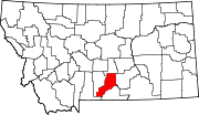
Stillwater County is a county in the U.S. state of Montana. As of the 2010 United States Census, the population was 9,117. Its county seat is Columbus.

Contents

Lakes

Aufwuchs Lake is a lake in Stillwater County, Montana, in the United States.

Barrier Lake lake in Alberta, Canada

Barrier Lake is a man made reservoir at the north end of Kananaskis Country in Alberta, Canada.

Bill Lake is a Canadian actor whose career began in Vancouver and who has appeared in many movies, television movies and series, stage plays and commercials.

Reservoirs

Mystic Lake is the deepest lake in the Beartooth Mountains. It has the largest sandy beach in the Absaroka-Beartooth Wilderness. The Montana Power Company utilizes the power of this large lake and has a dam present. Mystic Lake supports a rainbow trout fishery. Hiking the three-mile trail up to Mystic Lake provides views of West Rosebud Valley and a few other lakes.

See also

Notes

  1. "Arapooash Lake". Geographic Names Information System . United States Geological Survey.
  2. "Asteroid Lake". Geographic Names Information System . United States Geological Survey.
  3. "Aufwuchs Lake". Geographic Names Information System . United States Geological Survey.
  4. "Avalanche Lake". Geographic Names Information System . United States Geological Survey.
  5. "Barrier Lake". Geographic Names Information System . United States Geological Survey.
  6. "Beckwourth Lake". Geographic Names Information System . United States Geological Survey.
  7. "Big Foot Lake". Geographic Names Information System . United States Geological Survey.
  8. "Big Lake". Geographic Names Information System . United States Geological Survey.
  9. "Bill Lake". Geographic Names Information System . United States Geological Survey.
  10. "Blueball Lake". Geographic Names Information System . United States Geological Survey.
  11. "Brent Lake". Geographic Names Information System . United States Geological Survey.
  12. "Brown Lake". Geographic Names Information System . United States Geological Survey.
  13. "Cataract Lake". Geographic Names Information System . United States Geological Survey.
  14. "Chalice Lake". Geographic Names Information System . United States Geological Survey.
  15. "Chrome Lake". Geographic Names Information System . United States Geological Survey.
  16. "Cimmerian Lake". Geographic Names Information System . United States Geological Survey.
  17. "Clam Lake". Geographic Names Information System . United States Geological Survey.
  18. "Cold Lake". Geographic Names Information System . United States Geological Survey.
  19. "Comet Lake". Geographic Names Information System . United States Geological Survey.
  20. "Corkscrew Lake". Geographic Names Information System . United States Geological Survey.
  21. "Crater Lake". Geographic Names Information System . United States Geological Survey.
  22. "Dallmann Lake". Geographic Names Information System . United States Geological Survey.
  23. "Dreary Lake". Geographic Names Information System . United States Geological Survey.
  24. "Dry Lake". Geographic Names Information System . United States Geological Survey.
  25. "Dryad Lake". Geographic Names Information System . United States Geological Survey.
  26. "Eedica Lake". Geographic Names Information System . United States Geological Survey.
  27. "Emerald Lake". Geographic Names Information System . United States Geological Survey.
  28. "Frenco Lake". Geographic Names Information System . United States Geological Survey.
  29. "Froze-to-Death Lake". Geographic Names Information System . United States Geological Survey.
  30. "Halfbreed Lake". Geographic Names Information System . United States Geological Survey.
  31. "Heart Lake". Geographic Names Information System . United States Geological Survey.
  32. "Hermit Lake". Geographic Names Information System . United States Geological Survey.
  33. "Horseman Flats Lake". Geographic Names Information System . United States Geological Survey.
  34. "Hunter Lake". Geographic Names Information System . United States Geological Survey.
  35. "Island Lake". Geographic Names Information System . United States Geological Survey.
  36. "Island Lake". Geographic Names Information System . United States Geological Survey.
  37. "Jasper Lake". Geographic Names Information System . United States Geological Survey.
  38. "Jawbone Lake". Geographic Names Information System . United States Geological Survey.
  39. "Jay Lake". Geographic Names Information System . United States Geological Survey.
  40. "Kid Lake". Geographic Names Information System . United States Geological Survey.
  41. "Lake Diaphanous". Geographic Names Information System . United States Geological Survey.
  42. "Lake Pisce". Geographic Names Information System . United States Geological Survey.
  43. "Lake Surrender". Geographic Names Information System . United States Geological Survey.
  44. "Lake Turgulse". Geographic Names Information System . United States Geological Survey.
  45. "Lake Vengence". Geographic Names Information System . United States Geological Survey.
  46. "Lake Wildness". Geographic Names Information System . United States Geological Survey.
  47. "Lily Pad Lake". Geographic Names Information System . United States Geological Survey.
  48. "Little Arch Lake". Geographic Names Information System . United States Geological Survey.
  49. "Little Face Lake". Geographic Names Information System . United States Geological Survey.
  50. "Lost Lake". Geographic Names Information System . United States Geological Survey.
  51. "Memidgi Lake". Geographic Names Information System . United States Geological Survey.
  52. "Mountain View Lake". Geographic Names Information System . United States Geological Survey.
  53. "Needle Lake". Geographic Names Information System . United States Geological Survey.
  54. "Nightmare Lake". Geographic Names Information System . United States Geological Survey.
  55. "Nugget Lake". Geographic Names Information System . United States Geological Survey.
  56. "Phantom Lake". Geographic Names Information System . United States Geological Survey.
  57. "Princess Lake". Geographic Names Information System . United States Geological Survey.
  58. "Ram Lake". Geographic Names Information System . United States Geological Survey.
  59. "Ravin Lake". Geographic Names Information System . United States Geological Survey.
  60. "Reeves Lake". Geographic Names Information System . United States Geological Survey.
  61. "Roosevelt Lake". Geographic Names Information System . United States Geological Survey.
  62. "Saderbalm Lake". Geographic Names Information System . United States Geological Survey.
  63. "Sienna Lake". Geographic Names Information System . United States Geological Survey.
  64. "Silver Lake". Geographic Names Information System . United States Geological Survey.
  65. "Sioux Charley Lake". Geographic Names Information System . United States Geological Survey.
  66. "Snowball Lakes". Geographic Names Information System . United States Geological Survey.
  67. "Storm Lakes". Geographic Names Information System . United States Geological Survey.
  68. "Trouble Lake". Geographic Names Information System . United States Geological Survey.
  69. "Turco Pond". Geographic Names Information System . United States Geological Survey.
  70. "Twin Lakes". Geographic Names Information System . United States Geological Survey.
  71. "Upper Corkscrew Lake". Geographic Names Information System . United States Geological Survey.
  72. "Weeluna Lake". Geographic Names Information System . United States Geological Survey.
  73. "West Fishtail Creek Lakes". Geographic Names Information System . United States Geological Survey.
  74. "West Rosebud Lake". Geographic Names Information System . United States Geological Survey.
  75. "Wildcat Lakes". Geographic Names Information System . United States Geological Survey.
  76. "Wood Lake". Geographic Names Information System . United States Geological Survey.
  77. "Woodbine Lake". Geographic Names Information System . United States Geological Survey.
  78. "Zoeteman Lake". Geographic Names Information System . United States Geological Survey.
  79. "Hailstone Lake". Geographic Names Information System . United States Geological Survey.
  80. "Mystic Lake". Geographic Names Information System . United States Geological Survey.

Related Research Articles

Waterfalls of Montana Wikimedia list article

There are at least 120 named waterfalls in Montana. A waterfall is a place where flowing water rapidly drops in elevation as it flows over a steep region or a cliff. Waterfalls are most commonly formed when a river is young.