
Frazer is a census-designated place (CDP) in Valley County, Montana, United States, located within the Fort Peck Indian Reservation, about 80 miles from the Canadian border. The population was 420 at the 2020 census.

Stanford is a town in and the county seat of Judith Basin County, Montana, United States. The population was at 403 as of the 2020 census.

Raynesford is an unincorporated community in Judith Basin County, Montana, United States. Its elevation is 4,042 feet (1,232 m), and it is located at 47°16′12″N110°43′48″W. The community includes a community center, a catholic church, a fire department, and a post office. The post office was established under the name of "Spion Kop" on March 31, 1906; its name was changed to Raynesford exactly three years later.

Twodot or Two Dot is a census-designated place (CDP) in west-central Wheatland County, Montana, United States, along the route of U.S. Route 12.
Bynum is an unincorporated community and census-designated place in Teton County, Montana, United States, approximately 13 miles north of Choteau. Its population was 31 as of the 2010 census.
Haugan is an unincorporated community and census-designated place in Mineral County, Montana, United States. Haugan is situated 16 miles (26 km) east of the Idaho border and 90 miles (140 km) west of Missoula on Interstate 90 at the Haugan Exit #16. The St. Regis River flows through the community. As of the 2020 census, the population of Haugan was 58.
Coffee Creek is an unincorporated community in Fergus County, Montana, United States. It is located along Montana Highway 81 in west central Fergus County, several miles northwest of Denton. Coffee Creek has a post office with the ZIP code 59424.
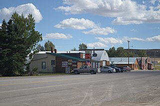
Comanche is an unincorporated community in Yellowstone County, Montana, United States. It lies on Montana Highway 3, 16 miles northwest of the city of Billings and shares a postal ZIP code with Acton (59002).
Turner is a Census-designated place village in Blaine County, Montana, United States. Turner is located on Montana State Highway 241, 41.5 miles (66.8 km) east-northeast of Chinook. It is 12 miles south of the Canadian border. Its population was 61 as of the 2010 census.
Rockvale is an unincorporated community in Carbon County, Montana, United States. As of 2024, it is the site of a bar, a casino, and some homes. Little remains of the original town site except a nearby cemetery.
Quietus is the site of a former town, centered on a post office now closed, and a community in the surrounding area. It was located in Big Horn County, Montana, United States. The surrounding area is now an unincorporated community.
Kirby was an unincorporated community in Big Horn County, Montana, United States. The community location is at an elevation of 3,878 feet (1,182 m). The site is on the west bank of Rosebud Creek. Rosebud Battlefield State Park lies approximately twelve miles south of the community, just west of Rosebud Creek.
Beehive is an unincorporated community located in Stillwater County, Montana, United States, which shares the ZIP code with Absarokee of 59001.
Molt is an unincorporated rural village located in Stillwater County, Montana, United States, which has a post office ZIP code (59057) and several granaries. A hardware store still stands, which stood as the Prairie Winds cafe for many years; today the building remains unoccupied.
Dean is an unincorporated community located in Stillwater County, Montana, United States.
Crane is a census-designated place and unincorporated community in Richland County, Montana, United States. Its population was 102 according to the 2010 census. Crane has a post office with the ZIP code 59217. Montana Highway 16 passes through Crane.
Whitewater is a census-designated place and unincorporated community in Phillips County, Montana, United States. Its population was 64 as of the 2010 census. Whitewater has a post office with ZIP code 59544.
Dupuyer is a census-designated place and unincorporated community in Pondera County, Montana, United States. Its population was 86 as of the 2010 census. The community is located along U.S. Route 89 and Dupuyer Creek. Dupuyer has a post office with ZIP code 59432.
Stockett is a census-designated place and unincorporated community in Cascade County, Montana, United States. Its population was 169 as of the 2010 census. Stockett has a post office with ZIP code 59480.
Marion is a census-designated place and unincorporated community in Flathead County, Montana, United States. Its population was 1,119 as of the 2020 census. Marion has a post office with ZIP code 59925.


