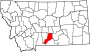
Harlowton is a city in and the county seat of Wheatland County, Montana, United States. The population was 955 at the 2020 census.

Billings is the most populous city in the U.S. state of Montana, with a population of 117,116 as of the 2020 census. Located in the south-central portion of the state, it is the seat of Yellowstone County and the principal city of the Billings Metropolitan Area, which had a population of 184,167 in the 2020 census. With one of the largest trade areas in the United States, Billings is the trade and distribution center for much of Montana east of the Continental Divide. Billings is also the largest retail destination for much of the same area. The Billings Chamber of Commerce claims the area of commerce covers more than 125,000 square miles (320,000 km2). In 2009, it was estimated to serve over 500,000 people.

A grain elevator or grain terminal is a facility designed to stockpile or store grain. In the grain trade, the term "grain elevator" also describes a tower containing a bucket elevator or a pneumatic conveyor, which scoops up grain from a lower level and deposits it in a silo or other storage facility.

Montana Rail Link was a privately held Class II railroad in the United States. It operated on trackage originally built by the Northern Pacific Railway and leased from its successor BNSF Railway. MRL was a unit of The Washington Companies and was headquartered in Missoula, Montana.

Rapelje is an unincorporated community and census-Designated Place in northern Stillwater County, Montana, United States. Rapelje was named for J. M. Rapelje, general manager and vice president of the Northern Pacific Railway. Rapelje had a population of approximately 110 people as of the 2000 census. Rapelje is located 24 miles north of Columbus on Montana Secondary Highway 306.

Withrow is an unincorporated community located in the city of Grant, Washington County, Minnesota, United States. Formerly an unincorporated village on the edge of the Minneapolis–St. Paul metropolitan area, Withrow was located in three different local government jurisdictions: May Township, Grant Township, and Oneka Township. The village had a post office and general store in May Township and a railroad station in Oneka. Withrow is located 6 miles (9.7 km) northeast of White Bear Lake and 6.4 miles (10.3 km) northwest of Stillwater.

Boyd was a town in Wasco County, Oregon, United States, disincorporated in 1955, and now vacant except for a few abandoned homes, weathered outbuildings, and a derelict wooden grain elevator surrounded by the wheat fields, which still produce the grain that used to fill it. The site was recently bought and turned into farmland. The site of the former settlement is 9.5 miles (15.3 km) southeast of The Dalles, on the east side of U.S. Route 197 from which it is visible at a distance.
Baker is an unincorporated community in northeastern Texas County, Oklahoma, United States, ¼ mile north of U.S. Route 64. Tyrone lies six miles to the north-northwest on U.S. Route 54 and Turpin lies eight miles to the east at the intersection of Route 64 and U.S. Route 83 in adjacent Beaver County.

Bents is an unincorporated community in Marriott No. 317, Saskatchewan, Canada. Prior to the town founding, the area was referred to as Piche. Bents took its name from Longniddry Bents in Scotland. Its derelict wooden grain elevator was once the subject of a National Geographic photograph. The remnants of the town are now located on private property.
Autwine is a ghost town in Kay County, Oklahoma, United States, formerly known as Pierceton and Virginia City. The town was named for a prominent citizen and leader of the Ponca Nation named Antoine Roy. It had a post office as Pierceton from May 26, 1894, and as Autwine from March 5, 1903, until June 30, 1922.

Mondak is a ghost town in Roosevelt County, Montana, United States, which flourished c. 1903–1919, in large measure by selling alcohol to residents of North Dakota, then a dry state.
Comanche is an unincorporated community in Yellowstone County, Montana, United States. It lies on Montana Highway 3, 16 miles northwest of the city of Billings and shares a postal ZIP code with Acton (59002).
Washoe is a settlement in Carbon County, Montana, United States, situated at the foot of the Beartooth Mountains. It is situated on Montana Secondary Highway 308.
Waco is a populated place and former town site located in Yellowstone County, Montana, United States. The elevation is 2,786 feet (849 m).
Molt is an unincorporated rural village located in Stillwater County, Montana, United States, which has a post office ZIP code (59057) and several granaries. A hardware store still stands, which stood as the Prairie Winds cafe for many years; today the building remains unoccupied.
Montana Silversmiths is a buckles and jewelry products seller located in Columbus, Montana. They produce the hand-engraved trophy belt buckles that are awarded to the winners of the Wrangler National Finals Rodeo each year.

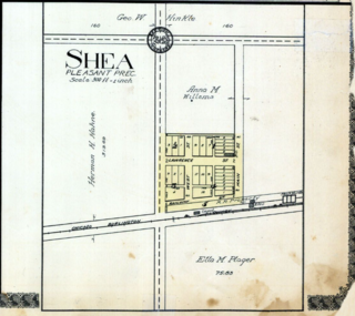
Shea was a small village in Jefferson County, Nebraska, located about four miles west of the town of Diller.
Connie Keogh is an American politician and educator serving as a member of the Montana House of Representatives from the 91st district. Elected in November 2018, she assumed office on January 7, 2019.


