There are at least 28 named lakes and reservoirs in Sheridan County, Montana .
There are at least 28 named lakes and reservoirs in Sheridan County, Montana .
Municipalities and communities of Sheridan County, Montana, United States | ||
|---|---|---|
| City | 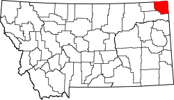 | |
| Towns | ||
| CDPs | ||
| Other communities | ||
| Ghost town | ||
| Indian reservations | ||
| Footnotes | ‡This populated place also has portions in an adjacent county or counties | |