Here is a list of mergers in Saga Prefecture, Japan since the Heisei era.
Here is a list of mergers in Saga Prefecture, Japan since the Heisei era.
| Special city | ||
|---|---|---|
| Cities | ||
| Districts | ||
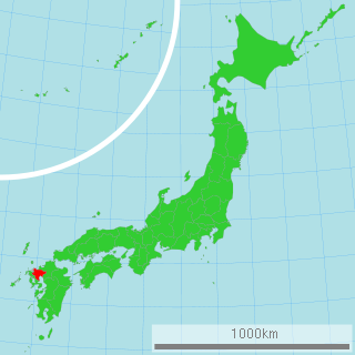
Saga Prefecture is a prefecture of Japan located on the island of Kyūshū. Saga Prefecture has a population of 809,248 and has a geographic area of 2,440 km2. Saga Prefecture borders Fukuoka Prefecture to the northeast and Nagasaki Prefecture to the southwest.
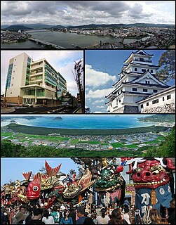
Karatsu is a city located in Saga Prefecture on the island of Kyushu, Japan. Its name, formed from the Japanese word roots 唐 kara, and 津 tsu (port), signifies its historical importance as an ancient trading port between Japan with China and Korea. The central area of Karatsu, which does not include the former cities and villages of Higashimatsuura District, has a population of 78,386. As of January 1, 2020, the city had an estimated population of 117,663 and a population density of 241 persons per km2. The total area is 487.59 km2.

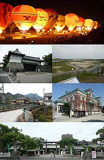
Takeo is a city located in Saga Prefecture on the island of Kyushu, Japan. In 2011, the city government was the first in Japan to switch to using Facebook for its website. As of October 1, 2016, the city has an estimated population of 48,845 and a population density of 257 persons per km². The total area is 195.44 km².

Hizen Province was an old province of Japan in the area of the Saga and Nagasaki prefectures. It was sometimes called Hishū (肥州), with Higo Province. Hizen bordered on the provinces of Chikuzen and Chikugo. The province was included in Saikaidō. It did not include the regions of Tsushima and Iki that are now part of modern Nagasaki Prefecture.
Kita-Amabe was a district located in Ōita Prefecture, Japan.
Saga District was a district located in Saga Prefecture, Japan.

Kanzaki is a city located in Saga Prefecture, Japan. As of February 28, 2017, the city has an estimated population of 31,981 and a population density of 260 persons per km². The total area is 125.01 km².

Ogi is a city located in the central part of Saga Prefecture on the island of Kyushu, Japan. As of February 28, 2017, the city has an estimated population of 45,638 and a population density of 480 persons per km². The total area is 95.85 km².
Kitahata was a village located in Higashimatsuura District, Saga Prefecture, Japan.

Genkai is a town located in Higashimatsuura District, Saga Prefecture, Japan. It has an area of 36.00 km² and as of February 28, 2017 has a population of 5,855. It is currently the only municipality in Higashimatsuura District. There was a town with the same name in Fukuoka Prefecture, but it now no longer exists.
Yamauchi was a town located in Kishima District, Saga Prefecture, Japan.

Shiroishi is a town located in Kishima District, Saga Prefecture, Japan. As of October 1, 2016, the town has an estimated population of 23,606.
Shiota was a town located in Fujitsu District, Saga Prefecture, Japan.

The Nagasaki Kaidō (長崎街道) was a road across Kyūshū from Kokura to Nagasaki, used by daimyōs for the sankin-kōtai, and also by the chief of the Dutch trading post at Nagasaki on whom a similar obligation of visiting the shōgun was imposed. The route stretched 228 km and took travelers approximately one week.
Saga is the capital city of Saga Prefecture, located on the island of Kyushu, Japan. Saga was the capital of Saga Domain in the Edo period, and the largest city of former Hizen Province. As of August 1, 2020, the city had an estimated population of 232,736 and a population density of 539 persons per km2. The total area is 431.84 km2.

Yoshinogari is a town located in Kanzaki District, Saga Prefecture, Japan. It is the result of a merger between the town of Mitagawa, and the village of Higashisefuri, both from Kanzaki District, on March 1, 2006. As of March 1, 2017, the town has an estimated population of 16,117.

National Route 34 is a highway in Japan on the island of Kyūshū which runs from Saga City in Saga Prefecture to Nagasaki in Nagasaki Prefecture. It follows the old Nagasaki Kaidō, a road from the Edo period. About 10% of the route is 4 lanes or more, and the rest is two lanes.