List of monastic houses in County Londonderry

Last updated

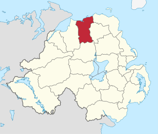
The following is a list of the monastic houses in County Londonderry, Northern Ireland.

Contents

The smaller establishments such as monastic cells and notable monastic granges (particularly those with resident monks) and camerae of the military orders of monks (Knights Templars and Knights Hospitallers) are included. The numerous monastic hospitals per se are not included here unless at some time the foundation had, or was purported to have, the status or function of an abbey, priory, or preceptory/commandery.

Layout

Communities/provenance: shows the status and communities existing at each establishment, together with such dates as have been established as well as the fate of the establishment after dissolution, and the current status of the site.

Formal name or dedication: shows the formal name of the establishment or the person in whose name the church is dedicated, where known.

Alternative names: some of the establishments have had alternative names over the course of time. In order to assist in text-searching such alternatives in name or spelling have been provided.

Abbreviations and Key

The sites listed are ruins or fragmentary remains unless indicated thus:
*current monastic function
+current non-monastic ecclesiastic function
^current non-ecclesiastic function
=remains incorporated into later structure
#no identifiable trace of the monastic foundation remains
~exact site of monastic foundation unknown
øpossibly no such monastic foundation at location
¤no such monastic foundation
identification ambiguous or confused

Locations with names in italics indicate probable duplication (misidentification with another location) or non-existent foundations (either erroneous reference or proposed foundation never implemented).

Trusteeship denoted as follows:
NIEA Scheduled Monument (NI)
NM National Monument (ROI)
C.I.Church of Ireland
R.C.Roman Catholic Church

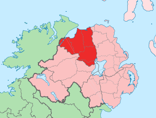
Location map Northern Ireland County Londonderry.png
Red pog.svg
Aghadowey Monastery
Red pog.svg
Aghanloo Monastery
Red pog.svg
Agivey Monastery
Red pog.svg
Ballymagrorty Monastery
Red pog.svg
Ballynascreen Monastery
Red pog.svg
Banagher Monastery
Red pog.svg
Bovevagh Monastery
Red pog.svg
Camus Monastery
Red pog.svg
Church Island Monastery
Red pog.svg
COLERAINE
(see right)
Red pog.svg
Cumber Monastery
Red pog.svg
LONDONDERRY (see right)
Red pog.svg
Desertmartin Monastery
Red pog.svg
Desertoghill Monastery
Red pog.svg
Donnybrewer Monastery (approx.)
Red pog.svg
Drumachose Abbey
Red pog.svg
Dunboe Monastery
Red pog.svg
Duncrun Monastery (approx.)
Red pog.svg
Dungiven Monastery
Red pog.svg
Errigal Monastery (approx.)
Red pog.svg
Faughvale Monastery
Red pog.svg
Kilcronaghan Monastery
Red pog.svg
Kilrea Monastery
Red pog.svg
Lan More Friary
Red pog.svg
Lissan Monastery (approx.)
Red pog.svg
Macosquin Abbey
Red pog.svg
Maghera Monastery
Red pog.svg
Magilligan Monastery (approx.)
Red pog.svg
Tamlaght Finlagan Monastery
Red pog.svg
Tamlaght O'Crilly Monastery
Red pog.svg
Termoneeny Monastery
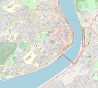
Locations of monastic houses in County Londonderry
Location map Londonderry.png
Red pog.svg
Derry Monastery
(poss site)
Red pog.svg
Derry Monastery
(poss site)
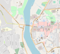
Locations of monastic houses in County Londonderry
Location map Northern Ireland Coleraine.png
Red pog.svg
Coleraine Monastery - St Patrick's
Red pog.svg
Coleraine Monastery - St Carbreus
(approx.)
Red pog.svg
Coleraine Friary
(approx.)
Red pog.svg
Coleraine Killowen
(approx.)
Locations of monastic houses in Coleraine
FoundationImageCommunities & ProvenanceFormal Name or Dedication
& Alternative Names
OnLine References & Location
Aghadowey Monastery #early monastic site;
hospital of St Gowry 1603
Achad-dubthaigh;
Achedoffey
[1] [2]
55°01′45″N6°39′27″W / 55.02928°N 6.65749°W / 55.02928; -6.65749 (Aghadowey Monastery)
Aghanloo Monasteryearly monastic site;
under erenaghs until 16th century
Ath-luga;
Ath-longe;
Allowa
[3] [4] [5]
55°05′37″N6°56′14″W / 55.093742°N 6.93718°W / 55.093742; -6.93718 (Aghanloo Monastery)
Agivey Monasteryearly monastic site; purportedly founded 7th century by St Guar of Aghadowey;
Cistercian monks
grange of Macosquin
Augheve;
Athgeybi
[6] [7] [8]
55°02′22″N6°35′16″W / 55.03937°N 6.58776°W / 55.03937; -6.58776 (Agivey Monastery)
Ballymagrorty Monastery (Derry Diocese)early monastic site, founded 6th century by St Colmcille Baile-meg-robhartaig;
Baile-megrabhartaigh
55°05′41″N6°39′49″W / 55.0946007°N 6.6635672°W / 55.0946007; -6.6635672 (Ballymagrorty Monastery (Derry Diocese))
Ballynascreen Monasteryearly monastic site, founded 6th century by St ColmcilleScrin-coluim-cille [9] [10]
54°45′33″N6°52′00″W / 54.75914°N 6.86654°W / 54.75914; -6.86654 (Ballynascreen Monastery)
Banagher Monastery Banagher Old Church - geograph.org.uk - 595232.jpg early monastic site, traditionally founded 11th century? by St Muriedbach O'Heney;
under erenaghs until early 17th century
Bennchor;
Bangoria
[11] [12]
54°53′19″N6°58′23″W / 54.8884889°N 6.9730569°W / 54.8884889; -6.9730569 (Banagher Monastery)
Bovevagh Monastery Site of Bovevagh old church - geograph.org.uk - 716443.jpg early monastic site, purportedly founded 575 by St Colmcille;
oratory burned 1100;
under erenaghs until 17th century
Both-mheidhbhe;
Both-medhbha
[13] [14]
54°57′33″N6°56′44″W / 54.9591207°N 6.9455911°W / 54.9591207; -6.9455911 (Bovevagh Monastery)
Camus Monasteryearly monastic site, founded before c.580;
under erenaghs until 16th/17th century
Camas;
Cambos;
Camsa
[15] [16]
55°06′02″N6°38′06″W / 55.10056°N 6.63513°W / 55.10056; -6.63513 (Camus Monastery)
Church Island Monastery, Lough Begearly monastic site;
plundered by Ulidians 1129;
under erenaghs until early 17th century
St Mochonna (possibly St Mochonna of Killyman)
____________________
Inistaiti;
InisTeda;
Ballyscullion;
Inish Taoide
[17]
54°47′24″N6°29′05″W / 54.7899946°N 6.4847811°W / 54.7899946; -6.4847811 (Church Island Monastery)
Coleraine Monastery
St Patrick's
early monastic site, founded 5th century by St Patrick;
burned 731;
suffered destruction 1171 and 1177;
Cuil Raithin;
Cul-rathain;
Colran;
Bannin;
[18]
55°07′55″N6°40′07″W / 55.13202°N 6.66850°W / 55.13202; -6.66850 (Coleraine Monastery - St Patrick's)
Coleraine Monastery
St Carbreus
early monastic site, founded 6th century by St Carbreus;
dismantled in 1213, Drumtarsey castle erected on site
Cuil Raithin;
Abbey of the Bann
[19] [20]
55°08′04″N6°40′43″W / 55.13432°N 6.67859°W / 55.13432; -6.67859 (Coleraine Monastery - St Carbreus (approx.)) (approx)
Coleraine FriaryDominican Friars
founded 1244;
Dominican Friars, Regular Observant
reformed 1484;
dissolved 1543
St Mary [21] [22]
55°07′49″N6°40′21″W / 55.13040°N 6.67237°W / 55.13040; -6.67237 (Coleraine Friary (approx.)) (approx)
Coleraine
Killowen
founded 1248Drumtarsy;
Cill Eoghain - Owen's church;
Cill-Eogain - St John's Church
[20] [23] [24] 55°07′42″N6°40′35″W / 55.12834°N 6.67638°W / 55.12834; -6.67638 (Coleraine Killowen (approx.)) (approx)
Cumber Monasteryearly monastic site, traditionally founded 5th century by St Patrick; under secular erenaghs until early 17th centuryCombior;
Camer;
Commyr
[25] [26]
54°54′20″N7°09′42″W / 54.905604°N 7.161785°W / 54.905604; -7.161785 (Cumber Monastery)
Derry Monastery ~early monastic site, traditionally founded c.546 by St Colmcille, but probably c.590 by Fiachra mac Ciárain mac Ainmerech mac Sétna;
St Augustine's C.I. Church or St Columb's Church are cited as alternative possible locations of the monastery
Daire-calgach;
Doire-Choluim-Chille;
Daire Duib-recles;
Cella Nigra
[27]
54°59′41″N7°19′26″W / 54.9947366°N 7.3239221°W / 54.9947366; -7.3239221 (St Augustine's Church, poss. site of Derry Monastery) possible
or
54°59′34″N7°19′43″W / 54.9929°N 7.3285°W / 54.9929; -7.3285 (Long Tower Church (St Columb's Church, poss. site of Derry Monastery) possible
Derry AbbeyAugustinian Canons Regular Arroasian affiliated to SS Peter & Paul, Armagh;
founded c.1233?;
reportedly in very poor state of repair by 1411, due to warfare and adversity;
churches desecrated and community expelled 1566; under occupation by English troops under Colonel Edward Randolph;
restored? canons possibly briefly returned;
dissolved 1576?; reoccupied by the English;
Augustinian Friars
refounded c.1643
Cella Nigra
Derry PrioryCistercian nuns
founded 1218;
dissolved 1512
Derry Franciscan Priorypurported foundation of Franciscan Friars;
(in 1609 the commissioners erroneously took the ruins of the Blackfriars house (see immediately below) to be Franciscan)
Derry — St Dominic's Prioryspurious accounts of earlier Dominican foundation;
Dominican Friars
founded 1274;
dissolved 1576;
briefly restored?
St Dominic
Desertmartin Monasteryearly monastic site, apparently founded by a member of the O'Lynn family (suggested by the name Mainister O'Fhloinn);
erenaghs until 16th century
Mainister O'Fhloinn;
Moneysterlin
[28] [29] [30]
54°46′12″N6°40′15″W / 54.76996°N 6.67091°W / 54.76996; -6.67091 (Desertmartin Monastery)
Desertoghill Monasteryearly monastic site, purportedly founded by St Colmcille;
erenaghs until 16th century
Disert-ui-tuathghaill;
Desert-O'Tuohill
[31] [32] [33]
54°58′23″N6°40′18″W / 54.97308°N 6.67169°W / 54.97308; -6.67169 (Desertoghill Monastery)
Donnybrewer Monasteryearly monastic siteDomnach-dala;
Domnach-dola
55°02′46″N7°13′44″W / 55.0461037°N 7.2287786°W / 55.0461037; -7.2287786 (Donnybrewer Monastery (approx.)) (approx)
Drumachose Abbeyearly monastic site, patronised 6th century by St CainnechDruimcoos;
Dirumcoos;
Dronagh;
Drungrosa;
Roa
[34] [35] [36]
55°03′03″N6°54′59″W / 55.05086°N 6.91641°W / 55.05086; -6.91641 (Drumachose Abbey)
Dunboe Monasteryearly monastic site, founded by St Adamnan;
erenaghs until 16th century
Dun-bo;
~co Dun-mbó i n-Dal riatai;
Duna-uó, a tempull;
Durrbo, par. ecclesie de
[37] [38] [39] [40]
55°09′36″N6°48′40″W / 55.160055°N 6.811075°W / 55.160055; -6.811075 (Dunboe Monastery)
Duncrun Monasteryearly monastic site, founded by St PatrickDun-cruithne 55°08′48″N6°56′01″W / 55.1466853°N 6.9335211°W / 55.1466853; -6.9335211 (Duncrun Monastery (approx.)) (approx)
Dungiven Monastery early monastic site, founded 7th century, by St Naechtain?Dun-geimin;
Dun-giobhin;
Dun-gevin
[41]
54°55′02″N6°55′18″W / 54.917333°N 6.9216549°W / 54.917333; -6.9216549 (Dungiven Monastery)
Dungiven PrioryAugustinian Canons Regular Arroasian?
founded after 1140? (after 1138?), purportedly by the O'Cahan family;
dissolved before 1603;
round tower incorporated into church, but collapsed c.1784
St Mary
Errigal Monasteryearly monastic site, purportedly founded 6th century by St Colmcille;
destroyed by Norsemen 9th century;
erenaghs until 16th/17th century
Airecal-Adamnan;
Arragel;
Temple Erigall;
Airecuil, Cainnech
[42] [43] [44]
54°58′32″N6°44′03″W / 54.97550°N 6.73408°W / 54.97550; -6.73408 (Errigal Monastery (approx.)) (approx)
Faughanvale Monasteryearly monastic site, erenaghs until 16th centurySt Canice (St Conici)
____________________
Nuachongbail;
Fochwayll;
Killeitra;
Tircaerthian
[45] [46] [4]
55°01′57″N7°05′42″W / 55.032436°N 7.094947°W / 55.032436; -7.094947 (Faughvale Monastery)
Kilcronaghan Monastery Old Kilcronaghan Church, Mormeal - geograph.org.uk - 355618.jpg early monastic site, patronised by St Cruithnechan;
erenaghs until early 17th century
Cell-cruithneachain [47] [48]
54°47′40″N6°44′00″W / 54.79438°N 6.73333°W / 54.79438; -6.73333 (Kilcronaghan Monastery)
Killelagh Monasteryerroneously given as County Derry in Gwynn & Hadcock index — actually County Donegal
Kilrea Monasteryearly monastic site; erenagh land until 1609Cell-reagh [49]
54°56′00″N6°34′42″W / 54.93341°N 6.57827°W / 54.93341; -6.57827 (Kilrea Monastery)
Lan More Friary ~Franciscan Friars, Third Order Regular
foundation unknown;
dissolution unknown;
possibly County Londonderry or County Antrim
Landmore? 55°02′05″N6°36′34″W / 55.0347919°N 6.6093536°W / 55.0347919; -6.6093536 (Lan More Friary)
Lissan Monasteryearly monastic site, founded before 744Lessan;
~Lessain episcopi;
~Lesan i Sliabh Callann,ó;
~o Lesan i Sliabh Callan
[50]
54°41′07″N6°46′05″W / 54.685226°N 6.7681474°W / 54.685226; -6.7681474 (Lissan Monastery (approx.)) (approx)
Macosquin Abbey + St Mary's Church of Ireland, Macosquin - geograph.org.uk - 529704.jpg Cistercian monks — from Morimond, France
founded 1218;
dissolved before 1600; granted to the London Companies (Merchant Taylors) authorities for the plantation of Derry;
house named 'Glebe House' built on site of claustral buildings c.1770;
scant remains of monastic church incorporated into St Mary's C.I. parish church, built on site
Clarus Fons;
Magoscain;
Moycoscain
[51]
55°05′59″N6°42′26″W / 55.0997568°N 6.7070842°W / 55.0997568; -6.7070842 (Macosquin Abbey)
Maghera Monastery + Maghera Church - geograph.org.uk - 222328.jpg early monastic site, founded 6th century by St Lurach;
plundeded by the Norsemen 832;
church burnt 1135;
diocesan cathedral
see transferred from Ardstraw c.1152;
see transferred to Derry 1254
Machaire-ratha-luraig;
Rath-Luraig;
Rath-lure
[52] [53]
54°50′32″N6°40′24″W / 54.84213°N 6.673466°W / 54.84213; -6.673466 (Maghera Monastery)
Magilligan Monasteryearly monastic site, erenagh land until early 17th centuryAird-megiollagain;
Ardia;
Scrin-i-nArdia;
Ballynascreen-ardia;
Tamlachta-ard;
Tamlaght-ard;
The Shrine of St Columb
55°07′44″N6°56′33″W / 55.1289776°N 6.9424186°W / 55.1289776; -6.9424186 (Magilligan Monastery (approx.)) (approx)
Tamlaght Finlagan Monasteryearly monastic site, founded 585 by St Fionn-logha;
erenaghs until early 17th century;
site occupied by remains of a church destroyed 1641
Tamlacht-fionloga;
Templefinlagan;
Ballykelly
[54]
55°02′26″N6°58′50″W / 55.0404831°N 6.9806735°W / 55.0404831; -6.9806735 (Tamlaght Finlagan Monastery)
Tamlaght O'Crilly Monasteryearly monastic site; erenaghs until early 17th centuryTa, lachta-mac-ninaich [55] [56]
54°53′37″N6°34′59″W / 54.89365°N 6.58304°W / 54.89365; -6.58304 (Tamlaght O'Crilly Monastery)
Termoneeny Monasteryearly monastic site; erenaghs until early 17th century~in Enga;
Termon-any
Eanegea
[57] [58]
54°50′00″N6°40′02″W / 54.83334°N 6.66735°W / 54.83334; -6.66735 (Termoneeny Monastery)
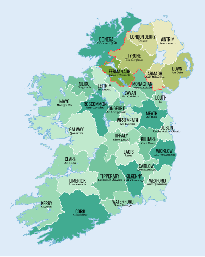
Click on a county to go to the corresponding article Ireland trad counties named.svg
Click on a county to go to the corresponding article

Related Research Articles

<span class="mw-page-title-main">County Londonderry</span> County in Northern Ireland

County Londonderry, also known as County Derry, is one of the six counties of Northern Ireland, one of the thirty-two counties of Ireland and one of the nine counties of Ulster. Before the partition of Ireland, it was one of the counties of the Kingdom of Ireland from 1613 onward and then of the United Kingdom after the Acts of Union 1800. Adjoining the north-west shore of Lough Neagh, the county covers an area of 2,118 km2 (818 sq mi) and today has a population of about 252,231.

<span class="mw-page-title-main">Limavady</span> Town in County Londonderry, Northern Ireland

Limavady is a market town in County Londonderry, Northern Ireland, with Binevenagh as a backdrop. Lying 17 miles (27 km) east of Derry and 14 miles (23 km) southwest of Coleraine, Limavady had a population of 11,279 people at the 2021 Census. In the 40 years between 1971 and 2011, Limavady's population nearly doubled. Limavady is within Causeway Coast and Glens Borough.

<span class="mw-page-title-main">Coleraine Borough Council</span> Human settlement in Northern Ireland

Coleraine Borough Council was a local council mainly in County Londonderry and partly in County Antrim in Northern Ireland. It merged with Ballymoney Borough Council, Limavady Borough Council and Moyle District Council in May 2015 under local government reorganisation in Northern Ireland to become Causeway Coast and Glens District Council.

<span class="mw-page-title-main">Ballykelly, County Londonderry</span> Village in County Londonderry, Northern Ireland

Ballykelly is a village and townland in County Londonderry, Northern Ireland. It lies 3 miles (4.8 km) west of Limavady on the main Derry to Limavady A2 road and is 15 miles (24 km) east of Derry. It is designated as a Large Village and in 2011 the population of Ballykelly was 2,107. It lies within Causeway Coast and Glens district.

<span class="mw-page-title-main">Castlerock</span> Seaside village in County Londonderry, Northern Ireland

Castlerock is a seaside village in County Londonderry, Northern Ireland. It is five miles west of Coleraine, and part of Causeway Coast and Glens district. It is very popular with summer tourists, with numerous apartment blocks and two caravan sites. Castlerock Golf Club has both 9-hole and 18-hole links courses bounded by the beach, the River Bann and the Belfast to Derry railway line. The village had a population of 1,155 people at the 2021 census, and is where near by village Articlave F.C play their home games.

<span class="mw-page-title-main">Tamlaght, County Londonderry</span> Village in County Londonderry, Northern Ireland

Tamlaght, also Tamlaght O'Crilly, is a small village, townland and civil parish in County Londonderry, Northern Ireland. In the 2001 Census it had a population of 123 people. It is situated within Mid-Ulster District.

Lavey is a Roman Catholic parish in County Londonderry, Northern Ireland. Lavey is bordered by the parishes of Castledawson, Maghera, Ballyscullion (Bellaghy), Greenlough and Kilrea. The parish contains no particularly large settlements, although it accommodates a number of small villages and hamlets, in order of size, these are: Gulladuff, Knockloughrim, Culnady, Tamlaght O'Crilly and Curran. The parish contains around fifteen different townlands. The parish is also closely associated with the civil parish of Termoneeny which covers the southern half of Lavey. There is also a parish called Lavey in County Cavan.

<span class="mw-page-title-main">Bellarena</span> Village in County Londonderry, Northern Ireland

Bellarena is a small village and townland in County Londonderry, Northern Ireland. It is on the A2 coastal road between Limavady and Coleraine, 6 miles (9.7 km) north of Limavady. The land was settled in the mid-17th century by a Northamptonshire gentleman, William Gage, who bought the lease of the estate – then called Ballymargy from the Irish meaning "town of the market" – from the Lord Bishop of Derry. In the 2001 census the population was 291. The village lies within Causeway Coast and Glens District Council area and the Binevenagh Area of Outstanding Natural Beauty, with open views eastwards to the scarp slope of Binevenagh. The village gets its name from the Earl Bishop of Derry.

<span class="mw-page-title-main">Causeway Coast and Glens</span> Local government district in Northern Ireland

Causeway Coast and Glens is a local government district covering most of the northern part of Northern Ireland. It was created on 1 April 2015 by merging the Borough of Ballymoney, the Borough of Coleraine, the Borough of Limavady and the District of Moyle. The local authority is Causeway Coast and Glens Borough Council.

<span class="mw-page-title-main">Kilcronaghan</span> Civil parish in Northern Ireland, United Kingdom

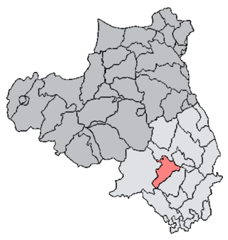
Kilcronaghan is a civil parish in County Londonderry, Northern Ireland. Containing one major settlement, Tobermore, and lying on the descending slope of Slieve Gallion, Kilcronaghan is bordered by the civil parishes of Ballynascreen, Desertmartin, Maghera, and Termoneeny. It lies within the former historic barony of Loughinsholin and is situated in Mid-Ulster District. As an ecclesiastical parish it lies within the Diocese of Derry and Raphoe.

<span class="mw-page-title-main">Loughinsholin</span> Barony in County Londonderry, Northern Ireland

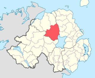
Loughinsholin is a barony in County Londonderry, Northern Ireland. Its southeast borders the northwest shore of Lough Neagh, and itself is bordered by seven other baronies: Dungannon Upper to the south; Strabane Upper to the west; Keenaght and Coleraine to the north; Kilconway, Toome Upper, and Toome Lower to the east. It was formed largely on the extent of the northern part of the medieval Irish túath of Uí Tuirtri.

Maghera is a parish in County Londonderry, Northern Ireland. It is bordered by the parishes of Ballynascreen, Ballyscullion, Desertmartin, Dungiven, Kilcronaghan, Killelagh, Magherafelt, Tamlaght O'Crilly, and Termoneeny. As a civil parish it lies within the former barony of Loughinsholin and as an ecclesiastical parish it lies within the Church of Ireland Diocese of Derry and Raphoe.

References

  1. "Home". Place Names NI. Retrieved 2 March 2020.
  2. Samuel Lewis. "AGHADOWY, or AGHADOEY, a parish - Topographical Dictionary of Ireland (1837)". Libraryireland.com. Retrieved 2 March 2020.
  3. "Home". Place Names NI. Retrieved 2 March 2020.
  4. 1 2 "Graveyards in Limavady Borough Which Opened Prior to the End of 1980 | Limavady Ancestry". Archived from the original on 14 February 2015. Retrieved 13 February 2015.
  5. Samuel Lewis (1837). A Topographical Dictionary of Ireland. Lewis. pp.  17–.
  6. "Home". Place Names NI. Retrieved 2 March 2020.
  7. Samuel Lewis. "AGIVEY, a grange - Topographical Dictionary of Ireland (1837)". Libraryireland.com. Retrieved 2 March 2020.
  8. "Shop.osi.ie Mapviewer". Archived from the original on 29 August 2012. Retrieved 14 February 2015.
  9. "Home". Place Names NI. Retrieved 2 March 2020.
  10. "Ballynascreen Old Church". Irishantiquities.bravehost.com. Retrieved 2 March 2020.
  11. "Home". Place Names NI. Retrieved 2 March 2020.
  12. "The Old Church of Banagher, County of Londonderry". Libraryireland.com. Retrieved 2 March 2020.
  13. "Home". Place Names NI. Retrieved 2 March 2020.
  14. Jochen Lueg, Limavady. "Bovevagh Old Church". Roevalley.com. Retrieved 2 March 2020.
  15. The Irish Ecclesiastical Record. Browne and Nolan. 1872. pp.  142–.
  16. "5.4 Camus - St Columba Trail". Colmcille.org. Retrieved 2 March 2020.
  17. "The Far Side of the Sky - Christopher E. Brennen". Authors.library.caltech.edu. Retrieved 2 March 2020.
  18. "History". Archived from the original on 18 February 2015. Retrieved 17 February 2015.
  19. William Cobbett. List of abbeys, priories, nunneries, hospitals, and other religious foundations in England and Wales and in Ireland: confiscated, seized on, or alienated, by the Protestant "Reformation" sovereigns and Parliaments.
  20. 1 2 "New Page 1". The Last Coleraine Militia. 28 June 1919. Retrieved 2 March 2020.
  21. "Coleraine". Archived from the original on 17 February 2015. Retrieved 17 February 2015.
  22. Dominican, Irish (9 September 2010). "COLERAINE ABBEY - Old wall on Abbey Street | COLERAINE ABBEY…". Flickr. Retrieved 2 March 2020.
  23. "Home". Place Names NI. Retrieved 2 March 2020.
  24. Samuel Lewis (1849). A Topographical Dictionary of Ireland: Comprising the Several Counties; Cities; Boroughs; Corporate, Market, and Post Towns; Parishes and Principal Villages; with Historical and Statistical Descriptions: Embellished with Engravings of the Arms of the Cities, Bishoprics, Corporate Towns, and Boroughs; and of the Seals of the Several Municipal Corporations. S. Lewis and Company. pp. 119–.
  25. "Home". Place Names NI. Retrieved 2 March 2020.
  26. "Archived copy" (PDF). Archived from the original (PDF) on 1 April 2014. Retrieved 18 February 2015.{{cite web}}: CS1 maint: archived copy as title (link)
  27. "Monastic Derry". Archived from the original on 4 April 2014. Retrieved 6 May 2014.
  28. "Home". Place Names NI. Retrieved 2 March 2020.
  29. "Cemeteries in Ireland and the UK". Archived from the original on 19 February 2015. Retrieved 19 February 2015.
  30. "Shop.osi.ie Mapviewer". Archived from the original on 29 August 2012. Retrieved 14 February 2015.
  31. "Home". Place Names NI. Retrieved 2 March 2020.
  32. "Irish Gravestone Inscriptions, Tracing your Irish Ancestors: Desertoghill parish". Archived from the original on 20 February 2015. Retrieved 19 February 2015.
  33. Adamnanus (de Iona) (1874). Life of Saint Columba, Founder of Hy. Edmonston and Douglas. pp. 59–.
  34. "Home". Place Names NI. Retrieved 2 March 2020.
  35. Jochen Lueg, Limavady. "Drumachose Old Church". Roevalley.com. Retrieved 2 March 2020.
  36. "Shop.osi.ie Mapviewer". Archived from the original on 29 August 2012. Retrieved 14 February 2015.
  37. "Archived copy" (PDF). Archived from the original (PDF) on 12 February 2015. Retrieved 11 February 2015.{{cite web}}: CS1 maint: archived copy as title (link)
  38. Memoir of the City and North Western Liberties of Londonderry - Parish of Templemore. Hodges. 1837. pp. 56–.
  39. "Home". Place Names NI. Retrieved 2 March 2020.
  40. Mervyn Archdall (1873). Monasticon Hibernicum. W. B. Kelly. pp.  211–.
  41. Priory at Dungiven
  42. "Home". Place Names NI. Retrieved 2 March 2020.
  43. "Home". Place Names NI. Retrieved 2 March 2020.
  44. "Errigal Glen Trail". WalkNI. Retrieved 2 March 2020.
  45. "Home". Place Names NI. Retrieved 2 March 2020.
  46. "Faughanvale Old Church". Irishantiquities.bravehost.com. Retrieved 2 March 2020.
  47. "Kilcronaghan parish (part 1)". Kilcronaghan.co.uk. Retrieved 2 March 2020.
  48. "Home". Place Names NI. Retrieved 2 March 2020.
  49. "Home". Place Names NI. Retrieved 2 March 2020.
  50. "Home". Place Names NI. Retrieved 2 March 2020.
  51. Cistercian Abbeys: MACOSQUIN
  52. Morrison, A. K; Lytle, S. D; Hipson, Alexander (1902). "Some Notes on the Parish of Maghera and Neighbourhood, in the County of Derry". Ulster Journal of Archaeology. 8 (3): 128–131. JSTOR   20566091.
  53. "Home". Place Names NI. Retrieved 2 March 2020.
  54. Jochen Lueg, Limavady. "Tamlaghtfinlagan Churches". Roevalley.com. Retrieved 2 March 2020.
  55. "Our Parish History | Tamlaght O'Crilly Greenlough Parish | Derry Diocese". Greenlough.com. Retrieved 2 March 2020.
  56. "Tamlaght O'Crilly Historical descriptions". Archived from the original on 26 November 2014. Retrieved 18 February 2015.
  57. "Home". Place Names NI. Retrieved 2 March 2020.
  58. Publications. 1850. pp. 81–.

See also