List of monastic houses in County Tyrone

Last updated

The smaller establishments such as monastic cells and notable monastic granges (particularly those with resident monks) and camerae of the military orders of monks (Knights Templars and Knights Hospitallers) are included. The numerous monastic hospitals per se are not included here unless at some time the foundation had, or was purported to have, the status or function of an abbey, priory, or preceptory/commandery.

Contents

Layout

Communities/provenance: shows the status and communities existing at each establishment, together with such dates as have been established as well as the fate of the establishment after dissolution, and the current status of the site.

Formal name or dedication: shows the formal name of the establishment or the person in whose name the church is dedicated, where known.

Alternative names: some of the establishments have had alternative names over the course of time. In order to assist in text-searching such alternatives in name or spelling have been provided.

Abbreviations and Key

The sites listed are ruins or fragmentary remains unless indicated thus:
*current monastic function
+current non-monastic ecclesiastic function
^current non-ecclesiastic function
=remains incorporated into later structure
#no identifiable trace of the monastic foundation remains
~exact site of monastic foundation unknown
øpossibly no such monastic foundation at location
¤no such monastic foundation
identification ambiguous or confused

Locations with names in italics indicate probable duplication (misidentification with another location) or non-existent foundations (either erroneous reference or proposed foundation never implemented).

Trusteeship denoted as follows:
NIEA Scheduled Monument (NI)
NM National Monument (ROI)
C.I.Church of Ireland
R.C.Roman Catholic Church
Map all coordinates using: OpenStreetMap


Location map Northern Ireland County Tyrone.png
Red pog.svg
Ardboe Monastery
Red pog.svg
Ardstraw Monastery
Red pog.svg
Ardtrea Monastery
Red pog.svg
Ballynasaggart Friary
Red pog.svg
Priory of Our Lady of Benburb
Red pog.svg
Bodoney Monastery
Red pog.svg
Brantry
Red pog.svg
Cappagh Monastery
Red pog.svg
Carrickmore Monastery
Red pog.svg
Clogher Abbey — St Macarten's Cathedral
Red pog.svg
Clonfeacle Monastery
Red pog.svg
Corickmore Abbey
Red pog.svg
Donaghanie Monastery
Red pog.svg
Donaghedy Monastery
Red pog.svg
Donaghenry Monastery
Red pog.svg
Donaghmore Monastery
Red pog.svg
Donaghrisk Priory
Red pog.svg
Dromore Abbey
Red pog.svg
Drumragh Monastery
Red pog.svg
Dungannon Friary (approx.)
Red pog.svg
Dunmisk Monastery
Red pog.svg
Errigal Keerogue Monastery
Red pog.svg
Glenarb Monastery (approx.)
Red pog.svg
Kilskeery Monastery (approx.)
Red pog.svg
Leckpatrick Monastery
Red pog.svg
Magheraglass Priory (approx.)
Red pog.svg
Omagh Friary
Red pog.svg
Pubble Friary (approx.)
Red pog.svg
Scarvagherin Friary
Red pog.svg
Strabane Friary (purported)
Red pog.svg
Termonamongan Monastery
Red pog.svg
Termonaguirk Monastery (approx.)
Red pog.svg
Trillick Monastery (approx.)
Locations of monastic houses in County Tyrone
FoundationImageCommunities & ProvenanceFormal Name or Dedication
& Alternative Names
OnLine References & Location
Ardboe Monastery Ardboe Abbey - geograph.org.uk - 190469.jpg early monastic site, founded late 6th century;
burned 1166;
destroyed by John de Courcey in 1198
Ard-bo;
Arboe
54°37′10″N6°30′18″W / 54.6195°N 6.50502°W / 54.6195; -6.50502 (Ardboe Monastery)
Ardstraw Monasteryearly monastic site, founded by St Eugene;
diocesan cathedral c.581;
see transferred to Maghera c.1152;
erenaghs until early 17th century
Ard-stratha;
Ard-strath;
Cenel-Eoghain;
Kinel-eoguin
[1] [2]
54°44′04″N7°27′31″W / 54.734492°N 7.45860°W / 54.734492; -7.45860 (Ardstraw Monastery)
Ardtrea Monasteryearly monastic site, nuns
founded 5th century by St Trea
Artrea;
Ard-trega
[3] [4]
54°37′38″N6°40′33″W / 54.627282°N 6.675965°W / 54.627282; -6.675965 (Ardtrea Monastery)
Ballinesaggart FriaryFranciscan Friars, Third Order Regular?
Ballynasaggart FriaryFranciscan Friars, Third Order Regular
founded c.1489 by Con O'Neal;
dissolved before 1607?
Baile-na-sagart;
Baile-i-dhalaigh
Balenesegert
[5] [6] [7]
54°27′28″N7°04′32″W / 54.457653°N 7.075692°W / 54.457653; -7.075692 (Ballynasaggart Friary)
Priory of Our Lady of Benburb * Servite Friars
founded 1949 at a mansion in the demesne of Benburb Castle
[8]
54°24′30″N6°44′31″W / 54.4084373°N 6.7418193°W / 54.4084373; -6.7418193 (Priory of Our Lady of Benburb)
Bodoney Monastery #early monastic site, founded 5th century by St Patrick;
St Patrick's C.I. parish church possibly built on site
Badoney;
Both-domnaich
[9] [10] [11]
54°45′46″N7°09′49″W / 54.76287°N 7.16364°W / 54.76287; -7.16364 (Bodoney Monastery)
BrantryFranciscan Friars Minor, Conventual — place of refuge from Armagh [12] [13]
54°27′36″N6°51′44″W / 54.4599572°N 6.8623256°W / 54.4599572; -6.8623256 (Brantry)
Cappagh Monastery Dunmullan old church and graveyard (2226792).jpg early monastic site, patron St Eoghan;
erenaghs until 16th century
Ceapach;
Kappagh
Cappaghquoart
[14] [15]
54°40′05″N7°18′17″W / 54.668007°N 7.304794°W / 54.668007; -7.304794 (Cappagh Monastery)
Carrickmore Monastery St Columbkille's Bed (2), Carrickmore - geograph.org.uk - 850759.jpg early monastic site, founded by St ColumbaTemple termonmaguirk?;
Termon Cumainig
[16] [17] [18]
54°35′57″N7°02′59″W / 54.599134°N 7.049600°W / 54.599134; -7.049600 (Carrickmore Monastery)
Clogher Abbey — St MaryAugustinian Canons Regular Arroasian
transferred from cathedral (see immediately below) before 1183;
dissolved before 1600?
St Mary
Clogher Abbey — St Macarten's Cathedral ClogherCathedral.JPG early monastic site, founded 5th century by St Patrick;
episcopal diocesan cathedral 1111;
Augustinian Canons Regular
founded after 1135;
Augustinian Canons Regular Arroasian
adopted after 1140;
see transferred to Louth c.1138;
transferred to new site (see immediately above) before 1183;
see returned 1192;
CI episcopal diocesan cathedral from 8 August 1542
St Macarten
____________________
Clochar
[19]
54°24′39″N7°10′19″W / 54.410833°N 7.171944°W / 54.410833; -7.171944 (Clogher Abbey — St Macarten's Cathedral)
Clonfeacle Monasteryearly monastic site, founded before 597;
Culdees
united to Armagh c.950;
site possibly occupied by St Jarlath's RC Church
Cluain-fiachne;
Cluain-fiacul
[20] [21]
54°24′38″N6°42′32″W / 54.4106415°N 6.7088388°W / 54.4106415; -6.7088388 (Clonfeacle Monastery)
Corickmore Abbey Corickmore Friary SE 2012 09 21.jpg Franciscan Friars, Third Order Regular
founded before 1500;
dissolved c.1603; granted to Sir Henry Piers; assignee Sir Daniel Lee
Caorock;
Comrac;
Corrock
[22]
54°44′22″N7°17′56″W / 54.7393454°N 7.2989237°W / 54.7393454; -7.2989237 (Corickmore Abbey)
Donaghanie Monastery Donaghanie graveyard - geograph.org.uk - 76550.jpg early monastic site, founded by St PatrickDomnach an Eich;
Donnagh an egh
[23] [24] [25]
54°33′39″N7°13′18″W / 54.560808°N 7.221675°W / 54.560808; -7.221675 (Donaghanie Monastery)
Donaghedy Monastery Donaghedy Church, Donemana - geograph.org.uk - 206601.jpg early monastic site, patron St Caidinus (Bishop Caoiti);
erenaghs until early 17th century
Domnach-caoide [26]
54°53′10″N7°17′35″W / 54.886082°N 7.293178°W / 54.886082; -7.293178 (Donaghedy Monastery)
Donaghenry Monasteryearly monastic site, founded by St PatrickinDomnuch Camri;
Dompnaghfynner;
Domhnach Fainre;
Donaghendry
[27] [28] [29] 54°35′23″N6°42′24″W / 54.589687°N 6.706618°W / 54.589687; -6.706618 (Donaghenry Monastery)
Donaghmore Monastery Donaghmore Cross - geograph.org.uk - 52364.jpg early monastic site, founded 5th century by St Patrick;
dissolved after 1172;
burned 1195;
shrines owned by Culdees 1291;
in use as parochial church 1306;
rectory owned by Culdees until 16th century;
church remains visible to 19th century;
damaged high cross re-erected 18th century; (NIEA)
Domnach-mor-maige-imclair [30] [31]
54°31′52″N6°48′48″W / 54.5310374°N 6.8132508°W / 54.5310374; -6.8132508 (Donaghmore Monastery)
Donaghrisk Priory Donaghrisk Old Graveyard.jpg order unknown
founded 1294 by a member of the O'Hagan family
Domnach-riascad;
Donarisk
[32] [33]
54°36′31″N6°44′32″W / 54.608569°N 6.742359°W / 54.608569; -6.742359 (Donaghrisk Priory)
Dromore Abbey Dromore Abbey - geograph.org.uk - 55654.jpg Cistercian monks
purportedly founded on the site of early nunnery (see immediately below);
burnt 1690;
[34]
54°30′45″N7°27′47″W / 54.51260°N 7.46297°W / 54.51260; -7.46297 (Dromore Abbey)
Dromore Monasteryearly monastic site, nuns, founded by St Patrick;
purportedly on the site of later Cistercian abbey (see immediately above)
Druim-Dubhain Cluain-Dubhain
Drumragh Monastery Drumragh Graveyard - geograph.org.uk - 95904.jpg early monastic site, patron St Colmcille;
erenagh land until 16th/17th century
Druim-raithe;
Dromeraa;
Little Abbey
[35]
54°34′28″N7°17′39″W / 54.574394°N 7.294268°W / 54.574394; -7.294268 (Drumragh Monastery)
Dungannon Friary Franciscan Friars, Third Order Regular
founded c.1489 by Con O'Neal (Con McHenry McOwen);
dissolved 1607; granted to Richard Nugent, Baron of Delvin 1611
Ballysaggart;
Ballinesaggirt
Baile Sagairt
[36] [37]
54°30′03″N6°46′09″W / 54.500854°N 6.769120°W / 54.500854; -6.769120 (Dungannon Friary (approx.)) (approx)
Dungannon FriaryFranciscan Friars, First Order
founded after the Restoration 1687;
dissolved 1817
Dunmisk Monasteryearly monastic site, founded by St Patrick; patron Presbyter MeascáinDomnach Meascáin;
Domnach Mescan;
Dún Meascáin
[38] [39] [40] [41]
54°34′52″N7°01′50″W / 54.581052°N 7.030447°W / 54.581052; -7.030447 (Dunmisk Monastery)
Errigal Keerogue Monastery Errigle Church and Cross, Errigle, Augher Co Tyrone - geograph.org.uk - 141927.jpg early monastic site, patron St Ciaran, founded before 506 by St Macartin;
Franciscan St Kieran's church built on site
Airecal-da-chiaroc;
Errigal Keeroge
[42]
54°27′31″N7°05′53″W / 54.4586671°N 7.0979904°W / 54.4586671; -7.0979904 (Errigal Keerogue Monastery)
Glenarb Monasteryearly monastic siteCluain-oirb;
Clonarb
[43] [44]
54°23′38″N6°50′13″W / 54.3937554°N 6.8368934°W / 54.3937554; -6.8368934 (Glenarb Monastery (approx.)) (approx)
Kilskeery Monasteryearly monastic site, founded 749;
erenagh into 16th century
Cell-scire;
Kilskirry
[45]
54°26′30″N7°32′26″W / 54.4418°N 7.5404476°W / 54.4418; -7.5404476 (Kilskeery Monastery (approx.)) (approx)
Leckpatrick Monastery Old Leckpatrick Graveyard, Ballymagorry, May 2010 (02).JPG early monastic site; erenagh land until after 1600Cell-patrick;
Magherynelec
[46] [47]
54°52′01″N7°25′22″W / 54.866911°N 7.422897°W / 54.866911; -7.422897 (Leckpatrick Monastery)
Longfield Monasteryearly monastic site; erenagh at least until 1609Lemchaill;
Leamcoil;
Lauchyll;
Langfield
Magheraglass Prioryearly monastic site, probably founded 6th century by St Columcille;
Augustinian Canons Regular Arroasian
dependent on Armagh;
founded 1242 by Terence O'Hagan;
possibly dissolved by c.1400;
converted into a fortress by the O'Hagans during the Elizabethan wars
Magh-erir-di-ghlais;
Maghcolum-cille;
Maghlemchailli?
[48]
54°38′36″N6°50′45″W / 54.6433545°N 6.8459421°W / 54.6433545; -6.8459421 (Magheraglass Priory (approx.)) (approx)
Omagh FriaryFranciscan Friars, Third Order Regular
founded 1464;
dissolved c.1603; granted to Sir Henry Piers, assigned to Sir Daniel Lee;
an ivy-clad wall along the riverbank by Abbey Bridge is purportedly part of a monastic foundation
An-Omach;
fOmach;
Ogmag;
Oghmagh
54°36′09″N7°18′22″W / 54.6025962°N 7.3060518°W / 54.6025962; -7.3060518 (Omagh Friary)
Omagh Monasteryearly monastic site, apparently founded by 792 (though may refer to Drumragh, supra)
Pubble FriaryFranciscan Friars, Third Order Regular
founded before 1500;
dissolved c.1603; granted to Sir Henry Piers, assigned to Sir Daniel Lee
Popu;
Pobul;
Puble
[49]
54°43′27″N7°24′14″W / 54.7242702°N 7.4039417°W / 54.7242702; -7.4039417 (Pubble Friary (approx.)) (approx)
Scarvagherin Friary Scarvagherin Old Church 2012 09 21.jpg Franciscan Friars, Third Order Regular
founded c.1456;
dissolved c.1603; granted to Sir Henry Piers
Scairb-an-ciothrainn;
Garvaghkeirinn;
Gervaghkerin
[50]
54°42′48″N7°31′18″W / 54.7133885°N 7.5215297°W / 54.7133885; -7.5215297 (Scarvagherin Friary)
Strabane Friarypurported Franciscan Friars, Third Order Regular
founded 14th century; [notes 1] (though Franciscans did not arrive until late 17th century);
merged with Scarvaherin, supra
[51] [52]

54°49′37″N7°27′42″W / 54.8268617°N 7.4615336°W / 54.8268617; -7.4615336 (Strabane Friary (purported))
Termonamongan Monastery St Caireall's Graveyard - geograph.org.uk - 698760.jpg early monastic site, founded 6th century,
patron St Caireall,
erenaghs at least to c.1411
Termon-ui-mhaoin;
Magherakeel;
Kylchyrryll;
Cill Chairill;
St Caireall's church
[53] [54] [55]
54°39′52″N7°43′02″W / 54.664462°N 7.717191°W / 54.664462; -7.717191 (Termonamongan Monastery)
Termonmaguirk Monasteryearly monastic site, purportedly founded by St Colmcille;
land owned by the Maguirk family 16th century
Termon-cumaing;
Termon-Comyn
54°33′29″N7°10′21″W / 54.5581468°N 7.1725059°W / 54.5581468; -7.1725059 (Termonaguirk Monastery (approx.)) (approx)
Trillick Monasteryearly monastic site, purportedly founded by 613Trelec-mor;
Trelick
[45]
54°27′08″N7°29′21″W / 54.4520961°N 7.4891353°W / 54.4520961; -7.4891353 (Trillick Monastery (approx.)) (approx)

See also

Notes

  1. Strabane — Thomas de Burgo, Hibernica Dominicana (ed. 1762) 747

Related Research Articles

Benburb ) is a village and townland in County Tyrone, Northern Ireland. It lies 7.5 miles from Armagh and 8 miles from Dungannon. The River Blackwater runs alongside the village as does the Ulster Canal.

<span class="mw-page-title-main">Carrickmore</span> Village in County Tyrone, Northern Ireland

Carrickmore is a small town in County Tyrone, Northern Ireland. It is situated in the historic barony of Omagh East, the civil parish of Termonmaguirk and the Roman Catholic Parish of Termonmaguirc between Cookstown, Dungannon and Omagh. It had a population of 612 in the 2001 Census. In the 2011 Census 2,330 people lived in the Termon Ward, which covers the Carrickmore and Creggan areas.

References

  1. "Ardstraw Presbyterian Church - Church History". Archived from the original on 29 November 2014. Retrieved 18 November 2014.
  2. "Place Names NI - Home". www.placenamesni.org.
  3. Michael O'Clery; Cucogry O'Clery; Ferfeasa O'Mulconry; Cucogry O'Duigenan; Conary O'Clery (1856). Annala Rioghachta Eireann: 903-1171. Hodges, Smith, and co. pp.  1026–.
  4. "Place Names NI - Home". www.placenamesni.org.
  5. "Franciscan Friars Third Order Regular - In Ireland". Archived from the original on 10 April 2013.
  6. "Place Names NI - Home". www.placenamesni.org.
  7. William Carleton (1841). "The Irish Prophecy Man". The Irish Penny Journal. 1 (50): 393–396. doi:10.2307/30001435. JSTOR   30001435.
  8. "Benburb Sunday, Valley Park, Library | Pastoral, Retreat, Conference Centre | The Servite Priory, Benburb, County Tyrone". Servites Benburb.
  9. "Bodoney (Badoney) Church - Castlederg". Discover Northern Ireland.
  10. "Place Names NI - Home". www.placenamesni.org.
  11. ":: The Origin of Greencastle (Francis Clarke) ::". www.greencastleparish.com.
  12. "Eglish Heritage Trail". O'Neill Country Historical Society.
  13. "Place Names NI - Home". www.placenamesni.org.
  14. "Place Names NI - Home". www.placenamesni.org.
  15. Irish Archaeological and Celtic Society (1850). Publications. Irish Archaeological Society. pp. 4–.
  16. "Carrickmore". Stewartstown and District Local History Society.
  17. "Termon Maguirc Prish, Carrickmore, Loughmacrory and Creggan | History". Archived from the original on 24 December 2014. Retrieved 24 December 2014.
  18. Lisa M. Bitel (1 February 1994). Isle of the Saints: Monastic Settlement and Christian Community in Early Ireland. Cornell University Press. pp. 70–. ISBN   0-8014-8157-0.
  19. "patron saint |".
  20. "Excavations.ie. Searchable database of Irish excavation reports". Archived from the original on 14 October 2013. Retrieved 6 May 2014.
  21. "Archived copy" (PDF). Archived from the original (PDF) on 4 April 2014. Retrieved 6 May 2014.{{cite web}}: CS1 maint: archived copy as title (link)
  22. "TYR 018:012" (PDF). Archived from the original (PDF) on 14 October 2013. Retrieved 6 May 2014.
  23. "Place Names NI - Home". www.placenamesni.org.
  24. McCusker, P. J. (1982). "Ballentaken: Beragh in the 17th Century". Seanchas Ardmhacha: Journal of the Armagh Diocesan Historical Society. 10 (2): 455–501. doi:10.2307/29740972. JSTOR   29740972.
  25. Ulster Journal of Archaeology. Ulster Archaeological Society. 1904.
  26. "Place Names NI - Home". www.placenamesni.org.
  27. "Place Names NI - Home". www.placenamesni.org.
  28. Jocelin. St Patrick Life and Acts. Lulu.com. pp. 51–. ISBN   978-1-291-53898-4.
  29. ó Doibhlin, Éamon (1971). "The Deanery of Tulach Óg". Seanchas Ardmhacha: Journal of the Armagh Diocesan Historical Society. 6 (1): 141–182. doi:10.2307/29740798. JSTOR   29740798.
  30. "Donaghmore Tyrone High Cross".
  31. "Donaghmore High Cross". irishantiquities.bravehost.com.
  32. Lewis, Samuel (7 September 1837). "A Topographical Dictionary of Ireland: Comprising the Several Counties; Cities; Boroughs; Corporate, Market and Post Towns; Parishes; and Villages, with Historical and Statistical Descriptions Embellished with Engravings of the Arms of the Cities, Bishopricks, Corporate Towns, and Boroughs; and of the Seals of the Several Municipal Corporations ..." S. Lewis via Google Books.
  33. Lyons, Dr Jane (7 March 2013). "Lewis' Topographical Dictionary Records".
  34. "Shop.osi.ie Mapviewer". Archived from the original on 29 August 2012. Retrieved 13 December 2014.
  35. "St Columbas Church Omagh | History". www.drumragh.derry.anglican.org.
  36. Mooney, Canice (1954). "The Franciscan Third Order Friary at Dungannon". Seanchas Ardmhacha: Journal of the Armagh Diocesan Historical Society. 1 (1): 12–23. doi:10.2307/29740564. JSTOR   29740564.
  37. "Place Names NI - Home". www.placenamesni.org.
  38. Andy O`Halpin; Conor Newman (26 October 2006). Ireland. OUP Oxford. pp. 129–. ISBN   978-0-19-151317-6.
  39. Saint Patrick; Aeterna Press (22 April 2014). The Life and Writings of Saint Patrick. pp. 360–.
  40. Ivens, R. J.; Goddard, A.; Power, Catryn; Donnabhain, Barra O.; Mallory, J. P. (1989). "Dunmisk Fort, Carrickmore, Co. Tyrone Excavations 1984-1986". Ulster Journal of Archaeology. 52: 17–110. JSTOR   20568137.
  41. "Place Names NI - Home". www.placenamesni.org.
  42. "Errigal Keeroge in County Tyrone". Archived from the original on 14 October 2013. Retrieved 6 May 2014.
  43. "Place Names NI - Home". www.placenamesni.org.
  44. Royal Historical and Archaeological Association of Ireland (1884). The Journal of the Royal Historical and Archaeological Association of Ireland. The Association.
  45. 1 2 Archdall, Mervyn; Moran, Patrick Francis (7 September 1873). "Monasticon hibernicum: or, A history of the abbeys, priories, and other religious houses in Ireland; interspersed with memoirs of their several founders and benefactors, and of their abbots and other superiors, to the time of their final suppression". Dublin, W. B. Kelly via Internet Archive.
  46. Irish Gravestone Inscriptions, Tracing your Irish Ancestors: Introduction
  47. "Your Place And Mine - Tyrone - Leckpatrick Graveyard". www.bbc.co.uk.
  48. "Read the eBook Armagh clergy and parishes : being an account of the clergy of the Church of Ireland in the Diocese of Armagh, from the earliest period, with historical notices of the several parishes, churches, &c by James B Leslie online for free (page 44 of 62)". www.ebooksread.com.
  49. Irish Gravestone Inscriptions, Tracing your Irish Ancestors: Corrick Abbey
  50. "TYR 016:044" (PDF). Archived from the original (PDF) on 14 October 2013. Retrieved 6 May 2014.
  51. "Strabane - Topographical Dictionary of Ireland (1837)". www.libraryireland.com.
  52. "Christ Church, Strabane - the Parish of Camus-juxta-Mourne". Archived from the original on 9 June 2014. Retrieved 9 June 2014.
  53. "The Parish of Aghyaran (Termonamongan), Derry Diocese, IRELAND". Archived from the original on 4 March 2016. Retrieved 29 December 2014.
  54. Acts of Archbishop Colton in his Metropolitan Visitation of the Diocese of Derry. 1850. pp. 72–.
  55. "Place Names NI - Home". www.placenamesni.org.


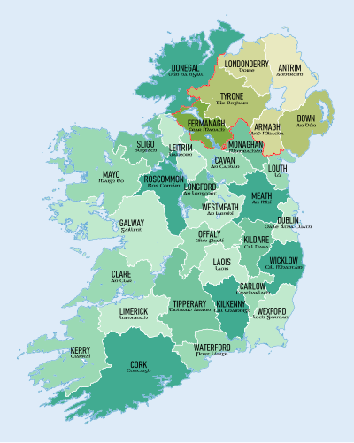
Click on a county to go to the corresponding article Ireland trad counties named.svg
Click on a county to go to the corresponding article