WikiMili
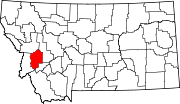
List of mountains in Granite County, Montana
Last updated
April 08, 2022
Map all coordinates using:
OpenStreetMap
Download coordinates as:
KML
This list is
incomplete
; you can help by
adding missing items
.
(
February 2011
)
There are at least
59 named
mountains
in
Granite County, Montana
.
Anaconda Hill
,
46°49′55″N
113°20′56″W
/
46.83194°N 113.34889°W
/
46.83194; -113.34889
(
Anaconda Hill
)
, el.
6,214 feet (1,894
m)
[1]
Anderson Hill
,
46°49′08″N
113°19′21″W
/
46.81889°N 113.32250°W
/
46.81889; -113.32250
(
Anderson Hill
)
, el.
6,854 feet (2,089
m)
[2]
Babcock Mountain
,
46°40′45″N
113°38′24″W
/
46.67917°N 113.64000°W
/
46.67917; -113.64000
(
Babcock Mountain
)
, el.
6,361 feet (1,939
m)
[3]
Burnt Mountain
,
46°40′38″N
113°36′12″W
/
46.67722°N 113.60333°W
/
46.67722; -113.60333
(
Burnt Mountain
)
, el.
6,365 feet (1,940
m)
[4]
Cable Mountain
,
46°15′10″N
113°11′36″W
/
46.25278°N 113.19333°W
/
46.25278; -113.19333
(
Cable Mountain
)
, el.
8,143 feet (2,482
m)
[5]
Cinnabar Point
,
46°33′59″N
113°48′14″W
/
46.56639°N 113.80389°W
/
46.56639; -113.80389
(
Cinnabar Point
)
, el.
7,241 feet (2,207
m)
[6]
Cinnamon Bear Point
,
46°33′24″N
113°46′14″W
/
46.55667°N 113.77056°W
/
46.55667; -113.77056
(
Cinnamon Bear Point
)
, el.
7,080 feet (2,160
m)
[7]
Congdon Peak
,
46°05′10″N
113°46′16″W
/
46.08611°N 113.77111°W
/
46.08611; -113.77111
(
Congdon Peak
)
, el.
8,894 feet (2,711
m)
[8]
Cutaway Mountain
,
46°01′50″N
113°21′53″W
/
46.03056°N 113.36472°W
/
46.03056; -113.36472
(
Cutaway Mountain
)
, el.
9,206 feet (2,806
m)
[9]
Douglas Mountain
,
46°29′48″N
113°09′05″W
/
46.49667°N 113.15139°W
/
46.49667; -113.15139
(
Douglas Mountain
)
, el.
6,217 feet (1,895
m)
[10]
Duffy Hill
,
46°19′50″N
113°17′55″W
/
46.33056°N 113.29861°W
/
46.33056; -113.29861
(
Duffy Hill
)
, el.
5,331 feet (1,625
m)
[11]
Eagle Point
,
46°22′57″N
113°47′58″W
/
46.38250°N 113.79944°W
/
46.38250; -113.79944
(
Eagle Point
)
, el.
7,979 feet (2,432
m)
[12]
East Hill
,
46°40′07″N
113°35′02″W
/
46.66861°N 113.58389°W
/
46.66861; -113.58389
(
East Hill
)
, el.
6,132 feet (1,869
m)
[13]
Emerine Mount
,
46°11′16″N
113°38′01″W
/
46.18778°N 113.63361°W
/
46.18778; -113.63361
(
Emerine Mount
)
, el.
8,629 feet (2,630
m)
[14]
Fisher Point, Granite County
,
46°24′42″N
113°39′54″W
/
46.41167°N 113.66500°W
/
46.41167; -113.66500
(
Fisher Point
)
, el.
6,913 feet (2,107
m)
[15]
Fox Peak, Granite County
,
46°06′07″N
113°45′58″W
/
46.10194°N 113.76611°W
/
46.10194; -113.76611
(
Fox Peak
)
, el.
8,783 feet (2,677
m)
[16]
Franklin Hill
,
46°19′15″N
113°15′58″W
/
46.32083°N 113.26611°W
/
46.32083; -113.26611
(
Franklin Hill
)
, el.
6,818 feet (2,078
m)
[17]
Goat Mountain
,
46°23′00″N
113°03′55″W
/
46.38333°N 113.06528°W
/
46.38333; -113.06528
(
Goat Mountain
)
, el.
9,190 feet (2,800
m)
[18]
Golden Mountain
,
46°38′27″N
113°35′05″W
/
46.64083°N 113.58472°W
/
46.64083; -113.58472
(
Golden Mountain
)
, el.
6,617 feet (2,017
m)
[19]
Green Mountain, Granite County
,
46°24′47″N
113°45′28″W
/
46.41306°N 113.75778°W
/
46.41306; -113.75778
(
Green Mountain
)
, el.
6,857 feet (2,090
m)
[20]
Harvey Point, Granite County
,
46°36′54″N
113°23′50″W
/
46.61500°N 113.39722°W
/
46.61500; -113.39722
(
Harvey Point
)
, el.
6,293 feet (1,918
m)
[21]
Henderson Mountain
,
46°27′23″N
113°19′03″W
/
46.45639°N 113.31750°W
/
46.45639; -113.31750
(
Henderson Mountain
)
, el.
7,100 feet (2,200
m)
[22]
Hickey Hill
,
46°23′19″N
113°09′37″W
/
46.38861°N 113.16028°W
/
46.38861; -113.16028
(
Hickey Hill
)
, el.
7,493 feet (2,284
m)
[23]
Hogback Point
,
46°27′38″N
113°38′50″W
/
46.46056°N 113.64722°W
/
46.46056; -113.64722
(
Hogback Point
)
, el.
8,166 feet (2,489
m)
[24]
Hope Hill
,
46°20′29″N
113°16′14″W
/
46.34139°N 113.27056°W
/
46.34139; -113.27056
(
Hope Hill
)
, el.
6,339 feet (1,932
m)
[25]
King Mountain
,
46°44′03″N
113°10′55″W
/
46.73417°N 113.18194°W
/
46.73417; -113.18194
(
King Mountain
)
, el.
6,630 feet (2,020
m)
[26]
Kurt Peak
,
46°02′12″N
113°17′22″W
/
46.03667°N 113.28944°W
/
46.03667; -113.28944
(
Kurt Peak
)
, el.
9,977 feet (3,041
m)
[27]
Medicine Tree Hill
,
46°41′58″N
113°28′01″W
/
46.69944°N 113.46694°W
/
46.69944; -113.46694
(
Medicine Tree Hill
)
, el.
4,104 feet (1,251
m)
[28]
Moose Mountain
,
46°05′18″N
113°38′00″W
/
46.08833°N 113.63333°W
/
46.08833; -113.63333
(
Moose Mountain
)
, el.
7,897 feet (2,407
m)
[29]
Mount Baldy
,
46°44′17″N
113°25′13″W
/
46.73806°N 113.42028°W
/
46.73806; -113.42028
(
Mount Baldy
)
, el.
6,926 feet (2,111
m)
[30]
Mount Princeton, Granite County
,
46°26′59″N
113°07′42″W
/
46.44972°N 113.12833°W
/
46.44972; -113.12833
(
Mount Princeton
)
, el.
7,900 feet (2,400
m)
[31]
Mount Tiny
,
46°03′34″N
113°16′27″W
/
46.05944°N 113.27417°W
/
46.05944; -113.27417
(
Mount Tiny
)
, el.
9,869 feet (3,008
m)
[32]
Nineteen ten Ridge
,
46°49′45″N
113°22′12″W
/
46.82917°N 113.37000°W
/
46.82917; -113.37000
(
Nineteen ten Ridge
)
, el.
6,250 feet (1,900
m)
[33]
Nirling Hill
,
46°33′56″N
113°19′16″W
/
46.56556°N 113.32111°W
/
46.56556; -113.32111
(
Nirling Hill
)
, el.
5,679 feet (1,731
m)
[34]
Pierre Hill
,
46°23′46″N
113°07′31″W
/
46.39611°N 113.12528°W
/
46.39611; -113.12528
(
Pierre Hill
)
, el.
7,103 feet (2,165
m)
[35]
Quigg Peak
,
46°28′56″N
113°43′06″W
/
46.48222°N 113.71833°W
/
46.48222; -113.71833
(
Quigg Peak
)
, el.
8,330 feet (2,540
m)
[36]
Racetrack Peak
,
46°21′11″N
113°03′34″W
/
46.35306°N 113.05944°W
/
46.35306; -113.05944
(
Racetrack Peak
)
, el.
9,367 feet (2,855
m)
[37]
Rainbow Mountain
,
46°03′07″N
113°19′12″W
/
46.05194°N 113.32000°W
/
46.05194; -113.32000
(
Rainbow Mountain
)
, el.
9,642 feet (2,939
m)
[38]
Ram Mountain
,
46°22′25″N
113°34′56″W
/
46.37361°N 113.58222°W
/
46.37361; -113.58222
(
Ram Mountain
)
, el.
6,837 feet (2,084
m)
[39]
Red Hill
,
46°21′13″N
113°17′12″W
/
46.35361°N 113.28667°W
/
46.35361; -113.28667
(
Red Hill
)
, el.
5,938 feet (1,810
m)
[40]
Red Lion Mountain
,
46°17′13″N
113°11′57″W
/
46.28694°N 113.19917°W
/
46.28694; -113.19917
(
Red Lion Mountain
)
, el.
8,733 feet (2,662
m)
[41]
Rose Mountain
,
46°26′40″N
113°02′56″W
/
46.44444°N 113.04889°W
/
46.44444; -113.04889
(
Rose Mountain
)
, el.
8,589 feet (2,618
m)
[42]
Rumsey Mountain
,
46°15′45″N
113°14′50″W
/
46.26250°N 113.24722°W
/
46.26250; -113.24722
(
Rumsey Mountain
)
, el.
8,159 feet (2,487
m)
[43]
Senate Mountain
,
45°59′33″N
113°33′41″W
/
45.99250°N 113.56139°W
/
45.99250; -113.56139
(
Senate Mountain
)
, el.
8,697 feet (2,651
m)
[44]
Silver King Mountain
,
46°30′28″N
113°27′33″W
/
46.50778°N 113.45917°W
/
46.50778; -113.45917
(
Silver King Mountain
)
, el.
7,848 feet (2,392
m)
[45]
Sliderock Mountain
,
46°35′19″N
113°33′18″W
/
46.58861°N 113.55500°W
/
46.58861; -113.55500
(
Sliderock Mountain
)
, el.
7,789 feet (2,374
m)
[46]
Solomon Mountain
,
46°37′56″N
113°41′00″W
/
46.63222°N 113.68333°W
/
46.63222; -113.68333
(
Solomon Mountain
)
, el.
6,893 feet (2,101
m)
[47]
Spink Point
,
46°33′02″N
113°36′36″W
/
46.55056°N 113.61000°W
/
46.55056; -113.61000
(
Spink Point
)
, el.
7,267 feet (2,215
m)
[48]
Strawberry Mountain, Granite County
,
46°37′44″N
113°32′33″W
/
46.62889°N 113.54250°W
/
46.62889; -113.54250
(
Strawberry Mountain
)
, el.
6,808 feet (2,075
m)
[49]
Sugarloaf, Granite County
,
46°33′11″N
113°16′46″W
/
46.55306°N 113.27944°W
/
46.55306; -113.27944
(
Sugarloaf
)
, el.
5,007 feet (1,526
m)
[50]
Sunrise Mountain
,
46°29′11″N
113°19′29″W
/
46.48639°N 113.32472°W
/
46.48639; -113.32472
(
Sunrise Mountain
)
, el.
6,608 feet (2,014
m)
[51]
Table Mountain, Granite County
,
46°04′24″N
113°43′06″W
/
46.07333°N 113.71833°W
/
46.07333; -113.71833
(
Table Mountain
)
, el.
8,455 feet (2,577
m)
[52]
The Eyebrow
,
46°31′57″N
113°16′09″W
/
46.53250°N 113.26917°W
/
46.53250; -113.26917
(
The Eyebrow
)
, el.
4,964 feet (1,513
m)
[53]
Twin Peaks, Granite County
,
46°17′12″N
113°08′13″W
/
46.28667°N 113.13694°W
/
46.28667; -113.13694
(
Twin Peaks
)
, el.
9,039 feet (2,755
m)
[54]
Tyler Point
,
46°38′33″N
113°28′01″W
/
46.64250°N 113.46694°W
/
46.64250; -113.46694
(
Tyler Point
)
, el.
6,877 feet (2,096
m)
[55]
Union Peak, Granite County
,
46°48′28″N
113°23′56″W
/
46.80778°N 113.39889°W
/
46.80778; -113.39889
(
Union Peak
)
, el.
6,821 feet (2,079
m)
[56]
Warren Peak, Granite County
,
45°59′12″N
113°27′37″W
/
45.98667°N 113.46028°W
/
45.98667; -113.46028
(
Warren Peak
)
, el.
10,407 feet (3,172
m)
[57]
Welcome Hill
,
46°13′49″N
113°08′23″W
/
46.23028°N 113.13972°W
/
46.23028; -113.13972
(
Welcome Hill
)
, el.
8,756 feet (2,669
m)
[58]
West Fork Buttes
,
46°16′12″N
113°34′03″W
/
46.27000°N 113.56750°W
/
46.27000; -113.56750
(
West Fork Buttes
)
, el.
7,064 feet (2,153
m)
[59]
See also
List of mountains in Montana
List of mountain ranges in Montana
Notes
↑
"Anaconda Hill"
.
Geographic Names Information System
.
United States Geological Survey
.
↑
"Anderson Hill"
.
Geographic Names Information System
.
United States Geological Survey
.
↑
"Babcock Mountain"
.
Geographic Names Information System
.
United States Geological Survey
.
↑
"Burnt Mountain"
.
Geographic Names Information System
.
United States Geological Survey
.
↑
"Cable Mountain"
.
Geographic Names Information System
.
United States Geological Survey
.
↑
"Cinnabar Point"
.
Geographic Names Information System
.
United States Geological Survey
.
↑
"Cinnamon Bear Point"
.
Geographic Names Information System
.
United States Geological Survey
.
↑
"Congdon Peak"
.
Geographic Names Information System
.
United States Geological Survey
.
↑
"Cutaway Mountain"
.
Geographic Names Information System
.
United States Geological Survey
.
↑
"Douglas Mountain"
.
Geographic Names Information System
.
United States Geological Survey
.
↑
"Duffy Hill"
.
Geographic Names Information System
.
United States Geological Survey
.
↑
"Eagle Point"
.
Geographic Names Information System
.
United States Geological Survey
.
↑
"East Hill"
.
Geographic Names Information System
.
United States Geological Survey
.
↑
"Emerine Mount"
.
Geographic Names Information System
.
United States Geological Survey
.
↑
"Fisher Point"
.
Geographic Names Information System
.
United States Geological Survey
.
↑
"Fox Peak"
.
Geographic Names Information System
.
United States Geological Survey
.
↑
"Franklin Hill"
.
Geographic Names Information System
.
United States Geological Survey
.
↑
"Goat Mountain"
.
Geographic Names Information System
.
United States Geological Survey
.
↑
"Golden Mountain"
.
Geographic Names Information System
.
United States Geological Survey
.
↑
"Green Mountain"
.
Geographic Names Information System
.
United States Geological Survey
.
↑
"Harvey Point"
.
Geographic Names Information System
.
United States Geological Survey
.
↑
"Henderson Mountain"
.
Geographic Names Information System
.
United States Geological Survey
.
↑
"Hickey Hill"
.
Geographic Names Information System
.
United States Geological Survey
.
↑
"Hogback Point"
.
Geographic Names Information System
.
United States Geological Survey
.
↑
"Hope Hill"
.
Geographic Names Information System
.
United States Geological Survey
.
↑
"King Mountain"
.
Geographic Names Information System
.
United States Geological Survey
.
↑
"Kurt Peak"
.
Geographic Names Information System
.
United States Geological Survey
.
↑
"Medicine Tree Hill"
.
Geographic Names Information System
.
United States Geological Survey
.
↑
"Moose Mountain"
.
Geographic Names Information System
.
United States Geological Survey
.
↑
"Mount Baldy"
.
Geographic Names Information System
.
United States Geological Survey
.
↑
"Mount Princeton"
.
Geographic Names Information System
.
United States Geological Survey
.
↑
"Mount Tiny"
.
Geographic Names Information System
.
United States Geological Survey
.
↑
"Nineteen ten Ridge"
.
Geographic Names Information System
.
United States Geological Survey
.
↑
"Nirling Hill"
.
Geographic Names Information System
.
United States Geological Survey
.
↑
"Pierre Hill"
.
Geographic Names Information System
.
United States Geological Survey
.
↑
"Quigg Peak"
.
Geographic Names Information System
.
United States Geological Survey
.
↑
"Racetrack Peak"
.
Geographic Names Information System
.
United States Geological Survey
.
↑
"Rainbow Mountain"
.
Geographic Names Information System
.
United States Geological Survey
.
↑
"Ram Mountain"
.
Geographic Names Information System
.
United States Geological Survey
.
↑
"Red Hill"
.
Geographic Names Information System
.
United States Geological Survey
.
↑
"Red Lion Mountain"
.
Geographic Names Information System
.
United States Geological Survey
.
↑
"Rose Mountain"
.
Geographic Names Information System
.
United States Geological Survey
.
↑
"Rumsey Mountain"
.
Geographic Names Information System
.
United States Geological Survey
.
↑
"Senate Mountain"
.
Geographic Names Information System
.
United States Geological Survey
.
↑
"Silver King Mountain"
.
Geographic Names Information System
.
United States Geological Survey
.
↑
"Sliderock Mountain"
.
Geographic Names Information System
.
United States Geological Survey
.
↑
"Solomon Mountain"
.
Geographic Names Information System
.
United States Geological Survey
.
↑
"Spink Point"
.
Geographic Names Information System
.
United States Geological Survey
.
↑
"Strawberry Mountain"
.
Geographic Names Information System
.
United States Geological Survey
.
↑
"Sugarloaf"
.
Geographic Names Information System
.
United States Geological Survey
.
↑
"Sunrise Mountain"
.
Geographic Names Information System
.
United States Geological Survey
.
↑
"Table Mountain"
.
Geographic Names Information System
.
United States Geological Survey
.
↑
"The Eyebrow"
.
Geographic Names Information System
.
United States Geological Survey
.
↑
"Twin Peaks"
.
Geographic Names Information System
.
United States Geological Survey
.
↑
"Tyler Point"
.
Geographic Names Information System
.
United States Geological Survey
.
↑
"Union Peak"
.
Geographic Names Information System
.
United States Geological Survey
.
↑
"Warren Peak"
.
Geographic Names Information System
.
United States Geological Survey
.
↑
"Welcome Hill"
.
Geographic Names Information System
.
United States Geological Survey
.
↑
"West Fork Buttes"
.
Geographic Names Information System
.
United States Geological Survey
.
v
t
e
Municipalities and communities of
Granite County, Montana
,
United States
County seat
:
Philipsburg
Towns
Drummond
Philipsburg
Granite County map
CDPs
Hall
Maxville
Ghost towns
Bearmouth
Garnet
Granite
Nimrod
Montana portal
United States portal
This page is based on this
Wikipedia article
Text is available under the
CC BY-SA 4.0
license; additional terms may apply.
Images, videos and audio are available under their respective licenses.