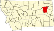
There are at least 26 named mountains in McCone County, Montana .
- Andrews Hill, 47°48′06″N106°11′12″W / 47.80167°N 106.18667°W , el. 2,598 feet (792 m) [1]
- Bald Butte, 47°51′45″N106°06′05″W / 47.86250°N 106.10139°W , el. 2,628 feet (801 m) [2]
- Big Butte, 47°51′16″N106°03′30″W / 47.85444°N 106.05833°W , el. 2,556 feet (779 m) [3]
- Big Heaven, 47°33′12″N105°58′05″W / 47.55333°N 105.96806°W , el. 2,582 feet (787 m) [4]
- Bonhoff Butte, 47°39′35″N106°03′37″W / 47.65972°N 106.06028°W , el. 2,812 feet (857 m) [5]
- Caprock Butte, 47°57′18″N106°13′02″W / 47.95500°N 106.21722°W , el. 2,628 feet (801 m) [6]
- Chalk Butte, 47°06′02″N105°57′22″W / 47.10056°N 105.95611°W , el. 2,982 feet (909 m) [7]
- Coal Hill, 47°56′52″N106°14′49″W / 47.94778°N 106.24694°W , el. 2,769 feet (844 m) [8]
- Cobb Hill, 47°27′14″N106°07′39″W / 47.45389°N 106.12750°W , el. 2,749 feet (838 m) [9]
- Corner Butte, 47°49′04″N106°04′08″W / 47.81778°N 106.06889°W , el. 2,464 feet (751 m) [10]
- Deadman Butte, 48°01′42″N106°18′07″W / 48.02833°N 106.30194°W , el. 2,628 feet (801 m) [11]
- Devils Table Rock, 47°32′36″N106°03′23″W / 47.54333°N 106.05639°W , el. 2,749 feet (838 m) [12]
- Goat Mountain, 47°50′39″N106°11′41″W / 47.84417°N 106.19472°W , el. 2,657 feet (810 m) [13]
- Indian Hill, 47°59′11″N106°18′12″W / 47.98639°N 106.30333°W , el. 2,726 feet (831 m) [14]
- Little Heaven, 47°32′39″N105°54′47″W / 47.54417°N 105.91306°W , el. 2,779 feet (847 m) [15]
- Lower Summit, 47°13′30″N105°31′23″W / 47.22500°N 105.52306°W , el. 2,920 feet (890 m) [16]
- Lucky Hill, 47°53′47″N106°16′17″W / 47.89639°N 106.27139°W , el. 2,648 feet (807 m) [17]
- Lytle Hill, 47°51′26″N106°02′59″W / 47.85722°N 106.04972°W , el. 2,520 feet (770 m) [18]
- Maxwell Hill, 47°57′06″N106°04′10″W / 47.95167°N 106.06944°W , el. 2,431 feet (741 m) [19]
- McDonald Butte, 47°30′01″N106°03′02″W / 47.50028°N 106.05056°W , el. 2,779 feet (847 m) [20]
- Rocky Butte, 47°49′04″N106°04′23″W / 47.81778°N 106.07306°W , el. 2,510 feet (770 m) [21]
- Stony Butte Hill, 47°19′46″N105°45′44″W / 47.32944°N 105.76222°W , el. 2,743 feet (836 m) [22]
- Teton Butte, 47°51′05″N106°05′17″W / 47.85139°N 106.08806°W , el. 2,490 feet (760 m) [23]
- Vanderhoof Hill, 47°48′33″N106°02′58″W / 47.80917°N 106.04944°W , el. 2,480 feet (760 m) [24]
- Westland Hill, 47°51′32″N106°10′56″W / 47.85889°N 106.18222°W , el. 2,651 feet (808 m) [25]
- Willis Buttes, 47°50′12″N106°05′08″W / 47.83667°N 106.08556°W , el. 2,589 feet (789 m) [26]