List of national monuments in County Tipperary

Last updated

Map all coordinates using: OpenStreetMap

This is a list of national monuments in County Tipperary. In the Republic of Ireland, a structure or site may be deemed to be a "national monument", and therefore worthy of state protection, if it is of national importance. If the land adjoining the monument is essential to protect it, this land may also be protected.

National monuments

NM#Monument nameDescriptionImageTownlandLocation
378 Lackeen Castle Castle Castles of Munster, Lackeen, Tipperary - geograph.org.uk - 1542016.jpg Abbeville 53°05′18″N8°04′26″W / 53.0884°N 8.0738°W / 53.0884; -8.0738
124 Ahenny High Crosses High Crosses Ahenny high crosses, Co. Tipperary - geograph.org.uk - 206930.jpg Ahenny 52°24′45″N7°23′36″W / 52.41246°N 7.39339°W / 52.41246; -7.39339
396 St. Berrihert's Kyle Crosses & Inscribed Slabs Some of the Crosses inside the Kyle.JPG Ardane 52°24′37″N8°04′38″W / 52.41021°N 8.07734°W / 52.41021; -8.07734
604 Ardcroney Burial Mound Burial Mound (Cist) Ardcroney 52°56′17″N8°09′26″W / 52.93818°N 8.15725°W / 52.93818; -8.15725
573 Ashleypark Burial Mound Burial Moundy (Cist) Ashleypark 52°56′02″N8°11′20″W / 52.933858°N 8.188848°W / 52.933858; -8.188848
120 Athassel Abbey Priory (Augustinian) Ireland Athassel Priory.jpg Cashel 52°28′46″N7°59′01″W / 52.479444°N 7.983611°W / 52.479444; -7.983611
581 Ballycomisk Ringforts Three Ringforts Ballycomisk 52°29′22″N7°50′27″W / 52.489523°N 7.840805°W / 52.489523; -7.840805
659 Ballingarry Warhouse House with historical associations The Widow McCormack's House, Near Ballingarry.JPG Farranrory Upper 52°37′09″N7°31′22″W / 52.619273°N 7.522898°W / 52.619273; -7.522898
234 Ballynahow Castle Castle Castles of Munster, Ballynahow, Tipperary - geograph.org.uk - 1542667.jpg Ballynahow 52°41′35″N7°52′41″W / 52.693070°N 7.878118°W / 52.693070; -7.878118
123 Ballynoran Church Church Ballynoran 52°21′20″N7°29′24″W / 52.355605°N 7.490105°W / 52.355605; -7.490105
370 Burncourt Castle Castle or fortified house Castles of Munster, Burncourt, Tipperary (2) - geograph.org.uk - 1393348.jpg Burncourt 52°18′55″N8°04′14″W / 52.31521°N 8.07049°W / 52.31521; -8.07049
595 Cahir Abbey Priory (Augustinian) Cahir Abbey.JPG Caherabbey Upper 52°22′45″N7°55′43″W / 52.379263°N 7.928563°W / 52.379263; -7.928563
507 Cahir Castle Castle Cahir- castle- Ireland..jpg Townparks 52°22′28″N7°55′38″W / 52.374571°N 7.927254°W / 52.374571; -7.927254
577 Cahir Castle Cottage Cahir Castle Cottage Townparks 52°22′26″N7°55′38″W / 52.374018°N 7.927183°W / 52.374018; -7.927183
647 Swiss Cottage Cottage Swiss Cottage Cahir 2005-08-08.JPG Kilcommon Beg 52°21′26″N7°55′25″W / 52.35729°N 7.92355°W / 52.35729; -7.92355
447 Carrick-on-Suir Castle Castle Ormond Castle.jpg Carrick-on-Suir 52°20′42″N7°24′25″W / 52.345084°N 7.406971°W / 52.345084; -7.406971
537 Rathanadav Ringfort Carron (St. Johnbaptist) 52°28′32″N7°53′16″W / 52.475425°N 7.887863°W / 52.475425; -7.887863
550 Carron fort Ringfort Carron (Tipperary town) 52°29′37″N8°10′48″W / 52.493514°N 8.179885°W / 52.493514; -8.179885
127 Hore Abbey Abbey (Cistercian) Hoare Abbey.jpg Cashel 52°31′07″N7°53′52″W / 52.5186°N 7.897893°W / 52.5186; -7.897893
128 Rock of Cashel Ecclesiastical site RockOfCashelSummer1986.jpg Cashel 52°31′12″N7°53′25″W / 52.51995°N 7.890288°W / 52.51995; -7.890288
667 Clonmel Main Guard Courthouse Cluain Meala (Clonmel), The Main Guard - geograph.org.uk - 260570.jpg Burgagery-Lands West 52°21′11″N7°42′05″W / 52.35298°N 7.70139°W / 52.35298; -7.70139
353 Timoney Hills Standing Stones Standing Stones Cullaun, Timenyhills, Timoney 52°54′01″N7°43′12″W / 52.900309°N 7.720127°W / 52.900309; -7.720127
533 Derryvella Early Medieval Ecclesiastical Site Derryvella 52°37′05″N7°40′09″W / 52.617944°N 7.669056°W / 52.617944; -7.669056
193 St. Dominic's Abbey Abbey (Dominican) Dominics Abbey Cashel.jpg St. Dominick's Abbey 52°31′05″N7°53′16″W / 52.518066°N 7.887777°W / 52.518066; -7.887777
122 Donaghmore Church Church Domhnach Mor.jpg Donaghmore 52°24′47″N7°43′29″W / 52.412987°N 7.724840°W / 52.412987; -7.724840
407 Grallagh Castle Castle & Bawn Castles of Munster, Grallagh, Tipperary - geograph.org.uk - 1542258.jpg Grallagh (Graystown) 52°35′41″N7°46′16″W / 52.594772°N 7.771243°W / 52.594772; -7.771243
121 Holy Cross Abbey Abbey (Cistercian) (part of) IMGHolycrossAbbey 4791w.jpg Holycross 52°38′22″N7°52′05″W / 52.63933°N 7.86813°W / 52.63933; -7.86813
654 Kilcash Church Church & graveyard Vcm s kf repr 832x624.jpg Kilcash 52°23′50″N7°31′24″W / 52.397176°N 7.523361°W / 52.397176; -7.523361
654 Kilcash Castle Castle Kilcash Castle2.jpg Kilcash 52°23′50″N7°31′16″W / 52.397326°N 7.521244°W / 52.397326; -7.521244
218 Kilcooly Abbey Abbey (Cistercian) KilcooleyTower2.jpg Kilcoolyabbey 52°40′15″N7°34′16″W / 52.670731°N 7.571237°W / 52.670731; -7.571237
584 Knockgraffon Motte & Bailey Knockgraffon Motte, New Inn, County Tipperary.jpg Knockgraffon 52°24′44″N7°55′59″W / 52.412111°N 7.933144°W / 52.412111; -7.933144
266 Liathmore Churches Two Churches RoundTowerLiathmore.jpg Leigh 52°40′12″N7°40′07″W / 52.66990°N 7.66866°W / 52.66990; -7.66866
348 Lismacrory Mounds Mounds Lismacrory Mound 1.jpg Lismacrory 53°02′16″N8°01′54″W / 53.037717°N 8.031574°W / 53.037717; -8.031574
524 Longstone Rath Standing Stone & prehistoric earthworks Longstone, Cullen.jpg Longstone 52°30′22″N8°17′52″W / 52.506051°N 8.297753°W / 52.506051; -8.297753
673 Lorrha Church Church & two crosses Lorrha Old St. Ruadhan's Parish Church SW 2010 09 04.jpg Lorrha 53°05′30″N8°07′13″W / 53.091572°N 8.120249°W / 53.091572; -8.120249
357 Lorrha Priory Priory (Augustinian) Lorrha Priory of St. Ruadhan SW 2010 09 04.jpg Lorrha 53°05′31″N8°07′17″W / 53.092012°N 8.121414°W / 53.092012; -8.121414
361 Lorrha Friary Friary (Dominican) LorrhaFriary.jpg Lorrha 53°05′28″N8°07′34″W / 53.091081°N 8.126113°W / 53.091081; -8.126113
335 Derrynaflan Church Church & Early Medieval Ecclesiastical site Derrynaflan Church site.png Lurgoe 52°35′50″N7°44′02″W / 52.597315°N 7.733829°W / 52.597315; -7.733829
125 Monaincha Church Church & Cross The Holy Island of Monaincha.JPG Monaincha 52°56′47″N7°44′53″W / 52.946321°N 7.74795°W / 52.946321; -7.74795
292 Moor Abbey Friary (Franciscan) Moor Abbey, Galbally, County Limerick.jpg Moorabbey 52°24′09″N8°16′42″W / 52.402466°N 8.278207°W / 52.402466; -8.278207
513 Nenagh Castle Castle Nenagh Castle.jpg Nenagh 52°51′54″N8°11′53″W / 52.865014°N 8.198154°W / 52.865014; -8.198154
Roscrea Friary Friary (Franciscan) Roscrea Friary W 2010 09 03.jpg Roscrea 52°57′09″N7°47′59″W / 52.952579°N 7.799620°W / 52.952579; -7.799620
451 Portland Church Church Portland 53°05′24″N8°10′32″W / 53.090070°N 8.175483°W / 53.090070; -8.175483
126 Roscrea Church Church, Round Tower, High Cross & Mill Roscrea St. Cronan's Romanesque Church 2010 09 03.jpg Roscrea 52°57′20″N7°47′45″W / 52.955606°N 7.795717°W / 52.955606; -7.795717
211 Roscrea Castle Castle Roscrea Castle.jpg Roscrea 52°57′19″N7°47′53″W / 52.9553°N 7.7980°W / 52.9553; -7.7980
548 Shrough Passage Tomb Passage Tomb Shrough 52°25′37″N8°13′58″W / 52.426943°N 8.232823°W / 52.426943; -8.232823
363 Terryglass Castle Castle Cemetery of Terryglass - geograph.org.uk - 648248.jpg Terryglass 53°03′34″N8°12′43″W / 53.059364°N 8.211910°W / 53.059364; -8.211910
332 Toureen Peakaun Church, Crosses & Slabs Toureen 52°24′32″N7°59′36″W / 52.408754°N 7.993235°W / 52.408754; -7.993235

Sources

Related Research Articles

<span class="mw-page-title-main">County Tipperary</span> County in Ireland

County Tipperary is a county in Ireland. It is in the province of Munster and the Southern Region. The county is named after the town of Tipperary, and was established in the early 13th century, shortly after the Norman invasion of Ireland. It is Ireland's largest inland county and shares a border with eight counties, more than any other. The population of the county was 159,553 at the 2016 census. The largest towns are Clonmel, Nenagh and Thurles.

<span class="mw-page-title-main">Derrynaflan Chalice</span> 8th- or 9th-century chalice

The Derrynaflan Chalice is an 8th- or 9th-century chalice that was found as part of the Derrynaflan Hoard of five liturgical vessels. The discovery was made on 17 February 1980 near Killenaule, County Tipperary in Ireland. According to art historian Michael Ryan the hoard "represents the most complex and sumptuous expression of the ecclesiastical art-style of early-medieval Ireland as we know it in its eighth- and ninth-century maturity." The area known as Derrynaflan is an island of pastureland surrounded by bogland, which was the site of an early Irish abbey. The chalice was found with a composite silver paten, a hoop that may have been a stand for the paten, a liturgical strainer and a bronze basin inverted over the other objects. The group is among the most important surviving examples of Insular metalwork. It was donated to the Irish State and the items are now on display in the National Museum of Ireland.
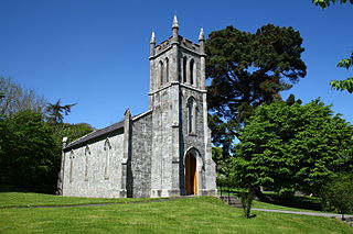
<span class="mw-page-title-main">Ardcroney</span> Village in County Tipperary, Ireland

Ardcroney, officially Ardcrony is a village and townland in County Tipperary, Ireland, 9 km (5.6 mi) north of Nenagh. It also forms a civil parish in the historical barony of Ormond Lower. It is halfway between Nenagh and Borrisokane on the N52 road.

<span class="mw-page-title-main">Galbally, County Limerick</span> Village in County Limerick, Ireland

Galbally is a village in southeast County Limerick, Ireland, on the border with County Tipperary. It is located at the foot of the Galtee Mountains and at the western approach to the Glen of Aherlow. The Aherlow River, flowing down from the Galtee mountains, runs by the village, to meet the Suir at Kilmoyler a short distance north of Cahir. Galbally is in a valley overlooked by the Galtee Mountains.
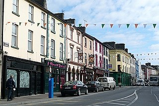
<span class="mw-page-title-main">Tipperary (town)</span> Town in County Tipperary, Ireland

Tipperary, commonly known as Tipperary Town, is a town and a civil parish in County Tipperary, Ireland. Its population was 4,979 at the 2016 census. It is also an ecclesiastical parish in the Roman Catholic Archdiocese of Cashel and Emly, and is in the historical barony of Clanwilliam. The town gave its name to County Tipperary.

<span class="mw-page-title-main">California Coastal National Monument</span> All islets, reefs and rock outcroppings along the coast of California

The California Coastal National Monument is located along the entire coastline of the U.S. state of California. This monument ensures the protection of all islets, reefs and rock outcroppings along the coast of California within 12 nautical miles (22 km) of shore along the entire 840-mile (1,350 km) long coastline. Conservative estimates are for at least 20,000 such outcroppings. The monument was created by Bill Clinton via Presidential proclamation on January 11, 2000, with the authority in section two of the Antiquities Act of 1906. As of 2014, the monument has expanded to 2,272 acres (919 ha). The U.S. Bureau of Land Management, an agency of the U.S. Department of the Interior that manages the monument, has developed gateways in cooperation with other agencies along the California coast to introduce the monument to the public. These include the Trinidad, Point Arena, Fort Bragg-Mendocino, Pigeon Point Lighthouse, Piedras Blancas State Marine Reserve and Marine Conservation Area, and the Palos Verdes Peninsula. Although being the most-viewed national monument in California, people are usually unaware that the entire coastline is a national monument.

Abbeville is a small country house in the townland of Abbeville in County Tipperary. It is set in relict parkland.

<span class="mw-page-title-main">Riverstown (near Birr)</span> Village in Munster, Ireland

Riverstown is a small village straddling the border between Counties Tipperary and Offaly on the outskirts of Birr in Ireland. It is mostly within the townland of Ballyloughnane, on the Tipperary side of the river.

<span class="mw-page-title-main">Lattin, County Tipperary</span> Village in County Tipperary, Ireland

Lattin is a village and civil parish in south County Tipperary in Ireland. It is within the historical barony of Clanwilliam, and is also one half of the 'Lattin and Cullen' parish in the Roman Catholic Archdiocese of Cashel and Emly. Lattin village is located on the R515 regional road between the towns of Emly and Tipperary.

<span class="mw-page-title-main">National monument (Ireland)</span> Monument assigned national importance in Ireland

A national monument in the Republic of Ireland is a structure or site, the preservation of which has been deemed to be of national importance and therefore worthy of state protection. If the land adjoining the monument is essential to protect it, this land may also be protected.

<span class="mw-page-title-main">Abbeville, County Tipperary</span> Townland in Munster, Ireland

Abbeville is a townland in the Barony of Ormond Lower, County Tipperary, Ireland. It is located in the Civil parish of Lorrha.

<span class="mw-page-title-main">Ballingarry, North Tipperary</span> Civil parish in County Tipperary, Ireland

Ballingarry is a civil parish and a townland in the barony of Ormond Lower, County Tipperary in Ireland. It is located on the N52 between Borrisokane and Birr. Ballingarry townland has an area of 5.3 square kilometres (2 sq mi), and had a population of 170 people as of the 2011 census.

<span class="mw-page-title-main">San Juan Islands National Monument</span> National monument in Washington, United States

San Juan Islands National Monument is a U.S. National Monument located in the Salish Sea in the state of Washington. The monument protects archaeological sites of the Coast Salish peoples, lighthouses and relics of early European American settlers in the Pacific Northwest, and biodiversity of the island life in the region. The monument was created from existing federal land by President Barack Obama on March 25, 2013 under the Antiquities Act.

<span class="mw-page-title-main">Killaloe Bridge</span> Road bridge in Ireland

Killaloe Bridge is a road bridge over the River Shannon between Ballina in County Tipperary and Killaloe, County Clare in Ireland. Built on the site of an earlier structure, the eighteenth-century bridge has thirteen arches and includes a lifting section that was added in 1929. The bridge has only one vehicular lane, with traffic lights to control vehicle movement. The bridge is a protected structure, listed on the Record of Protected Structures by both Clare County Council (#210) and Tipperary County Council (#S672).

<span class="mw-page-title-main">Organ Mountains–Desert Peaks National Monument</span>

The Organ Mountains–Desert Peaks National Monument is a United States national monument in the state of New Mexico, managed by the Bureau of Land Management as part of the National Landscape Conservation System.

<span class="mw-page-title-main">Basin and Range National Monument</span> National monument in southeastern Nevada, United States

Basin and Range National Monument is a national monument of the United States spanning approximately 704,000 acres of remote, undeveloped mountains and valleys in Lincoln and Nye counties in southeastern Nevada. It is described as "one of the emptiest spaces in a state famous for its emptiness."
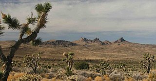
<span class="mw-page-title-main">Castle Mountains National Monument</span> Protected area in Mojave Desert, California

Castle Mountains National Monument is a U.S. National Monument located in the eastern Mojave Desert and northeastern San Bernardino County, in the state of California.