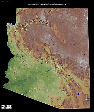
The Colorado Plateau is a physiographic and desert region of the Intermontane Plateaus, roughly centered on the Four Corners region of the southwestern United States. This plateau covers an area of 336,700 km2 (130,000 mi2) within western Colorado, northwestern New Mexico, southern and eastern Utah, northern Arizona, and a tiny fraction in the extreme southeast of Nevada. About 90% of the area is drained by the Colorado River and its main tributaries: the Green, San Juan, and Little Colorado. Most of the remainder of the plateau is drained by the Rio Grande and its tributaries.

The Sevier River is a 400-mile (640 km)-long river in the Great Basin of southwestern Utah in the United States. Originating west of Bryce Canyon National Park, the river flows north through a chain of high farming valleys and steep canyons along the west side of the Sevier Plateau before turning southwest and terminating in the endorheic basin of Sevier Lake in the Sevier Desert. It is used extensively for irrigation along its course, with the consequence that Sevier Lake is usually dry.

The Roan Cliffs are a series of desert mountains and cliffs in eastern Utah and western Colorado, in the western United States that are distinct from the Book Cliffs.

The Sevier orogeny was a mountain-building event that affected western North America from northern Canada to the north to Mexico to the south.
The Star Range is an 8-mile (12 km) long, small mountain range located in central Beaver County, Utah. The range is "star"-shaped as small ridges end at peaks, like fingers of a hand. Another adjacent range sequence southwest, the Shauntie Hills has other fingers of the star-shape.

The Straight Cliffs Formation is a stratigraphic unit in the Kaiparowits Plateau of south central Utah. It is Late Cretaceous in age and contains fluvial, paralic, and marginal marine (shoreline) siliciclastic strata. It is well exposed around the margin of the Kaiparowits Plateau in the Grand Staircase – Escalante National Monument in south central Utah. The formation is named after the Straight Cliffs, a long band of cliffs creating the topographic feature Fiftymile Mountain.

The Sevier Desert is a large arid section of central-west Utah, United States, and is located in the southeast of the Great Basin. It is bordered by deserts north, west, and south; its east border is along the mountain range and valley sequences at the perimeter of the Great Basin, with the large north–south Wasatch Range and its associated mountainous landforms. Its eastern border is specifically, the East Tintic, Gilson, and Canyon Mountains; also the massive Pahvant Range.
The Canyon Mountains are a 25-mile (40 km) long mountain range located in the northeast corner of Millard County, Utah; the range is bisected north-south with a southeast border section of Juab County.

The Cricket Mountains are a 35-mile (56 km) long mountain range located in central-south Millard County, Utah, United States, on the east border of Sevier Lake, in the Great Basin Desert.

The San Francisco Mountains are a 20-mile-long (32 km) mountain range located in north‑central Beaver County, Utah, United States that extend into central-south Millard County.

The San Pitch Mountains are a 40-mile (64 km) long mountain range located in Juab and Sanpete counties in central Utah, United States.

The Gilson Mountains are an 11-mile (18 km) long almost circular, small mountain range adjacent the north terminus of the Canyon Mountains,, located in far eastern Juab County, Utah, United States.
Beaver Valley is a 16-mile (26 km) long small valley located in eastern Beaver County, Utah, United States. The valley is nestled between three mountain ranges, with the Mineral Mountains at its western border, but also an outlying peak section on the mountain range northeast, forming the northern border of the valley.

The Valley Mountains are a 28-mile-long (45 km) mountain range located on the southwest border of Sanpete County, Utah, United States, with the northeast border of Millard County. The north of the range is in Juab County; the south in Sevier County.

The Long Valley of Utah is a 13-mile (21 km) long valley located in western Kane County. The valley is located in source water regions of waters flowing north, south, and southwest, in the west of the High Plateaus section of the Colorado Plateau; the High Plateaus section also extends into northern Arizona, the region north of the Grand Canyon.

Chinle Valley is a 65-mile (105 km) long valley located mostly in Apache County Arizona. Chinle Creek continues north into Utah to meet the San Juan River (Utah).

The Defiance Plateau, part of the geologic Defiance Uplift, is an approximately 75-mile (121 km) long, mostly north-trending plateau of Apache County, Arizona, with its east and southeast perimeter, as parts of San Juan and McKinley Counties, New Mexico.

The White Rim Sandstone is a sandstone geologic formation located in southeastern Utah. It is the last member of the Permian Cutler Group, and overlies the major Organ Rock Formation and Cedar Mesa Sandstone; and again overlies thinner units of the Elephant Canyon and Halgaito Formations.


