Planetary nomenclature, like terrestrial nomenclature, is a system of uniquely identifying features on the surface of a planet or natural satellite so that the features can be easily located, described, and discussed. Since the invention of the telescope, astronomers have given names to the surface features they have discerned, especially on the Moon and Mars. To found an authority on planetary nomenclature, the International Astronomical Union (IAU) was organized in 1919 to designate and standardize names for features on Solar System bodies.

Iapetus is the outermost of Saturn's large moons. With an estimated diameter of 1,469 km (913 mi), it is the third-largest moon of Saturn and the eleventh-largest in the Solar System. Named after the Titan Iapetus, the moon was discovered in 1671 by Giovanni Domenico Cassini.

Xanadu is a highly reflective area on the leading hemisphere of Saturn's moon Titan. Its name comes from an alternate transcription of Shangdu, the summer capital of the Yuan dynasty established by Kublai Khan and made famous by Samuel Taylor Coleridge.
This is a directory of lists of geological features on planets excepting Earth, moons and asteroids ordered by increasing distance from the Sun.

In planetary geology, an albedo feature is a large area on the surface of a planet which shows a contrast in brightness or darkness (albedo) with adjacent areas.

The classical albedo features of Mars are the light and dark features that can be seen on the planet Mars through an Earth-based telescope. Before the age of space probes, several astronomers created maps of Mars on which they gave names to the features they could see. The most popular system of nomenclature was devised by Giovanni Schiaparelli, who used names from classical antiquity. Today, the improved understanding of Mars enabled by space probes has rendered many of the classical names obsolete for the purposes of cartography; however, some of the old names are still used to describe geographical features on the planet.

Alpha Regio is a region of the planet Venus extending for about 1500 kilometers centered at 22°S, 5°E.

Beta Regio is a region of the planet Venus known as a volcanic rise. Measuring about 3,000 kilometres in extent, it constitutes a prominent upland region of Venus centered at 25.3°N 282.8°E.
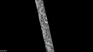
Tui Regio is a region on Titan, the Saturnian moon, in the southwest corner of Xanadu, named after Tui, a Chinese goddess of happiness, joy and water. Tui appears to lack the erosion channels that mark other highland regions on Titan, suggesting it may be geologically young. Patterns resembling lava flows have also been observed, suggesting cryovolcanism.

Tawhaki Patera is an active volcano on Jupiter's moon Io. It is located on Io's leading hemisphere at 3.32°N 76.18°W within the equatorial plains of western Media Regio. Tawhaki is an Ionian patera, a type of volcanic crater similar to a caldera, 49.8 kilometers (30.9 mi) wide and 550 meters (1,800 ft) deep.

Main is an impact crater on Mars, located in the Mare Australe quadrangle at 76.6°S latitude and 310.9°W longitude. It measures 109.0 kilometers in diameter and was named after Rev. Robert Main. The name was approved in 1973, by the International Astronomical Union (IAU) Working Group for Planetary System Nomenclature (WGPSN). The floor of Main shows dark portions which are caused by pressurized carbon dioxide blowing dust in the atmosphere in the spring when the temperature goes up. Some of the dust is shaped into streaks if there is a wind.

Occator is an impact crater located on Ceres, the largest object in the main asteroid belt that lies between the orbits of Mars and Jupiter, that contains "Spot 5", the brightest of the bright spots observed by the Dawn spacecraft. It was known as "Region A" in ground-based images taken by the W. M. Keck Observatory on Mauna Kea.

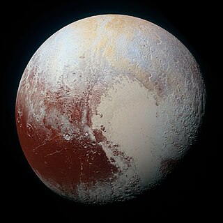
Belton Regio is a prominent surface feature of the dwarf planet Pluto. It is an elongated dark region along Pluto's equator, 2,990 km (1,860 mi) long and one of the darkest features on its surface.

The geography of Pluto refers to the study and mapping of physical features across the dwarf planet Pluto. On 14 July 2015, the New Horizons spacecraft became the first spacecraft to fly by Pluto. During its brief flyby, New Horizons made detailed geographical measurements and observations of Pluto and its moons.

Ogygis Undae is the only named southern hemisphere dune field on Mars. It is named after one of the classical albedo features on Mars, Ogygis Regio. Its name, which refers to Ogyges, a primeval mythological ruler in ancient Greece, was officially approved by the International Astronomical Union (IAU) on September 17, 2015. It is situated just outside Argyre Planitia, a plain located in the southern highlands of Mars. The dunes of Ogygis Undae extend from latitude −49.94°N to −49.37°N and from longitude 292.64°E to 294.93°E. They are centered at latitude −49.66°N, longitude 293.79°E (66.21°W), and extend approximately 87 km to the east and west from there. Ogygis Undae has an area of 1904 km2, and due to its large size is a primary subject for research on Martian dune morphology and sand composition.


