
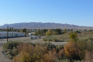
The Mohave Valley is a valley located mostly on the east shore of the south-flowing Colorado River in northwest Arizona. The valley extends into California's San Bernardino County; the northern side of the valley extends into extreme southeast Clark County, Nevada. The main part of the valley lies in southwest Mohave County, Arizona and is at the intersection of the southeast Mojave and northwest Sonoran deserts.

The Big Maria Mountains are located in the southeastern part of the U.S. state of California, near the Colorado River and Arizona. The range lies between Blythe and Vidal, and west of U.S. Route 95 in California and east of Midland. The mountains are home to the Eagle Nest Mine and reach an elevation of 1,030 meters, (3,379 ft). A power line that runs from Parker Dam to Yuma, Arizona runs through the range. A smaller range, the Little Maria Mountains, lie to the west of the Big Marias.

The Chemehuevi Mountains are found at the southeast border of San Bernardino County in southeastern California adjacent the Colorado River. Located south of Needles, California and northwest of the Whipple Mountains, the mountains lie in a north-south direction in general, and are approximately 15 miles in length.
The Sacramento Mountains are a mountain range in the Eastern Mojave Desert and within Mojave Trails National Monument, in San Bernardino County, California.

The Piute Range is located in the Mojave Desert, primarily in northeast San Bernardino County, California, United States, with a north portion in Nevada. Most of the range is the eastern border of the Mojave National Preserve, a National Park Service natural area and park.

Lanfair Valley is located in the Mojave Desert in southeastern California near the Nevada state line. It is bounded on the north by the New York Mountains and Castle Mountains, on the east by the Piute Range, and on the south by the Woods Mountains and Vontrigger Hills. Joshua Trees can be found in most of the valley. Elevation is 4,045 feet.
The Black Mountains of northwest Arizona are an extensive, mostly linear, north-south trending 75 miles (121 km) long mountain range. It forms the north-south border of southwest Mohave County as it borders the eastern shore of the south-flowing Colorado River from Hoover Dam.

The Imperial Reservoir is an artificial lake formed by the construction of the Imperial Diversion Dam across the Colorado River in the Lower Colorado River Valley of Imperial County, California, and Yuma County, Arizona. A component of the Imperial National Wildlife Refuge, the reservoir is 16 miles (26 km) northeast of Yuma, Arizona.

Bouse Wash is one of the larger eastern-bank dry washes that enter the Colorado River in the Lower Colorado River Valley. It is located in La Paz County, extreme western Arizona.
The Parker Valley is located along the Lower Colorado River within the Lower Colorado River Valley region, in southwestern Arizona and southeastern California.
The Dome Rock Mountains are a mountain range in southern La Paz County, Arizona. The range borders the Colorado River on the west and the Colorado River Indian Reservation on the northwest located in the Lower Colorado River Valley. Quartzsite, Arizona lies on the eastern foothills of the range.

Tyson Wash is one of the larger eastern-bank dry washes that enter the Colorado River in western Arizona. It drains the La Posa Plain south-to-north and is also coincident with the Plain,.
Tenmile Wash is an ephemeral wash and watercourse about 85 miles (137 km) long in the northern Sonoran Desert of south-central Arizona. It forms the eastern drainage of a two drainage system of dry washes into the Gila River Valley; both flow northwesterly, and the western drainage is the San Cristobal Wash Drainage of approximately the same length.

The Buckskin Mountains is a mountain range in La Paz County, Arizona, United States. The range lies just east of the north–south Colorado River, and borders south of the east–west, west-flowing Bill Williams River.

The Piute Wash of extreme southeastern Nevada and northeast San Bernardino County California is the south-flowing drainage of the Piute Valley. The wash and valley are located northwest of Needles, California.
The Piute Valley is a 45-mile-long (72 km) north–south valley southeast of Las Vegas, Nevada, and northwest of Needles. The north of the valley is at Searchlight, with some of the valley extending northwest from Searchlight. At the center-north lies Cal-Nev-Ari, Nevada.
Vidal Valley is a 20-mile (32 km) long valley in the far eastern Colorado Desert bordering the Colorado River. Most of the valley is in eastern San Bernardino County, California, but the outfall on the Colorado River is in northeast Riverside County. Vidal Valley forms the large border of the south side of the east-west block of the Whipple Mountains massif, the landform that forces the Colorado to flow southeast, then back southwest. The southeast exit of the valley into Parker Valley on the Colorado River skirts the north end of the Riverside Mountains. The Colorado River Aqueduct crosses the midpoint of the valley at Vidal Junction, California. The Vidal Valley also lies due east of the Danby Dry Lake landform.
The Peacock Mountains are a small, 26 mi (42 km) long mountain range in northwest Arizona, US. The range is a narrow sub-range, and an extension north, at the northeast of the Hualapai Mountains massif, which lies to the southwest. The range is defined by the Hualapai Valley to the northwest, and north and south-flowing washes on its east border, associated with faults and cliffs; the Cottonwood Cliffs are due east, and are connected to the Aquarius Cliffs southward at the west perimeter of the Aquarius Mountains; the cliffs are a result of the Aquarius Fault, which is an extension southward from the Grand Wash Cliffs and Grand Wash Fault which crosses the Colorado River at Lake Mead, and the west perimeter of the Grand Canyon/Colorado Plateau.
The Rice Valley is a valley of the southeastern Mojave Desert, located within Riverside County, California.

The Ward Valley (California) is a lengthy almost true N-S trending valley of far eastern San Bernardino County, California.
