The Chuckwalla Mountains are a mountain range in the transition zone between the Colorado Desert—Sonoran Desert and the Mojave Desert, climatically and vegetationally, in Riverside County of southern California.

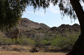
The Sheep Hole Mountains are a mountain range in the Mojave Desert, to the north of Joshua Tree National Park, in San Bernardino County, California. The mountains were once Chemehuevi hunting grounds.

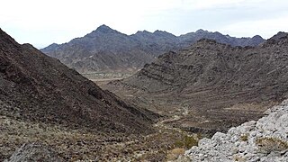
The Chemehuevi Mountains are a mountain range that are found at the southeast border of San Bernardino County in southeastern California and are adjacent the Colorado River. Located south of Needles, California and northwest of the Whipple Mountains, the mountains are oriented in a north–south direction, and stretch for approximately 15 miles (24 km) in length.
The Palen Mountains are located in the southern Mojave Desert – northern Colorado Desert in eastern Riverside County, California, US. The range lies southeast of the Coxcomb Mountains, and northeast of the Chuckwalla Mountains near Interstate 10. The mountains lie in a southwest-northeasterly direction and are approximately 15 miles long and nine miles wide at their widest point.

The Whipple Mountains are located in eastern San Bernardino County, California. They are directly west of the Colorado River, Parker Dam, and Lake Havasu; south of Needles, California; north of Parker, Arizona and Vidal, California; and northeast of Vidal Junction, California.
The Little Maria Mountains are located in southeastern California in the United States. The range lies in a northwest-southeasterly direction east of the Palen Mountains and west of the Big Maria Mountains. The mountain range is approximately 15 miles long and is located about 12.6 miles north of Interstate 10, and 12 miles southwest of the abandoned Rice Army Airfield near State Route 62. The Victor Mine is found at the southeastern end of the range near Midland.
The McCoy Mountains are located in southeastern California in the United States. The southeast terminus of the range lies adjacent the western edge of the Parker Valley in a southern stretch of the Lower Colorado River Valley corridor.

The Piute Range is located in the Mojave Desert, primarily in northeast San Bernardino County, California, United States, with a north portion in Nevada. Most of the range is the eastern border of the Mojave National Preserve, a National Park Service natural area and park.

The Lower Colorado River Valley (LCRV) is the river region of the lower Colorado River of the southwestern United States in North America that rises in the Rocky Mountains and has its outlet at the Colorado River Delta in the northern Gulf of California in northwestern Mexico, between the states of Baja California and Sonora. This north–south stretch of the Colorado River forms the border between the U.S. states of California/Arizona and Nevada/Arizona, and between the Mexican states of Baja California/Sonora.

The 112,400-acre (45,500 ha) Warm Springs Wilderness makes up the entirety of the Black Mesa and parts of the surrounding foothills, washes, alluvial fans, and valleys. The Black Mesa is the southernmost section of the Black Mountains of western Mohave County, in northwest Arizona. The region is in the east and southeast of the Mojave Desert of Arizona, southern Nevada, and California.

The Eldorado Mountains, also called the El Dorado Mountains, are a north-south trending mountain range in southeast Nevada bordering west of the south-flowing Colorado River; the endorheic Eldorado Valley borders the range to the west, and the range is also on the western border of the Colorado River's Black Canyon of the Colorado, and El Dorado Canyon on the river. The range is 50 miles (80 km) southeast of Las Vegas, Nevada; and the Eldorado Mountains connect with the Highland and Newberry mountains.
The Arica Mountains are a small mountain range in northern Riverside County, California. The range lies along the south edge of Rice Valley 6.2 miles (10.0 km) southwest of the old Rice townsite on California State Route 62. They lie 6 miles (9.7 km) north of the Little Maria Mountains and 9 miles (14 km) southwest of the Turtle Mountains. The Granite Mountains lie about 8 miles to the west. They are in the Colorado Desert, in the Lower Colorado River Valley region. They are north the Palen Mountains and Big Maria Mountains; and northwest of Blythe, California.

The Riverside Mountains are a mountain range in Riverside County, California. The town of Vidal, California is located in the West Riverside Mountains.
The Harcuvar Mountains are a narrow mountain range in western-central Arizona, United States. The range lies just east of the north–south Colorado River, and south of the east–west, west-flowing Bill Williams River, from Alamo Lake.
The Piute Valley is a 45-mile-long (72 km) north–south valley southeast of Las Vegas, Nevada, and northwest of Needles. The north of the valley is at Searchlight, with some of the valley extending northwest from Searchlight. At the center-north lies Cal-Nev-Ari, Nevada.
The Rawhide Mountains are a mountain range of western Arizona, in the southwest of Mohave County. It is part of a block of mountain ranges on the north of an insular region called the Maria fold and thrust belt, containing mountain ranges, valleys, and plains. The Rawhide Mountains border the much smaller Artillery Mountains southeast, bordering on Alamo Lake State Park and the south-flowing Big Sandy River.
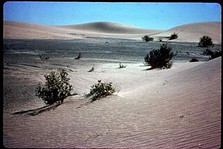
The Rice Valley Wilderness is a wilderness area near Blythe and Rice in the Mojave Desert region of California, managed by the Bureau of Land Management.

Sand to Snow National Monument is a U.S. National Monument located in San Bernardino County and northern Riverside County, Southern California.

The Ward Valley (California) is a lengthy almost true N-S trending valley of far eastern San Bernardino County, California.

The Chuckwalla Valley is a large valley in eastern Riverside County, California, named for a large lizard, the chuckwalla found in the arid Southwestern United States deserts.