
Southern California is a geographic and cultural region that generally comprises the southern portion of the U.S. state of California. It includes the Los Angeles metropolitan area as well as the Inland Empire. The region generally contains ten of California's 58 counties: Los Angeles, San Diego, Orange, Riverside, San Bernardino, Kern, Ventura, Santa Barbara, San Luis Obispo, and Imperial counties.
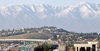
Corona is a city in northwestern Riverside County, California, United States. At the 2020 census, the city had a population of 157,136, up from 152,374 at the 2010 census. Corona is surrounded by Riverside to the east, Norco to the north and northeast, Yorba Linda to the northwest, Cleveland National Forest and the Santa Ana Mountains to the west, southwest, and south. Several unincorporated communities are along the rest of the city's borders. Downtown Corona is approximately 48 miles southeast of Downtown Los Angeles and 95 miles (153 km) north-northwest of San Diego.
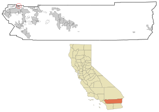
Highgrove is a census-designated place (CDP) and an unincorporated community in Riverside County, California, United States. The population was 3,988 at the 2010 census, up from 3,445 at the 2000 census. The latest 2020 census shows 7,515 total population, an 88.4% increase from last 2010 census, which makes it the fastest-growing location in entire Riverside County. The city of Riverside, California has plans to annex Highgrove in the near future.

Riverside is a city in and the county seat of Riverside County, California, United States, in the Inland Empire metropolitan area. It is named for its location beside the Santa Ana River. It is the most populous city in the Inland Empire and in Riverside County, and is about 50 miles (80 km) southeast of downtown Los Angeles. It is also part of the Greater Los Angeles area. Riverside is the 61st-most-populous city in the United States and the 12th-most-populous city in California. As of the 2020 census, it had a population of 314,998. Along with San Bernardino, Riverside is a principal city in the nation's 13th-largest Metropolitan Statistical Area (MSA); the Riverside-San Bernardino-Ontario MSA ranks in population just below San Francisco (4,749,008) and above Detroit (4,392,041).

San Jacinto is a city in Riverside County, California, United States. It is located at the north end of the San Jacinto Valley, with Hemet to its south and Beaumont to its north. The mountains associated with the valley are the San Jacinto Mountains. The population was 44,199 at the 2010 census. The city was founded in 1870 and incorporated on April 20, 1888, making it one of the oldest cities in Riverside County.

Moosic is a borough in Lackawanna County, Pennsylvania, United States, 3 miles (5 km) south of downtown Scranton and 10 miles (16 km) northeast of downtown Wilkes-Barre, on the Lackawanna River.

State Route 91 (SR 91) is a major east–west state highway in the U.S. state of California that serves several regions of the Greater Los Angeles urban area. A freeway throughout its entire length, it officially runs from Vermont Avenue in Gardena, just west of the junction with the Harbor Freeway, east to Riverside at the junction with the Pomona and Moreno Valley freeways.

San Jacinto Peak is a 10,834 ft (3,302 m) peak in the San Jacinto Mountains, in Riverside County, California. Lying within Mount San Jacinto State Park it is the highest both in the range and the county, and serves as the southern border of the San Gorgonio Pass. Naturalist John Muir wrote of San Jacinto Peak, "The view from San Jacinto is the most sublime spectacle to be found anywhere on this earth!"

The Santa Rosa Mountains are a short mountain range in the Peninsular Ranges system, located east of the Los Angeles Basin and northeast of the San Diego metropolitan area of Southern California, in the Southwestern United States.

Palomar Mountain is a mountain ridge in the Peninsular Ranges in northern San Diego County, California. It is known as the location of Palomar Observatory and Hale Telescope, and known for Palomar Mountain State Park.

The Chocolate Mountains of California are located in Imperial and Riverside counties in the Colorado Desert of Southern California. The mountains stretch more than 60 miles (100 km) in a northwest to southeast direction, and are located east of the Salton Sea and south and west of the Chuckwalla Mountains and the Colorado River. To the northwest lie the Orocopia Mountains.

The San Bernardino National Forest is a United States national forest in Southern California encompassing 823,816 acres (3,333.87 km2) of which 677,982 acres (2,743.70 km2) are federal. The forest is made up of two main divisions, the eastern portion of the San Gabriel Mountains and the San Bernardino Mountains on the easternmost of the Transverse Ranges, and the San Jacinto and Santa Rosa Mountains on the northernmost of the Peninsular Ranges. Elevations range from 2,000 to 11,499 feet. The forest includes seven wilderness areas: San Gorgonio, Cucamonga, San Jacinto, South Fork, Santa Rosa, Cahuilla Mountain and Bighorn Mountain. Forest headquarters are located in the city of San Bernardino. There are district offices in Lytle Creek, Idyllwild, and Fawnskin.

The San Gorgonio Wilderness is located in the eastern San Bernardino Mountains, in San Bernardino County and into northern Riverside County, Southern California.

The San Gorgonio Pass, or Banning Pass, is a 2,600 ft (790 m) elevation gap on the rim of the Great Basin between the San Bernardino Mountains to the north and the San Jacinto Mountains to the south. The pass was formed by the San Andreas Fault, a major transform fault between the Pacific plate and the North American plate that is slipping at a rate of 7.2 ±2.8 mm/year. The tall mountain ranges on either side of the pass result in the pass being a transitional zone from a Mediterranean climate west of the pass, to a Desert climate east of the pass. This also makes the pass area one of the windiest places in the United States, and why it is home to the San Gorgonio Pass wind farm.

Anza is a census-designated place located in southwestern Riverside County, California, in the Anza Valley, a semi-arid region at a mean elevation of 3,921 feet (1,195 m) above sea level. It is located 13 miles (21 km) south of Idyllwild, 32 miles (51 km) east-northeast of Temecula, 40 miles (64 km) southwest of Palm Springs, and 90 miles (140 km) northeast of San Diego, being traversed by State Route 371. Anza is on the Pacific Crest Trail. The population was 3,075 at the 2020 census.
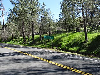
Mountain Center is an unincorporated community and census-designated place in the San Jacinto Mountains, within western central Riverside County, California.

The Riverside Mountains are a mountain range in Riverside County, California. The town of Vidal, California is located in the West Riverside Mountains.
Riverside is an unincorporated community in Kanawha County, West Virginia, United States. Riverside is located on the north bank of the Kanawha River and U.S. Route 60, 1 mile (1.6 km) southeast of Glasgow.

Riverside County is a county located in the southern portion of the U.S. state of California. As of the 2020 census, the population was 2,418,185, making it the fourth-most populous county in California and the 10th-most populous in the United States. The name was derived from the city of Riverside, which is the county seat.

