
Sambia or Samland or Kaliningrad Peninsula is a peninsula in the Kaliningrad Oblast of Russia, on the southeastern shore of the Baltic Sea. The peninsula is bounded by the Curonian Lagoon to the north-east, the Vistula Lagoon in the southwest, the Pregolya River in the south, and the Deyma River in the east. As Sambia is surrounded on all sides by water, it is technically an island. Historically it formed an important part of the historic region of Prussia.

The Taymyr Peninsula is a peninsula in the Far North of Russia, in the Siberian Federal District, that forms the northernmost part of the mainland of Eurasia. Administratively it is part of the Krasnoyarsk Krai Federal subject of Russia.

The Chukchi Peninsula, at about 66° N 172° W, is the easternmost peninsula of Asia. Its eastern end is at Cape Dezhnev near the village of Uelen. The Chukotka Mountains are located in the central/western part of the peninsula, which is bounded by the Chukchi Sea to the north, the Bering Sea to the south, and the Bering Strait to the east, where at its easternmost point it is only about 60 km (37 mi) from Seward Peninsula in Alaska; this is the smallest distance between the land masses of Eurasia and North America. The peninsula is part of Chukotka Autonomous Okrug of Russia.

Rybachy Peninsula is the northernmost part of continental European Russia. Its name is translated as "Fisher Peninsula". It is connected with the Sredny Peninsula, "Middle Peninsula" by a thin isthmus. So the peninsula is in fact nearly completely surrounded by water. Administratively, it is included into Pechengsky District of Murmansk Oblast and is within several hours of ride from Murmansk.

The Taman Peninsula is a peninsula in Krasnodar Krai, Russia, which borders the Sea of Azov to the north, the Kerch Strait to the west and the Black Sea to the south.

Zemlya Georga, or Prince George Land, is the largest island in Franz Josef Land, Arkhangelsk Oblast, Russian Arctic.

Mangyshlak or Mangghyshlaq Peninsula is a large peninsula located in western Kazakhstan. It borders on the Caspian Sea in the west and with the Buzachi Peninsula, a marshy sub-feature of the main peninsula, in the northeast. The Tyuleniy Archipelago lies off the northern shores of the peninsula.
Nordvik was a settlement and a harbour-port in Krasnoyarsk Krai, Russian SFSR, Soviet Union, located on the Khatanga Gulf at the mouth of the Khatanga River, on the Uryung Tumus Peninsula, west of Nordvik Bay.

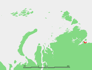
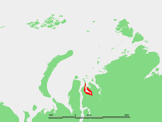
The Mikhailov Peninsula is a small peninsula in the eastern shores of the Kara Sea on the western side of the Taymyr Peninsula. Its latitude is 75° 05' N and its longitude 87° 15' E.

The Gyda Peninsula is a geographical feature of the Siberian coast in the Kara Sea. It takes its name from the river Gyda, that flows on the peninsula. It is roughly 400 km long and 360 km wide. This wide peninsula lies between the estuaries of the Ob and Yenisei Rivers. The southwestern corner of the peninsula is limited by the Taz Estuary, and across the river lies the Yamal Peninsula. The climate in the whole area is arctic and harsh.
The Khalmyer Bay, also known as Gydan Bay is a bay on the Siberian coast in the Kara Sea. It is located in the Gyda Peninsula and it is roughly 185 km long and 47 km wide at its widest point. Lat 71°30′ N, long 76° E.

The Yuratski Bay is an inlet on the Siberian coast in the Kara Sea. It is located in the Gyda Peninsula and it is roughly 45 km long and 30 km wide at its widest point. Lat 71° 50’ N, long 77° 45’ E.

The Shelonsky Islands is an island group in the Sakha Republic (Yakutia), Russian Federation.

The Yam Islands, Yamsky Islands or Yamskiye Islands, is a small island group located close to the coast in the northern Sea of Okhotsk. Administratively the Yam Islands belong to the Magadan Oblast of the Russian Federation.
Onezhsky (masculine), Onezhskaya (feminine), or Onezhskoye (neuter) may refer to:

Cape Patience is a peninsula protruding 65 km (40 mi) km of east-central Sakhalin Island into the Sea of Okhotsk. It forms the eastern boundary of the Gulf of Patience. The width of the peninsula varies from less than 1 km (0.62 mi), at the Lodochniy Isthmus, to 30 km (19 mi) at its widest point. It reaches a maximum elevation of 350 m (1,150 ft). The cape is the southernmost extension of the East Sakhalin Mountains, a north-south range that runs along the eastern side of Sakhalin Island.

Blagoevgrad Peninsula is the mostly ice-covered peninsula projecting 15 km in southeast direction from Oscar II Coast in Graham Land, Antarctica, and 17 km wide. It is bounded by Vaughan Inlet to the north and Exasperation Inlet to the south, ending in Foyn Point to the southeast. The east coast of the peninsula is indented by Yamforina Cove, and its interior is partly occupied by the southeast portion of Poibrene Heights. It was formed as a result of the break-up of Larsen Ice Shelf in the area in 2002, and subsequent retreat of the adjacent Evans Glacier and Punchbowl Glacier.
Krymsky (masculine), Krymskaya (feminine), or Krymskoye (neuter) may refer to:
Ledyanyye Islands are a small island group in the Kara Sea. They are coastal islands near the Nordenskiöld Archipelago, which lies further east.

Kigilyakh Peninsula is a peninsula in the New Siberian Islands, Sakha Republic, Russia.
