Iony Island, or Jonas' Island, formerly Ostrov Svyatogo Iony, is a small island in the Sea of Okhotsk.

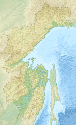
Taui Bay is a body of water in the Sea of Okhotsk off the coast of the Magadan Oblast in Russia. The bay opens to the south.

Ulban Bay is a bay in the northwestern Sea of Okhotsk, just south of the Shantar Islands. It is a southern branch of Academy Bay to the north. The Syran and Ulban rivers flow into its head.
Tugur Bay or Tugursky Bay is a large bay in the Tuguro-Chumikansky District of Khabarovsk Krai, Russian Federation.
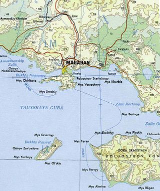
Nagaev Bay or Nagayev Bay, also known as Nagayeva Bay, is a bay within Taui Bay in the northern part of the Sea of Okhotsk, Magadan Oblast, Russia.
Prokofyeva is a small island in the Sea of Okhotsk. It is one of the Shantar Islands. It lies to the northeast of Bolshoy Shantar Island.

Uda Bay is a bay in Khabarovsk Krai, Russian Federation.
Ptichy Island is a small island in the Sea of Okhotsk.
Academy Bay is a large bay in the Tuguro-Chumikansky District of Khabarovsk Krai, Russian Federation.

Shelting Bay is a wide bay on the northern coast of the Sea of Okhotsk. It lies just west of Taui Bay. It is entered between Capes Moskvitin and Dal'ny and is about 32 km wide. Its shores are primarily high and rocky, with the exception of a sandy beach at its northwest end. Sheltered anchorages from southerly winds may be obtained in the northwestern and eastern parts of the bay.
Luzhin Bay is a bay in Magadan Oblast, Russian Federation. It is named after Russian cartographer Fyodor Luzhin.
Cape Ukoy is a steep, narrow cape in the western Sea of Okhotsk. It consists of high and prominent rocks. Ukoy Bay lies just west of the cape.
Seneka Point is a steep-to point in the western Sea of Okhotsk. It has sheer cliffs that are 152 m high and grayish-brown in color. It forms the eastern point of the entrance to Tugur Bay, the southeastern point of Lindholm Strait, and the western point of the entrance of Academy Bay; to its north lies Belichy Island. Numerous tide rips and eddies form near the point.
Cape Ukurunru is a cape in the western Sea of Okhotsk. It has sheer cliffs that are grayish-brown in color. It forms the western point to the entrance of Ulban Bay.
Cape Bol'shoy Dugandzha is a headland in Khabarovsk Krai, Russia.
Aldoma Bay is a small bay in the western Sea of Okhotsk. It is 8 km east to west and 14.5 km north to south. The Aldoma River flows into it from the west; to its east lies the Nurki Peninsula. It is considered the best anchorage in the northwestern part of the sea as it offers shelter from northeast winds.
Lyutsun Bay is a small bay in the western Sea of Okhotsk. To its west lies Uda Gulf, while to its north and east lies the Shantar Sea, and to its south and east Tugur Bay.
Yeyriney Gulf is a small bay in Khabarovsk Krai, Russian Federation.
Cape Manorsky is a cape in the western Sea of Okhotsk. It lies ten miles southwest of Cape Nosorog. A small reef extends to the south of the cape.
Cape Opasnyy is a very prominent headland in Penzhina Bay, the right arm of Shelikhov Gulf, in the northeastern Sea of Okhotsk. It lies to the northwest of The Gorlo. A ledge projects about three quarters of a mile east-northeast of the headland, while a group of detached rocks lies about 1.2 miles north northeast of it.