
Andhra Pradesh is a state in the south-eastern coastal region of India. It is the seventh-largest state by area covering an area of 162,975 km2 (62,925 sq mi) and tenth-most-populous state, with 49,386,799 inhabitants. It is bordered by Telangana to the north-west, Chhattisgarh to the north, Odisha to the north-east, Tamil Nadu to the south, Karnataka to the west and the Bay of Bengal to the east. It has the second longest coastline in India after Gujarat, of about 974 km (605 mi). Andhra State was the first state to be formed on a linguistic basis in India on 1 October 1953. On 1 November 1956, Andhra State was merged with the Telugu-speaking areas of the Hyderabad State to form United Andhra Pradesh. In 2014 these merged areas of Hyderabad State were bifurcated from United Andhra Pradesh to form the new state Telangana. The present form of Andhra is similar to Andhra state, but some mandalas like Bhadrachalam are still included in Telangana. Amaravati serves as the capital of present Andhra with the largest city being Visakhapatnam.

Nandamuri Taraka Rama Rao, often referred to by his initials NTR, was an Indian actor, filmmaker and politician who served as Chief Minister of Andhra Pradesh for seven years over three terms. He starred in over 300 films, predominantly in Telugu cinema, and was referred by the media as Viswa Vikhyatha Nata Sarwa Bhouma. Rao received three National Film Awards for co-producing Thodu Dongalu (1954) and Seetharama Kalyanam (1960) under National Art Theater, Madras, and for directing Varakatnam (1970). Known for his breakthrough performances in Raju Peda (1954) and Lava Kusa (1963), Rao garnered the Nandi Award for Best Actor for Kodalu Diddina Kapuram in 1970, and the Inaugural Filmfare Award for Best Actor – Telugu in 1972 for Badi Panthulu.

India is a federal union comprising 28 states and 8 union territories, with a total of 36 entities. The states and union territories are further subdivided into districts and smaller administrative divisions.

Ongole is a city in Prakasam district of the Indian state of Andhra Pradesh. It is the headquarters of Prakasam district and also the mandal headquarters of Ongole mandal in Ongole revenue division. Ongole cattle, an indigenous breed of oxen, derived its name from Ongole.
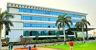
Vijayawada, formerly known as Bezawada, is the second largest city in the Indian state of Andhra Pradesh and is a part of the state's Capital Region. It is the administrative headquarters of the NTR district. Its metropolitan region comprises NTR and parts of Krishna and Guntur districts.Vijayawada lies on the banks of Krishna river surrounded by the hills of Eastern Ghats, known as Indrakeeladri Hills. It geographically lies on the center spot of Andhra Pradesh. The city has been described as the commercial, political, cultural and educational capital of Andhra Pradesh It is the second largest city in Andhra Pradesh with a population of 1,723,000 in 2021, estimated population of 1,991,189 in the Vijayawada Metropolitan Area. It is one of the fastest growing urban areas in India and among the top 10 fastest growing cities in the world according to Oxford Economics report.

Anantapur, officially Anantapuramu, is a city in Anantapur district of the Indian state of Andhra Pradesh. It is the mandal headquarters of Anantapuru mandal and also the divisional headquarters of Anantapur revenue division. The city is located on National Highway. It was also the headquarters of the Datta Mandalam in 1799. It was also a position of strategic importance for the British Indian Army during the Second World War.

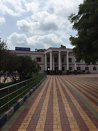
Kurnool is a city in the state of Andhra Pradesh, India. It formerly served as the capital of Andhra State (1953–1956). The city is often referred to as "The Gateway of Rayalaseema". Kurnool is also known as The City of Gem Stones. It also serves as the district headquarters of its Kurnool district. As of 2011 census, it is the fifth most populous city in the state with a population of 484,327. It is located on the banks of the Tungabhadra river. Although the area has been inhabited for thousands of years, modern Kurnool was founded in the 16th century CE with the construction of the Konda Reddy Fort.

Vizianagaram is a city and the headquarters of the Vizianagaram district in the Indian state of Andhra Pradesh. It is located in the Eastern Ghats, about 24 km (15 mi) west of the Bay of Bengal and 40 km (25 mi) north-northeast of Visakhapatnam. The city has a population of 228,025 and was established as the capital of the Vizianagaram estate by Raja Vijayaram Raj from the Pusapati dynasty. The rulers had a notable role in the history of the region in the 18th century and were patrons of education and arts.

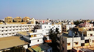
Tenali is a city in Guntur district of the Indian state of Andhra Pradesh. It is a municipality and the headquarters of Tenali mandal and Tenali revenue division. The city is renowned for art, culture, drama and hence, it is called Andhra Paris. It is one of the twelve urban local bodies in Andhra Pradesh Capital Region and the twelfth most populous city in the state, with a population of 199,345 as of 2011. Tenali City is also part of Andhra Pradesh Capital Region Development Authority (APCRDA).
Kavali is a town in Nellore district of Andhra Pradesh of India. It also serves as headquarters of Kavali mandal and Kavali revenue division.It is one of the few cities from Andhra Pradesh which were selected for Atal Mission for Rejuvenation and Urban Transformation (AMRUT) Scheme.

Chittoor district is one of the eight districts in the Rayalaseema region of the Indian state of Andhra Pradesh. The district headquarters is located at Chittoor. It has a population of 18,72,951 according to 2011 census of India. It lies in the Poini River Valley of southernmost Andhra Pradesh along the Chennai–Bangalore section of Chennai-Mumbai highway. Chittoor district is a major market centre for mangoes, grains, sugarcane, and peanuts.
Nandyal is a city and District headquarters of Nandyal district of the Indian state of Andhra Pradesh. It is a municipality and the headquarters of Nandyal mandal in Nandyal revenue division.
Tanuku is a town in West Godavari district of the Indian state of Andhra Pradesh. It is the mandal headquarters of Tanuku mandal in Narasapuram revenue division. Tanuku is the fourth largest city in the West Godavari district after Bhimavaram, Tadepalligudem and Palakollu in terms of population.
The administrative divisions of India are subnational administrative units of India; they are composed of a nested hierarchy of administrative divisions.
Gudur is a town in Tirupati district of the Indian state of Andhra Pradesh. It is a municipality and the headquarters of Gudur mandal and Gudur revenue division.
Bapatla is a city and District headquarters of Bapatla district in the Indian state of Andhra Pradesh. It is a municipality and the mandal headquarters of Bapatla mandal of Bapatla revenue division. The nearest towns and cities to Bapatla are Chirala, Ponnur, Tenali and Guntur of 17 km, 22 km, 50 km and 53 km respectively.
Chilakaluripet is a city in Palnadu district of the Indian state of Andhra Pradesh. It is the Mandal headquarters of Chilakaluripet Mandal in Narasaraopet Revenue Division.

The Old Godavari Bridge is a decommissioned bridge that spans the Godavari River in Andhra Pradesh, India. Commissioned in 1900, the bridge served trains plying between Howrah and Madras. It is the earliest of three bridges that span the Godavari River at Rajahmundry. The Godavari Arch Bridge was later constructed as a replacement for the Havelock Bridge. The bridge along with the Godavari bridge and Godavari Arch Bridge is one of the most recognised symbols of Rajahmundry and of the state of Andhra Pradesh.

Mangalagiri mandal is one of the 57 mandals in Guntur district of the Indian state of Andhra Pradesh. It is under the administration of Tenali revenue division and the headquarters are located at Mangalagiri town part of Mangalagiri Tadepalle Municipal Corporation. The mandal is bounded by Thullur, Tadepalle, Tadikonda, Pedakakani and Duggirala mandals and a portion of the mandal lies on the banks of Krishna River.
Tenali mandal is one of the 57 mandals in Guntur district of the Indian state of Andhra Pradesh. It is under the administration of Tenali revenue division, headquartered at Tenali. The mandal is located in Velanadu region, bounded by Pedakakani, Duggirala, Kollipara, Vemuru, Amruthalur, Tsundur and Chebrole mandals.
