Michael John Savage is an Irish-born Canadian politician, who was elected Mayor of the Halifax Regional Municipality on October 20, 2012. He previously served as a Liberal Party of Canada Member of Parliament for the riding of Dartmouth—Cole Harbour from 2004 to 2011.

Halifax is the capital and largest municipality of the Canadian province of Nova Scotia, and the largest municipality in Atlantic Canada. Halifax is one of Canada's fastest growing municipalities, and as of 2022, it is estimated that the CMA population of Halifax was 480,582,with 348,634 people in its urban area. The regional municipality consists of four former municipalities that were amalgamated in 1996: Halifax, Dartmouth, Bedford, and Halifax County.

The Halifax Peninsula is peninsula within the urban area of the Municipality of Halifax, Nova Scotia.
Halifax Regional Council is the governing body of Halifax, known as the Halifax Regional Municipality (HRM). Halifax is governed by a mayor-council system, where councillors are elected from sixteen geographic districts though a first-past-the-post system and the mayor is elected via a municipality-wide first-past-the-post vote. Halifax Regional Council was formed in 1996 and consisted of twenty-three councillors and one mayor. It was reduced in size to sixteen councillors and the mayor in 2012. The council meets at Halifax City Hall.

The Halifax Regional Police (HRP) is one of a number of law enforcement agencies operating in the Halifax, Nova Scotia; the other primaries being the Royal Canadian Mounted Police and the Canadian Forces Military Police. The city also is home to a small detachment of the Canadian National Railway Police.
The Halifax Regional Municipality (HRM) in Nova Scotia, Canada has a widely varied geography.
Shannon Park is an urban neighbourhood and former national defence site in the north end of Dartmouth on the eastern shore of Halifax Harbour in the Halifax Regional Municipality (HRM) in Nova Scotia, Canada. It is immediately south of the A. Murray MacKay Bridge in the community of Dartmouth. It straddles Highway 111, a CN Rail freight line, and Halifax Harbour. It is bordered on the south by Tuft's Cove.
Fergusons Cove is a suburban community within the Halifax Regional Municipality (HRM), Nova Scotia on the western shore of Halifax Harbour between Purcell's Cove and Herring Cove along Route 253. The first 3 digits of the postal code in the area are B3V.
Clam Harbour is a rural community on the Eastern Shore region of the Halifax Regional Municipality Nova Scotia, Canada on the West Ship Harbour Road off of Trunk 7 84 kilometers (52 mi) east of Dartmouth. The community is host to the Clam Harbour Beach sandcastle contest every year in August.

Musquodoboit Harbour is a rural community located in Nova Scotia, Canada within the Halifax Regional Municipality. The community is situated on the Eastern Shore at the mouth of the Musquodoboit River. The community lies 45 kilometres east of downtown Halifax. With a hospital, RCMP detachment, postal outlet, schools, recreational center, library, municipal office and other services, Musquodoboit Harbour is a serve centre for many of the surrounding communities.

Sambro is a rural fishing community on the Chebucto Peninsula in the Halifax Regional Municipality, in Nova Scotia, Canada.

Halifax, Nova Scotia, is a major multi-modal transportation centre for freight and passengers in Atlantic Canada. Halifax, formally known as the Halifax Regional Municipality (HRM), is the capital and largest municipality of the Canadian province of Nova Scotia.
The Halifax Regional Municipality (HRM) is a major generator of economic activity in Atlantic Canada.

Halifax Regional Municipality, formally known as Halifax is located in Nova Scotia, Canada. The municipality is governed by a mayor and a sixteen-person Regional Council, who are elected by geographic district; municipal elections occur every leap year.
Halifax Regional Fire and Emergency Services provides fire protection, rescue and first responder assistance throughout Halifax, Nova Scotia, Canada.

The Chebucto Community Net (CCN) is a Canadian FreeNet operating in Nova Scotia's Halifax Regional Municipality (HRM). It is registered as a non-profit society under Nova Scotia's Registry of Joint Stocks using the name Chebucto Community Net Society. The name "Chebucto" comes from the local l'nu word for Halifax Harbour meaning "big water".

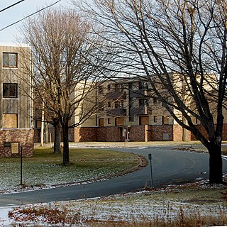
Harbourview is a 15 ha neighbourhood in Dartmouth, Nova Scotia. Located in central Dartmouth, it abuts the HRM Capital District and overlooks Halifax Harbour. The community is dominated by the Angus L. Macdonald Bridge, completed in 1955.
High Resolution Melt (HRM) analysis is a powerful technique in molecular biology for the detection of mutations, polymorphisms and epigenetic differences in double-stranded DNA samples. It was discovered and developed by Idaho Technology and the University of Utah. It has advantages over other genotyping technologies, namely:
Sheet Harbour Road is a community of the Halifax Regional Municipality in the Canadian province of Nova Scotia. It is located just five minutes south of Upper Musquodoboit, Nova Scotia. Its name is derived from Route 224, which is the primary route from the Musquodoboit Valley to Sheet Harbour, Nova Scotia.
Grand Lake is a lake just west of Sheet Harbour, Nova Scotia. It is crescent-shaped. Its primary outflow is Little West River, which flows into the Northwest Arm of Sheet Harbour. The land area of the Sheet Harbour 36 Indian reserve extends to a part of the shore of Grand Lake. In 2012, the Nova Scotia Government bought 470 hectares of land near the lake worth $1.1 million.
