The 24th Field Artillery Regiment (Philippine Scouts) (24th FA (PS)) was a Philippine Scouts unit, part of the US Army's Philippine Division, formed in 1922 and active until April 1942. Antecedent units dated back to 1899.

A Moscow mule is a cocktail made with vodka, ginger beer and lime juice, garnished with a slice or wedge of lime, and a sprig of mint. The drink, being a type of buck, is sometimes called vodka buck. It is popularly served in a copper mug, which takes on the cold temperature of the liquid.

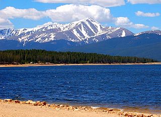
Mount Elbert is the highest summit of the Rocky Mountains of North America. With an elevation of 14,440 feet (4401.2 m), it is also the highest point in the U.S. state of Colorado and the second-highest summit in the contiguous United States after Mount Whitney, which is slightly taller. The ultra-prominent fourteener is the highest peak in the Sawatch Range, as well as the highest point in the entire Mississippi River drainage basin. Mount Elbert is located in San Isabel National Forest, 12.1 miles (19.4 km) southwest of the city of Leadville in Lake County, Colorado.

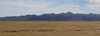
The Mule Mountains are a north/south running mountain range located in the south-central area of Cochise County, Arizona. The highest peak, Mount Ballard, rises to 7,500 ft (2,300 m). Prior to mining operations commencing there, the mountains were heavily forested with large Rocky Mountain Douglas-fir and other conifers, but these were all cut down for housing needs and to feed the ore smelting furnaces in Douglas, Arizona, approximately 20 miles due east. Now, the primary vegetation of the Mules consists of manzanita brush, juniper, lowland oaks and pines, and various grasses. To the east of the mountain range lies Sulphur Springs Valley, and the San Pedro River and Valley to the west.

Horsetooth Mountain is a mountain summit in the foothills of the Front Range of the Rocky Mountains of North America. The 7,259-foot (2,213 m) peak is located in the Horsetooth Mountain Open Space, 7.0 miles (11.2 km) west of downtown Fort Collins in Larimer County, Colorado, United States.

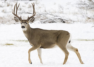
The mule deer is a deer indigenous to western North America; it is named for its ears, which are large like those of the mule. Two subspecies of mule deer are grouped into the black-tailed deer.

A teamster in American English is a truck driver; a person who drives teams of draft animals; or a member of the International Brotherhood of Teamsters, a labor union. In some places, a teamster was called a carter, the name referring to the bullock cart.

The Old Woman Mountains are located south of the town of Essex, California, and north of Danby Dry Lake. The range reaches an elevation of 5,325 feet (1,623 m) at the west end, and lies in San Bernardino County in the Mojave Desert.

The Big Maria Mountains are located in the southeastern part of the U.S. state of California, near the Colorado River and Arizona. The range lies between Blythe and Vidal, and west of U.S. Route 95 in California and east of Midland. The mountains are home to the Eagle Nest Mine and reach an elevation of 1,030 m (3,380 ft). A power line that runs from Parker Dam to Yuma, Arizona runs through the range. A smaller range, the Little Maria Mountains, lie to the west of the Big Marias.

Old Woman Mountains Wilderness is a wilderness area in the Old Woman Mountains of the eastern Mojave Desert. It is located south of Essex in San Bernardino County, California.

The Strawberry Range, also known as the Strawberry Mountains, is a mountain range in the U.S. state of Oregon. It is east of John Day, within Malheur National Forest. The highest peak is Strawberry Mountain.

Calico Mountains Wilderness is a U S Wilderness Area in Nevada under the Bureau of Land Management. It is located in the Calico Hills.

The Seven Devils Mountains are notable peaks in the western United States, located in west central Idaho in the Hells Canyon Wilderness. They are above the east bank of the Snake River, which forms the Idaho-Oregon border.

Mountain Jam is an annual music festival held in upstate New York since 2005. It started as a small one day music festival in 2005 with 3000 attendees, and has grown over the years into the largest rock and camping festival in the Northeast that is usually 3 or 4 days long, drawing over 40,000 attendees over the duration of the Festival.
The Bull Mountains, el. 3,845 feet (1,172 m), are a mountain range of the Rocky Mountains located in Yellowstone and Musselshell Counties in the U.S. state of Montana, lying northeast of Billings and south of Roundup.They are a lower elevation mountain range compared to other ranges in the same geographic region. Vegetation consists primarily of grassy meadows, tracts of sagebrush, and ponderosa pine forests, with the western half of the range being slightly more forested than the eastern half of the range. While the Bull Mountains are decent habitat for mule deer, Merriam's turkeys, bobcats, mountain lions, and elk, hunting and other recreational activities are limited unless an outfitter is hired, as there is little public land in the range.
Mount Ballard, with an elevation of 7,374 feet (2,248 m) is located in Cochise County, Arizona, about 1.8 miles (3 km) west of Bisbee.

The Little Jacks Creek Wilderness is located on the high basalt plateaus of Owyhee County in southwestern Idaho in the western United States. Big Jacks Creek Wilderness is on its southeast border. About 12.4 miles (20.0 km) of Little Jacks Creek is classified as a wild river.
Bismuth is a ghost town in the Black Hills of Custer County, South Dakota, United States.
Bill Williams Peak, elevation 13,389 feet (4,081 m), is an mountain located in Pitkin County, Colorado, United States. The summit of the mountain is the high point of the Williams Mountains, a subrange of the Sawatch Range. The summit is located 12.2 miles (19.6 km) east of Aspen, Colorado, in the Hunter–Fryingpan Wilderness of White River National Forest. Bill Williams Peak is the 42nd highest major summit of Colorado and the 45th highest major summit of the Rocky Mountains of the United States and Canada.


