Little White Salmon River | |
---|---|
Fish hatchery and log flume, 1898 | |
Location | |
Country | United States |
State | Washington |
County | Skamania, Klickitat |
Physical characteristics | |
Source | Monte Cristo Range of the Cascade Range |
- location | Gifford Pinchot National Forest, Klickitat County |
- coordinates | 45°55′07″N121°35′52″W / 45.91861°N 121.59778°W [1] |
- elevation | 3,384 ft (1,031 m) [2] |
Mouth | Columbia River |
- location | Drano Lake of the Bonneville Pool, Skamania County |
- coordinates | 45°43′14″N121°38′25″W / 45.72056°N 121.64028°W Coordinates: 45°43′14″N121°38′25″W / 45.72056°N 121.64028°W [1] |
- elevation | 98 ft (30 m) [1] |
Length | 19 mi (31 km) [3] |
Basin size | 136 sq mi (350 km2) [4] |
The Little White Salmon River is a tributary, about 19 miles (31 km) long, [3] of the Columbia River in the U.S. state of Washington. Its headwaters are in the Monte Cristo Range in Gifford Pinchot National Forest. The river flows from this part of the Cascade Range into Drano Lake, an arm of the Bonneville Pool of the Columbia. [4] The river drains a basin of 136 square miles (350 km2) [4] The basin's population was an estimated 513 in 2000. [4]
The Columbia River is the largest river in the Pacific Northwest region of North America. The river rises in the Rocky Mountains of British Columbia, Canada. It flows northwest and then south into the US state of Washington, then turns west to form most of the border between Washington and the state of Oregon before emptying into the Pacific Ocean. The river is 1,243 miles (2,000 km) long, and its largest tributary is the Snake River. Its drainage basin is roughly the size of France and extends into seven US states and a Canadian province. The fourth-largest river in the United States by volume, the Columbia has the greatest flow of any North American river entering the Pacific.
Washington, officially the State of Washington, is a state in the Pacific Northwest region of the United States. Named for George Washington, the first president of the United States, the state was made out of the western part of the Washington Territory, which was ceded by Britain in 1846 in accordance with the Oregon Treaty in the settlement of the Oregon boundary dispute. It was admitted to the Union as the 42nd state in 1889. Olympia is the state capital; the state's largest city is Seattle. Washington is sometimes referred to as Washington State to distinguish it from Washington, D.C., the capital of the United States.
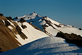
Gifford Pinchot National Forest is a National Forest located in southern Washington, USA, managed by the United States Forest Service. With an area of 1.32 million acres (5300 km2), it extends 116 km along the western slopes of Cascade Range from Mount Rainier National Park to the Columbia River. The forest straddles the crest of the South Cascades of Washington State, spread out over broad, old growth forests, high mountain meadows, several glaciers, and numerous volcanic peaks. The forest's highest point is at 12,276 ft. at the top of Mount Adams, the second tallest volcano in the state after Rainier. It includes the 110,000-acre (450 km2) Mount St. Helens National Volcanic Monument, established by Congress in 1982
Whitewater kayaking experts sometimes run a 4-mile (6.4 km) stretch of rapids in a steep canyon between the Cook– Underwood Road bridge and Drano Lake. [5] The run, dangerous throughout, is rated Class V (extremely difficult) on the International Scale of River Difficulty. [5] Named rapids include Gettin' Busy, Boulder Sluice, Island, Sacriledge, Double Drop, Backender, S-Turn, Wishbone, Bowey's Hotel, The Gorge, Stovepipe, Spirit Falls, Chaos and Master Blaster. [5] The river has been the scene of two kayaking deaths since this stretch was first run in the 1990s. [6]
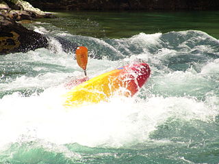
Whitewater kayaking is the sport of paddling a kayak on a moving body of water, typically a whitewater river. Whitewater kayaking can range from active, moving water, to demanding, extreme whitewater.
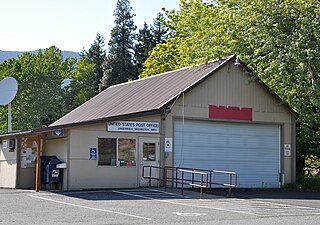
Underwood is an unincorporated community in Skamania County, Washington, United States. Underwood is located along Washington State Route 14 at the confluence of the White Salmon and Columbia Rivers. It is across the Columbia River from Hood River, Oregon, and 2 miles (3.2 km) west of White Salmon, Washington. Underwood has a post office with ZIP code 98651.
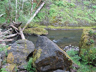
The Little White Salmon River begins in the Monte Cristo Range in western Klickitat County near its border with Skamania County. In its upper reaches, it flows generally south through the Gifford Pinchot National Forest before turning southwest, receiving Beetle Creek from the right and entering Skamania County. Downstream of the county border, it passes through Oklahoma Campground and under Oklahoma Road (Forest Road 18), which then runs along the right. In the next stretch, the river receives Homes Creek from the left and Lusk Creek from the right. [7]
Klickitat County is a county located in the U.S. state of Washington. As of the 2010 census, the population was 20,318. The county seat and largest city is Goldendale. The county is named after the Klickitat tribe of the Yakama Native Americans.
Skamania County is a county located in the U.S. state of Washington. As of the 2010 census, the population was 11,066. The county seat and largest incorporated city is Stevenson, although the Carson River Valley CDP is more populous. The county was founded in 1854 and derives its name from the Cascades Chinook word sk'mániak, meaning "swift waters".
Turning more sharply south, the river receives Berry Creek from the right, then passes under Oklahoma Road again before Cabbage Creek enters from the right. The road now runs along the left bank of the river as it meanders along the base of Shingle Mountain, which is to the river's right. In this stretch, Wilson Creek enters from the left before the river reaches Big Cedars County Park. Below the park, the river passes under Oklahoma Road again before flowing by Moss Creek Campground, on the river's right along the road. Below camp, Moss Creek enters from the right. [7]
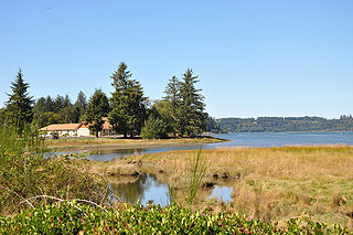
Over the next stretch, the river reaches the community of Willard and leaves the national forest. Just below Willard, the river passes under Willard Road, and Pine Creek enters from the right. Slightly further downstream, the Little White Salmon passes the Willard National Fish Hatchery, on the right, flows under Cook–Underwood Road, enters the Columbia River Gorge National Scenic Area, and receives Lapham Creek from the left. In a narrow canyon paralleled by Cook–Underwood Road on both sides of the river for the next stretch, the stream receives Rock, Squaw, and Bunker creeks, all from the right. At the end of the canyon, the river passes through the Little White Salmon National Fish Hatchery and enters Drano Lake, 163 miles (262 km) from the Columbia's mouth on the Pacific Ocean. [7]
Willard is a small unincorporated community in Skamania County, in southwestern Washington.
The Columbia River Gorge is a canyon of the Columbia River in the Pacific Northwest of the United States. Up to 4,000 feet (1,200 m) deep, the canyon stretches for over 80 miles (130 km) as the river winds westward through the Cascade Range forming the boundary between the State of Washington to the north and Oregon to the south. Extending roughly from the confluence of the Columbia with the Deschutes River in the east down to the eastern reaches of the Portland metropolitan area, the water gap furnishes the only navigable route through the Cascades and the only water connection between the Columbia River Plateau and the Pacific Ocean. It is thus the route of Washington State Route 14, Interstate 84, U.S. Route 30, and railroad tracks on both sides.
The United States Forest Service operates the Oklahoma Campground along upper Little White Salmon River. Amenities include 22 campsites, vault toilets, and potable water. [8] The Lower Monte Carlo Trailhead is across Oklahoma Road (Forest Road 18) from the campground. [9]
The United States Forest Service (USFS) is an agency of the U.S. Department of Agriculture that administers the nation's 154 national forests and 20 national grasslands, which encompass 193 million acres (780,000 km2). Major divisions of the agency include the National Forest System, State and Private Forestry, Business Operations, and the Research and Development branch. Managing approximately 25% of federal lands, it is the only major national land agency that is outside the U.S. Department of the Interior.
Further downstream, Skamania County manages the Big Cedars Campground, with two sites for tents and another for a small motorized camper. [10] Near the county park and on the opposite side of Oklahoma Road is Moss Creek Campground, run by the Forest Service. Amenities include potable water, vault toilets, and 17 campsites. [11]
The Sandy River is a 56-mile (90 km) tributary of the Columbia River in northwestern Oregon in the United States. The Sandy joins the Columbia about 14 miles (23 km) upstream of Portland.
The Clackamas River is an approximately 83-mile (134 km) tributary of the Willamette River in northwestern Oregon, in the United States. Draining an area of about 940 square miles (2,435 km2), the Clackamas flows through mostly forested and rugged mountainous terrain in its upper reaches, and passes agricultural and urban areas in its lower third. The river rises in eastern Marion County, about 55 miles (89 km) east-southeast of Salem. The headwaters are on the slopes of Olallie Butte in the Mount Hood National Forest, about 10 miles (16 km) north of Mount Jefferson, at an elevation of 4,909 feet (1,496 m) in the Cascade Range. The Clackamas flows briefly north and then flows northwest through the mountains, passing through North Fork Reservoir and Estacada. It then emerges from the mountains southeast of Portland. It joins the Willamette near Oregon City and forms the boundary between Oregon City and Gladstone.
The Salmon River is located in Idaho in the northwestern United States. The Salmon is also known as "The River of No Return". It flows for 425 miles (685 km) through central Idaho, draining a rugged, thinly populated watershed of 14,000 square miles (36,000 km2) and dropping more than 7,000 feet (2,100 m) between its headwaters, near Galena Summit above the Sawtooth Valley in the Sawtooth National Recreation Area, and its confluence with the Snake River. Measured at White Bird, its average discharge is 11,060 cubic feet per second. It is one of the largest rivers in the continental United States without a single dam on its mainstem.
The Nestucca River flows for about 57 miles (92 km) through forests near the Pacific coast of northwest Oregon in the United States. It drains a timber-producing area of the Northern Oregon Coast Range west of Portland.
The Alsea River flows 48.5 miles (78.1 km) from Alsea, an unincorporated community in the coastal mountains of the U.S. state of Oregon, to the Pacific Ocean near the city of Waldport. It begins at the confluence of the North Fork Alsea River and the South Fork Alsea River and ends in Alsea Bay, a wide estuary at Waldport. The river flows generally west-northwest in a winding course through the mountains of southern Benton and Lincoln counties, passing near the unincorporated community of Tidewater and through the Siuslaw National Forest. Its drainage basin extends into Lane County, along the headwaters of the South Fork Alsea River.
The Little River is a tributary of the North Umpqua River, about 30 miles (48 km) long, in southwestern Oregon in the United States. It drains part of the western side of the Cascade Range east of Roseburg, between the North and South Umpqua.
The Washougal River is a 33-mile (53 km) tributary of the Columbia River in the U.S. state of Washington. Its headwaters and upper 21 miles (34 km) are in Skamania County in the Gifford Pinchot National Forest, and its lower 12 miles (19 km) are in Clark County. The river, which meets the Columbia near the cities of Washougal and Camas, is a popular stream for fishing, swimming, and boating.
The Cispus River is about 54 miles (87 km) long and flows into the Cowlitz River at Lake Scanewa in the Cascade Range of Washington. Its tributaries drain most of south-central and southeastern Lewis County, extreme northeast Skamania County, and some of western Yakima County.
The White Salmon River is a 44-mile (71 km) tributary of the Columbia River in the U.S. state of Washington. Originating on the slopes of Mount Adams, it flows into the Columbia Gorge near the community of Underwood. Parts of the river have been designated Wild and Scenic. The principal tributaries of the White Salmon River include Trout Lake and Buck, Mill, Dry, Gilmer, and Rattlesnake Creeks.
The Salmon River is a 33.5-mile (53.9 km) river in the Cascade Range in the U.S. state of Oregon that drains part of southwestern Mount Hood. The entire length of the river is a protected National Wild and Scenic River. Several portions are in protected wilderness. It is affluent to the Sandy River, a tributary of the Columbia River.
The Imnaha River is a 73.3-mile-long (118.0 km) tributary of the Snake River in the U.S. state of Oregon. Flowing generally east near the headwaters and then north through Wallowa County, the entire river is designated Wild and Scenic. It follows a geologic fault to the Snake River, and in addition to land in the Wallowa–Whitman National Forest and private land, its corridor includes parts of three special management areas: the Eagle Cap Wilderness, Hells Canyon National Recreation Area, and Hells Canyon Scenic Byway. The Imnaha flows by the unincorporated community of Imnaha, the only settlement along its course, and enters the Snake River roughly 4 miles (6 km) from the larger river's confluence with the Salmon River of Idaho and 192 miles (309 km) from its confluence with the Columbia River.
The Lochsa River is in the northwestern United States, in the mountains of north central Idaho. It is one of two primary tributaries of the Middle Fork of the Clearwater River in the Clearwater National Forest. Lochsa is a Nez Perce word meaning rough water. The Salish name is Ep Smɫí, "It Has Salmon."
Quartzville Creek is a 28-mile (45 km) tributary of the Middle Santiam River in Linn County in the U.S. state of Oregon. It is paralleled by the Quartzville Back Country Byway and used for recreation, including camping, fishing, hunting, kayaking, and gold panning. The lower 12 miles (19 km) of the creek, from the Willamette National Forest boundary to Green Peter Reservoir, was designated Wild and Scenic in 1988.
The Little Wenatchee River is the southern and smaller of the two rivers that flow into the west end of Lake Wenatchee. The northern and larger one is the White River. A large number of place names in the Little Wenatchee River basin, including the river's name itself, were given by Albert H. Sylvester.
Ochoco Creek is a 30-mile (48 km) tributary of the Crooked River in the U.S. state of Oregon. Part of the drainage basin of the Columbia River, it arises in the Ochoco National Forest in Wheeler County and flows generally southwest and west for most of its length through Crook County to slightly northwest of Prineville.
The South Fork McKenzie River is a tributary, about 31 miles (50 km) long, of the McKenzie River in the U.S. state of Oregon. It begins at about 4,500 feet (1,400 m) above sea level near Mink Lake in the Three Sisters Wilderness of the Cascade Range. Flowing northwest within Lane County, it meets the McKenzie River about 60 miles (97 km) from the larger river's confluence with the Willamette River.
Olallie Lake is an alpine lake and one of several in the area fed by streams coming off the glaciers from nearby Mount Adams. A small, but popular Olallie Lake Campground offers scenic camping as well as non-motorized boating and fishing experiences. It is located at 4,200 feet elevation in the Gifford Pinchot National Forest, in Washington state.