Little Willamette River

Last updated
Little Willamette River
USA Oregon location map.svg
Red pog.svg
Location of the mouth of the Little Willamette River in Oregon
Location
Country United States
State Oregon
County Linn
Physical characteristics
SourceWetlands west of Albany
  locationGravel pit near the Willamette River
  coordinates 44°36′58″N123°10′37″W / 44.61611°N 123.17694°W / 44.61611; -123.17694 [1]
  elevation199 ft (61 m) [2]
Mouth Willamette River
  location
Bowers Rock State Park
  coordinates
44°38′12″N123°09′04″W / 44.63667°N 123.15111°W / 44.63667; -123.15111 Coordinates: 44°38′12″N123°09′04″W / 44.63667°N 123.15111°W / 44.63667; -123.15111 [1]
  elevation
177 ft (54 m) [1]
Length3 mi (4.8 km) [3]

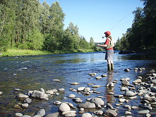
The Little Willamette River is a minor tributary of the Willamette River in Linn County in the U.S. state of Oregon. It begins in a gravel pit slightly east of the main stem in a bend of the larger river west of Albany. Flowing generally northeast and roughly parallel to the main stem for about 3 miles (5 km), it enters the Willamette about 121.5 miles (195.5 km) from the larger river's mouth on the Columbia River. [3]

Willamette River major river in northwest Oregon

The Willamette River is a major tributary of the Columbia River, accounting for 12 to 15 percent of the Columbia's flow. The Willamette's main stem is 187 miles (301 km) long, lying entirely in northwestern Oregon in the United States. Flowing northward between the Oregon Coast Range and the Cascade Range, the river and its tributaries form the Willamette Valley, a basin that contains two-thirds of Oregon's population, including the state capital, Salem, and the state's largest city, Portland, which surrounds the Willamette's mouth at the Columbia.

Linn County, Oregon County in the United States

Linn County is a county located in the U.S. state of Oregon. As of the 2010 census, the population was 116,672. The county seat is Albany. The county is named in honor of Lewis F. Linn, a U.S. Senator from Missouri who advocated the American settlement of the Oregon Country.

U.S. state constituent political entity of the United States

In the United States, a state is a constituent political entity, of which there are currently 50. Bound together in a political union, each state holds governmental jurisdiction over a separate and defined geographic territory and shares its sovereignty with the federal government. Due to this shared sovereignty, Americans are citizens both of the federal republic and of the state in which they reside. State citizenship and residency are flexible, and no government approval is required to move between states, except for persons restricted by certain types of court orders. Four states use the term commonwealth rather than state in their full official names.

Along its lower course, the Little Willamette flows through Bowers Rock State Park, a 568-acre (230 ha) tract in a riparian forest. [4] The park, largely undeveloped, with primitive trails and no amenities, is part of the Willamette Greenway. [5] The only named tributary of the Little Willamette is Coon Creek, which enters from the left. [3]

Willamette Greenway

The Willamette River Greenway Program, established by the 1967 Oregon legislature, is a cooperative state and local government effort to maintain and enhance the scenic, recreational, historic, natural and agricultural qualities of the Willamette River and its adjacent lands. A number of trails exist along the greenway, but significant gaps still exist.

See also

Related Research Articles

Santiam River river in the United States of America

The Santiam River is a tributary of the Willamette River, about 12 miles (19 km) long, in western Oregon in the United States. Through its two principal tributaries, the North Santiam and the South Santiam rivers, it drains a large area of the Cascade Range at the eastern side of the Willamette Valley east of Salem and Corvallis.

Pudding River river in the United States of America

The Pudding River is a 62-mile (100 km) tributary of the Molalla River in the U.S. state of Oregon. Its drainage basin covers 528 square miles (1,368 km2). Among its tributaries are Silver Creek, Butte Creek, Abiqua Creek, and the Little Pudding River.

Calapooia River river in the United States of America

The Calapooia River is an 80-mile (130 km) tributary of the Willamette River in the U.S. state of Oregon.

Yamhill River river in the United States of America

The Yamhill River is an 11-mile (18 km) tributary of the Willamette River, in the U.S. state of Oregon. Formed by the confluence of the South Yamhill River and the North Yamhill River about 3 miles (5 km) east of McMinnville, it drains part of the Northern Oregon Coast Range. The river meanders east past Dayton to join the Willamette River at its river mile (RM) 55 or river kilometer (RK) 89, south of Newberg.

Luckiamute River watercourse in the United States of America

The Luckiamute River is a tributary of the Willamette River, about 61 miles (98 km) long, in western Oregon in the United States. It drains an area of Central Oregon Coast Range and the western Willamette Valley northwest of Corvallis.

Coast Fork Willamette River river in the United States of America

The Coast Fork Willamette River is one of two forks that unite to form the Willamette River in western Oregon in the United States. It is about 40 miles (64 km) long, draining an area of the mountains at the south end of the Willamette Valley south of Eugene.

North Santiam River river in the United States of America

The North Santiam River is a 92-mile (148 km) tributary of the Santiam River in western Oregon in the United States. It drains 766 square miles (1,980 km2) of the Cascade Range on the eastern side of the Willamette Valley east of Salem.

South Santiam River river in the United States of America

The South Santiam River is a tributary of the Santiam River, about 69 miles (111 km) long, in western Oregon in the United States. It drains an area of the Cascade Range into the Willamette Valley east of Corvallis.

Middle Santiam River river in the United States of America

The Middle Santiam River is a tributary of the South Santiam River, 38.5 miles (62.0 km) long, in western Oregon in the United States. It drains a remote area of the Cascade Range east of Sweet Home in the watershed of the Willamette River.

Middle Fork Willamette River river in the United States of America

The Middle Fork Willamette River is one of several forks that unite to form the Willamette River in the western part of the U.S. state of Oregon. It is approximately 115 miles (185 km) long, draining an area of the Cascade Range southeast of Eugene, which is at the southern end of the Willamette Valley.

Mission Creek (Marion County, Oregon) river in the United States of America

Mission Creek is a tributary, roughly 9 miles (14 km) long, of Champoeg Creek in Marion County in the U.S. state of Oregon. The creek arises southwest of St. Paul in the French Prairie region of the Willamette Valley and flows generally northeast to meet Champoeg Creek near Champoeg. The combined streams then flow less than 1 mile (1.6 km) before entering the Willamette River, 45 miles (72 km) from its confluence with the Columbia River.

Course of the Willamette River

The Willamette River is a 187-mile (301 km) tributary of the Columbia River in the U.S. state of Oregon. The upper tributaries of the Willamette originate in mountains south and southeast of Eugene and Springfield. Formed by the confluence of the Middle Fork Willamette River and Coast Fork Willamette River near Springfield, the main stem meanders generally north from source to mouth. The river's two most significant course deviations occur at Newberg, where the stream turns sharply east, and about 18 miles (29 km) downriver from Newberg, where it turns north again. Near its mouth, the river splits into two channels that flow around Sauvie Island. The main channel enters the Columbia about 101 miles (163 km) from the larger stream's mouth on the Pacific Ocean, and the smaller Multnomah Channel enters the Columbia about 14.5 miles (23.3 km) further downstream near St. Helens in Columbia County.

Scoggins Creek river in the United States of America

Scoggins Creek, formerly known as "Scoggin Creek", is a 19-mile (31 km) tributary of the Tualatin River in Tillamook and Washington counties in the U.S. state of Oregon. It is named for pioneer settler Gustavus Scoggin.

South Fork Breitenbush River river in the United States of America

The South Fork Breitenbush River is a 10-mile (16 km) tributary of the Breitenbush River in the U.S. state of Oregon. The river flows generally northwest from Russell Lake in the Mount Jefferson Wilderness of the Cascade Range to near Breitenbush Hot Springs, where it merges with the North Fork Breitenbush River to form the main stem.

Mosby Creek (Oregon) river in the United States of America

Mosby Creek is a 21-mile (34 km) tributary of the Row River in Lane County, in the U.S. state of Oregon. It begins at the confluence of the east and west forks of the creek near the Calapooia Divide and the border with Douglas County. From its source it flows generally north-northwest to meet the river slightly east of Cottage Grove and about 4 miles (6 km) from the larger stream's confluence with the Coast Fork Willamette River.

Wildhorse Creek (Alvord Lake) river in the United States of America

Wildhorse Creek is a tributary of Alvord Lake in Harney County in the U.S. state of Oregon. It originates at a spring on Steens Mountain and flows generally south through Wildhorse Canyon to the shallow alkaline lake, south of the Alvord Desert and north of the unincorporated community of Fields.

Little Minam River river in the United States of America

The Little Minam River is a tributary of the Minam River in Union County in the U.S. state of Oregon. It begins at the base of Cartwheel Ridge in the Wallowa Mountains and flows generally north through the Wallowa–Whitman National Forest to meet the main stem river at the north end of Backbone Ridge.

Little Yaquina River river in the United States of America

The Little Yaquina River is a minor tributary of the Yaquina River in Benton and Lincoln counties in the U.S. state of Oregon. It begins in the Central Oregon Coast Range on the eastern side of the border between the two counties but crosses immediately west into Lincoln County through which it flows generally south to meet the main stem near Hamar Lake, north of Nashville. The Little Yaquina has one named tributary, Cedar Creek, which enters from the right.

Oak Creek (Marys River) stream in Oregon, USA

Oak Creek is a tributary, about 3.5 miles (5.6 km) long, of Marys River in Benton County in the U.S. state of Oregon. The stream descends from forested hills north of Corvallis through the northwest part of the city and across the campus of Oregon State University.

References

  1. 1 2 3 "Little Willamette River". Geographic Names Information System (GNIS). United States Geological Survey. November 28, 1980. Retrieved December 25, 2015.
  2. Source elevation derived from Google Earth search using GNIS source coordinates.
  3. 1 2 3 "United States Topographic Map". United States Geological Survey. Retrieved December 23, 2015 via Acme Mapper. The map includes mile markers along the main stem Willamette.
  4. Odegard, Kyle (December 21, 2014). "Bowers Rock: Oregon State Parks' Hidden Gem" . Albany Democrat–Herald. Retrieved December 25, 2015.
  5. "Bowers Rock State Park". Willamette Riverkeeper. Retrieved December 25, 2015.