
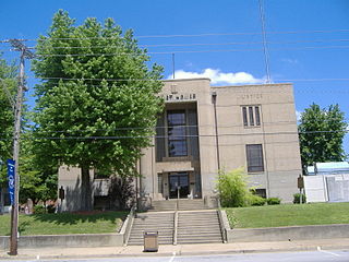
McLean County is a county located in the U.S. state of Kentucky. As of the 2020 census, the population was 9,152. Its county seat is Calhoun and its largest city is Livermore. McLean is a prohibition or dry county. McLean County is part of the Owensboro, KY Metropolitan Statistical Area, which has a population of some 114,752.

Daviess County ( "Davis"), is a county in Kentucky. As of the 2020 census, the population was 103,312. Its county seat is Owensboro. The county was formed from part of Ohio County on January 14, 1815.

Maysville is a home rule-class city in Mason County, Kentucky, United States, and is the county seat of Mason County. The population was 8,873 as of the 2020 census. Maysville is on the Ohio River, 66 miles (106 km) northeast of Lexington. It is the principal city of the Maysville Micropolitan Statistical Area, which comprises Mason County. Two bridges cross the Ohio from Maysville to Aberdeen, Ohio: the Simon Kenton Memorial Bridge built in 1931 and the William H. Harsha Bridge built in 2001.

Livermore is a home rule-class city located at the confluence of the Green and Rough rivers in McLean County in the U.S. state of Kentucky. The population was 1,230 as of the 2020 census, down from 1,365 in 2010. It is included in the Owensboro metropolitan area.
Hartford is a home rule-class city in Ohio County, Kentucky, in the United States. It is the seat of its county. The population was 2,668 at the 2020 census. The town slogan, "Home of 2,000 happy people and a few soreheads", welcomes visitors when they enter the community. The Hartford, Kentucky website explains that "soreheads are community-minded, progressive citizens who work to promote civic pride".

U.S. Route 41, also U.S. Highway 41 (US 41), is a major north–south United States Numbered Highway that runs from Miami, Florida, to the Upper Peninsula of Michigan. Until 1949, the part in southern Florida, from Naples to Miami, was US 94. The highway's southern terminus is in the Brickell neighborhood of Downtown Miami at an intersection with Brickell Avenue (US 1), and its northern terminus is east of Copper Harbor, Michigan, at a modest cul-de-sac near Fort Wilkins Historic State Park at the tip of the Keweenaw Peninsula. US 41 is closely paralleled by Interstate 75 (I-75) from Naples, Florida, all the way through Georgia to Chattanooga, Tennessee.

The Green River is a 384-mile-long (618 km) tributary of the Ohio River that rises in Lincoln County in south central Kentucky. Tributaries of the Green River include the Barren River, the Nolin River, the Pond River and the Rough River. The river was named after Nathanael Greene, a general of the American Revolutionary War.
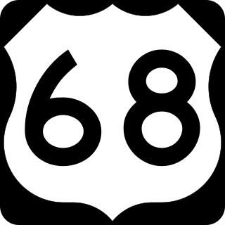
U.S. Route 68 is a United States highway that runs for 560 miles (900 km) from northwest Ohio to Western Kentucky. The highway's western terminus is at US 62 in Reidland, Kentucky. Its present eastern terminus is at Interstate 75 in Findlay, Ohio, though the route once extended as far north as Toledo. US 68 intersects with US 62 three times during its route.

U.S. Route 231 (US 231) is a north–south U.S highway that is a parallel route of US 31. It runs for 912 miles (1,468 km) from St. John, Indiana, at US 41 to south of US 98 in downtown Panama City, Florida. One of its most notable landmarks is the William H. Natcher Bridge, a 0.853 miles (1.373 km) long cable-stayed bridge that connects Rockport, Indiana, to Owensboro, Kentucky, spanning the Ohio River.

U.S. Route 431 (US 431) is a spur of U.S. Route 31. It currently travels for approximately 556 miles (895 km) from US 231/Alabama State Route 210 and US 231 Business and US 431 Bus. in Dothan, Alabama, to Owensboro, Kentucky, at US 60 and Kentucky Route 2831. The major cities US 431 connects to are Dothan and Huntsville, Alabama, Franklin and Nashville, Tennessee, and Owensboro, Kentucky.

The Wilderness Road was one of two principal routes used by colonial and early national era settlers to reach Kentucky from the East. Although this road goes through the Cumberland Gap into southern Kentucky and northern Tennessee, the other is sometimes called the "Cumberland Road" because it started in Fort Cumberland in Maryland. Despite Kentucky Senator Henry Clay's advocacy of this route, early in the 19th century, the northern route was selected for the National Road, connecting near Washington, Pennsylvania into the Ohio Valley of northern Kentucky and Ohio.

The Wheeling Suspension Bridge is a suspension bridge spanning the main channel of the Ohio River at Wheeling, West Virginia. It was the largest suspension bridge in the world from 1849 until 1851. Charles Ellet Jr. designed it and supervised construction of what became the first bridge to span a major river west of the Appalachian Mountains. It linked the eastern and western section of the National Road, and became especially strategically important during the American Civil War. Litigation in the United States Supreme Court concerning its obstruction of the new high steamboat smokestacks eventually cleared the way for other bridges, especially needed by expanding railroads. Because this bridge was designed during the horse-and-buggy era, 2-ton weight limits and vehicle separation requirements applied in later years until it was closed to automobile traffic in September 2019.

U.S. Route 31W is the westernmost of two parallel routes for U.S. Route 31 from Nashville, Tennessee to Louisville, Kentucky.
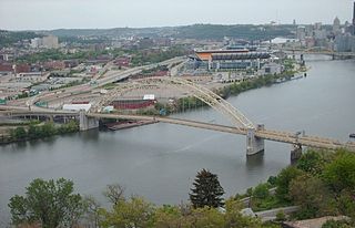
The West End Bridge is a steel tied-arch bridge over the Ohio River in Pittsburgh, Pennsylvania, approximately 1 mile (1.6 km) below the confluence of the Allegheny and Monongahela Rivers. It connects the West End to the Chateau neighborhood on the North Side of Pittsburgh.

The Rough River is a 136-mile-long (219 km) tributary of the Green River in west-central Kentucky in the United States. It's located about 70 miles southwest of Louisville, and flows through Breckinridge, Hardin, Grayson, and Ohio counties. Via the Green and Ohio rivers, it is part of the watershed of the Mississippi River. According to the Geographic Names Information System, it has also been known historically as "Rough Creek". In the 1950s it was dammed, creating Rough River Lake.

Kentucky Route 79 (KY 79) is a 102-mile-long (164 km) north–south state highway that traverses five counties in west-central Kentucky. It can be seen as an extension of U.S. Route 79 (US 79), as they have the same number and once intersected; KY 79 begins in the same city that US 79 ends, and both travel on a northeast–southwest diagonal path.

U.S. Route 79 enters Kentucky from Tennessee in Todd County west of Guthrie and runs northeast into Logan County, terminating at a junction with US 68, US 68 Business, and Kentucky Route 80 in Russellville. US 79 remains a two-lane road throughout Kentucky.
William "Bill" Smeathers, also known as Smithers or Smothers, was a pioneer settler of Kentucky and later Texas.
U.S. Route 431 in Kentucky runs 86.93 miles (139.90 km) from the Tennessee state line south of Adairville to US 60 at Owensboro. It crosses the state in mainly west-central portions of the state, passing through or near towns such as Russellville, Lewisburg, Central City and Livermore. The route goes through Logan, Muhlenberg, McLean, and Daviess counties.

The bridge is significant locally as the only Pratt through-truss bridge remaining in Kosciusko County, and is important regionally as one of the few surviving spans built by the Bellefontaine Bridge and Iron Company.


