
Snowdonia, or Eryri, is a mountainous region and national park in North Wales. It contains all 15 mountains in Wales over 3000 feet high, including the country's highest, Snowdon, which is 1,085 metres (3,560 ft) tall. These peaks are all part of the Snowdon, Glyderau, and Carneddau ranges in the north of the region. The shorter Moelwynion and Moel Hebog ranges lie immediately to the south.

Blaenau Ffestiniog is a town in Gwynedd, Wales. Once a slate mining centre in historic Merionethshire, it now relies much on tourists, drawn for instance to the Ffestiniog Railway and Llechwedd Slate Caverns. It reached a population of 12,000 at the peak development of the slate industry, but fell with the decline in demand for slate. The population of the community, including the nearby village Llan Ffestiniog, was 4,875 at the 2011 census: the fourth most populous in Gwynedd after Bangor, Caernarfon and Llandeiniolen. The population not including Llan is now only about 4,000.
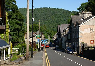
Betws-y-Coed is a village and community in the Conwy valley in Conwy County Borough, Wales, located in the historic county of Caernarfonshire, right on the boundary with Denbighshire, in the Gwydir Forest. It is now a very popular visitor destination in the Snowdonia National Park. The population of the community as of the 2021 census was 476, a decline on the previous census.
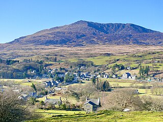
Dolwyddelan is a village and community in Conwy County Borough, Wales. The community occupies most of the valley of the Afon Lledr, and contains the settlements of Dolwyddelan, Pentre Bont, Blaenau Dolwyddelan, and Pont-y-Pant. It lies within Snowdonia, and the surrounding hills are part of the Moelwynion range. The population of the community was recorded as 454 in the 2021 census, and in the 2011 census the proportion of Welsh speakers was recorded as 50.8%.
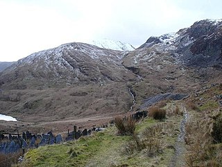
The Crimea Pass is a mountain pass in North Wales, on the A470 road between Blaenau Ffestiniog and Dolwyddelan connecting the counties of Gwynedd and Conwy.
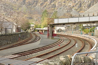
The Conwy Valley line is a railway line in north-west Wales. It runs from Llandudno via Llandudno Junction to Blaenau Ffestiniog, and was originally part of the London and North Western Railway, being opened in stages to 1879. The primary purpose of the line was to carry slate from the Ffestiniog quarries to a specially built quay at Deganwy for export by sea. The line also provided goods facilities for the market town of Llanrwst, and via the extensive facilities at Betws-y-Coed on the London to Holyhead A5 turnpike road it served many isolated communities in Snowdonia and also the developing tourist industry. Although only a little over 27 miles (43 km) between Llandudno and Blaenau Ffestiniog, the journey takes over one hour, largely due to the sinuous and steeply graded nature of the route taken. Most of the stations along the line are treated as request stops.
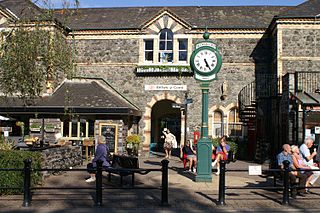
Betws-y-coed railway station is on the Conwy Valley Line, which runs between Llandudno and Blaenau Ffestiniog. It is situated 15+1⁄2 miles (24.9 km) south of Llandudno Junction.

Roman Bridge railway station is a request stop passenger station in the Lledr Valley, Wales, on the Conwy Valley Line from Llandudno Junction to Blaenau Ffestiniog, which is operated by Transport for Wales Rail.

Pont-y-Pant railway station is a single platform passenger station in the Lledr Valley, Wales, on the Conwy Valley line from Llandudno Junction to Blaenau Ffestiniog, which is operated by Transport for Wales Rail. The station house is well maintained and used as a private dwelling.

The Afon Lledr is a river in north-west Wales and the second major tributary of the River Conwy. It is about 10 miles or 16 km long, and flows in a generally easterly direction.
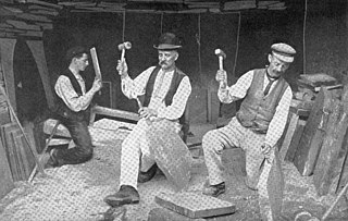
The existence of a slate industry in Wales is attested since the Roman period, when slate was used to roof the fort at Segontium, now Caernarfon. The slate industry grew slowly until the early 18th century, then rapidly during the Industrial Revolution in Wales until the late 19th century, at which time the most important slate producing areas were in northwest Wales. These sites included the Penrhyn Quarry near Bethesda, the Dinorwic Quarry near Llanberis, the Nantlle Valley quarries, and Blaenau Ffestiniog, where the slate was mined rather than quarried. Penrhyn and Dinorwig were the two largest slate quarries in the world, and the Oakeley mine at Blaenau Ffestiniog was the largest slate mine in the world. Slate is mainly used for roofing, but is also produced as thicker slab for a variety of uses including flooring, worktops and headstones.

The Cwt y Bugail quarry is a former slate quarry located east of Blaenau Ffestiniog in Wales. It was first worked as a trial pit around 1840. Continuous production began in 1863 and continued until closure in 1961. The quarry was connected to the Ffestiniog Railway at Duffws Station via the Rhiwbach Tramway.

Bro Machno is a community in Conwy County Borough, in Wales, formed from the former civil parish of Penmachno. It covers the Penmachno Valley, through which runs the Afon Machno, and includes the villages of Penmachno and Cwm Penmachno. To the south west borders Gwynedd, and is located 4.8 miles (7.7 km) south of Betws-y-Coed, 21.8 miles (35.1 km) north west of Corwen, and 19.4 miles (31.2 km) south of Conwy. The whole of the community is within the Snowdonia national park, while much of it forms part of Gwydir Forest. According to the 2011 census, the population of the Bro Machno Parish was 617, of whom 342 (55%) were able to speak Welsh and 214 (34%) had no skills in Welsh.

The Nod Glas Formation is an Ordovician lithostratigraphic group in Mid Wales. The rock of the formation is made up of pyritous, graptolitic mudstone that is generally black in colour. It weathers to a soft, very well cleaved and coal-like material. The formation runs from Conwy in the north, down to Cardigan Bay in the area around Aberdyfi and Tywyn, though it is not a continuous over this area.

The Prince Llewellyn quarry was a slate quarry that stands on the west side of the Lledr Valley, ENE of Dolwyddelan. It was worked from around 1820 to 1934.
Chwarel Ddu quarry was the earliest slate quarry in the Lledr Valley. It was working before 1810, and continued in sporadic operation until the late 1920s. It is about 0.5 miles (0.80 km) west of Dolwyddelan, just beneath Dolwyddelan Castle.
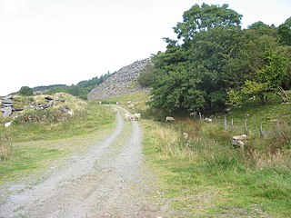
Ty'n-y-bryn quarry was a slate quarry that was worked from the 1840s to about 1914. It stands on the south-east edge of Dolwyddelan.

Rhiw-goch quarry was a slate quarry that was worked from the 1860s to 1908. It stands on the north side of the Afon Lledr, on the opposite side of the valley from Pont-y-Pant railway station.

Owen Gethin Jones, was a Welsh building contractor, quarry owner and prominent poet.

The Penmachno quarry was a slate quarry near Cwm Penmachno, Conwy, North Wales. It was directly below the Rhiwbach Quarry. It was worked between 1818 and 1962.


