
Lexington is a city in Kentucky, United States that is the county seat of Fayette County. By population, it is the second-largest city in Kentucky and 59th-largest city in the United States. By land area, it is the country's 28th-largest city. The city is also known as "Horse Capital of the World". It is within the state's Bluegrass region. Notable locations in the city include the Kentucky Horse Park, The Red Mile and Keeneland race courses, Rupp Arena, Central Bank Center, Transylvania University, the University of Kentucky, Bluegrass Community and Technical College, and the National Thoroughbred Racing Association (NTRA) Headquarters.
La Grange is a home rule-class city in Oldham County, Kentucky, in the United States. The population was 10,067 at the time of the 2020 U.S. census. It is the seat of its county. An unusual feature of La Grange is the CSX Transportation street-running mainline track on Main Street.
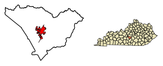
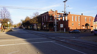
Campbellsville is a city in central Kentucky founded in 1817 by Andrew Campbell. It is known for Campbellsville University, Taylor Regional Hospital health care system, its historic downtown, and the proximity to Green River Lake State Park. Campbellsville is the county seat of Taylor County, with a geographic boundary shaped like a heart. Campbellsville celebrated its bicentennial on July 4, 2017.

U.S. Route 23 or U.S. Highway 23 is a major north–south U.S. Highway between Jacksonville, Florida, and Mackinaw City, Michigan. It is an original 1926 route which originally reached only as far south as Portsmouth, Ohio, and has since been extended. It was formerly part of the major highway known as the Dixie Highway. The highway's southern terminus is in Jacksonville, Florida at US 1/US 17. The northern terminus is at I-75 in Mackinaw City, Michigan.

U.S. Route 150 is a 571-mile (919 km) long northwest–southeast United States highway, signed as east–west. It runs from U.S. Route 6 outside of Moline, Illinois to U.S. Route 25 in Mount Vernon, Kentucky.

Russell is a neighborhood immediately west of downtown Louisville, Kentucky, USA. It was named for renowned African American educator and Bloomfield, Kentucky native Harvey Clarence Russell Sr. Its boundaries are West Market Street, 9th Street, West Broadway and I-264.
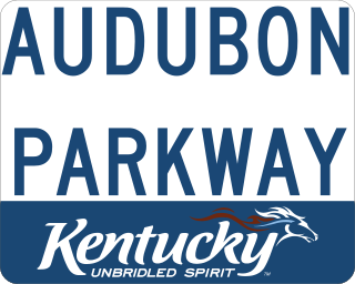
The Audubon Parkway is a four-lane controlled-access freeway connecting the cities of Henderson and Owensboro, Kentucky. Named for John James Audubon, an early American naturalist, the Audubon's western terminus is at US 41; the eastern terminus is US 60. The road opened on December 18, 1970, at a cost of $23.5 million and, at 23.4 miles (37.7 km), is the shortest of the seven roads in the state's parkway system. It is also the only road in the parkway system that has not had the name of a Kentucky politician attached to it. The road carries the unsigned designation of Kentucky Route 9005 (KY 9005). A white and gold shield was used along the Audubon Parkway until 2006, when a new, standardized blue-on-white marker was introduced for all of Kentucky's parkways.

South Louisville is a neighborhood two miles south of downtown Louisville, Kentucky, US. "South Louisville" or "South Side" is also used to describe the entire area of Southern Louisville. The neighborhood itself is bounded by Industry Road, the CSX railroad tracks, Central Avenue, Taylor Boulevard, Longfield Avenue, Compton Street, Thornberry Avenue, Colorado Avenue, Euclid Avenue, and Lincoln avenue. The world-famous Churchill Downs horse racing track and Kentucky Derby Museum are located in South Louisville.

Limerick is a neighborhood one mile south of downtown Louisville, Kentucky, USA.

OpenStreetMap (OSM) is a free, open geographic database updated and maintained by a community of volunteers via open collaboration. Contributors collect data from surveys, trace from aerial imagery and also import from other freely licensed geodata sources. OpenStreetMap is freely licensed under the Open Database License and as a result commonly used to make electronic maps, inform turn-by-turn navigation, assist in humanitarian aid and data visualisation. OpenStreetMap uses its own topology to store geographical features which can then be exported into other GIS file formats. The OpenStreetMap website itself is an online map, geodata search engine and editor.
Iroquois is a neighborhood on the south side of Louisville, Kentucky, United States. It is split into two parts by Beechmont. From a historical perspective, the northwestern section would be the Bryn Mawr neighborhood and the southeastern section would be the Kenwood neighborhood. The Iroquois neighborhood is roughly bounded by Hazelwood Avenue, Beechmont, Third Street, Kenwood Drive, and Iroquois Park. Located near the Louisville International Airport, residents have frequently complained of noise and challenged airport expansion. The largely residential neighborhood was developed as a suburb after World War II and into the 1950s.

U.S. Route 31E (US 31E) is the easternmost of two parallel routes for U.S. Highway 31 from Nashville, Tennessee, to Louisville, Kentucky.

U.S. Route 31W is the westernmost of two parallel routes for U.S. Route 31 from Nashville, Tennessee to Louisville, Kentucky. At one time, it split with U.S. Route 31E at Sellersburg, Indiana, crossing into nearby Louisville via the Kentucky & Indiana Terminal Bridge. Tennessee State Route 41 is its unsigned companion route in Tennessee.

The Hal Rogers Parkway, formerly named the Daniel Boone Parkway, connects Somerset and Hazard in southeastern Kentucky. This toll road opened in November 1971, and the tolls were removed June 1, 2003. The original extent of the highway was to be 65.70 miles (105.73 km) with that mileage to have been included with an unconstructed limited-access London bypass and what is east of this area. The original portion of the road is designated unsigned Kentucky Route 9006. An extension of the Hal Rogers Parkway name west along Kentucky Route 80 (KY 80) to U.S. Route 27 (US 27) in Somerset was made in 2015 bringing the total mileage to 91.135 miles (146.668 km).
Alumni Gymnasium, now known as Alumni Gym Fitness Center, is a building on the University of Kentucky (UK) campus in Lexington, Kentucky. It is located on the corner of South Limestone Street and Avenue of Champions next to the University of Kentucky Student Center. When it opened in 1924, replacing Alumni Hall, it was a 2,800 seat multi-purpose arena, serving as home to the UK Wildcats basketball team. It was replaced when the Memorial Coliseum opened in 1950. The building later became a student recreation facility, and was frequently used for recreational and intramural basketball. During this period, it was also home to the University of Kentucky Men's Club Basketball team, University of Kentucky Club Dodgeball team, and the UK Men's Club Volleyball team. The interior of the facility was gutted in 2017 as part of a project to renovate the university's student center, and the building reopened in 2018 as a student fitness center.

Interstate 75 (I-75) runs from Cincinnati to Toledo by way of Dayton in the US state of Ohio. The highway enters the state running concurrently with I-71 from Kentucky on the Brent Spence Bridge over the Ohio River and into the Bluegrass region. I-75 continues along the Mill Creek Expressway northward to the Butler County line just north of I-275. From there, the freeway runs into the Miami Valley and then passes through the Great Black Swamp before crossing into Michigan.

Interstate 64 (I-64) in the US state of Indiana is a major east–west highway providing access between Illinois and Kentucky. It passes through southern Indiana as part of its connection between the two metropolitan areas of St Louis, Missouri, and Louisville, Kentucky.
Achachi, ; also Romanized as Āchāchī) is a city in the Central District of Mianeh County, East Azerbaijan province, Iran.
The Russellville Bypass is a beltway around Russellville in Logan County in south central Kentucky. The 12.260-mile-long (19.731 km) highway comprises overlapping portions of U.S. Route 68 and Kentucky Route 80, US 79, and US 431. The north side of the circumferential highway was conceived in the 1980s to relieve traffic in downtown Russellville and as part of greater improvements along the US 68 corridor. The first two phases of the ring road, from US 79 on the west side to US 68 on the east side, were constructed in the 1990s. The state decided to complete the orbital road in the 2000s to resolve continuing traffic bottlenecks along US 431 and US 79 on the south side. The second two phases of the beltline were started in 2010 and completed in 2017. Construction of the Russellville Bypass led to a series of route changes over 20 years involving the city's U.S. Highways, special routes, and state-numbered highways.


