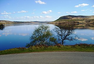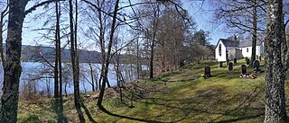
Gairloch is a village, civil parish and community on the shores of Loch Gairloch in Wester Ross, in the North-West Highlands of Scotland. A tourist destination in the summer months, Gairloch has a golf course, a museum, several hotels, a variety of shops, takeaway restaurants, a community centre, a leisure centre with sports facilities, a local radio station, beaches and nearby mountains. Gairloch is one of the principal villages on the North Coast 500 route.
EDINA is a centre for digital expertise, based at the University of Edinburgh as a division of the Information Services Group.

Digimap is a web mapping and online data delivery service developed by the EDINA national data centre for UK academia. It offers a range of on-line mapping and data download facilities which provide maps and spatial data from Ordnance Survey, British Geological Survey, Landmark Information Group and OceanWise Ltd Ltd.,, Getmapping Ltd, the Environment Agency, OpenStreetMap, CollinsBartholomew Ltd, and various other sources.

Loch Affric is a freshwater loch within Glen Affric, in the Highland council area of Scotland. It lies about 25 miles (40 km) southwest of Beauly. The loch sits in a national nature reserve known for being home to a number of rare species and the loch itself is popular for trout fishing. An annual duathlon is held on the banks of the loch in May and the loch has been widely used as the backdrop in films.

Loch Badanloch is a loch in Sutherland in the Highland Council Area of northern Scotland.

Loch Naver is a loch in the Farr parish in Sutherland in the Highland council area of northern Scotland. It is situated upon the B873 main road. Upon the loch are also the settlements of Kilbreck, Redhackaistelll and Dailmallhart. Additionally Alltnaharra and Achanaes are nearby. Fishing is very popular on Loch Naver and the River Naver.

Eela Water is a freshwater loch (lake) in Northmavine, part of the mainland of Shetland in Scotland. Besides being a freshwater fishing location, the site supplies clean water for the mainland of Shetland, and is one of the largest lochs on the mainland. The loch is 3.2 kilometres (2 mi) west of Ollaberry, and only 1.62 miles (2.61 km) to the sea (westwards).

Loch Meiklie is a freshwater loch in Inverness-shire, Scotland, 6.4 kilometres (4.0 mi) west of Drumnadrochit.

Loch Aisir Mòr is a lochan in Scotland's Flow Country. It is situated about one mile from the western coast of Sutherland, at the northeast edge of Oldshoremore, a scattered crofting settlement, and about two miles north of the larger settlement of Kinlochbervie. The lochan is surrounded by heathland. A claybed lines its north shore. Its outflow to the sea is Abhainn Aisir Mhòr, a river about one mile long.

Achridigill Loch, sometimes listed as Achridig Loch, is a remote lochan in Scotland's Flow Country, roughly 2.5 miles southeast of Strathy, a crofting settlement on Scotland's north coast.
Loch Airigh an Eilein is a lochan in Wester Ross, Scotland roughly 4 km northwest of the scattered crofting settlement of Inverasdale.

Antermony Loch is a lochan in East Dunbartonshire, Scotland, at the edge of the village of Auchenreoch.

Loch na Beinne Baine is a remote mountain loch on the northern lid of Glenmoriston, Scotland. It sits on the historic boundary between the parishes of Glenmoriston and Strathglass.

Loch Sealbhanach is a freshwater loch in Glen Cannich, Scotland.

Loch Neaty is a remote mountain loch in Inverness-shire, Scotland, just 900m west of the much larger Loch Bruicheach.

Loch na Bairness is a loch in Moidart, Scotland, roughly 1.8 km southwest of the village of Glenuig.

Ashgrove Loch, also known as Stevenston Loch, is a mesotrophic lochan in North Ayrshire, Scotland, approximately 2 km northeast of the town of Stevenston.

Akermoor Loch is a remote upland lochan in Selkirkshire, Scotland, approximately 6.5 kilometres (4.0 mi) west of the village of Ashkirk.

Loch Baile Mhic Chailein is a loch in Argyll, Scotland, situated on the River Creran roughly 5.5km upstream of Loch Creran.

Loch a' Chairn Mòr is a remote mountain loch in Wester Ross, Scotland, roughly 2km west of its main outflow, Loch Broom.


