| Loenpo Gang | |
|---|---|
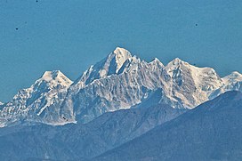 Loenpo Gang (right) behind Dorje Lhakpa (centre) | |
| Highest point | |
| Elevation | 6,979 m (22,897 ft) [1] |
| Prominence | 1,019 m (3,343 ft) |
| Parent peak | Nyanang Ri |
| Listing | |
| Coordinates | 28°11′44″N85°47′58″E / 28.19556°N 85.79944°E |
| Geography | |
 Loenpo Gang 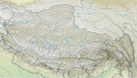 Loenpo Gang  Loenpo Gang | |
| Countries | Nepal and China |
| Parent range | Himalayas |
| Climbing | |
| First ascent | May 3, 1962 |
Loenpo Gang (also known as Lönpo Gang) is a mountain peak in the Himalayas on the border of Nepal and the Tibet Autonomous Region of People's Republic of China. [1]