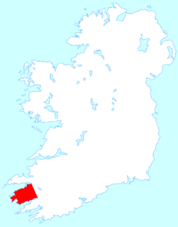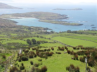
The Iveragh Peninsula is located in County Kerry in Ireland. It is the largest peninsula in southwestern Ireland. A mountain range, the MacGillycuddy's Reeks, lies in the centre of the peninsula. Carrauntoohil, its highest mountain, is also the highest peak in Ireland.

Derrynane, sometimes spelled Darrynane, is a townland in the parish of Caherdaniel in County Kerry, Ireland. It is located on the Iveragh peninsula, just off the N70 national primary road near Caherdaniel on the shores of Derrynane Bay.

Tornant Moat is an Irish National Monument composed of a ringfort and nearby barrows.

Cashlaungar, also Cashlaungarr, Cashlaun Gar or Cashlán Gar, is a stone ringfort (cashel) and National Monument located in The Burren, a region in County Clare, Ireland.

Cloghanecarhan is a ringfort and ogham stone forming a National Monument located in County Kerry, Ireland.

The Beginish house is a stone house and National Monument associated with the Viking period, located in County Kerry, Ireland.

Beenbane is an ancient site and National Monument located in County Kerry, Ireland.

Kilcoolaght East Ogham Stones are a collection of ogham stones forming a National Monument located in County Kerry, Ireland.

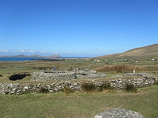
Leacanabuaile is a stone ringfort (cashel) and National Monument in County Kerry, Ireland. Leacanabuaile is immediately northwest of Cahergal, 3 km (1.9 mi) northwest of Cahirciveen.

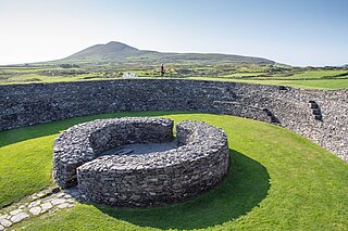
Cahergall is a stone ringfort (cashel) and National Monument located in County Kerry, Ireland.

Callanafersy is a stone ringfort (cashel) and National Monument located in County Kerry, Ireland.

Glanfahan is a townland on the Dingle Peninsula, Ireland, notable for its large collection of clocháns, which form a National Monument.

Church Island is a medieval Christian monastery and National Monument located in Lough Currane, Ireland.

Caherdorgan North is a National Monument located in County Kerry, Ireland.

Kilmalkedar is a medieval ecclesiastical site and National Monument located in County Kerry, Ireland.

Ballynavenooragh is a stone fort and National Monument located in County Kerry, Ireland.

Glin North is the location of a National Monument in County Kerry, Ireland.

Ballinknockane is the location of a National Monument in County Kerry, Ireland.

Dún Conor is a stone ringfort (cashel) and National Monument located on Inishmaan, Ireland.

Dún Fearbhaí is a stone ringfort (cashel) and National Monument located on Inishmaan, Ireland.


