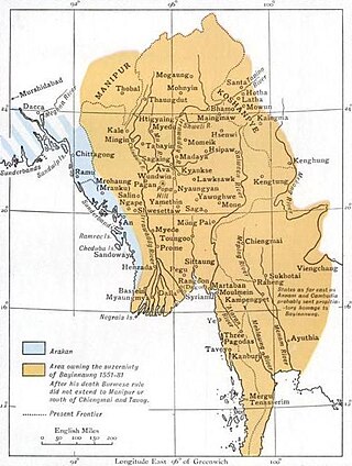
Laihka State, also spelt Legya or Lecha, was a state in the central division of the Southern Shan States of Burma, with an area of 3,711 square kilometres (1,433 sq mi).

Yawnghwe, known as Nyaungshwe in Burmese, was a Shan state in what is today Myanmar. It was one of the most important of the Southern Shan States. Yawnghwe state included the Inle Lake. The administrative capital was Taunggyi, located in the northern part of the state. The Agent of the British government, the Superintendent of the Southern Shan States, resided at Taunggyi and the king's palace was at Yawnghwe.
Tachileik District is a district of the Shan State in Myanmar. It consists of one town and 295 villages. It is one of the four districts of Eastern Shan State.

Loi-ai was a Shan state in the Myelat region of what is today Burma. It was one of the westernmost Shan states, bordering with Yamethin district of Upper Burma. The capital was Lonpo (Aungpan) and the population was mostly Pa-O, but there were also Danu, Shan and Karen people in the area.
Mong Nawng, Mong Naung or Mongnawng is a town in Shan State, Myanmar. It is located a few miles to the west of the Nam Pang river.

Kantarawadi, also known as Gantarawadi, was one of the Karenni States in what is today Kayah State in Burma. It was also known as "Eastern Karenni" owing to the location of part of its territory east of the Salween River.
Loi Pangnao is the highest mountain of the Daen Lao Range, a subrange of the Shan Hills. It is located near Mong Yawng in Shan State, Burma close to the border with China.
Mong Ping is a town and seat of Mong Ping Township in Mongsat District, Shan State in eastern Myanmar. The town was not the capital of Mongping State in the Lawksawk area.
Nā-hki-lek or Na-hkilek is a river village on the Salween River in Shan State of eastern Burma. It lies on the confluence of the Salween and the Nam Pang River. A few miles north beyond the junction is said to be "a strange whirlpool, at the place the river is in a gorge between limestone cliffs, which fall smooth and precipitous to the water's edge."

Mawkmai, also known as Maukme, was a Shan State in what is today Burma. It belonged to the Eastern Division of the Southern Shan States.

Mongnai, also known as Möngnai, Mone, Mōng Nai or Monē, was a Shan state in what is today Burma. It belonged to the Eastern Division of the Southern Shan States. Its capital was Mongnai town.

Mongpan, also known as Maingpan was a Shan state in what is today Burma. It belonged to the Eastern Division of the Southern Shan States.

Tawngpeng was a Shan state in what is today Myanmar. It belonged to the Northern Shan States. The capital was Namhsan (Om-yar).

The Wa States was the name formerly given to the Wa Land, the natural and historical region inhabited mainly by the Wa people, an ethnic group speaking an Austroasiatic language. The region is located to the northeast of the Shan States of British Burma, in the area of present-day Shan State of northern Burma (Myanmar) and the western zone of Pu'er Prefecture, Yunnan, China.

Hsawnghsup was one of the outlying Shan princely states in what is today Burma.
Möng Kyawt, also known as Mongkyawt is a village in Mong Ton Township of Mongsat District, Shan State, eastern Burma (Myanmar).

Mongpu or Möngpu was a small state of the Shan States in what is today Burma.
Möng Pu or Mong Pu is a village in Mong Ping Township, Mongsat District, Shan State, eastern Myanmar.
Loi San is a mountain of the Shan Hills, in Shan State, Burma.
Loi Wengwo is a mountain of the Shan Hills, in Shan State, Burma.


