Mong Hsu Township is a township of Loilen District in the Shan State of Myanmar. The principal town is Mong Hsu. Om-pu waterfall on Nam Parng River of Mong Hsu is the second largest waterfall of Shan State. The nearest commercial airport to Mong Hsu is Lashio Airport.
Mongyai Township is a township of Lashio District in the Shan State of eastern Burma. The principal town is Mongyai. Mount Loi Leng of Mongyai is the highest point in Shan State.
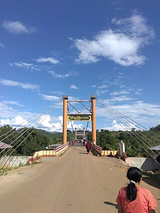
Tangyan Township is a township of Lashio District in the Shan State of eastern Burma. The principal town is Tangyan. Tangyan emerged as an important centre for Panthay people in the mid-20th century, especially after the destruction of Panglong during World War II.

Mong Ton Township or Mong Tong Township is a township of Mongs Ton District in the Eastern Shan State of Myanmar. The capital town is Mong Ton. It borders Mong Pying Township to the north, Mong Hsat Township to the east, Mong Nai Township and Mong Pan Township to the west and Thailand to the south. Loi Hkilek mountain is located in the area. It has two townships. They are Pone Par Khem, and Mong Hta. At Mong Ton township, live in Shan, Lahu, Lisu, Wa, Burma, and Chinese.
Mong Ping Township is a township of Kengtung District in the Shan State of Myanmar. The capital town is Mong Ping.
Mong Kung Township or Mongkaung Township is a township of Loilen District in the Shan State of Burma. The principal town is Mong Kung.
Kengtung District is a district of the Shan State in Myanmar. It consists of three towns and 1449 villages.
Mong Hsat District or Mongsat District is a district of the Shan State in Myanmar. It consists of 2 townships 5 towns and 1095 villages.

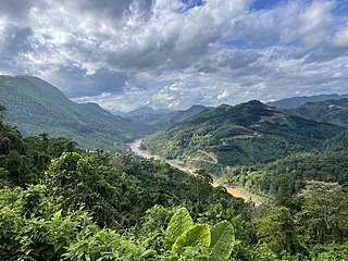
The Shan Hills, also known as Shan Highland, is a vast mountainous zone that extends through Yunnan to Myanmar and Thailand. The whole region is made up of numerous peaks separated mostly by narrow valleys, as well as a few broader intermontane basins. The ranges in the area are aligned in such a way that they link to the foothills of the Himalayas further to the northwest.
Loi Pangnao is the highest mountain of the Daen Lao Range, a subrange of the Shan Hills. It is located near Mong Yawng in Shan State, Burma close to the border with China.

Loi Leng is the highest mountain of the Shan Hills. It is located in Shan State, Burma, 45 kilometres (28 mi) to the southeast of Lashio.
Tai Loi, also known as Mong Lue, refers to various Palaungic languages spoken mainly in Burma, with a few hundred in Laos and some also in China. Hall (2017) reports that Tai Loi is a cover term meaning 'mountain Tai' in Shan, and refers to various Angkuic, Waic, and Western Palaungic languages rather than a single language or branch. The Shan exonym Tai Loi can refer to:
Mong Ping is a town and seat of Mong Ping Township in Mongsat District, Shan State in eastern Myanmar. The town was not the capital of Mongping State in the Lawksawk area.
Savaiq is a Waic language spoken in Kunlong Township, Shan State, Burma.
Homein also known as Homong, Homöng, Ho Mong and Wān Ho-möng, is a village in Langkho Township, Langkho District, southern Shan State, Myanmar (Burma).
Loi Hkilek or Loi Kyi-lek is a mountain of the Shan Hills, in Shan State, Burma.
Möng Kyawt, also known as Mongkyawt is a village in Mong Ton Township of Mongsat District, Shan State, eastern Burma (Myanmar).

Mongpu or Möngpu was a small state of the Shan States in what is today Burma.
Möng Pu or Mong Pu is a village in Mong Ping Township, Mongsat District, Shan State, eastern Myanmar.
Loi San is a mountain of the Shan Hills, in Shan State, Burma.
