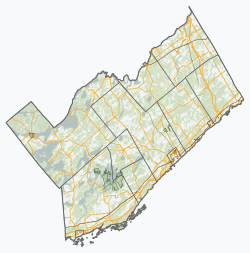
Lombardy, Ontario, is a community in the Township of Rideau Lakes, Leeds and Grenville County in Eastern Ontario. Its nearest communities are the town of Smiths Falls to the northeast, Rideau Ferry and Perth to the west, and Portland, Ontario to the southwest. The village of Lombardy is home to approximately 100 residents, with many more inhabiting the rural areas surrounding it. The only store in Lombardy is a vape shop, which was previously a restaurant.
Although the name reprises that of the Italian region of the same name, the Ontarian community supposedly owes its name to Francis Lombard, a French soldier who settled in the area in the early 1820s. It has also been known by other names, including Landon's Corners, Landon's Mills, Lombard's Corners and South Elmsley. Capitalising on its proximity to Otter Creek, a number of mills were built in Lombardy, along with tradesmen's shops and hotels and taverns, which served the travelers passing through. [1]
The community has two churches, Blessed Sacrament Catholic Church, and Holy Trinity Anglican church. It has an elementary school, Lombardy Public School, which serves children from junior kindergarten to the eighth grade and offers library services to the general public. The Rideau Lakes branch of the Ontario Provincial Police is located within the community off of Highway 15.
Rural Lombardy is home to several beautiful lakes including Rideau Lake, Bass Lake and Otter Lake. Additionally, the Lombardy area boasts several tourist attractions, including campgrounds, like Bass Lake Lodge, Sandy Beach (Otter Lake), Moonlight Bay and Camp Otterdale, as well as the Lombard Glen Golf and Country Club. Strawberry picking is available at Miller Bay Farm along with fresh vegetables sold at their roadside stand.
It is also home to the Lombardy Agricultural Hall and Fairgrounds, which hosts the Lombardy Fair every year on the August long weekend. [2] The fair is celebrating its 153rd anniversary in 2019, and will move from a 4 to 3 day fair. The Fairgrounds are also host to various events such as auction sales, car shows, gun shows, music festivals, dog shows and an annual barn dance held every year in September.
Perth is a town in Eastern Ontario, Canada. It is located on the Tay River, 83 kilometres (52 mi) southwest of Ottawa, and is the seat of Lanark County.
Actons Corners is a community in the municipality of North Grenville, United Counties of Leeds and Grenville, in eastern Ontario, Canada. An unincorporated place and compact rural community, it is located on County Road 43 between Kemptville and Merrickville at the intersection with Actons Corners Road and County Road 25.
Westport is a village in Eastern Ontario, Canada. It lies at the west end of Upper Rideau Lake, at the head of the navigable Rideau Canal system, 100 km (62 mi) southwest of Ottawa.
Whitewater Region is a township on the Ottawa River in Renfrew County, located within the scenic Ottawa Valley in eastern Ontario, Canada. Whitewater Region is made up of the former municipalities of Beachburg, Cobden, Ross and Westmeath, which were amalgamated into the current township on January 1, 2001.
South Frontenac is a township in Frontenac County in eastern Ontario, Canada. It was amalgamated in 1998 from the former townships of Bedford, Loughborough, Portland, and Storrington.
Middlesex Centre is a township in Middlesex County, in southwestern Ontario, Canada, north and west of London. The Corporation of the Township of Middlesex Centre formed on January 1, 1998, with the amalgamation of the former Townships of Delaware, Lobo, and London. It is part of the London census metropolitan area.
South Glengarry is a township in eastern Ontario, Canada on the Saint Lawrence River in the United Counties of Stormont, Dundas and Glengarry. South Glengarry borders Quebec.
Elizabethtown-Kitley is a township in eastern Ontario, Canada, in the United Counties of Leeds and Grenville. Its southern border lies along the St. Lawrence River and it extends north into many rural hamlets and villages. The township was created on January 1, 2001 by the amalgamation of the former Township of Elizabethtown and Township of Kitley.
Burritts Rapids is a small village located on the Rideau River in eastern Ontario.
Delta, Ontario, is a community in the Township of Rideau Lakes, Leeds and Grenville County in Eastern Ontario. The village is located between two lakes, Upper Beverley and Lower Beverley, along highway 42, approximately 15 kilometres west of Athens, Ontario and 28 kilometres east of Westport, Ontario.
Kars is a village on the Rideau River within Rideau-Goulbourn Ward in the city of Ottawa, Ontario. Prior to joining the city in 2000 it was part of Rideau Township.
Battersea is a community in the Canadian province of Ontario, located in the township of South Frontenac, 20 kilometres (12 mi) north of Kingston. Battersea is well known for its fishing and outdoor activities as it is close to Loughborough Lake, Dog Lake and the Rideau Canal Waterway.
Rideau Lakes is a township located within Leeds and Grenville United Counties in Eastern Ontario, Canada. The township was incorporated on 1 January 1998 by amalgamating the former townships of North Crosby, South Crosby, Bastard, South Burgess and South Elmsley with the village of Newboro.
Merrickville–Wolford is a village-status municipality in Eastern Ontario, Canada, located in the United Counties of Leeds and Grenville. It spans both shores of the Rideau River.
Leeds and the Thousand Islands is a township in the Canadian province of Ontario, located within the United Counties of Leeds and Grenville. The township is located along the Saint Lawrence River, and extends north into rural hamlets and villages. Formerly, this township was divided into three separate townships: Leeds, Landsdowne and Escott townships; these townships amalgamated to form the current township of Leeds and the Thousand Islands.
Kenmore is a rural community in Osgoode Ward in the southeastern corner of the City of Ottawa, Ontario, Canada. Prior to amalgamation in 2001, it was located in Osgoode Township. It consists of two small residential neighbourhoods and farmland. Notable features include Kenmore Bicentennial Park, Kenmore Community Centre, and the Castor River, a tributary of the South Nation River. According to the Canada 2011 Census, the population of the surrounding blocks was 501.
Cashel, Ontario is a small hamlet situated in Unionville, Ontario located at the intersection of Elgin Mills Road and York Regional Road 67. Originally it was called Crosby Corners after John Crosby, the village's first store owner, who came originally from New York State. The name was changed to Cashel in 1851 with the opening of its first post office. It was likely named after Cashel in Ireland. In 1851 the community had a sawmill, cobbler shop, blacksmith shop, wagon shop, inn and tavern, Masonic Lodge, and Presbyterian church. In 1890 Peaches United Church was built on land from farmer Thomas Peach at 10762 McCowan Road. The church is a historic site and not operating since the 1960s to 1970s, but cemetery remains in active use. The east west sideroad along the church was locally called Peaches (Peach's) Sideroad or otherwise known as Elgin Mills Road.
Stone Mills is a lower-tier township north of Greater Napanee in Lennox and Addington County, Ontario, Canada. According to the 2016 census, the township has a population of 7,702.
Norfolk County in the Canadian province of Ontario consists of a long list of communities. Its four designated population centres are Simcoe, Port Dover, Delhi, and Waterford.