
The Great Lakes, also called the Great Lakes of North America, are a series of large interconnected freshwater lakes in the mid-east region of North America that connect to the Atlantic Ocean via the Saint Lawrence River. There are five lakes, which are Superior, Michigan, Huron, Erie, and Ontario and are in general on or near the Canada–United States border. Hydrologically, lakes Michigan and Huron are a single body joined at the Straits of Mackinac. The Great Lakes Waterway enables modern travel and shipping by water among the lakes.

Lake Erie ( "eerie") is the fourth largest lake by surface area of the five Great Lakes in North America and the eleventh-largest globally. It is the southernmost, shallowest, and smallest by volume of the Great Lakes and therefore also has the shortest average water residence time. At its deepest point Lake Erie is 210 feet (64 m) deep.

Lake Ontario is one of the five Great Lakes of North America. It is bounded on the north, west, and southwest by the Canadian province of Ontario, and on the south and east by the U.S. state of New York. The Canada–United States border spans the centre of the lake.

The Trans-Canada Highway is a transcontinental federal–provincial highway system that travels through all ten provinces of Canada, from the Pacific Ocean on the west coast to the Atlantic Ocean on the east coast. The main route spans 7,476 km (4,645 mi) across the country, one of the longest routes of its type in the world. The highway system is recognizable by its distinctive white-on-green maple leaf route markers, although there are small variations in the markers in some provinces.
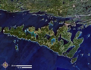
Manitoulin Island is an island in Lake Huron, located within the borders of the Canadian province of Ontario, in the bioregion known as Laurentia. With an area of 2,766 km2 (1,068 sq mi), it is the largest lake island in the world, large enough that it has over 100 inland lakes itself. In addition to the historic Anishinaabe and European settlement of the island, archaeological discoveries at Sheguiandah have demonstrated Paleo-Indian and Archaic cultures dating from 10,000 BC to 2,000 BC.

The Thousand Islands constitute a North American archipelago of 1,864 islands that straddles the Canada–US border in the Saint Lawrence River as it emerges from the northeast corner of Lake Ontario. They stretch for about 50 miles (80 km) downstream from Kingston, Ontario. The Canadian islands are in the province of Ontario and the U.S. islands in the state of New York.
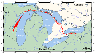
The Niagara Escarpment is a long escarpment, or cuesta, in Canada and the United States that runs predominantly east–west from New York through Ontario, Michigan, Wisconsin, and into Illinois. The escarpment is most famous as the cliff over which the Niagara River plunges at Niagara Falls, for which it is named.

Lake of the Woods is a lake occupying parts of the Canadian provinces of Ontario and Manitoba and the U.S. state of Minnesota. Lake of the Woods is over 70 miles (110 km) long and wide, containing more than 14,552 islands and 65,000 miles (105,000 km) of shoreline. It is fed by the Rainy River, Shoal Lake, Kakagi Lake and other smaller rivers. The lake drains into the Winnipeg River and then into Lake Winnipeg. Ultimately, its outflow goes north through the Nelson River to Hudson Bay.

Lake Simcoe is a lake in southern Ontario, Canada, the fourth-largest lake wholly in the province, after Lake Nipigon, Lac Seul, and Lake Nipissing. At the time of the first European contact in the 17th century the lake was called Ouentironk by the native Wendat/Ouendat (Huron) people. It was also known as Lake Taronto until it was renamed by John Graves Simcoe, the first Lieutenant-Governor of Upper Canada, in memory of his father, Captain John Simcoe of the Royal Navy. In Anishinaabemowin, the ancestral language of the First Nations living around this lake, namely Anishinaabek of Rama and Georgina Island First Nations, Lake Simcoe is called Zhooniyaang-zaaga'igan, meaning "Silver Lake".

Manitoulin District is a district in Northeastern Ontario within the Canadian province of Ontario. It was created in 1888 from part of the Algoma District. The district seat is in Gore Bay.

Lambton County is a county in Southwestern Ontario, Canada. It is bordered on the north by Lake Huron, which is drained by the St. Clair River, the county's western border and part of the Canada-United States border. To the south is Lake Saint Clair and Chatham-Kent. Lambton County's northeastern border follows the Ausable River and Parkhill Creek north until it reaches Lake Huron at the beach community of Grand Bend. The county seat is in the Town of Plympton-Wyoming.
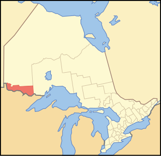
Rainy River District is a district and census division in Northwestern Ontario in the Canadian province of Ontario. It was created in 1885. It is the only division in Ontario that lies completely in the Central Time Zone, except for the township of Atikokan observing Eastern Standard Time year-round. Its seat is Fort Frances. It is known for its fishing and its location on the US border opposite International Falls, Minnesota, and Baudette, Minnesota.
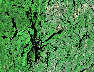
Lake Temagami, formerly spelled as Lake Timagami, is a lake in Nipissing District in northeastern Ontario, Canada, situated approximately 80 km north of North Bay. The lake's name comes from dimii-agamiing "tih-MEE-uh-guh-MEENG", which means "it is deep water by the shore" in the Ojibwa language.
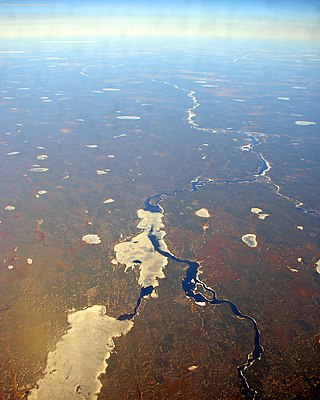
The Albany River is a river in Northern Ontario, Canada, which flows northeast from Lake St. Joseph in Northwestern Ontario and empties into James Bay. It is 982 kilometres (610 mi) long to the head of the Cat River, tying it with the Severn River for the title of longest river entirely in Ontario. Major tributaries include the Kenogami River and Ogoki River.
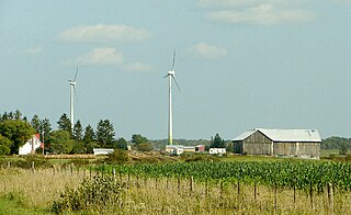
Central Manitoulin is a township in the Canadian province of Ontario. It is located on Manitoulin Island and in Manitoulin District.
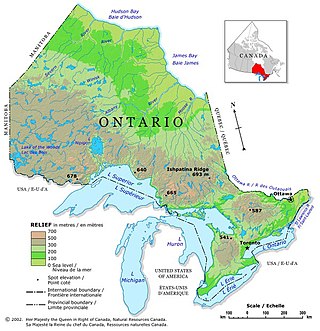
Ontario is located in East/Central Canada. It is Canada's second largest province by land area. Its physical features vary greatly from the Mixedwood Plains in the southeast to the boreal forests and tundra in the north. Ontario borders Manitoba to the west, Hudson Bay and James Bay to the north, Quebec to the east, and the Great Lakes and the United States to the south. The province is named for Great Lake Ontario, an adaptation of the Iroquois word Onitariio, meaning "beautiful lake", or Kanadario, variously translated as "beautiful water". There are approximately 250,000 lakes and over 100,000 kilometres (62,000 mi) of rivers in the province.

Temagami, formerly spelled as Timagami, is a municipality in northeastern Ontario, Canada, in the Nipissing District with Lake Temagami at its heart.

The North Shore is a township in the Canadian province of Ontario, located in the Algoma District. The township had a population of 497 in the Canada 2016 Census. It is along the north shore of the North Channel of Lake Huron, with its main communities all along Highway 17.

The geography of New York (state) varies widely. Most of New York is dominated by farms, forests, rivers, mountains, and lakes. New York's Adirondack Park is larger than any U.S. National Park in the contiguous United States. Niagara Falls, on the Niagara River as it flows from Lake Erie to Lake Ontario, is a popular attraction. The Hudson River begins near Lake Tear of the Clouds and flows south through the eastern part of the state without draining lakes George or Champlain. Lake George empties at its north end into Lake Champlain, whose northern end extends into Canada, where it drains into the Richelieu River and then the St. Lawrence. Four of New York City's five boroughs are on the three islands at the mouth of the Hudson River: Manhattan Island, Staten Island, and Brooklyn and Queens on Long Island.
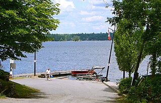
Stony Lake is a lake in Peterborough County in central Ontario, Canada. There are three interconnected lakes which together are known as Stony or Stoney Lake. Stoney Lake forms the eastern end of the Kawartha Lakes region. It is primarily a summer cottage area but there are many permanent residences on the lakes.


