
Saint-Casimir is a municipality located in Portneuf RCM, Capitale-Nationale region, Quebec, Canada.

Sainte-Anne River, Teyaiar River, rivière Sainte-Anne (French), flows from north to south on the north shore in the estuary section of the St. Lawrence River, in Les Chenaux, Portneuf and La Jacques-Cartier RCM, Mauricie and National Capital regions, Quebec, Canada.

Sainte-Christine-d'Auvergne, formerly Sainte-Catherine, is located along the banks of the Sainte-Anne River, in the Capitale-Nationale region, Portneuf RCM, Quebec, Canada.

Batiscan River has its source in the region of Lac Édouard, in the Laurentians Mountains, the Batiscan River flows over a length of 177 km. It receives water from numerous tributaries, including, in its upper reach, the Rivière aux Éclairs and the Jeannotte river. In its downstream part, it waters Saint-Narcisse and Sainte-Geneviève-de-Batiscan before flowing into the St. Lawrence River at Batiscan.

Saint-Alban is a municipality located in Portneuf RCM, Capitale-Nationale region, Quebec, Canada.

The Romaine River, Kanatuahkuiau, Uanaman Hipu, Uepatauekat Shipu, the river traditional indigenous variants, Rivière Romaine in French, it flows from north to south, emptying into the Jacques Cartier Strait, the Gulf of St. Lawrence and Havre-Saint-Pierre municipality.
The Charest River originates from Charest Lake in the Montauban-les-Mines area, located in the eastern part of Notre-Dame-de-Montauban, within the Mekinac Regional County Municipality, in the administrative region of Mauricie in the province of Quebec, Canada. It flows southward, passing through several regions and receiving water from lakes such as Mine, Perron, Perreault, and End in its upper course.

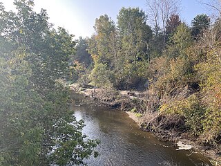
Noire River, Rivière Noire is one of the main watercourses of the Sainte-Anne River watershed, it measures 62 km in length, its watershed has an area of 568 km².

Lake Montauban is located in the municipalities of Rivière-à-Pierre and Saint-Alban, Portneuf RCM, Capitale-Nationale, Quebec, Canada.

The Blanche River (St-Casimir) is a stream flowing in the municipalities of Saint-Ubalde, Saint-Thuribe, Saint-Alban and Saint-Casimir, in Portneuf RCM, Capitale-Nationale, Quebec, Canada.

The Weller River (Stream) is a tributary left bank of the Blanche River (St-Casimir) whose confluence is found east of the municipality of Saint-Ubalde, in the Portneuf Regional County Municipality, in the administrative region of Capitale-Nationale, in the province of Quebec in Canada.
The American River is a tributary of the Jacquot River flowing in the municipality of Sainte-Christine-d'Auvergne, in the MRC Portneuf Regional County Municipality, in the administrative region of Capitale-Nationale, in Quebec, in Canada.
The Mauvaise river is a tributary of the Bras du Nord flowing in the town of Saint-Raymond, in the Portneuf Regional County Municipality, in the administrative region of Capitale-Nationale, in Quebec, in Canada.
The Talayarde North East River is a tributary of the Talayarde River flowing in the administrative region of Capitale-Nationale, at Quebec, in Canada. The course of the river crosses the municipality of Saint-Gabriel-de-Valcartier and the city of Saint-Raymond, in the Portneuf Regional County Municipality).
The Rivière Verte is a tributary of the Sainte-Anne River flowing in the town of Saint-Raymond, in the Portneuf Regional County Municipality, in the administrative region of Capitale-Nationale, in Quebec, in Canada.
Lac Gregory is a body of fresh water crossed from north to south by the Tourilli River, located in the Laurentides Wildlife Reserve, in the unorganized territory of Lac-Croche, in the La Jacques-Cartier Regional County Municipality, administrative region of Capitale-Nationale, in province from Quebec, to Canada.

Portneuf Regional Natural ParkParc naturel régional de Portneuf (French), is located on the territory of Portneuf City and the municipalities of Saint-Ubalde, Saint-Alban, Saint-Casimir and Rivière-à-Pierre, Portneuf RCM, Capitale-Nationale, Quebec, Canada.
The lac Carillon is located on the north shore of the St. Lawrence River, in the province of Quebec, in Canada. This lake straddles the municipalities of:

Lake Clair (Sainte-Christine-d'Auvergne), Lac Clair (French) is located in the municipalities of Saint-Alban and Sainte-Christine-d’Auvergne, Portneuf RCM, Capitale-Nationale, Quebec, Canada.
The Rivière des Pins is a freshwater stream, in Quebec, in Canada. This river crosses the municipalities of:


