
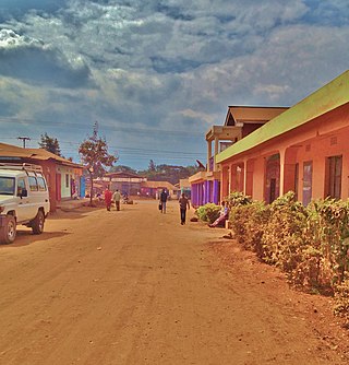
Usa River also known locally as Ussa is an administrative ward of the Meru District in the Arusha Region of Tanzania. It is the seat of Meru District. To the north and west, the ward is surrounded by the wards of Nkoaranga, Poli, and Seela Sing'isi. To the south and east, respectively, are the wards of Kikwe and Maroroni, and Maji ya Chai. As of 2012, Usa River ward had a population of 23,437.

Monduli Mjini is an administrative ward and district capital located in the Monduli District of the Arusha Region of Tanzania.The ward is totally surrounded by the Engototo ward. In 2016 the Tanzania National Bureau of Statistics report there were 8,699 people in the ward, from 7,796 in 2012. The average elevation of Monduli Mjini is 1,553m.
Karatu or Karatu Town is an administrative ward and district capital located in the Karatu District of the Arusha Region of Tanzania. The ward town is bordered on its north side by Ganako ward, to the east by Rhotia ward, to the south by Endamarariek ward, and to the west by Qurus ward. According to the 2012 census, the ward has a total population of 26,617. Karatu ward is the most populous ward in Karatu district and is the capital of Karatu District.

Sekei is an administrative ward and district capital located in the Arusha City Council of Arusha Region in Tanzania. The ward is bordered by Kaloleni ward to the west, Sokon II ward to the north, Kimandolu ward to the east, Themi to the south and, a tiny portion of Kati ward to the southeast. The name sekei comes from the Masai word seki which is a type of tree that grew there before settlement. Sekei ward was officially established in 1969 and is the location of the headquarters of Arusha City Council.
Goba is an administrative ward in Ubungo District of the Dar es Salaam Region in Tanzania. The Wazo, Mbezi Juu, and Makongo wards of Kinondoni MC border the ward on the north and the east, respectively. The ward is bordered by Saranga to the south and Mbezi to the west. According to the 2012 census, the ward has a total population of 42,669.

Kibamba is an administrative ward in Ubungo District of the Dar es Salaam Region in Tanzania. Mbezi and Kwembe wards border the ward to the north and east, respectively. The ward is bordered to the south by Kiluvya in the Kisarawe District and to the west by Maili Moja in the Kibaha District. According to the 2012 census, the ward has a total population of 28,885.

Mabibo chuo(Kata ya Kimara, in Swahili) is an administrative ward in Ubungo District of the Dar es Salaam Region in Tanzania. The ward borders Kinondoni's Makongo to the north. Ubungo and Makuburi border the ward to the east. Kimanga and Kinyerezi of Ilala are to the south. Saranga ward is to the west. According to the 2012 census, the ward has a total population of 76,577.

Sinza is an administrative ward in Ubungo District of the Dar es Salaam Region in Tanzania. The Kinondoni MC communities of Makongo and Kijitonyama, which border the ward to the north and east, respectively. Manzese and Ubungo wards are to the south and west of here. According to the 2012 census, the ward has a total population of 40,546.
Buguruni is an administrative ward of the Ilala Municipical Council of the Dar es Salaam Region in Tanzania. The Kigogo ward of Kinondoni MC borders the ward to the north. The ward is bordered to the east by the Ilala ward. By Temeke MC's Chang'ombe and Temeke wards to the south. Vingunguti and Tabata wards border the ward to the west. According to the 2022 census, the ward has a total population of 47,278.

Chanika is an administrative ward of the Ilala Municipical Council of the Dar es Salaam Region in Tanzania. Majohe ward encircles the ward on its northern edge. Tambani Ward of the Mkuranga District in the Pwani Region lies to the south, while Msongola is to the east. The Msimbu and Kisarawe wards of the Kisarawe District in the Pwani Region are also to the west. According to the 2022 census, the ward has a total population of 75,271.

Jangwani is an administrative ward of the Ilala Municipical Council of the Dar es Salaam Region in Tanzania. The Upanga East and Upanga West wards border the ward on its northern side. The ward is bordered by Mchafukoge and Kisutu to the east. Mchikichini ward borders the ward to the west. The ward is bordered to the south by the Kariakoo ward. According to the 2012 census, the ward has a total population of 17,647.

Mchafukoge is an administrative ward and district capital of the Ilala district in the Dar es Salaam Region of Tanzania. Kisutu and Kivukoni wards form the ward's northern boundary. The Dar es Salaam Harbor forms its eastern border. The Temeke District wards of Kurasini and Keko border it on the south. Kariakoo and Jangwani wards border the ward to the west. The ward is home to the Uhuru Monument, the Central Railway Station, and the headquarters for Tanzania Revenue Authority at Mapato House. In 2022, the population of the ward was 7,999.

Ukonga is an administrative ward of the Ilala Municipical Council of the Dar es Salaam Region in Tanzania. Kinyerezi forms the ward's northern boundary. To the east is Kipawa, and to the south are Kivule and Majohe. Gongolamboto ward is to the west. According to the 2012 census, the ward has a total population of 80,034.

Azimio is an administrative ward in the Temeke district of the Dar es Salaam Region of Tanzania. Temeke and Miburani wards encircle the ward on its northern border. Makangarawe and Tandika are to the west. Buza, Mbagala, and Kijichi are to the south. Mtoni ward is to the east. According to the 2012 census, the ward has a total population of 55,082.

Sandali is an administrative ward in the Temeke district of the Dar es Salaam Region of Tanzania. Kurasini forms the northern boundary of the ward. the west are the wards of Ilala MC, Vingunguti and Kiwalani. Temeke forms the eastern boundary of the ward. Kilakala and Tandika form the ward's southern boundary. According to the 2012 census, the ward has a total population of 59,378.
Somangila is an administrative ward and district capital of the Kigamboni District of the Dar es Salaam Region in Tanzania. The Indian Ocean borders the ward to the north, Kimbiji to the south and Kisarawe II on the southwest. The ward is home to Mbuamaji and Mbutu Bandarini historic sites. According to the 2012 census, the ward has a total population of 19,283.

Sokon II is one of the 27 administrative wards of the Arusha District Council located in the Arusha Region of Tanzania. The name Sokon comes from the Swahili word for market, sokoni. The ward shares a similar name with another ward located in Arusha Urban District called Sokon I and the former is one of 27 rural administrative wards in the district as of 2012. Sokon II ward is bordered by Oltoroto and Moivo ward in the west, Ilkiding'a ward to the north, Bangata ward to the east. On the southern border Sokon II is bordered by Baraa, Kimandolu and Sekei wards. According to the 2012 census, the ward has a total population of 32,073. Thus, Sokon II is the most populous ward in Arusha District. Also the ward headquarters are Oldadai village. In addition, the Arusha District Administration building is located in Sokon II ward.

Kiomoni is an administrative ward in Tanga City Council of Tanga Region in Tanzania. The Mzizima, Gombero, and Mnyenzani wards the latter two of Mkinga, surround the ward on its northern side. Chumbageni and Nguvumali wards are to the east. Maweni and Pongwe wards are located to the south. The Muheza District wards of Mlingoni and Pande Darajani are to the west. The ward covers an area of 83.5 km2 (32.2 sq mi), and has an average elevation of 52 m (171 ft). The ward is home to the Amboni Caves and also the largest limestone mine in the country. According to the 2012 census, the ward has a total population of 6,587.
Kirare is an administrative ward in Tanga City Council of Tanga Region in Tanzania. Marungu forms the ward's northern boundary. Tongoni is to the east. Kigombe ward is in the south. The Muheza District ward of Ngomeni is to the west. The ward covers an area of 55.6 km2 (21.5 sq mi), and has an average elevation of 39 m (128 ft). According to the 2012 census, the ward has a total population of 4,756.
Mabawa is an administrative ward in Tanga City Council of Tanga Region in Tanzania. The ward is bounded to the north by the wards of Makorora and Msambweni. East of here is Mzingani. The Tangasisi ward is to the south. Duga ward is to the west. The ward covers an area of 5.1 km2 (2.0 sq mi), and has an average elevation of 19 m (62 ft). According to the 2012 census, the ward has a total population of 35,125.


