
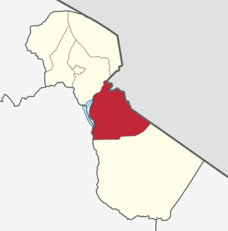
Biharamulo District is one of the eight districts of the Kagera Region of Tanzania. It is bordered to the north by Karagwe District and Muleba District, to the east and south by Geita Region, to the west by Ngara District, and to the southwest by the Kigoma Region. Its administrative seat is Biharamulo town. Biharamulo Game Reserve is located within the borders of the district.
Mwanga is one of the seven districts of the Kilimanjaro Region of Tanzania. The district covers an area of 1,831 km2 (707 sq mi), It is bordered to the northeast by Kenya, to the northwest by the Moshi Rural District, to the southwest by Simanjiro District of Manyara Region, and to the south by the Same District. Its administrative seat is the town of Mwanga. The tallest peak in the district is Kindoroko at 2,100m in the North Pare Mountains that are located entirely within the district. According to the 2012 Tanzania National Census, the population of Mwanga District was 131,442.
Olbalbal is an administrative ward in the Ngorongoro District of the Arusha Region of Tanzania. The ward is home to the famous Olduvai Gorge. The ward covers an area of 7.893 square kilometres (3.048 sq mi) with an average elevation of 1,405 metres (4,610 ft).
Bangata is an administrative ward in the Arusha Rural District of the Arusha Region of Tanzania. According to the 2012 census, the ward has a total population of 9,136.
Bwawani is an administrative ward in the Arusha Rural District of the Arusha Region of Tanzania. According to the 2012 census, the ward has a total population of 11,117.
Ilkiding'a is an administrative ward in the Arumeru district of the Arusha Region of Tanzania. Ikiding'a means a gathering place in Masai language. According to the 2012 census, the ward has a total population of 10,850.
Kiranyi is an administrative ward in the Arusha Rural District of the Arusha Region of Tanzania. According to the 2012 census, the ward has a total population of 25,469.
Oljoro is an administrative ward in the Arusha Rural District of the Arusha Region of Tanzania. The ward is home to Mungu Crater which is 1,030 meters deep. According to the 2002 census, the ward has a total population of 7,896
Olkokola is an administrative ward in the Arusha Rural District of the Arusha Region of Tanzania. According to the 2012 census, the ward has a total population of 24,728.
Oltrumet is an administrative ward in the Arusha District of the Arusha Region of Tanzania. The name of the ward is from a Maasai word meaning a place of grazing. According to the 2012 census, the ward has a total population of 10,226.
Engutoto is an administrative ward in the Arusha District of the Arusha Region of Tanzania. Meaning the hidden place in Maasai. According to the 2012 census, the ward has a total population of 7,426.
Buger is an administrative ward in the Karatu district of the Arusha Region of Tanzania. According to the 2012 census, the ward has a total population of 9,919.
Daa is an administrative ward in the Karatu district of the Arusha Region of Tanzania. According to the 2012 census, the ward has a total population of 9,868.
Daraja Mbili is an administrative ward in the Arusha District of the Arusha Region of Tanzania. According to the 2012 census, the ward has a total population of 19,491.
Kaloleni is an administrative ward in the Arusha District of the Arusha Region of Tanzania. According to the 2012 census, the ward has a total population of 9,591.
Sokon I is an administrative ward in the Arusha District of the Arusha Region of Tanzania. According to the 2012 census, the ward has a total population of 73,331.
Unga Limited is an administrative ward in the Arusha District of the Arusha Region of Tanzania. According to the 2012 census, the ward has a total population of 17,342.
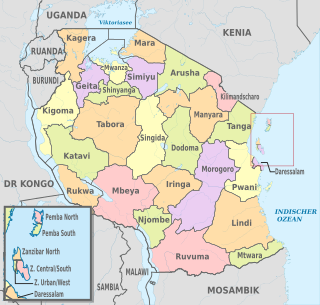
The administrative divisions of Tanzania are controlled by Part I, Article 2.2 of the Constitution of Tanzania. Tanzania is divided into thirty-one regions. Each region is subdivided into districts. The districts are sub-divided into divisions and further into local wards. Wards are further subdivided for management purposes: for urban wards into streets and for rural wards into villages. The villages may be further subdivided into hamlets.

Mafia is one of the 6 districts of the Pwani Region of Tanzania. It covers Mafia Island and its associated archipelago.
Buhanda is an administrative ward in Kigoma-Ujiji District of Kigoma Region in Tanzania. The ward covers an area of 5.5 km2 (2.1 sq mi), and has an average elevation of 864 m (2,835 ft). In 2016 the Tanzania National Bureau of Statistics report there were 8,397 people in the ward, from 7,629 in 2012.
