
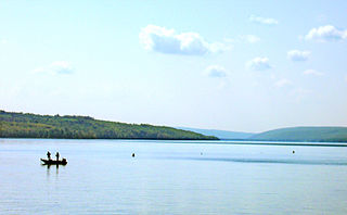
Chautauqua Lake is located entirely within Chautauqua County, New York, United States. The lake is approximately 17 miles (27 km) long and two miles (3.2 km) wide at its greatest width. The surface area is approximately 13,000 acres (53 km2). The maximum depth is about 78 feet (24 m). The shoreline is about 41.1 miles (66 km) of which all but 2.6 mi (4 km) are privately owned.
Owasco Lake is the sixth largest and third easternmost of the Finger Lakes of New York in the United States.
Conesus Lake is located in Livingston County, New York. Conesus Lake is the westernmost of New York's eleven Finger Lakes. It is located off Interstate 390 about 15 miles (24 km) south of Interstate 90.

Canadarago Lake is a 1,917-acre (7.76 km2) lake located in Otsego County, New York and is the source of Oaks Creek. The Village of Richfield Springs is located at the lake's northern end. It is the second largest lake in Otsego County, lying to the west of and parallel to the larger Otsego Lake. The lake's name is also spelled "Candajarago Lake" or "Caniadaraga Lake".
Squam Lake is a lake located in the Lakes Region of central New Hampshire, United States, south of the White Mountains, straddling the borders of Grafton, Carroll, and Belknap counties. The largest town center on the lake is Holderness. The lake is located northwest of much larger Lake Winnipesaukee.

Maurice K. Goddard State Park is a 2,856-acre (1,156 ha) Pennsylvania state park in Deer Creek, Mill Creek, New Vernon and Sandy Lake Townships, Mercer County, Pennsylvania in the United States. It features wildlife, waterways and public recreational facilities. Lake Wilhelm shares its shorelines with Maurice K. Goddard State Park and State Game Land No. 270. The dam, built in 1971, creates a 1,860-acre (750 ha) reservoir providing a resource for people and wildlife. Many species of fish and amphibians make Lake Wilhelm their home. A variety of outdoor activities are available in and around the park vicinity. Special events and programs are held throughout the summer months. Maurice K. Goddard State Park is just off exit 130 of Interstate 79 on Pennsylvania Route 358.
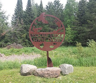
Moose Lake State Park is a state park of Minnesota, USA, near the city of Moose Lake, MN in Carlton County. The park is located one-half mile east of Interstate 35 at the 214 exit. The park entrance is off of County Highway 137. Moose Lake State Park was established in 1971. In total, the park is 1,194 acres in area. Some of the highlights of the park include 5.5 miles of hiking trails, a 105-acre Echo Lake, wildlife pond, paved trail to Moose Lake and Willard Munger State Trail, and Agate/Geological Interpretive Center; located within the park office.

Grafton Pond is a 319-acre (1.3 km2) water body located in Grafton County in western New Hampshire, United States, in the town of Grafton. The pond is part of the Mascoma River watershed, flowing to the Connecticut River. Outflow from the pond travels through Bicknell Brook to Crystal Lake in Enfield, then north to the Mascoma River in West Canaan.
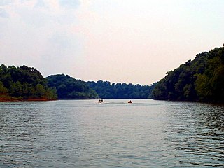
The Rough River Lake is a Y-shaped reservoir located in Breckinridge, Hardin, and Grayson counties in Kentucky, United States, about 70 miles southwest of Louisville. This lake was created by the building of a dam, begun in 1955 and completed in 1961, 89.3 miles (143.7 km) above the connection between the Rough River and the Green River. The land and water, along with the wildlife, fisheries, and recreational activities, are all managed under the cooperation of the U.S. Army Corps of Engineers and the Commonwealth of Kentucky. A primary attraction is Rough River Dam State Resort Park.

Silver Springs State Fish and Wildlife Area is an Illinois state park on 1,350 acres (550 ha) in Kendall County, Illinois, United States. The park was established in the late 1960s and is named for the natural spring within its boundaries. The park has two artificial lakes and the Fox River flows through the northern end of the park. Silver Springs hosts a variety of activities including fishing, hunting, boating and hiking. The park has areas of native prairie restoration, a sledding hill and a seven-mile (11 km) equestrian trail. The prairie restoration areas hold many species of plants including lead plant, and purple coneflower.

The Prineville Reservoir is in the high desert hills of Central Oregon, Oregon, United States. The reservoir is on the Crooked River 14 miles (22.5 km) southeast of Prineville, and 29 miles (46.7 km) east of Bend. This reservoir is a popular retreat for most of Central Oregon. It is near the geographic center of Oregon. Prineville Reservoir State Park is managed by the Oregon Parks and Recreation Department.

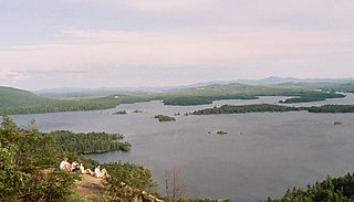
Blue Mountain Lake is a 1,334-acre (540 ha) lake in Hamilton County, New York, in the central Adirondacks. Blue Mountain Lake is the eastern end of the Eckford chain of lakes. It is located west of Blue Mountain. The hamlet of Blue Mountain Lake lies on its southeastern shore and the Adirondack Museum looks down from high above its eastern shore. It has been a popular vacation destination since the mid-19th century.

Indian Lake is a 12-mile (19 km) long, 4,255-acre (1,722 ha) reservoir with a southwest to northeast orientation in the towns of Indian Lake and Lake Pleasant in Hamilton County, in the Adirondack Park of New York State, in the United States. The hamlet of Indian Lake is located 2 miles (3.2 km) north of the north end of Indian Lake. New York State Route 30 runs along the west shore of the lake. Most of the shore is part of the Forest Preserve. Indian Lake is fed by the Jessup River, and drains through the Indian River into Lake Abanakee, and from there through the Indian River to the Hudson River.

Eisenhower State Park is a state park located in Grayson County, Texas, northwest of Denison, Texas on the shores of Lake Texoma. The park is 423.1 acres (171 ha).

Saratoga Lake is in the eastern part of Saratoga County, New York. The lake is approximately 4.5 miles (7.2 km) long, about 1.5 miles (2.4 km) wide at its widest point, and about 95 feet (29 m) deep.

Willard Pond is a small, protected lake in Antrim, New Hampshire, United States. The lake, located in southwestern New Hampshire, is about 108 acres (44 ha) in size with an average depth of 25 feet (7.6 m) and a maximum depth of 58 feet (18 m). No petroleum motors are allowed, and fly fishing is the only form of fishing allowed. It is part of the dePierrefeu Wildlife Sanctuary, which is owned by the New Hampshire Audubon Society. Because the pond and the land around it are part of the sanctuary, the shore is unable to be developed. Therefore, there are no buildings around the pond and there won't be any in the foreseeable future. Willard is instead surrounded by extensive amounts of wilderness and hiking trails that lead around the pond and to the summits of Bald Mountain and Goodhue Hill. Willard is a popular fishing, boating and hiking destination, and it has become more popular with its mention in numerous magazines and newspapers.
East Caroga Lake is located in the Town of Caroga by Caroga Lake, New York. The lake provides excellent warm water fishing and rainbow trout fishing. The lake is connected to West Caroga Lake by a small channel. Origin of the name, "Caroga" is derived from the once nearby Indian Village known as "Caroga".
Stillwater Reservoir is a man-made lake located by Beaver River, New York within the Western Adirondacks. The lake has a large amount of recreational uses including camping, canoeing, boating, fishing, hunting, snowmobiling, and cross-country skiing. The lake has undeveloped edges with remote camping on both the islands and the shoreline. Camping permits and lake information may be obtained from the hamlet of Stillwater at the Forest Ranger Headquarters. Fish species present in the reservoir are smallmouth bass, splake, rock bass, yellow perch, sunfish and brown trout. There is a state owned hard surface ramp on Stillwater Road, 28 miles east of Lowville, New York. the record low temperature for the state of New York of −52 °F (−47 °C) took place at Stillwater Reservoir, and was later tied by Old Forge on February 17, 1979.
Fall Lake is located north of Piseco, New York. Fish species present in the lake are rock bass, white sucker, black bullhead, smallmouth bass, yellow perch, and pickerel. There is carry down access on Fall Stream off Old Piseco Road on land owned by the Irondequoit Club.
Loon Lake is located near Cohocton, New York. Fish species present in the lake include largemouth bass, yellow perch, black bullhead, cisco, rock bass, smallmouth bass, pickerel, brown bullhead, and pumpkinseed sunfish. There is access for fee via boat launch on the west shore off Laf Alot Road. You can also access it by going down Faki Road and getting a paid boat.

