
Avera is a city in Jefferson County, Georgia, United States. As of the 2010 census, the city had a population of 246.

Grambling is a city in Lincoln Parish, Louisiana, United States. The population was 4,949 at the 2010 census. The city is home to Grambling State University and is part of the Ruston Micropolitan Statistical Area.

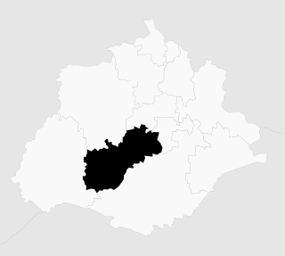
Cuautitlán Izcalli is a city and municipality in the north of State of Mexico, Mexico. The name comes from Náhuatl and means 'your house among the trees.'

Cuautitlán is a city and municipality in the State of Mexico, just north of the northern tip of the Federal District within the Greater Mexico City urban area. The city has engulfed most of the municipality, making the two synonymous. The name comes from Nahuatl and means 'between the trees.'

Coacalco de Berriozábal is a city and municipality in the State of Mexico, Mexico. The municipality lies in the Greater Mexico City conurbation, north of Mexico City. The municipal seat is San Francisco Coacalco and the municipality is named after Felipe Berriozábal (1829–1900), a Mexican politician and military leader.

Laredo–Nuevo Laredo is one of six transborder agglomerations along the U.S.-Mexican border. The city of Laredo is situated in the U.S. state of Texas on the northern bank of the Rio Grande and Nuevo Laredo is located in the Mexican State of Tamaulipas in the southern bank of the river. This area is also known as the Two Laredos or the Laredo Borderplex. The area is made up of one county: Webb County in Texas and three municipalities: Nuevo Laredo Municipality in Tamaulipas, Hidalgo Municipality in Coahuila, Anáhuac Municipality in Nuevo León in Mexico. Two urban areas: the Laredo Metropolitan Statistical Area and the Zona Metropolitana Nuevo Laredo three cities and 12 towns make the Laredo–Nuevo Laredo Metropolitan area which has a total of 636,516 inhabitants according to the INEGI Census of 2010 and the United States Census estimate of 2010. The Laredo–Nuevo Laredo is connected by four International Bridges and an International Railway Bridge. According to World Gazetteer this urban agglomeration ranked 157th largest in North and South America in 2010 with an estimated population of 775,481. This area ranks 66th in the United States and 23rd in Mexico.

El Campanario y Oradel is a community located in Oradel Industrial Center, Nuevo Laredo Municipality in the Mexican state of Tamaulipas. Its elevation is 140 meters above sea level. According to the INEGI Census of 2010, El Campanario y Oradel has a population of 6,951 inhabitants, 3488 of them are male and 3463 of them are female. In this town there are 1796 family homes. The main work activity of this community is to work in the companies located within the Oradel Industrial Center. In the El Campanario and Villas Oradel is the Technological University of Nuevo Laredo, as well as an IMSS nursery. This community has 2 soccer fields, one where the Villas de Oradel league is held.
Álvarez, Tamaulipas is a community located in the Nuevo Laredo Municipality in the Mexican state of Tamaulipas. According to the INEGI Census of 2010, Álvarez has a population of 1,714 inhabitants. Its elevation is 141 meters above sea level.
Nuevo Progreso, Tamaulipas also known as El Progreso is a community located in Nuevo Laredo Municipality in the Mexican state of Tamaulipas. According to the INEGI Census of 2010, El Progreso has a population of 432 inhabitants. Its elevation is 150 meters above sea level.
América is a community located in Nuevo Laredo. According to the INEGI Census of 2010, América has a population of 255 inhabitants. Its elevation is 140 meters above sea level.
América is a community located in Nuevo Laredo Municipality in the Mexican state of Tamaulipas. According to the INEGI Census of 2010, América has a population of 197 inhabitants. Its elevation is 135 meters above sea level. It is the second locality of the same name in the municipality, the other is América, which lies just to the west, across Mexican Federal Highway 85.
La Cruz is a community located in Nuevo Laredo Municipality in the Mexican state of Tamaulipas. According to the INEGI Census of 2010, La Cruz has a population of 159 inhabitants. Its elevation is 132 meters above sea level.
Zumpuhuacán is a municipality in the State of Mexico. Its municipal seat is also called Zumpahuacán: The area was settled by Mexicas in 1220.

Ciudad Miguel Alemán, known prior to 1950 as San Pedro de Roma, is a city in the Mexican state of Tamaulipas, located across the Rio Grande from the U.S. city of Roma, Texas. The two are linked by the Roma – Ciudad Miguel Alemán International Bridge, a suspension bridge. As of 2010, the population of the city was 19,997. The total population of the surrounding municipality was 27,015.
Jesús María is a municipality in the Mexican state of Aguascalientes. It stands at 21°58′N102°21′W. As of 2010, the municipality had a total population of 99,590.

Ajacuba is a town and one of the 84 municipalities of Hidalgo, in central Mexico. The municipality covers an area of 192.7 km².
San Agustín Tlaxiaca is a town and one of the 84 municipalities of Hidalgo, in central-eastern Mexico. The municipality covers an area of 354.6 km².

Ocoyoacac is a town and municipality in the State of Mexico in Mexico. The municipality covers an area of 134.71 km². It is one of the 17 municipalities that border Mexico City. It borders the Distrito Federal's western borough of Cuajimalpa.
La Esperanza is a community located in Nuevo Laredo Municipality in the Mexican state of Tamaulipas. According to the INEGI Census of 2010, La Esperanza has a population of 69 inhabitants, 39 males and 30 females. Its elevation is 164 meters above sea level.
Muir is a census-designated place located in Porter Township, Schuylkill County in the state of Pennsylvania. Muir was part of the Reinerton-Orwin-Muir CDP at the 2000 census before splitting into three individual CDPs for the 2010 census. The other communities, along with Muir are Reinerton and Orwin. The community is located near the borough of Tower City along U.S. Route 209. As of the 2010 census the population was 451 residents.

