McHenry is a city in McHenry County, Illinois, United States. It is located about 50 miles northwest of Chicago. Per the 2020 census, the population was 27,135. McHenry was at one time the county seat of McHenry County, which once included adjoining Lake County to the east. McHenry took its name from the county, which was named for Major William McHenry, a prominent US Army officer in the Black Hawk War.

The Fox River is a river in eastern Wisconsin in the Great Lakes region of the United States. It is the principal tributary of Green Bay, and via the Bay, the largest tributary of Lake Michigan. The city of Green Bay, one of the first European settlements in the interior of North America, is on the river at its mouth on lower Green Bay.

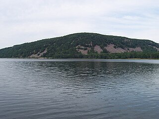
Devil's Lake State Park is a state park located in the Baraboo Range in eastern Sauk County, just south of Baraboo, Wisconsin. It is around thirty-five miles northwest of Madison, and is on the western edge of the last ice-sheet deposited during the Wisconsin glaciation. The state park encompasses 9,217 acres (3,730 ha), making it the largest in Wisconsin. The state park is known for its 500-foot-high (150 m) quartzite bluffs along the 360-acre (150 ha) Devil's Lake, which was created by a glacier depositing terminal moraines that plugged the north and south ends of the gap in the bluffs during the last ice age approximately 12,000 years ago. The sand at the bottom of Devil's Lake is thought to be deposited by glaciers.

Devil's Lake is a lake in the South Range of the Baraboo Range, about two miles south of Baraboo, Wisconsin, in Sauk County, Wisconsin, United States. It has no surface outlets, so by some definitions, it is endorheic; however, it possibly drains by underground channels into the Baraboo River, which would make the lake cryptorheic. The lake is one of the primary attractions of Devil's Lake State Park. It is also a popular recreation destination for watercraft, fishing, hiking, and climbing.
Mazo Beach is the colloquial name for Mazomanie Bottoms State Natural Area, located in Sauk County in the U.S. state of Wisconsin. Property along the river was acquired in parcels by the State of Wisconsin since the 1950s to provide a full range of nature based activities including hiking, wildlife viewing, hunting, fishing, and wildlife habitat. Since 1978, the beach and surrounding nature preserve have attracted picnickers and swimming day-trippers to its open and expansive shoreline.

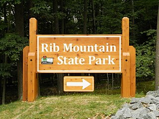
Rib Mountain State Park is a 1,528-acre (618 ha) Wisconsin state park near the city of Wausau. The park includes a ski resort, Granite Peak Ski Area, concession stand, picnic areas, a reservable amphitheater, a former quarry, observation tower, and 15.1 miles of trails. The park is ten miles (16 km) north-northwest of Central Wisconsin Airport.

Wyalusing State Park is a 2,628-acre (1,064 ha) Wisconsin state park at the confluence of the Mississippi and Wisconsin rivers in the village Bagley, just south of Prairie du Chien.

Whitefish Dunes State Park is a 867-acre (351 ha) state park of Wisconsin on the eastern shore of the Door Peninsula. This day-use park preserves the most substantial sand dunes on the western shore of Lake Michigan. The remains of eight successive prehistoric Native American villages are on the National Register of Historic Places as Whitefish Dunes-Bay View Site. Cave Point County Park is an enclave inside the state park, allowing visitors free foot access to the state park by the shoreline trail connecting the parks.

Wildcat Mountain State Park is a state park of Wisconsin, United States, on the Kickapoo River in the Driftless Area. Sandstone bluffs topped with limestone, two of which are Wildcat Mountain and Mount Pisgah, provide views over the narrow valley of the river and its tributaries. The Kickapoo Valley Reserve is immediately adjacent and forms a continuous protected area. Wildcat Mountain State Park is open for year-round recreation including hiking, canoeing, fishing, and cross-country skiing. The 3,643-acre (1,474 ha) park is located in Vernon County near the town of Ontario, Wisconsin.

Mirror Lake State Park is a 2,179-acre (882 ha) Wisconsin state park in the Wisconsin Dells region. The process of establishing the park began in 1962 and the park officially opened on August 19, 1966. It contains Mirror Lake, a narrow reservoir with steep sandstone sides up to 50 feet (15 m) tall. The lake has a surface area of 137 acres (55 ha) and an average depth of 10 to 14 feet. Recessed out of the wind, the water of Mirror Lake is usually calm and often as glassy-smooth as a mirror, hence the name. Situated in a major tourist area, the state park has an extensive campground and other visitor amenities. Also located within the park is the Seth Peterson Cottage, a Frank Lloyd Wright-designed building available for public rental.

Backbone State Park is Iowa's oldest state park, dedicated in 1919. Located in the valley of the Maquoketa River, it is approximately three miles (5 km) south of Strawberry Point in Delaware County. It is named for a narrow and steep ridge of bedrock carved by a loop of the Maquoketa River originally known as the Devil's Backbone. The initial 1,200 acres (490 ha) were donated by E.M. Carr of Lamont, Iowa. Backbone Lake Dam, a relatively low dam built by the Civilian Conservation Corps (CCC) in the 1930s, created Backbone Lake. The CCC constructed a majority of trails and buildings which make up the park.

Patapsco Valley State Park is a Maryland state park extending along 32 miles (51 km) of the Patapsco River south and west of the city of Baltimore, Maryland. The park encompasses multiple developed areas on over 14,000 acres (5,700 ha) acres of land, making it Maryland's largest state park. In 2006, it was officially celebrated as Maryland's first state park, its first formation being in 1906. Patapsco Valley State Park is managed by the Maryland Department of Natural Resources.

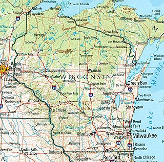
Wisconsin, a state in the Midwestern United States, has a vast and diverse geography famous for its landforms created by glaciers during the Wisconsin glaciation 17,000 years ago. The state can be generally divided into five geographic regions—Lake Superior Lowland, Northern Highland, Central Plain, Eastern Ridges & Lowlands, and Western Upland. The southwestern part of the state, which was not covered by glaciers during the most recent ice age, is known as the Driftless Area. The Wisconsin glaciation formed the Wisconsin Dells, Devil's Lake, and the Baraboo Range. A number of areas are protected in the state, including Devil's Lake State Park, the Apostle Islands National Lakeshore, and the Chequamegon–Nicolet National Forest.
Heritage Hill State Historical Park, is a 56-acre open-air museum located in Allouez, Wisconsin. A Wisconsin state park, the site is operated by a non-profit organization called the Heritage Hill Corporation in partnership with the Wisconsin Department of Natural Resources (DNR). The Heritage Hill Corporation operates, maintains and develops the park under terms of a lease with the DNR.

Kohler-Andrae State Park comprises two adjacent Wisconsin state parks located in the Town of Wilson, a few miles south of the city of Sheboygan. They are managed as one unit. Terry Andrae State Park, established in 1927, and John Michael Kohler State Park, established in 1966, total 988 acres (4.00 km2). The parks contain over two miles (3 km) of beaches and sand dunes along the shore of Lake Michigan, with woods and wetlands away from the water. The Black River flows through the parks.

Potawatomi State Park is a 1,225-acre (496 ha) Wisconsin state park northwest of the city of Sturgeon Bay, Wisconsin in the Town of Nasewaupee. It is located in Door County along Sturgeon Bay, a bay within the bay of Green Bay. Potawatomi State Park was established in 1928.
Roaring River State Park is a public recreation area covering of 4,294 acres (1,738 ha) eight miles (13 km) south of Cassville in Barry County, Missouri. The state park offers trout fishing on the Roaring River, hiking on seven different trails, and the seasonally open Ozark Chinquapin Nature Center.

Pattison State Park is a 1,436-acre (581 ha) Wisconsin state park south of Superior, Wisconsin. Situated on the Black River, the park contains both Big Manitou Falls, the highest waterfall in Wisconsin at 165 feet (50 m), and Little Manitou Falls, which is 30 feet (9.1 m). Pattison State Park was established in 1920.

Eleazer Williams was a Canadian-American clergyman and missionary of Mohawk descent. In later years he claimed that he was the French "Lost Dauphin" and was a pretender to the throne of France.
Menominee River State Recreation Area is a state-managed protected area located in Breitung and Norway townships in Dickinson County and Faithorn Township in Menominee County, Michigan, southeast of Iron Mountain. It is 2,354 acres (953 ha) in area and is currently undeveloped. The park comprises a 145.35-acre (58.82 ha) tract along 1.5 miles (2.4 km) of the Menominee River south of the City of Norway and the 2,208.83-acre (893.88 ha) Quiver Falls Tract along eight miles (13 km) of the river farther downstream. In 2016, an additional 525-acre (212 ha) of Escanaba State Forest land was transferred from the Forestry Division to the DNR's Parks and Recreation Division and became the Pemene Falls Unit of the park, matching a similarly named unit on the Wisconsin side of the river.


