
The Lower Rhine Plain [1] (German: Niederrheinisches Tiefland) is one of the natural regions of Germany and lies on either side of the Rhine north of the city of Düsseldorf.

The Lower Rhine Plain [1] (German: Niederrheinisches Tiefland) is one of the natural regions of Germany and lies on either side of the Rhine north of the city of Düsseldorf.
The Lower Rhine Plain is bordered in the south by the Lower Rhine Bay and Cologne Lowland, in the southeast by the Bergisches Land, to the east and northeast by the Westphalian Basin and in the west by the Netherlands.
The Lower Rhine Plain is an extensively terraced landscape. The otherwise level terraces are interrupted by various features like the V-shaped valleys, flood plains, old river courses or the terminal moraine ridges of the Lower Rhine Heights. The height of the terrain is under 100m above NN almost everywhere.
The Lower Rhine Plain is the northern half of the geological structure known as the Lower Rhine Bay (Niederrheinische Bucht). Its geology was probably a result of deposition in the last 30 million years, which has given rise to sediments and layers of sedimentary rock in this plain up to 1,300 m thick.
Annual precipitation in the area is between 700 and 750mm and the average annual temperature is between 9.5 and 10.5 °C. The area benefits from a 'North Atlantic' climate with mild winters and a long growing season.

Canada has a vast geography that occupies much of the continent of North America, sharing a land border with the contiguous United States to the south and the U.S. state of Alaska to the northwest. Canada stretches from the Atlantic Ocean in the east to the Pacific Ocean in the west; to the north lies the Arctic Ocean. Greenland is to the northeast with a shared border on Hans Island. To the southeast Canada shares a maritime boundary with France's overseas collectivity of Saint Pierre and Miquelon, the last vestige of New France. By total area, Canada is the second-largest country in the world, after Russia. By land area alone, however, Canada ranks fourth, the difference being due to it having the world's largest proportion of fresh water lakes. Of Canada's thirteen provinces and territories, only two are landlocked while the other eleven all directly border one of three oceans.
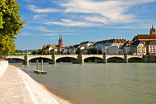
The Rhine is one of the major European rivers. The river begins in the Swiss canton of Graubünden in the southeastern Swiss Alps. It forms the Swiss-Liechtenstein border and partly the Swiss-Austrian and Swiss-German borders. After that the Rhine defines much of the Franco-German border, after which it flows in a mostly northerly direction through the German Rhineland. Finally in Germany, the Rhine turns into a predominantly westerly direction and flows into the Netherlands where it eventually empties into the North Sea. It drains an area of 9,973 km2.

The geography of Switzerland features a mountainous and landlocked country located in Western and Central Europe. Switzerland's natural landscape is marked by its numerous lakes and mountains. It is surrounded by five countries: Austria and Liechtenstein to the east, France to the west, Italy to the south and Germany to the north. Switzerland has a maximum north–south length of 220 kilometres (140 mi) and an east–west length of about 350 kilometres (220 mi).

Düsseldorf is one of the five Regierungsbezirke of North Rhine-Westphalia, Germany, located in the north-west of the country. It covers the western part of the Ruhr Area, as well as the Niederrheinische Tiefebene, the lower Rhine area. It is the most populated of all German administrative areas of the kind. It is the only area in Germany where the traditional dialects are Low Franconian, rather than Low German or High German.
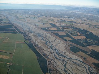
An alluvial plain is a plain created by the deposition of sediment over a long period by one or more rivers coming from highland regions, from which alluvial soil forms. A floodplain is part of the process, being the smaller area over which the rivers flood at a particular time. In contrast, the alluvial plain is the larger area representing the region over which the floodplains have shifted over geological time.

The Swiss Plateau or Central Plateau is one of the three major landscapes in Switzerland, lying between the Jura Mountains and the Swiss Alps. It covers about 30% of the Swiss surface area, and is partly flat but mostly hilly. The average height is between 400 metres (1,300 ft) and 700 metres (2,300 ft) AMSL. It is by far the most densely populated region of Switzerland, the center of economy and important transportation.

The Kaiserstuhl is a range of hills in the state of Baden-Württemberg in southwest Germany with a maximum height of 556.6 metres (1,826 ft). It is of volcanic origin and located in the southwest of the state in the counties of Emmendingen and Breisgau-Hochschwarzwald. In terms of natural regions it is considered to be a part of the Upper Rhine Plain.

Lower Rhine refers to the section of the Rhine between Bonn in Germany and the North Sea at Hook of Holland in the Netherlands, including the Nederrijn within the Rhine–Meuse–Scheldt delta; alternatively, Lower Rhine may also refer to just the part upstream of Pannerdens Kop, excluding the Nederrijn.
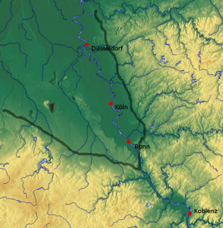
The Cologne Lowland, also called the Cologne Bay or, less commonly, the Cologne Bight, is a densely populated area of Germany lying between the cities of Bonn, Aachen, and Düsseldorf/Neuss. It is situated in the southwest of the state of North Rhine-Westphalia and forms the natural southern conclusion of the Lower Rhenish lowlands and the transition to the Rhenish Massif.
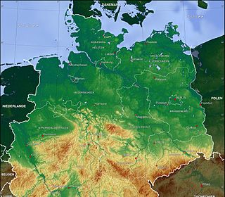
The North German Plain or Northern Lowland is one of the major geographical regions of Germany. It is the German part of the North European Plain. The region is bounded by the coasts of the North Sea and the Baltic Sea to the north, Germany's Central Uplands to the south, by the Netherlands to the west and Poland to the east.
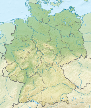
Germany is a country in Central and Western Europe that stretches from the Alps, across the North European Plain to the North Sea and the Baltic Sea. It is the second-most populous country in Europe after Russia, and is seventh-largest country by area in the continent. The area of Germany ranked 63rd and covers 357,600 km2 (138,070 sq mi), consisting of 349,250 km2 (134,846 sq mi) of land and 8,350 km2 (3,224 sq mi) of waters, smaller than Japan but larger than Republic of the Congo.

This division of Germany into major natural regions takes account primarily of geomorphological, geological, hydrological, and pedological criteria in order to divide the country into large, physical units with a common geographical basis. Political boundaries play no part in this, apart from defining the national border.
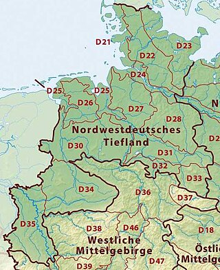
The Westphalian Lowland, also known as the Westphalian Basin is a flat landscape that mainly lies within the German region of Westphalia, although small areas also fall within North Rhine and in Lower Saxony. Together with the neighbouring Lower Rhine Plain to the west, it represents the second most southerly region of the North German Plain, after the Cologne Bight. It is variously known in German as the Westfälische Bucht, the Münsterländer or Westfälische Tieflands- or Flachlandsbucht.
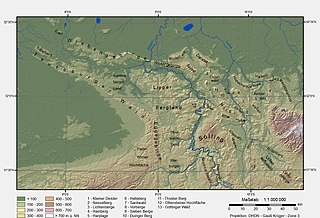
The Lower Saxon Hills are one of the 73 natural regions in Germany defined by the Federal Agency for Nature Conservation (BfN). Geographically it covers roughly the same area as the Weser Uplands in its wider sense.

The West Hesse Depression is part of the West Hesse Highlands and Lowlands region in the north of the German state of Hesse. Like the East Hesse Depression, it is a series of separate depressions that form a natural corridor and have been an important historical trade route.

The South German Scarplands is a geological and geomorphological natural region or landscape in Switzerland and the south German states of Bavaria and Baden-Württemberg. The landscape is characterised by escarpments.
The Klever Reichswald is an Imperial forest in North Rhine-Westphalia, Germany, between the rivers Rhine and Meuse at the German–Dutch border. The forest is located in the municipal territory of Kleve, Goch, Kranenburg and Bedburg-Hau. It is the largest coherent wooded area of the lower Rhine and the largest coherent public state forest of North Rhine-Westphalia with an area of 51 km2.

The Lower Germanic Limes is the former frontier between the Roman province of Germania Inferior and Germania Magna. The Lower Germanic Limes separated that part of the Rhineland left of the Rhine as well as the southern part of the Netherlands, which was part of the Roman Empire, from the less tightly controlled regions east of the Rhine.

The Lower Rhine Bay, sometimes called the Lower Rhine Bight, is a lowland plain in the German state of North Rhine-Westphalia that cuts into the Rhenish Massif. From a natural region perspective it is a major unit group which includes the Cologne Lowland around the city of Cologne as well as the land lying to the west and, in a clearly narrower strip of land, to the east of the central Cologne plain. That said, the term "Cologne Bay" or "Cologne Bight" is occasionally used, pars pro toto, for the entire region.

The is a large volcanic mountain range in the German Central Uplands in the state of Hesse, separated from the Rhön Mountains by the Fulda river valley. Emerging approximately 19 million years ago, the Vogelsberg is Central Europe's largest basalt formation, consisting of a multitude of layers that descend from their peak in ring-shaped terraces to the base.