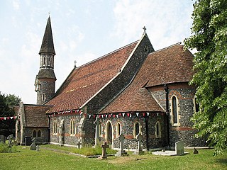
Sawbridgeworth is a town and civil parish in Hertfordshire, England, close to the border with Essex. It is 12 miles (19 km) east of Hertford and 9 miles (14 km) north of Epping. It is the northernmost part of the Greater London Built-up Area.

The Stort Navigation is the canalised section of the River Stort running 22 kilometres (14 mi) from the town of Bishop's Stortford, Hertfordshire, downstream to its confluence with the Lee Navigation at Feildes Weir near Rye House, Hoddesdon, Hertfordshire.

Little Hallingbury is a small village and a civil parish in the Uttlesford district of Essex, England.

Sawbridgeworth Town Football Club is an English football club based in Sawbridgeworth, Hertfordshire. The club are currently members of the Essex Senior League and play at Crofters End.

The Essex Olympian Football League is a football competition based in England, founded in the 1966–67 season. It has a total of six senior divisions and one under 21 division. The Premier Division sits at step 7 of the National League System and it is a feeder to Division One South of the Eastern Counties Football League. Between 1986 and 2005, the league was known as the Essex Intermediate League.

Sawbridgeworth railway station is on the West Anglia Main Line serving the town of Sawbridgeworth in Hertfordshire, England. It is 26 miles 57 chains (43.0 km) down the line from London Liverpool Street and is situated between Harlow Mill and Bishop's Stortford stations. Its three-letter station code is SAW.

Sheering is a civil parish and village in the Epping Forest district of Essex, England. Sheering village is situated 2.8 miles (5 km) north-east from Harlow, 4.5 miles (7 km) south of Bishop's Stortford and 25 miles (40 km) north-east from London. The Stort Navigation to the west has a lock at Sheering Mill. Lower Sheering, adjacent to Sawbridgeworth in Hertfordshire and its railway station, forms part of the civil parish.
Sawbridgeworth Cricket Club is a cricket club located in Sawbridgeworth, Hertfordshire, England.

Hatfield Heath is a village, civil parish, and an electoral ward in the Uttlesford district of Essex, England, and at its west is close to the border with Hertfordshire. In close proximity are the towns of Bishop's Stortford and Sawbridgeworth. Stansted Airport is approximately 5 miles (8 km) to the north.

High Wych is a village and civil parish in the East Hertfordshire district of Hertfordshire, England. The village is located a little over one mile south-west of the town of Sawbridgeworth, and around three miles north-east of Harlow in the neighbouring county of Essex.

Sawbridgeworth Marsh is a 6.3-hectare (16-acre) biological Site of Special Scientific Interest (SSSI) near Sawbridgeworth in Hertfordshire, apart from a small area in the north which is in Essex. It is managed by the Essex Wildlife Trust. The planning authorities are East Hertfordshire District Council and Uttlesford District Council.
The 2015–16 season was the 45th in the history of Essex Senior Football League, a football competition in England.

Pincey Brook is a watercourse in the Uttlesford and Epping Forest districts of Essex, England, and is a tributary to the River Stort.
The 2020–21 season was the 50th in the history of the Essex Senior Football League, a football competition in England.
The 2000–01 season was the 30th in the history of Essex Senior Football League a football competition in England.
The 1983–84 season was the 13th in the history of Essex Senior Football League, a football competition in England.
The 1976–77 season was the sixth in the history of Essex Senior Football League, a football competition in England.
The 2022–23 season was the 52nd in the history of the Essex Senior Football League, a football competition in England.

The Three Forests Way is a long-distance footpath in Essex and Hertfordshire, England. The 59-mile (95 km) circular path passes through three forests in west Essex. It is waymarked, and named on Ordnance Survey mapping.

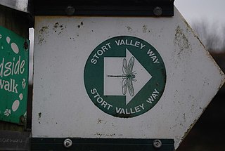
The Stort Valley Way is a long-distance footpath in west Essex, England. The 30-mile circular path is centred on Harlow and the Stort Navigation. It is waymarked, and named on Ordnance Survey mapping.
This page is based on this
Wikipedia article Text is available under the
CC BY-SA 4.0 license; additional terms may apply.
Images, videos and audio are available under their respective licenses.


