Loxstedt

Last updated

Loxstedt
Loxstedt (German)
Lox (Low Saxon)
Wappen Loxstedt.png
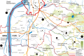
Location of Loxstedt within Cuxhaven district
Loxstedt in CUX.svgBokelSteinauWannaNeuenkirchenLangenMidlumCappelOberndorfNeuhaus
Germany adm location map.svg
Red pog.svg
Loxstedt
Lower Saxony location map.svg
Red pog.svg
Loxstedt
Coordinates: 53°28′N08°39′E / 53.467°N 8.650°E / 53.467; 8.650 Coordinates: 53°28′N08°39′E / 53.467°N 8.650°E / 53.467; 8.650
Country Germany
State Lower Saxony
District Cuxhaven
Government
   Mayor (202126) Detlef Wellbrock [1] (Ind.)
Area
  Total141.24 km2 (54.53 sq mi)
Elevation
1 m (3 ft)
Population
 (2020-12-31) [2]
  Total16,387
  Density120/km2 (300/sq mi)
Time zone UTC+01:00 (CET)
  Summer (DST) UTC+02:00 (CEST)
Postal codes
27612
Dialling codes 04703, 0471, 04740, 04744
Vehicle registration CUX
Website www.loxstedt.de

Loxstedt (in High German, in Low Saxon: Lox) is a municipality in the district of Cuxhaven in Lower Saxony, Germany. It is situated south of Bremerhaven.

Contents

History

Lacstidi (literally in lake stead), first mentioned in 1059, belonged to the Duchy of Saxony. At the carve-up of Saxony it became a part of the Prince-Archbishopric of Bremen, newly raised to imperial immediacy in 1180. In the mid-16th century the inhabitants adopted Lutheranism. During the Leaguist occupation under Tilly (1628–1630), they suffered from attempts at re-Catholicisation.

In 1648 the prince-archbishopric was transformed into the Duchy of Bremen, which was first ruled in personal union by the Swedish – interrupted by a Danish occupation (1712–1715) – and from 1715 on by the Hanoverian Crown. In 1807 the ephemeric Kingdom of Westphalia annexed the duchy, before France annexed it in 1810. In 1813 the duchy was restored to the Electorate of Hanover, which – after its upgrade to the Kingdom of Hanover in 1814 – incorporated the duchy in a real union and the ducal territory, including Loxstedt, became part of the Stade Region, established in 1823.

In 1974 Loxstedt incorporated a number of smaller municipalities in its environs, among them Büttel, Dedesdorf, Eidewarden, Maihausen, Overwarfe, Ueterlande, and Wiemsdorf, which all had never been part of the Hanoveran state but had been part of the neighbouring state of Oldenburg, thus having a different history.

Villages in the municipality

Topographic map of Loxstedt Topomap loxstedt CUX.svg
Topographic map of Loxstedt

The municipality consists of 21 villages, of which several include smaller settlements (number of inhabitants as of 28 February 2004) :

  • Bexhövede (2201)
    • Hosermühlen
    • Junkernhose
    • Nückel
  • Loxstedt-Büttel|Büttel (285)
    • Buttel
    • Indiek
    • Schwingenfeld
  • Dedesdorf (207)
  • Donnern (656)
    • Böcken
  • Düring (923)
    • Friedrich-Wilhelmsdorf
  • Eidewarden (378)
  • Fleeste (109)
  • Hahnenknoop (258)
    • Drostendamm
  • Hetthorn (81)
    • Moorhausen
  • Holte (Loxstedt)|Holte (82)
    • Speckje
  • Lanhausen (238)
    • Welle
  • Loxstedt (5077)
    • Dünenfähr
    • Hohewurth
    • Siedewurt
  • Maihausen (44)
  • Nesse (1421)
    • Im Zollenhamm
  • Neuenlande (166)
  • Overwarfe (182)
  • Schwegen (218)
    • Langendammsmoor
  • Stinstedt (Loxstedt)|Stinstedt (824)
  • Stotel (2615)
    • Sandberg
  • Ueterlande (412)
    • Auf der Jührde
  • Wiemsdorf (163)

Transportation

Loxstedt has three exits on the Bundesautobahn 27. The Bundesstraße 437, connecting the Stotel A27 exit to the Weser tunnel, has been constructed so that it can be easily upgraded to an autobahn. The Bundesautobahn 22, the so-called Küstenautobahn, which currently is in planning stage, will replace the B 437 in the future. The Bundesstraße 71 runs through Bexhövede and Stinstedt, connecting the municipality to Bremerhaven and Beverstedt.

Public transport is mostly carried by buses within the public transport association Bremen/Lower Saxony (VBN). A minicab scheme, carried out by BremerhavenBus, offers hourly connections to Bremerhaven and to Loxstedt railway station, which is on the Bremen–Bremerhaven line and has been served since December 2010 by line RS 2 of the Bremen S-Bahn, running hourly between Bremerhaven-Lehe and Twistringen. [3]

Relief of Heinrich Luden, a German historian, in Loxstedt Heinrich Luden.jpg
Relief of Heinrich Luden, a German historian, in Loxstedt

Twin towns

Loxstedt's twin towns include:

Related Research Articles

Schiffdorf Municipality in Lower Saxony, Germany

Schiffdorf is a municipality in the district of Cuxhaven, in Lower Saxony, Germany. It is situated at the eastern boundary of the Bremian city of Bremerhaven, and 35 kilometers south of Cuxhaven.

Hagen im Bremischen Municipality in Lower Saxony, Germany

Hagen im Bremischen is a municipality in the district of Cuxhaven, in Lower Saxony, Germany. It is situated approximately 20 km south of Bremerhaven, and 35 km northwest of Bremen. Hagen was the seat of the former Samtgemeinde Hagen.

Hemmoor Town in Lower Saxony, Germany

Hemmoor is a small town in the district of Cuxhaven, in Lower Saxony, Germany. It is situated near the river Oste, approx. 40 km northeast of Bremerhaven, and 25 km south of Brunsbüttel.

Oyten Municipality in Lower Saxony, Germany

Oyten is a municipality in the district of Verden, in Lower Saxony, Germany. It is situated approximately 20 km northwest of Verden, and 15 km east of Bremen.

Belum Municipality in Lower Saxony, Germany

Belum is a municipality in the district of Cuxhaven, in Lower Saxony, Germany.

Alfstedt Municipality in Lower Saxony, Germany

Alfstedt is a municipality in the district of Rotenburg, in Lower Saxony, Germany.

Anderlingen Municipality in Lower Saxony, Germany

Anderlingen is a municipality in the district of Rotenburg, in Lower Saxony, Germany.

Deinstedt Municipality in Lower Saxony, Germany

Deinstedt is a municipality in the district of Rotenburg, in Lower Saxony, Germany.

Ebersdorf, Lower Saxony Municipality in Lower Saxony, Germany

Ebersdorf is a municipality in the district of Rotenburg, in Lower Saxony, Germany.

Farven Municipality in Lower Saxony, Germany

Farven is a municipality in the district of Rotenburg, in Lower Saxony, Germany.

Hepstedt Municipality in Lower Saxony, Germany

Hepstedt is a municipality in the district of Rotenburg, in Lower Saxony, Germany.

Hipstedt Municipality in Lower Saxony, Germany

Hipstedt is a municipality in the district of Rotenburg, in Lower Saxony, Germany.

Kirchtimke Municipality in Lower Saxony, Germany

Kirchtimke is a municipality in the district of Rotenburg, in Lower Saxony, Germany.

Lengenbostel Municipality in Lower Saxony, Germany

Lengenbostel is a municipality in the district of Rotenburg, in Lower Saxony, Germany.

Oerel Municipality in Lower Saxony, Germany

Oerel is a municipality in the district of Rotenburg, in Lower Saxony, Germany.

Ostereistedt Municipality in Lower Saxony, Germany

Ostereistedt is a municipality in the district of Rotenburg, in Lower Saxony, Germany.

Vorwerk, Lower Saxony Municipality in Lower Saxony, Germany

Vorwerk is a municipality in the district of Rotenburg, in Lower Saxony, Germany.

Westertimke Municipality in Lower Saxony, Germany

Westertimke is a municipality in the district of Rotenburg, in Lower Saxony, Germany.

Dollern Municipality in Lower Saxony, Germany

Dollern is a municipality in the district of Stade, Lower Saxony, Germany. In 2006 the population was 1,747.

Krummendeich Municipality in Lower Saxony, Germany

Krummendeich is a municipality in the district of Stade, in Lower Saxony, Germany.

References

  1. "Direktwahlen in Niedersachsen vom 12. September 2021" (PDF). Landesamt für Statistik Niedersachsen. 13 October 2021.
  2. Landesamt für Statistik Niedersachsen, LSN-Online Regionaldatenbank, Tabelle A100001G: Fortschreibung des Bevölkerungsstandes, Stand 31. Dezember 2020.
  3. Anruf-Sammeltaxi press release Archived 21 October 2007 at the Wayback Machine